Challock (SFA)

Distance: 59.5 miles. Elevation: 2699 ft.

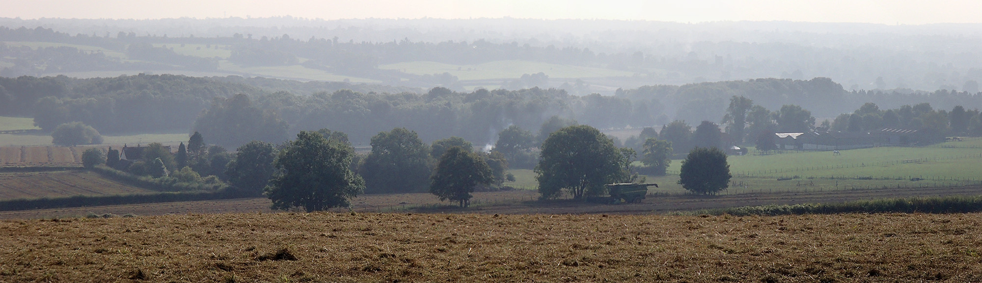
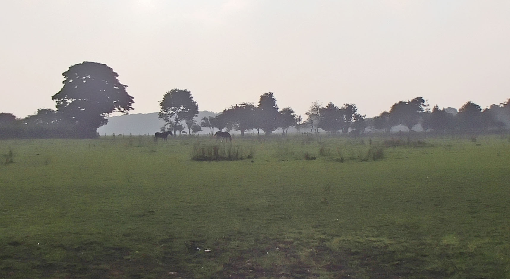
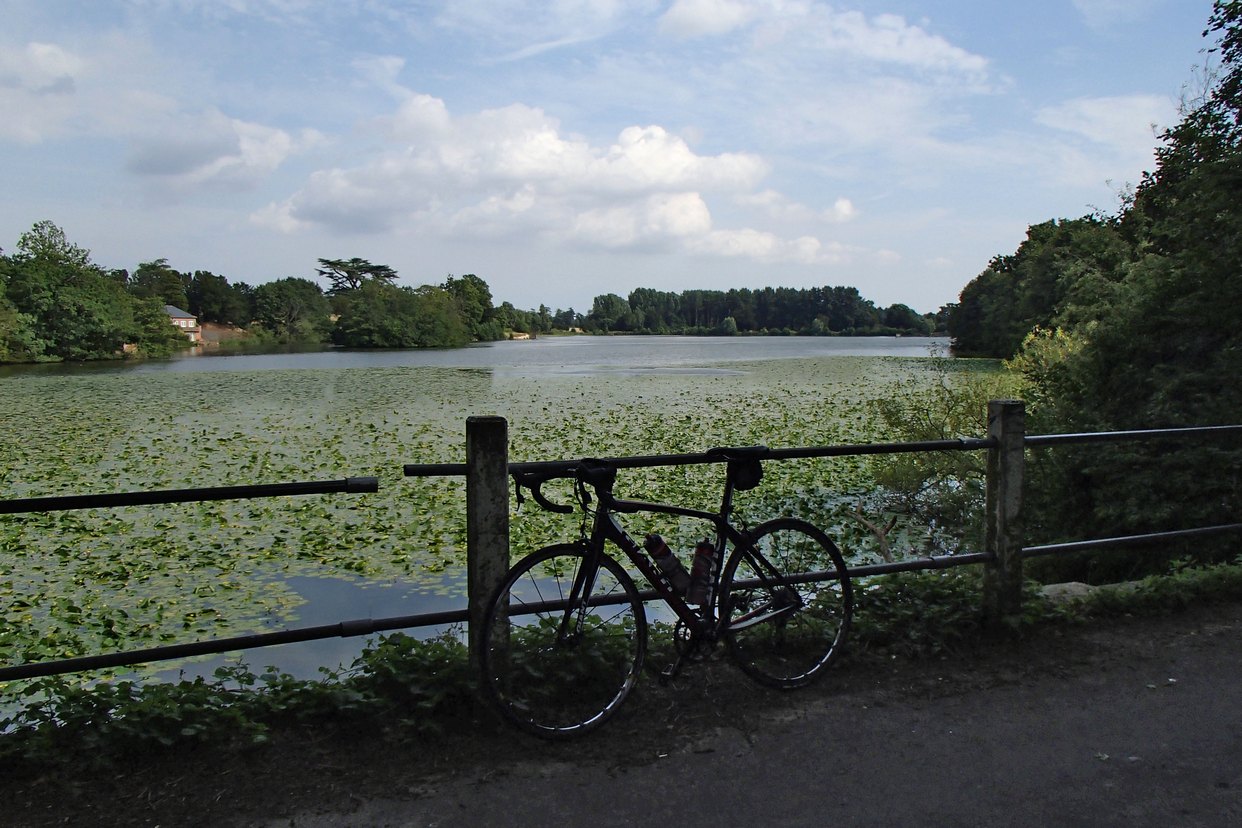
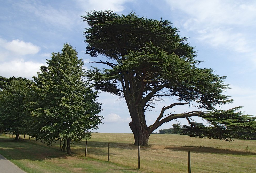
Another ride with the Sunday Intermediates. It was a chilly, misty morning with the promise of sunshine later. As I cycled down into the Vale of Kent on my way to Marden the mist got thicker, enough to get me and the bike wet. My fingers were also cold for the first time since last Winter. The upside was that the misty landscape provided plenty of evocative scenery.

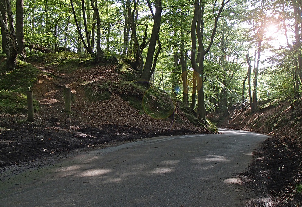
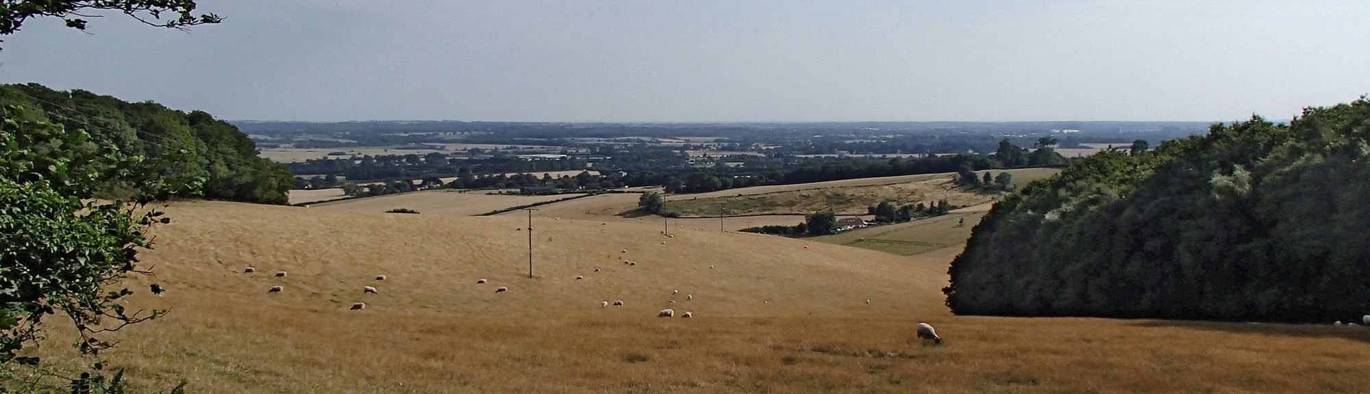
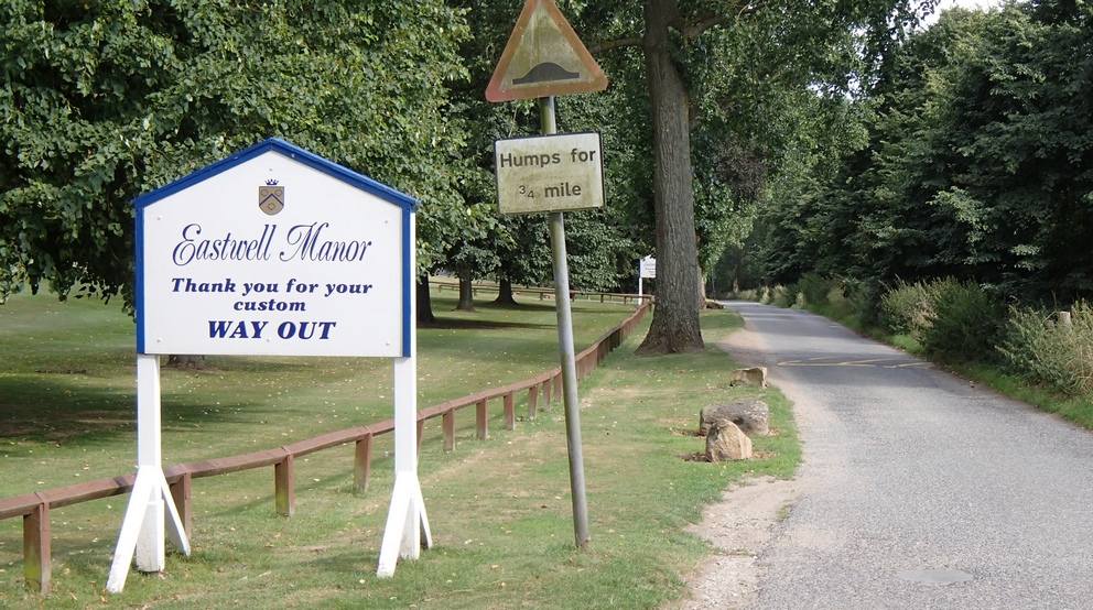
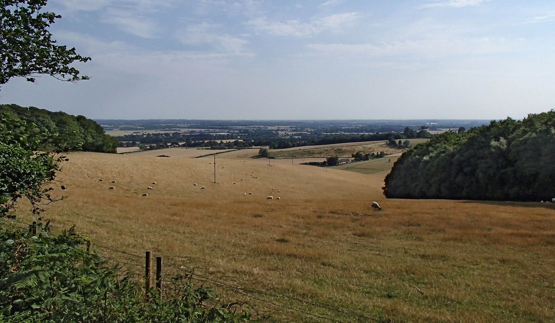
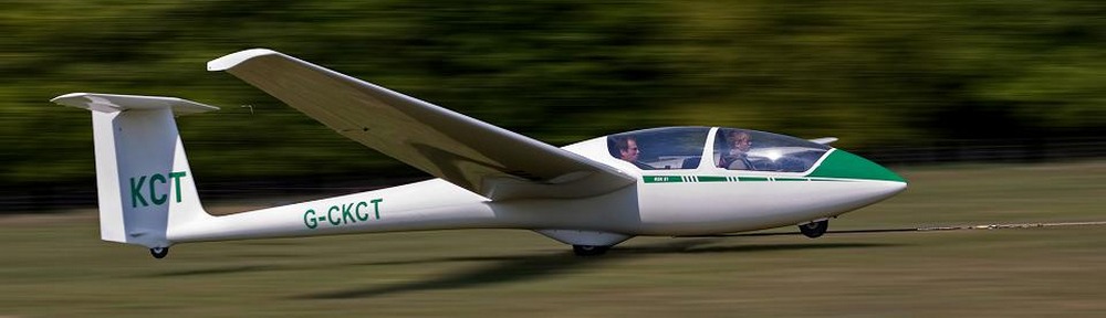
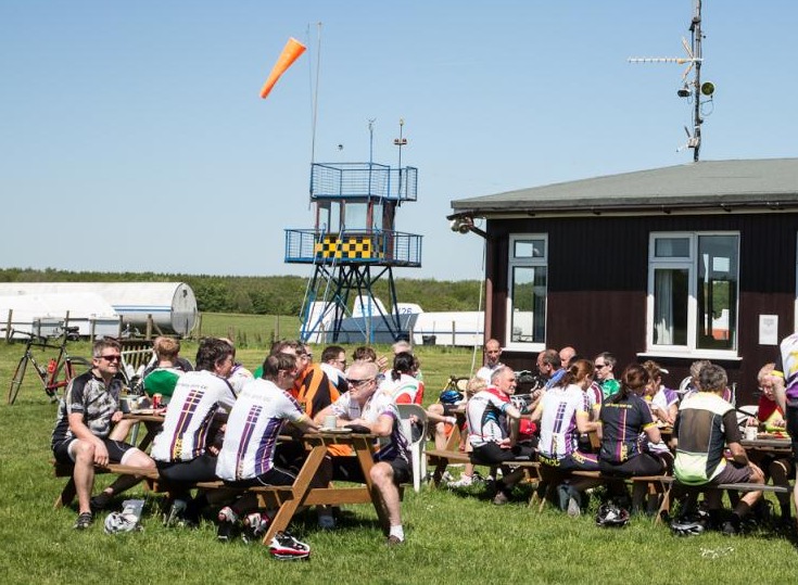
I met the others at Marden as usual. There were seven of us on the ride. As we made our way to Challock Glider Club, the mist gradually cleared and the sun did indeed come out. It turned into a lovely morning. A couple of miles before Challock, the group split to take two different routes. Two of the guys were on fixies and wanted to take a less steep, off-road route. The rest of us took the longer, steeper, on-road route. This caused a bit of confusion in the numbers and when the group I was in arrived at the glider club, we realised that a rider had gone missing (we had become quite stretched out on a steep hill about a mile beforehand). Two of the guys went back to search for him but returned about 20 minutes later empty-handed. Luckily, the missing rider turned up about five minutes after that. So we all sat in the sunshine watching the gliders being launched into the blue sky as we scoffed our grub.

Some Fairies (not today's ride) at the glider club
Some Fairies (not today’s ride) at the glider club

On the way back, I left the group to take a more direct route home, instead of going to Marden. About three miles into my solo journey, I took a wrong turning. I realised that I was heading too far to the South, so I turned around to retrace my steps back to a turn-off I had missed. As I was making my way back, lo and behold, the rest of the group came up the road behind me! I rode with them for another couple of miles and peeled-off again, for a more direct route home. Joking, one of them shouted after me “see you in 5 minutes!”. But they didn’t. This time I didn’t get lost.

I was really flagging over the last few miles. I struggled up Barn Hill, recording one of my slowest times for ages! Maybe it was yesterday’s hilly ride that had worn me out.


Ham Street (SFA)

Distance: 72 miles. Elevation: 2209 ft.

Another club run with the Sunday Intermediates. The day started off cloudy but the sun broke through later for a while. Roughly 14-16°C. I wore my arm warmers for the first leg of the ride, but took them off after the café stop, but it wasn’t as warm as I thought and I wished I had them back on again. Guess I may as well concede that Summer is over and it’s time for long sleeves!

I had fitted a 12-30T cassette to my Colnago the day before, to make sure I wouldn’t get caught out on the hills again. However, today’s route turned out to be extremely flat, taking in the Vale of Kent and bits of Romney Marsh.

I decided to cycle to the start this morning instead of driving. When I got to Marden, the group had just set off, so it was good timing. A minute later and I would have missed them! There were eight of us out today and we rode at a good pace of over 17 mph despite a constant fresh westerly breeze. We stopped for food at a garden centre in Ham Street. Scrambled eggs on toast was the popular choice of the day!

The pace on the return journey was even more frantic, at 18.2 mph back to Marden, again with that breeze hindering us much of the time. The average speeds of the Sunday club runs are steadily increasing, it seems, and are now often significantly higher than the 14-16 mph that’s advertised as the norm for this group. This is no doubt helped by the younger riders that have been attending. While these higher averages are nice for those that can manage them, I feel there is a danger that it could deter some members who would otherwise choose to ride with this group.

An enjoyable ride!

Ride notes:

Don’t take your arm-warmers off too early

Remember to re-start the timer on your Garmin when you start riding back
It will save you 90minutes+ of rebuilding the ride data in Excel later!

September

View from Cotman's Ash Lane

Distance: 41.8 miles. Elevation: 3544 ft.

It was a hazy, lazy, balmy, calm(y) day; a great example of why September is my favourite time of year. A watery sun presided over misty landscapes; far away, smoke rose from small fires as landowners cleared away Summer’s exuberant growth. In the distance, farmers silently went about their Autumn tasks. All of nature seemed in a sleepy mood.

The heady aroma of dappled sunlight

OK, OK, so it was a beautiful day already! Get over it! Let’s get onto the nuts and bolts of this ride. And it did involve quite a few nuts and bolts, as I made numerous adjustments and changes to my new bike before setting off:

  1. I fitted my Mavic Ksyrium Elite wheels. Off the bike, it was easy to feel that the Mavics were noticeably lighter than the Shimano RS30s they were replacing. The only thing was that the red tyres looked terrible on my new frame.P9240535rNo matter, I’ll change the tyres at some later date. I left the SRAM 11-32 cassette on the rear. The di2 electronic shift worked perfectly with it, except it couldn’t cope with the combination of big chain ring and 32T sprocket (it just couldn’t stretch that far), so I had to remember not to use that combination; to do so would risk wrecking the whole drive-train, or even damaging the frame itself!
  2. I changed my handlebar stem to a 100mm version, up from 90mm to see if it felt any better. (It didn’t – I felt like I was slightly too stretched while riding on the hoods.)
  3. I lowered my saddle about 6mm, as I felt it was slightly too high compared with what I was used to.
  4. I fitted my SPD-SL road pedals. After having used my SPD pedals for the past few months to see if they cured a knee problem I was having, I decided to switch back to these to see if the problem recurred.
  5. I changed the cleats on my shoes – to fit the SPD-SL pedals.

So I finally set off on the ride after making all those changes.

Immediately, I felt that the right pedal cleat wasn’t aligned correctly, so I stopped after 13 miles (I was looking for a nice place to stop!) and adjusted it. I was mindful throughout the whole ride to not use 1st gear, as I would not have a gear that low on the new cassette that I’ve recently ordered, so I just wanted to make sure that I could climb all my usual hills on a higher ratio. I managed it OK – even the ridiculously steep Saint Helen’s Lane.

The rest of the ride went without incident. On Strava afterwards, I saw that I had achieved 10 personal bests! And I wasn’t even trying that hard. It’s definitely a fast bike!

Did I mention it was a beautiful day?


OLYMPUS DIGITAL CAMERA

View from Cotman's Ash Lane

Ride notes:

White handlebar tape
Already beginning to look grubby after less than 200 miles – who’d have thought? Just as I was coming into West Malling, my chain came off and I got my fingers greasy putting it back on; cautious of not getting the bar tape dirty, I cleaned my hands on the surprisingly strong leaves of a nearby tree!

Comfort
Since putting the Ksyrium Elites on, the new bike is noticeably less comfortable than it was with the Shimano RS30s. A shame, but such is the price of performance I guess.

Hawkhurst (SFA)

Distance: 51.6 miles. Elevation: 3291 ft.

Another club run with the Sunday Intermediates. It was a very mild, by recent standards, overcast day. There were nine of us this time and we rode a roundabout route to Hawkhurst Fish Farm for our brunch.

It was the first decent ride using my new bike. The bike was great; however, I suffered a bit on the hills with its 11-25 cassette. My other bike, with its 11-32 has two more lower gears. So I was going up hills in what I consider to be third gear! Not impossible, but a lot more effort. I’m definitely going to change the cassette to gain at least a 28 on the back. Two youngsters on the ride were telling me that you can go up any hill with a 25 on the back! I politely explained to them that when they get as old as me they will need lower gears! Regarding the electronic shifting, it worked flawlessly except for two occasions: at one point it dropped the chain off the front small ring, but I managed easily to re-thread it by operating the front mech towards the big ring; at another point in the ride, it wouldn’t switch to the big ring at the front despite repeated efforts on the levers – I ‘fixed’ this by switching to the small ring (even though it was already on it) and then back to the large ring.

The ride back after our food stop was particularly lumpy, and I found this ride pretty tough-going really. We achieved an average of 15.3 mph, which was good considering the amount of hills, some stops, an off-road section and getting lost a couple of times (blame the gps!). There was some joking about my new bike getting dirty and maybe scratched by all the stones flying around as we cycled off-road through some woods near Bedgebury!

As usual, despite the exertion, I still really enjoyed the ride.

Going for it

Went out this evening on this ride:

It was a beautiful sunny evening. I really went for it, hoping to beat my last average of 17.2 mph. My legs were still aching from yesterday’s 53 mile/4000 ft ride and I’d only had 4.5 hours sleep last night. Right, that’s the excuses out of the way! I really gave it everything I had (left).

By the time I had covered the 11.6 miles to the foot of Yalding Hill I had averaged 19.1 mph and was over a minute up on my previous best. But I had nothing left for Yalding Hill. I went up it as fast as I could. I kept getting out of the saddle but the pain in my legs was too much so I’d sit down again. Then I got up again, and down again. “Work, you bastards” I said under my breath (but actually out loud) to my legs, but they had had enough. I pushed as hard as I could to the top. It was such an effort that I thought I might have beaten my previous time up the hill, but later analysis showed otherwise. At the top of the hill I saw 17.6 avg on the Garmin so I knew I was still up on my previous best for the journey as a whole. I pushed as hard as I could for the last mile, most of which was still slightly uphill, and managed to end up with 17.4 mph. I had beaten my previous time by 51 seconds, even with the slower climb of YH.

Now my legs are aching even more.

Four Elms (SFA)

A club run to Four Elms. Only five of us this time. The weather had threatened showers but we managed to stay dry. Not too hilly, we managed 16.4 mph over the whole journey, although the return leg had a good average of 17.3, and over the last 16 miles we averaged 18 mph, so basically we got much faster towards the end!

I forgot to switch my Garmin on until about a mile into the journey, so it was just over 56 miles in all. Nice one.

20+ mph

Went out on a 34-mile ride this evening and averaged 20.2 mph over the 8.5 miles to Staplehurst, beating my previous best of 19.1 mph! I’m very pleased with that!

I had only taken my rear light with me and by the time I got back it was almost dark. Cycling through the woods at the top of Barn Hill, I literally could not see the road – I was guided purely by the dark silhouette of the trees. It was so dark I could see the glow of my flashing red rear light on the road in front of me! I also got 2 personal bests on the way back – probably because I was racing to beat the failing light!

White Hill

This route was planned with the sole purpose of riding up White Hill. Someone on a club run had mentioned it and I had made a note to do it one day. And that day was today. As usual, of late, the weather was warm and sunny. I planned a 54-mile route that took in quite a lot of unknown territory.


The first 18 miles or so were covered at 16mph. There were some nice lanes around Charing, just keeping to the South of the Downs. After 23 miles I came to a lovely lake, Eastwell Lake.

OLYMPUS DIGITAL CAMERALess than a mile past the lake my progress came to an abrupt halt when I was confronted with this:

gateDamn! Again I had failed to check if all of the route was on public roads. But again I figured that the route-planning software wouldn’t direct me across private land, so I once more assumed that there was some sort of right-of-way.

Footpath

tower

I looked for a way around this road blockage and noticed, a little further back from the gate, a footpath sign. This led me past some sort of old tower or something.

Through one of those anti-bike type gates and across a rough field I came to another bike-unfriendly gate. This one was too small to manoeuvre through, so I just lifted my bike over the gate next to it.

style

and found myself on a smooth tarmac road

OLYMPUS DIGITAL CAMERA

OLYMPUS DIGITAL CAMERA

After about a mile of this I came to learn where I actually was, by virtue of this sign

sign

Another interesting ‘off-road’ excursion comes to an end.

About a mile and a half later I arrived at the goal of this journey, namely White Hill. As it turned out, it wasn’t too bad a hill. It’s quite long at 1.6 miles, over which it rises about 450 feet, but I managed nearly all of it in 3rd gear, so it was hardly challenging. But the view from the top was worth it.

OLYMPUS DIGITAL CAMERA

The next seven miles consisted of some beautiful roads across the top of the Downs before dropping down again through Lenham Heath and Grafty Green, after which I climbed Ulcombe Hill to the Greensand Ridge for the next four miles before dropping down again into the Vale of Kent. I included a bit of a twist in the tail of this journey in the shape of Westerhill Road, whose 17% gradient I just had enough energy left to climb.