Distance: 40.3 miles. Elevation: 4197 ft.
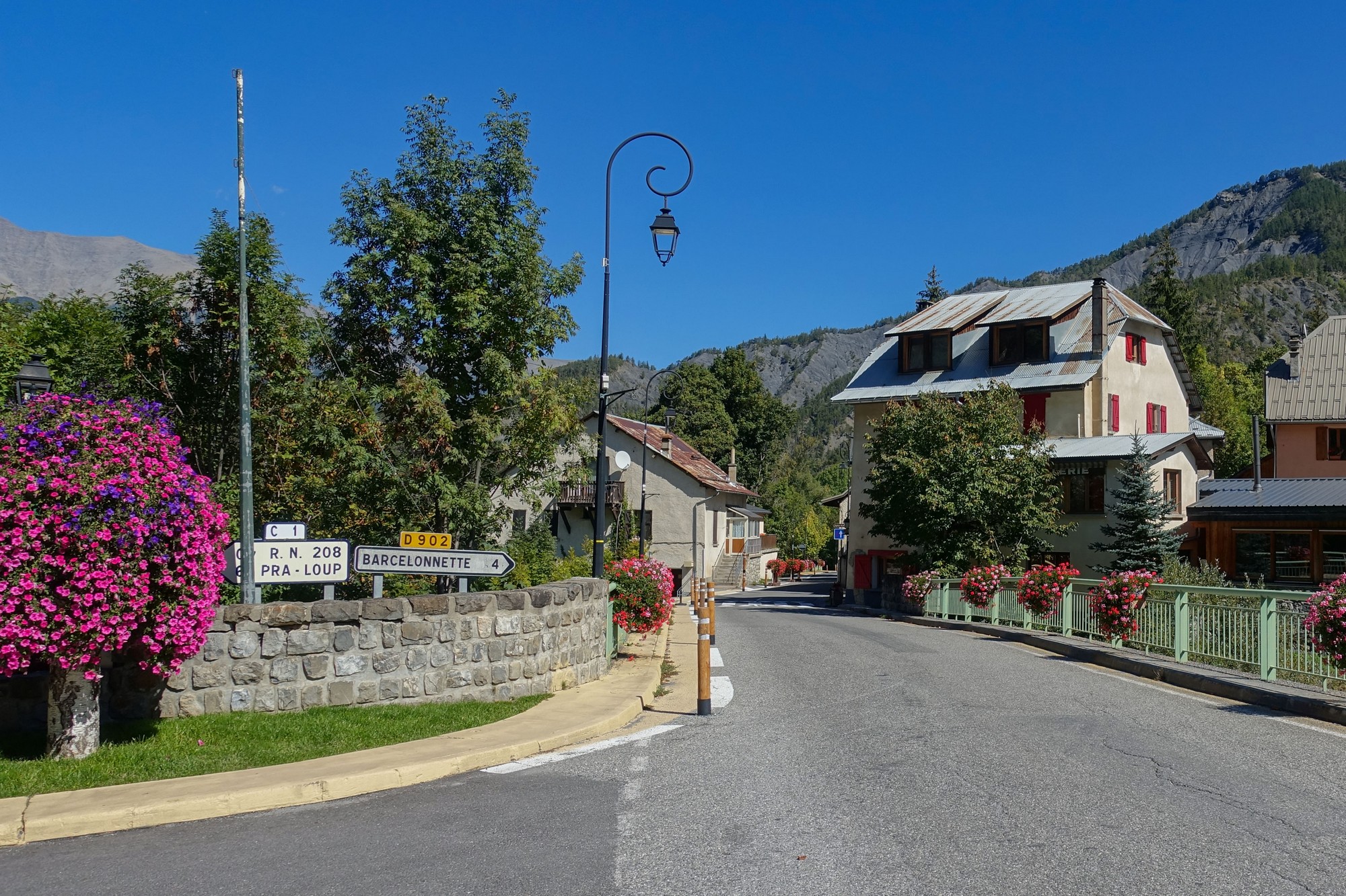
The Col de la Cayolle has been on my list for at least a couple of years, after reading about it and having it recommended to me by a campsite owner last year. For this ride I climbed it from the north, from just outside Barcelonnette, in the Ubaye valley.
Reports were dictated into my phone at various points as usual, with photos added later, as appropriate.
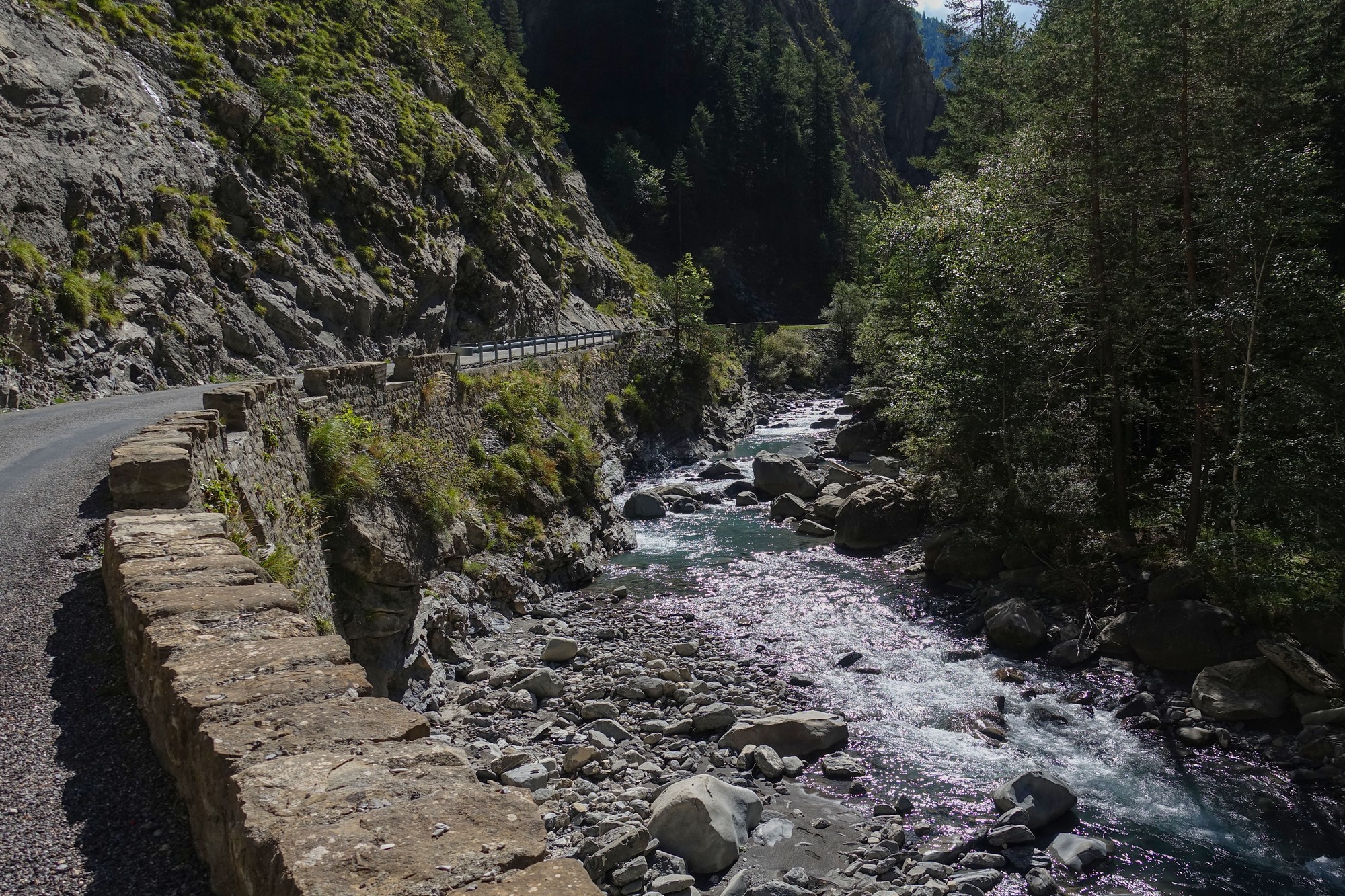
14:33 I’ve decided to stop here at the 11-mile point so that I can sit in some sunshine and get my thoughts down so far. When I first came out, the air felt very chilly – in fact I nearly put my arm warmers on but there was no need to in the end. So I have a base layer on; my arm warmers, snood and rain jacket are available for the ride back down. As expected, up until now the gradient has been very easy – in fact I’ve been careful to not push it too hard, knowing that it gets steeper and steeper towards the end. The road has followed the valley of le Bachelard river and it’s a gorge road and I’m constantly hearing the sound of the river next to me, rushing over its rocky bed. I’m warm enough even though the air is chilly, but as usual lately I am dripping with sweat – I don’t know what that’s all about, but they say that it means you’re healthy, or fit. I would say up until now less than ten cars have passed me on this road, and just the odd motorbike and a couple of cyclists descending. I just stopped when I saw some goats and got some photos, so I’m now going to have a banana and carry on the rest of the ride.


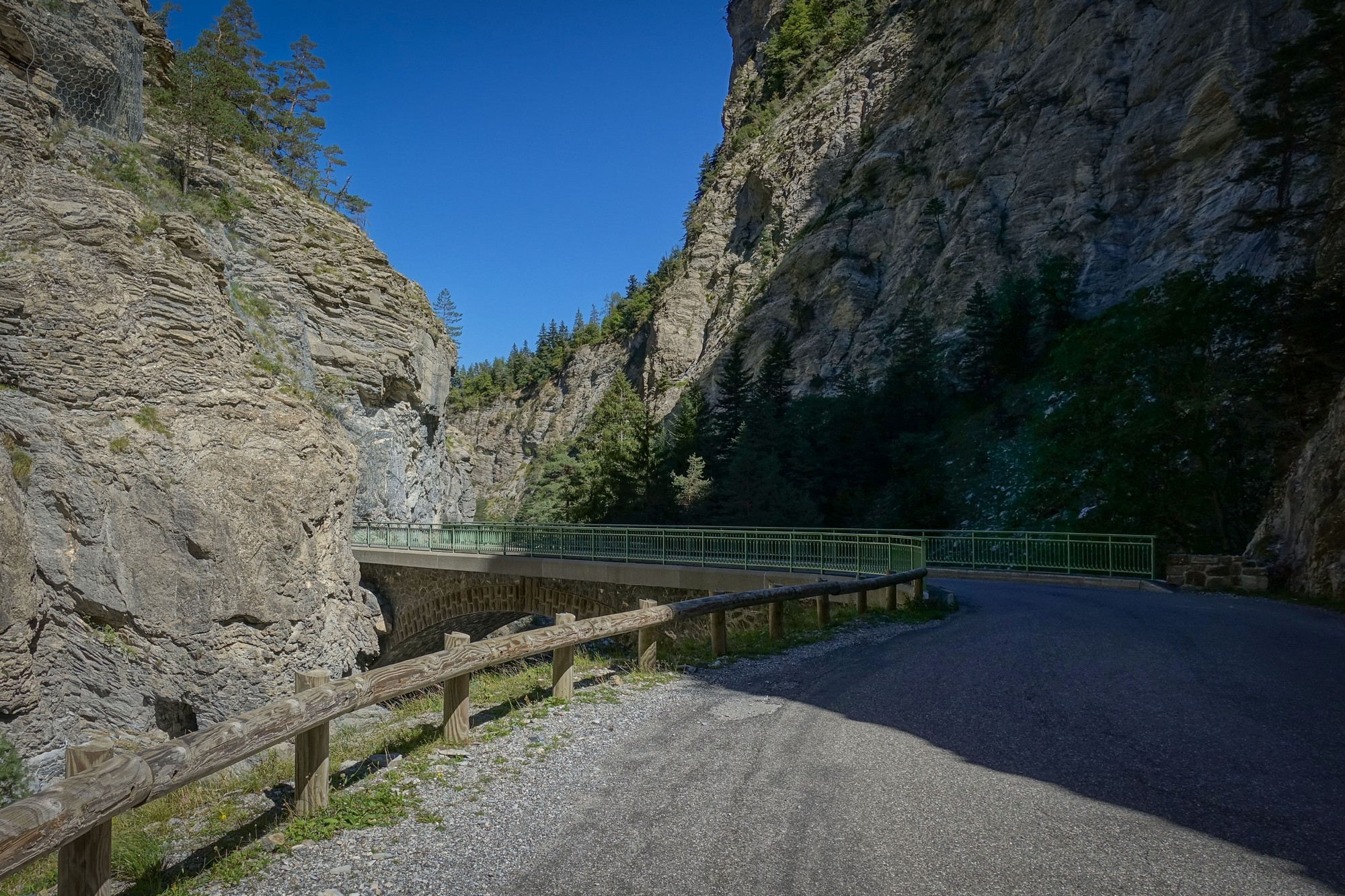
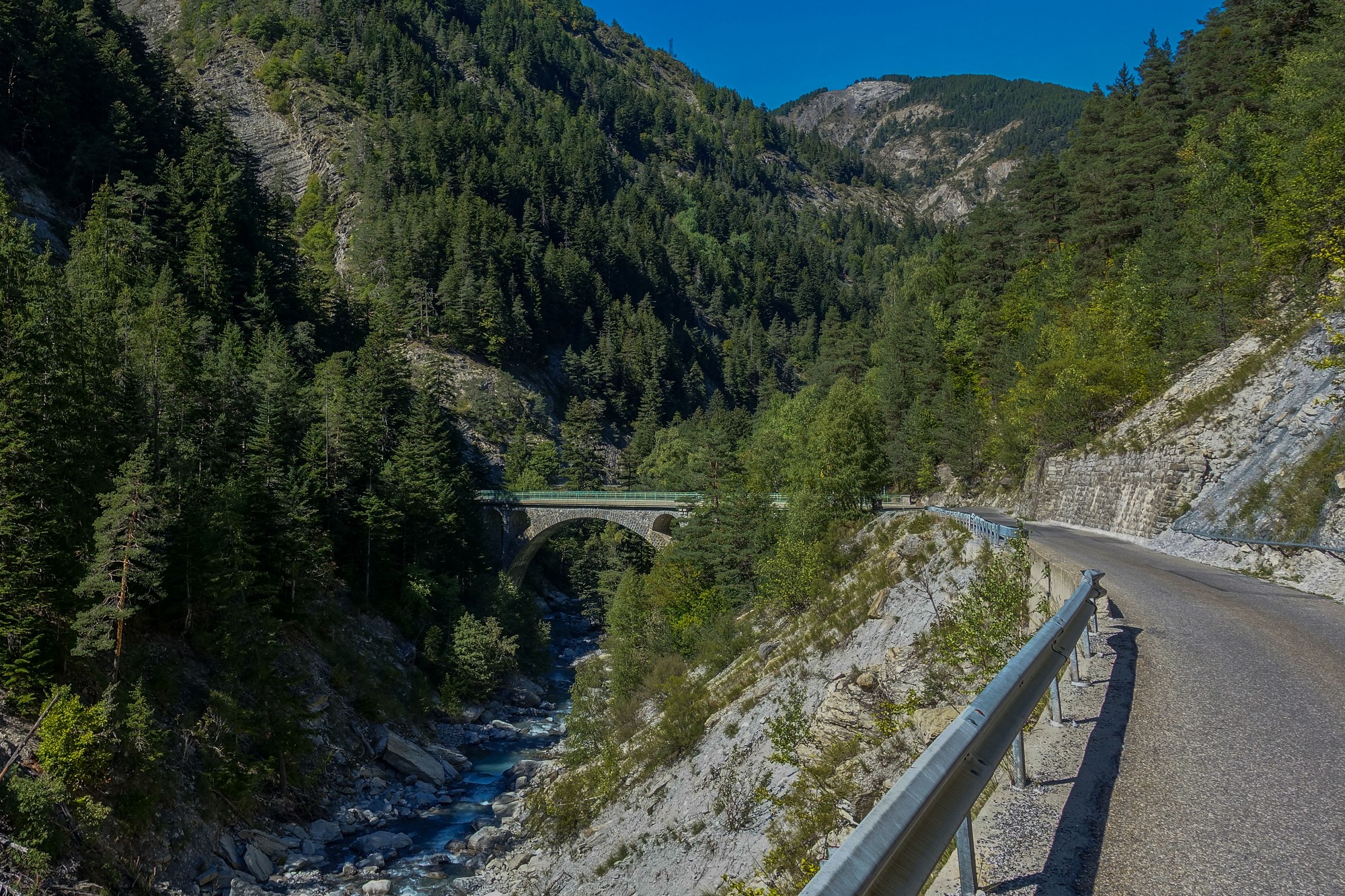
16:38 (at the col) Since the last report the road went through a variety of personalities. First it strode along confidently, quite straight without much gradient along the now wider valley of the Bachelard. Then, seeing no way through the mountains ahead, it cut to the right, bridged over the river and twisted its way more slowly up into the forest via a series of switchbacks and bridges before once again opening out on a long stretch of road, quite a way above the river.


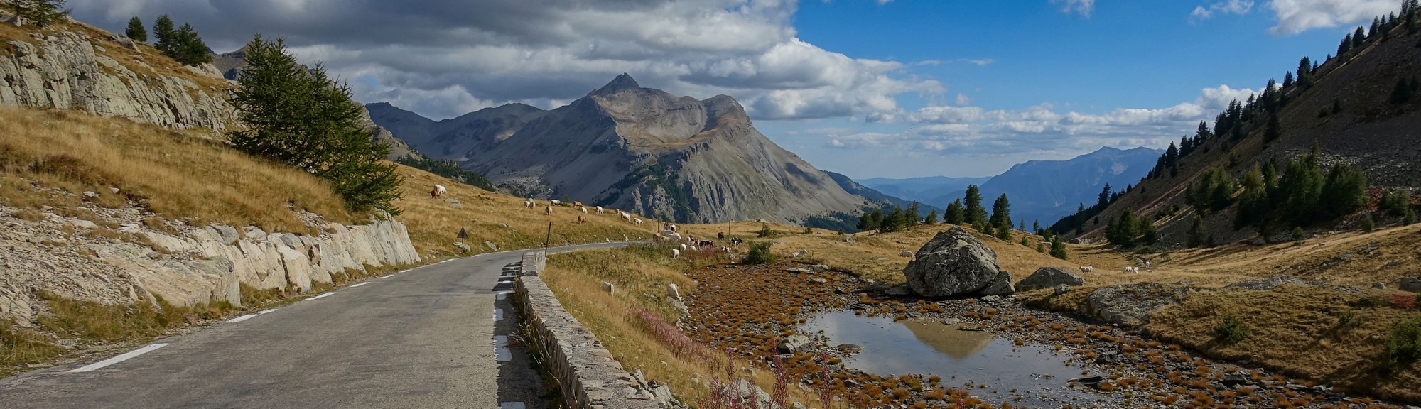
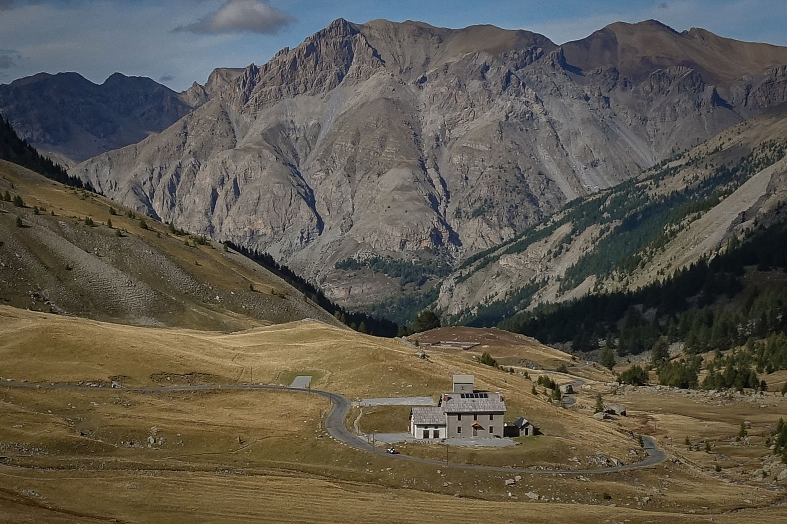
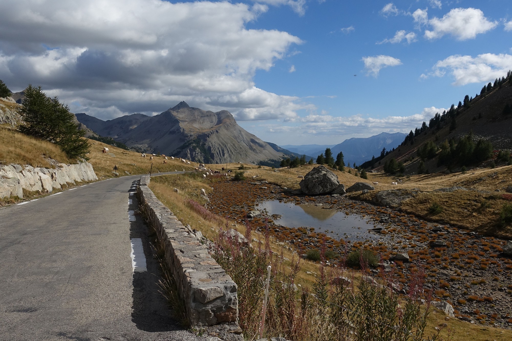
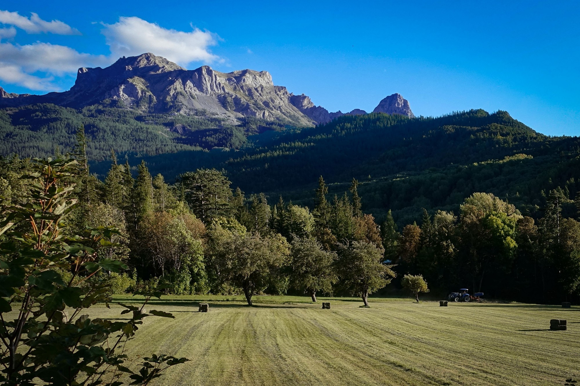
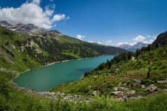
Through pastures and via more twists and turns, it climbed ever steeper for the final lunge to the col, the landscape now largely treeless and barren.

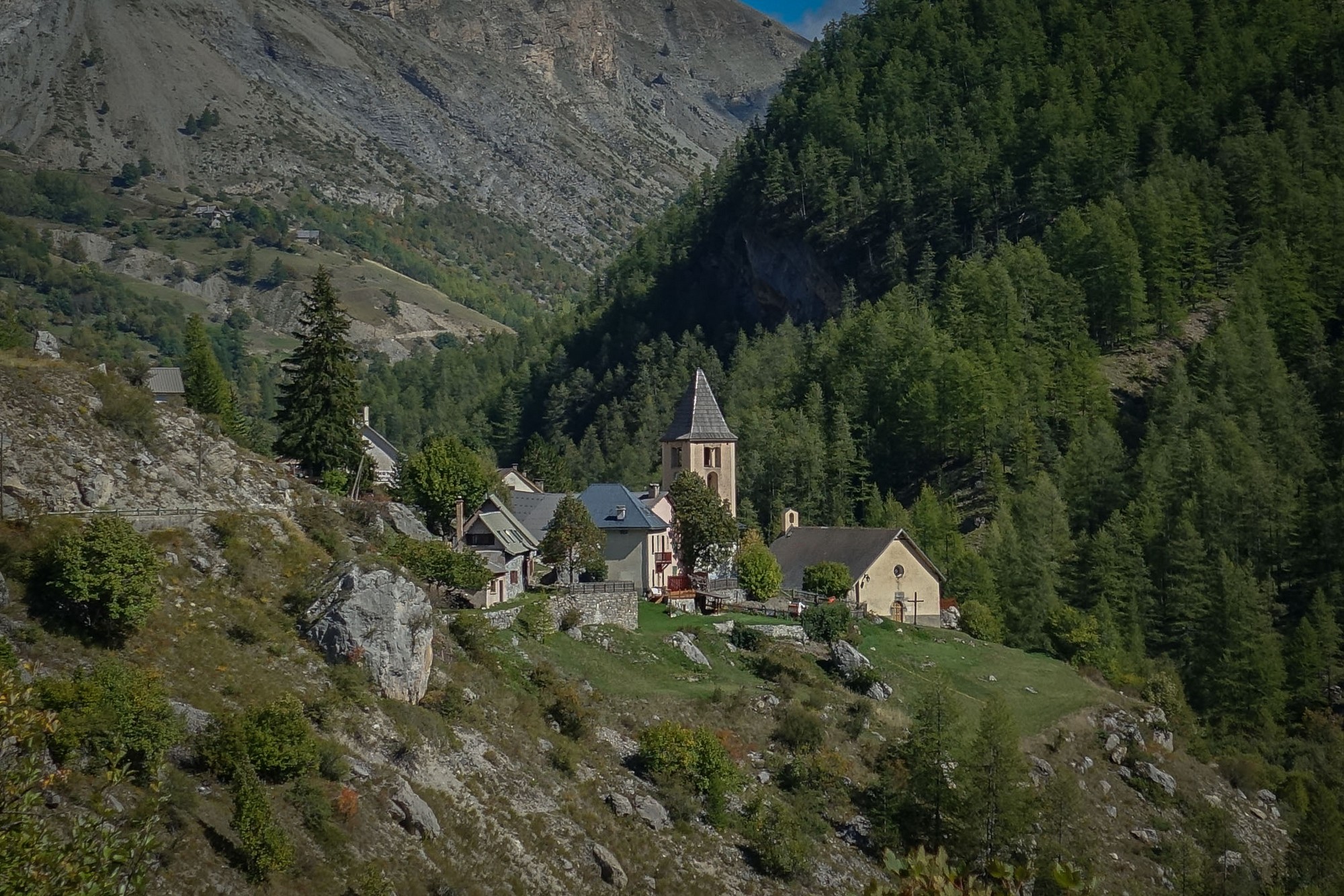
A building, the Refuge du Col de la Cayolle, appeared on the horizon and I thought it might be the top, but when I turned the bend past the building, I could see the road sweeping round in front of me for another half a mile or so. I could see the small speck of a cyclist up ahead, who’d passed me earlier. I just carried on plodding my way up that final stretch to the Col de la Cayolle.
At the col I chatted to a cyclist who was on a recumbent type of bike. He had only one arm and had restricted head mobility, so his recumbent was a custom rig. I was chatting to him about his bike and the fact he had mirrors because of his reduced neck motion and we spoke about some other rides that we’d done. He’d done the Cime de la Bonette from both sides. Speed-wise he told me he’d once done 80kph (50 mph) on his bike when conditions allowed! The conversation was a mixture of French and English. A very nice man, I wished him ‘bon courage’ as he set off for the descent.
Then I offered to take a motorbiker’s col shot for him but he’d set his phone up in selfie mode so that it would have been a picture of me, so we had a bit of a joke about that and in the end I took his photo.
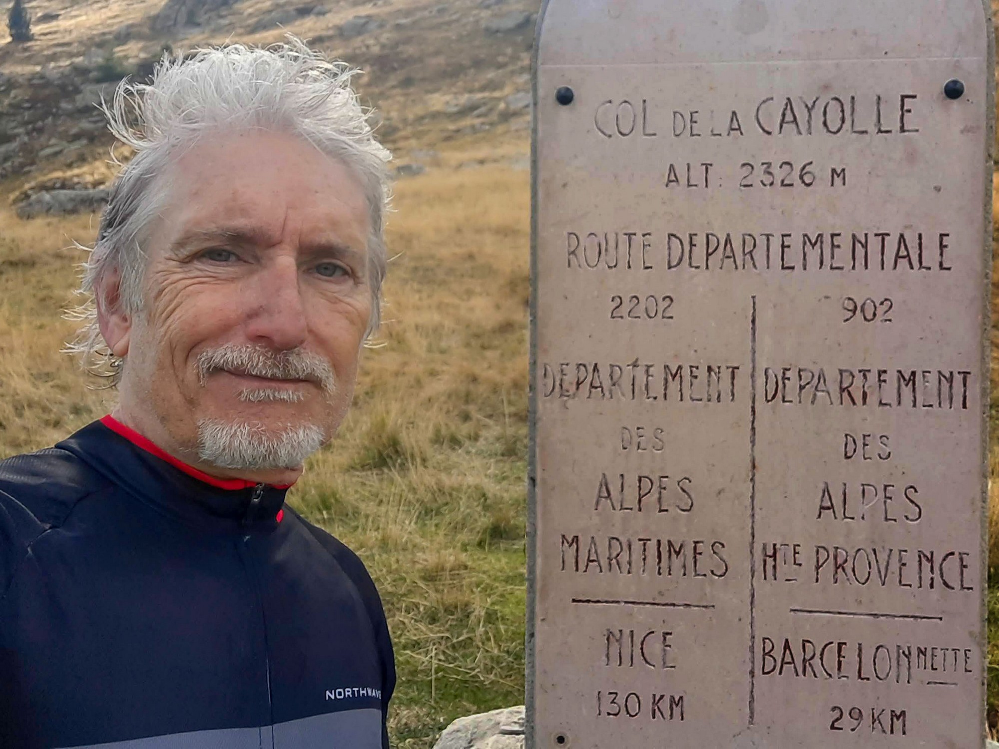
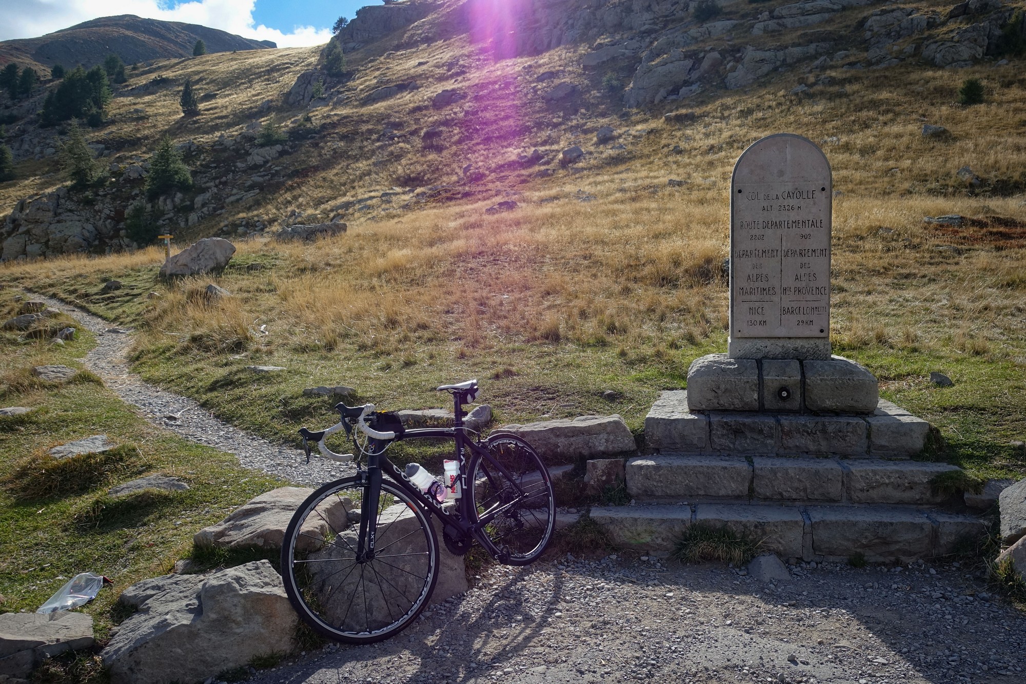
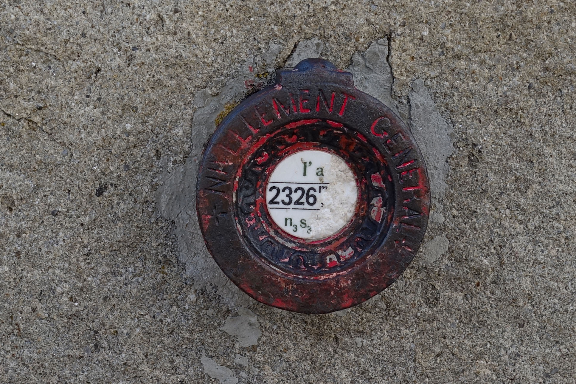
I know I am at altitude (2,326 metres to be exact) but it’s really uncomfortably cold. This could be the last ride I do wearing shorts and mitts, unless I go further south, or the weather gets significantly warmer. I have only heard a few marmots today – they must be getting ready to hibernate I expect. It’s very peaceful up on this col. In fact I’d call it a friendly col because the road is never that wide or busy, or rushed, as it winds its way up here.
18:40 (after ride) Considering how uncomfortably cold and frustrated I was at the col it seems inconceivable that during the rest of the descent I gradually realised I was on the most amazing road. At first I was thinking it was ‘one of the’ best roads I’ve been on but by the time I reached the gorge, it had been promoted to the most beautiful road I’ve ever ridden. And it’s largely due to the sheer variety of landscape, the waterfalls and the lovely old bridges with their lime green painted wrought-iron railings.


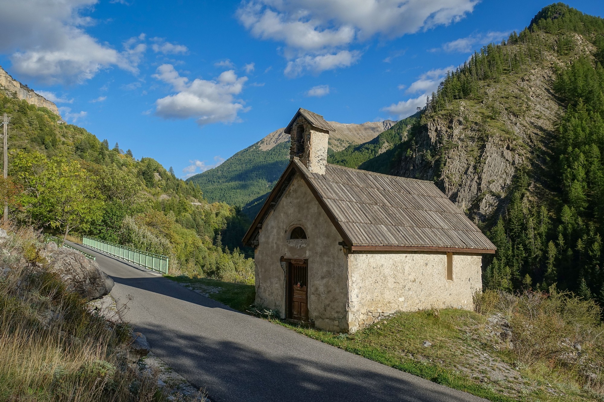


At the top was the magical mixture of pastures and sparse forest, and the huge mountains of course. Then further down was the valley – spectacular. Then to top it all off there comes the gorge section. I mean photos and words just can’t do it justice. I would love to do this ride again with the sun higher in the sky, in May or June maybe. Although I’m sure in about a month’s time that road is gonna look amazing with all the autumn colours. So even though I was fundamentally cold, I was invigorated by the experience.
It was so quiet, traffic-wise, most of the time I was the only one there, with nothing else in earshot. Nearer to the bottom there is the constant noise of the river rushing over the rocks.
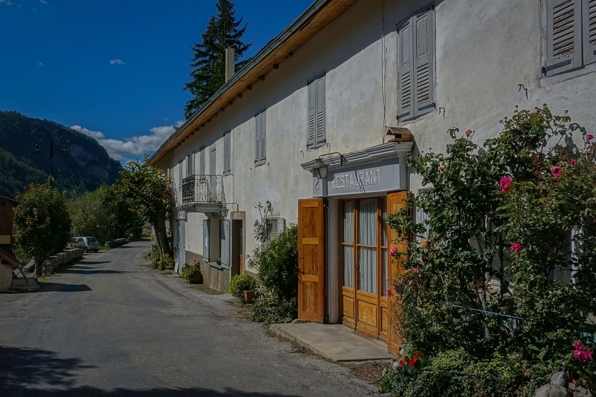
So I got back feeling good. The whole of this valley I’m in is so beautiful.
Will France ever stop blowing my mind?
Fuel
More Info
Gallery
Click to enlarge / see slideshow


Thanks again for your great report and photos Vince. I rode the 3 col loop of Allos Colmar and Cayolle back in 2019, this brought back some great memories. The 3 col loop can be ridden in either direction and was in great condition when I was there. With over 3,000 metres of climbing it’s a long day but well worth it!
Cheers
Martin
Thanks for your comment Martin.
And well done for doing the 3 col loop!
Indeed that loop has been on my list since last year. I’ve planned it from Guillaumes but may change that to near Barcelonette. From the profile chart it looks like the climbs are less steep going clockwise. Hopefully I’ll be posting a report on that ride in the near future.
Cheers
Hi Vince, I rode the loop in a counter-clockwise direction from Barcelonette and there was new pavement from Colmar up to the Col de Champs, so it was a very nice ascent. I’m sure it will be just as sweet from either side. Enjoy!