Distance: 10.4 miles. Elevation: 1781 ft
I knew I would get back here one day and here I am again in the Vercors region of France. Owing to the risk of rain tomorrow I decided to do this ride as soon as I arrived at the campsite.
After driving over 300 miles over 6 hours in a non-air-conditioned van, I needed something to cool me down. What better than a tough 1800ft (in 5 miles) climb to finish off the day (and me!). I had planned this ride before leaving the UK. Only 10 miles; 5 up and 5 down! The purpose was to see an interesting bit of road where a sort of balcony/tunnel has been cut into the rocks on a route to Presles, a small village up on the plateau. RideWithGPS gave it as 7.5% gradient.
I started off at 6:53PM. It was a balmy 28°C, mainly overcast.
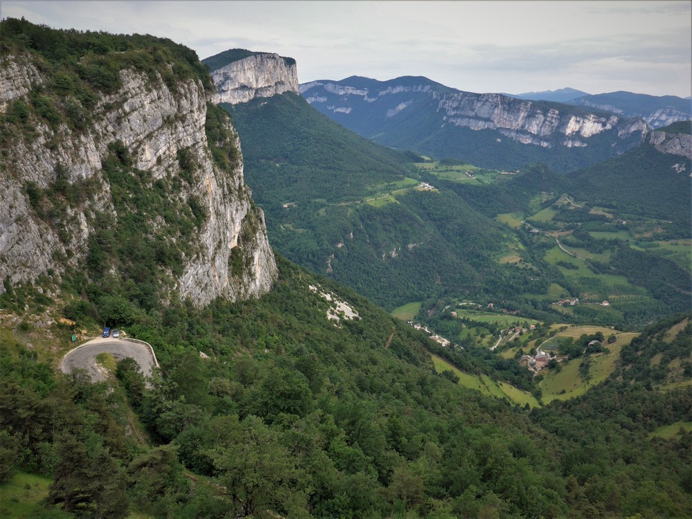
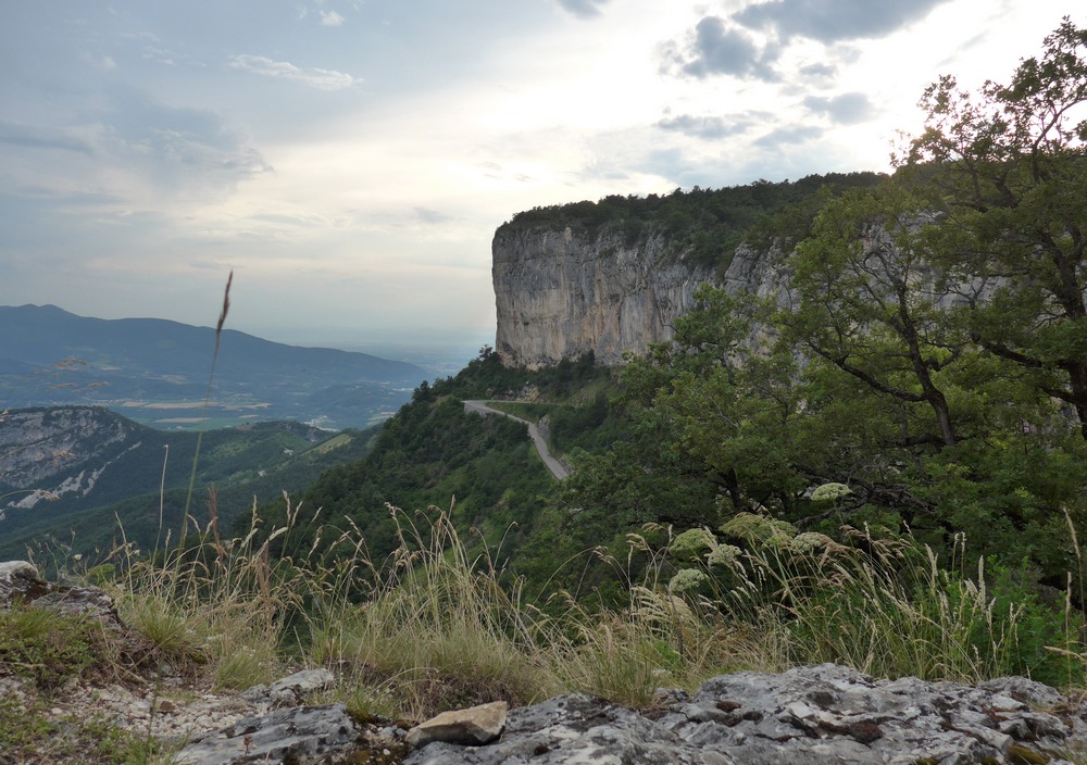
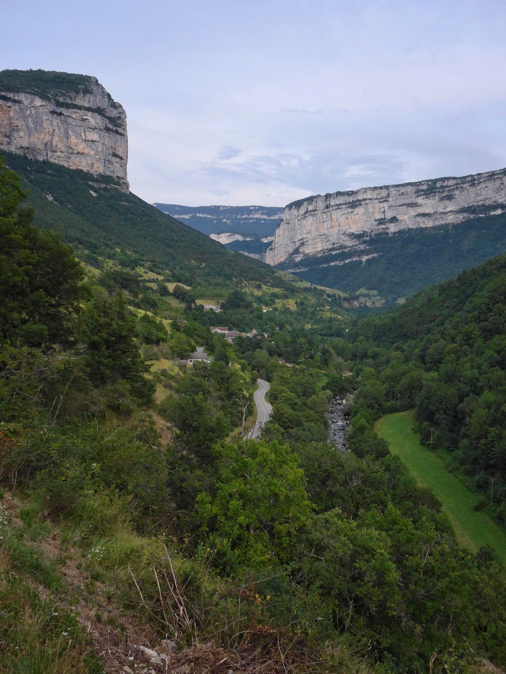
After just a couple of minute’s ride through the village of Chorance I saw the sign to Presles, and that’s where the climb began, and never really let up until the end. With the gradient at about 5%, quick progress was made, altitude-wise. I was riding in third gear and found it comfortable. The river Bourne and the gorge shrank rapidly away below me. Such was the rate at which the scenery diminished to reveal spectacular views, I thought “well this shouldn’t take long at this rate”. I stopped to get a couple of photos.
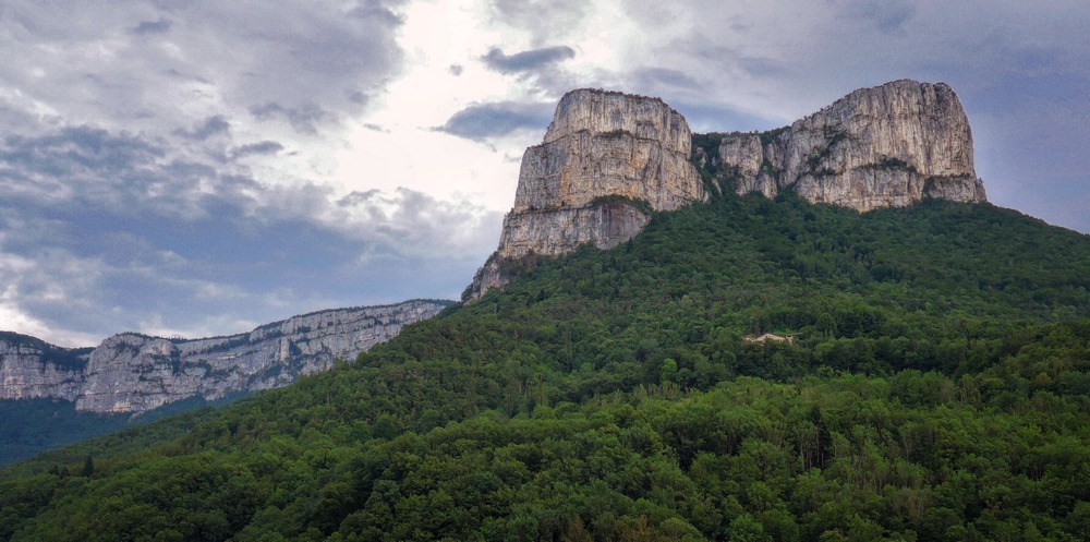
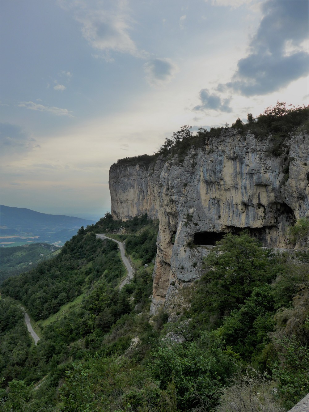
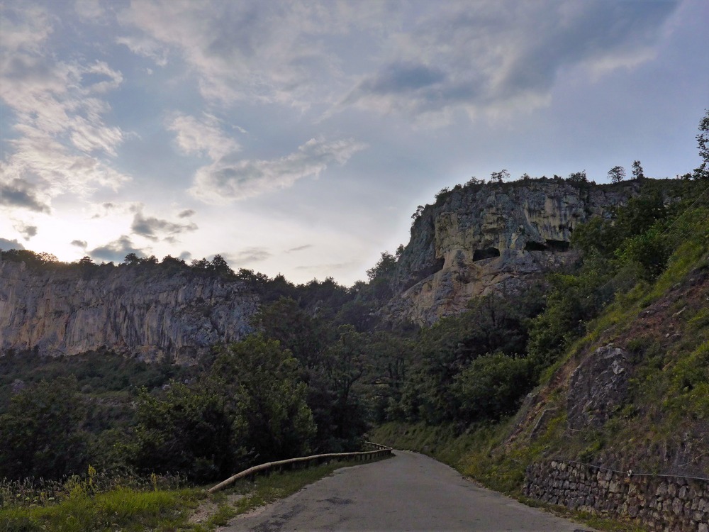
A few minutes later I rounded a bend and looked up to see my destination far higher up. Looking rather like a WWII pillbox, the three black slots in the rock face were the balcony road I was aiming for (roughly in middle of photo below).
Shortly after that photo was taken the gradient ramped up to 7.5% and I was forced to use lower gears from there on – I did the rest in first gear (32T). It never ceased. You have to give the road builders some credit for building a road with such a uniform gradient up the side of a mountain. My target went out of view again as the road twisted its tortuous route towards it. I felt like I had been riding for ages when I looked at the Garmin and saw that I’d done less than a mile! Every switch-back I went round I was hoping to see some change to the gradient, but I was disappointed each time. At one point I noted the unguarded other side of the road was next to a steep drop. I thought that the descent could be hairy as I would be on that side of the narrow track and if a car came up it would be very tight, with me on the outside, near the drop!
Still the grind continued. It was hot – in fact it seemed hotter the higher I went. My head was cooking. I was annoyed at myself for not having filled one bidon with juice and the other with plain water for pouring over my head. Still, I didn’t care; I needed cooling so I tipped one over my head anyway. Looked at the Garmin again – still only two miles gone. I looked up at the massive rock faces high up and tried to spot the tunnel again. I couldn’t see it. Please don’t let it be right up there, I said to myself looking at the top of one towering outcrop.
The cicadas were very noisy. A lizard scuttled away in front of me. As the pressure dropped as I got higher, my two bidons would make little gasps of air, equalising the pressure in the bottle. It was like they too were finding it a struggle. All the time I found myself looking up at the ominous rock faces looming over me.That gave me a feeling of vertigo. It was easier to look out over the amazing view. Sometimes I heard cowbells jangling way off in the distance.
I hadn’t stopped since those early photos and I was hoping to do the rest of the climb in one go, but the effort and heat eventually got to me, so I stopped for an energy gel and a rest. I felt quite spaced-out for a while as I stood there breathing heavily for a while. I soon recovered my senses and a couple of minutes later I resumed the task at hand, feeling better for the breather. Climbing ever higher it became more peaceful. I seemed to be above cicada altitude now. It was very still and there was almost complete silence. A solitary bird was pipping away, it’s call echoing off the rock faces. Another look at the Garmin – 1 mile to go. Even at my slow speed of 4 miles an hour it would only take another 15 minutes to the top, so I felt the end was in sight (if not literally). Eventually the ‘pillbox’ came back into view, and it was still a long way above me, but I could see on my Garmin there were only 3 switchbacks to go. I counted them down. As I turned the last one there was a nice surprise; the gradient eased slightly for the rest of the way to the tunnel. I had made it. I was thinking of stopping to take photos but decided to carry on and get them on the descent. I continued past the tunnel until the road stopped climbing.
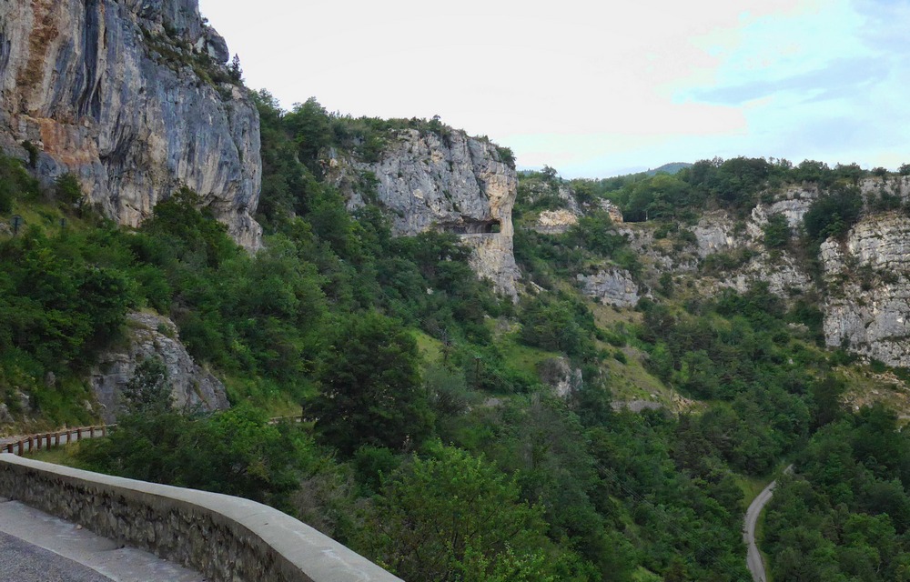
It opened out to a flat landscape that was rather dull by comparison – not a lump of rock in sight! I turned back to the balcony tunnel bit and got loads of photos.
I stood there looking at the view for a while, taking in the complete tranquillity. I had passed maybe three cars and a couple of motorbikes during the hour.
Now it was time for my downward return. The combination of gradient, switch-backs, narrow road, blind bends, less than perfect surface in places and the hair-raising drops over the edge made this less than straightforward. In fact to call this descent ‘technical’ would be an understatement. This was no Mont Ventoux where you can really let go on the wide road, long straights and gentle bends. No, here you’re on the brakes nearly the whole time. And that got me worried after just a few minutes. I remembered that I had recently clocked my front brake pads getting quite low, but had done nothing about it. I was concerned enough to stop and check them, front and back. There seemed to be enough rubber left on them. I continued my downhill challenge and made a point of alternating between front and rear brakes as much as possible to try to prevent my wheels overheating. Luckily there was no other traffic at all on the way down so I didn’t have to go perilously close to the edge. As I neared the river again, I saw a nice view of Chorance so I stopped to get a photo.
Before I got back on my bike I checked to see how warm the wheels were. They were very warm but still touchable; that was after having spent a while taking the photo – I wonder how they would have felt immediately after I’d stopped?
About a mile later, through the village of Chorance and over the bridge across the river Bourne, I returned back to camp. Another Vercors destination ticked off my list.
Fuel








Nice ride Vince, great pictures. Eventually found it on the map between Grenoble and Valence. Not a straight road in sight – I wonder why. The West side of the Rhône is also very attractive. We went up the valley west of Tournon (Gourges du Doux) by train.
Cheers Al. I’m always on the lookout for new ideas. Just googled Gorges du Doux and it looks amazing, particularly by train. I did find a report about a cycle path in the area as well. It looks like there’s also some sort of vehicle that you can cycle along the railway tracks – velorail or something – did you go on that?