
Distance: 47.6 miles. Elevation: 5658 ft.
Col du Mont Cenis | Col du Petit Mont Cenis
Col du Mont Cenis — one of the oldest passes in the Alps, and maybe (although probably not) the path taken by Hannibal. It has been in my collection of routes for three years but it's only now I find myself in the vicinity. While previewing it I discovered there's another col nearby—Col du Petit Mont Cenis—so I included that one too, as an 'off-piste' addition.
The forecast suggested the weather would be better earlier in the day, so I planned to head to the Col du Petit Mont Cenis straight after the main climb to the Col du Mont Cenis, before riding on past the lake towards the Italian border.
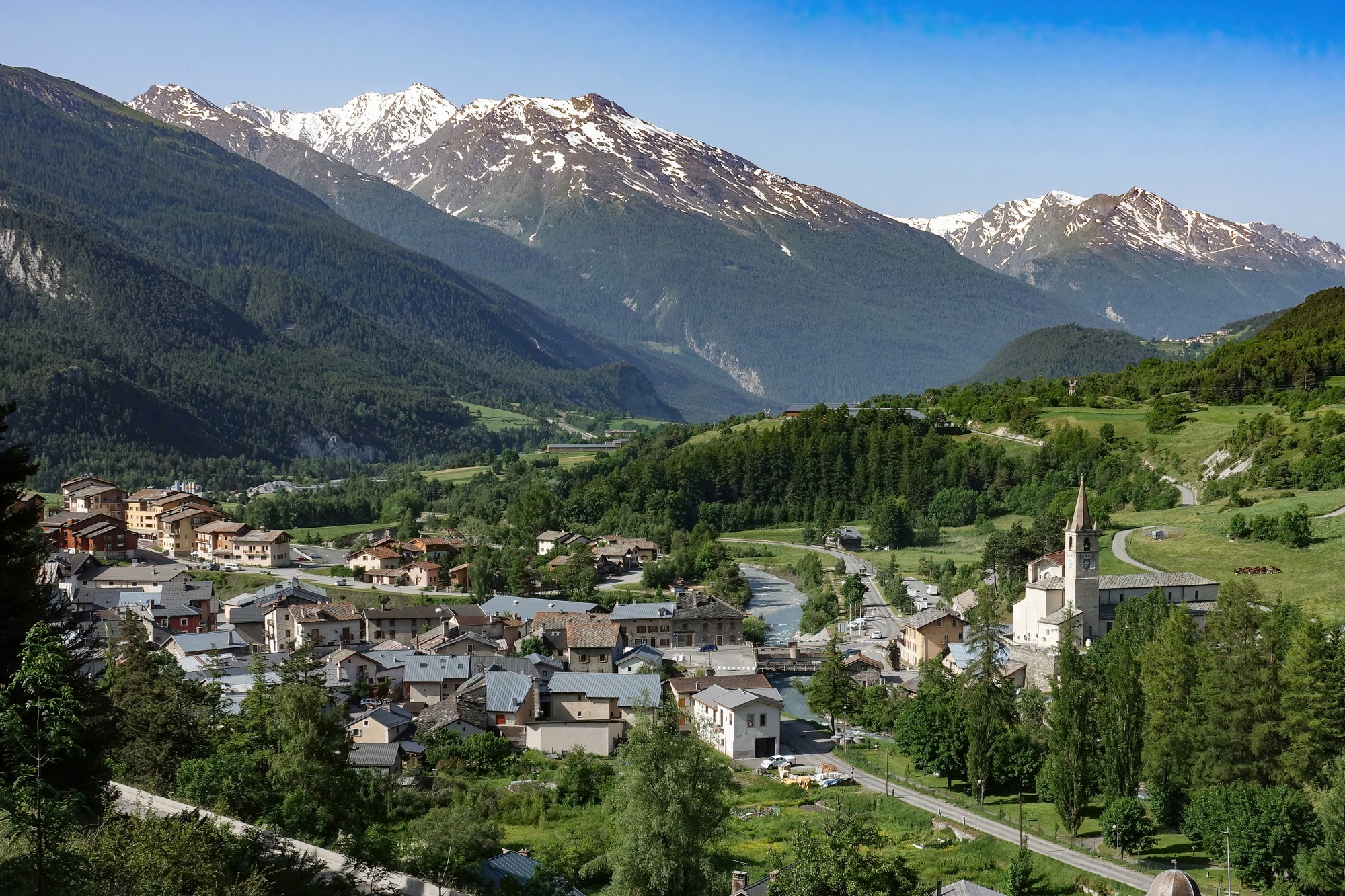
I set off just before 9:30. It was a warm, cloudless morning. The first four miles to Lanslebourg followed the same route as yesterday's ride to Col de l'Iseran. I stopped briefly on the steep ramp out of Termignon to take a photo looking back at the village — my van was also visible, over to the right, beyond the church.
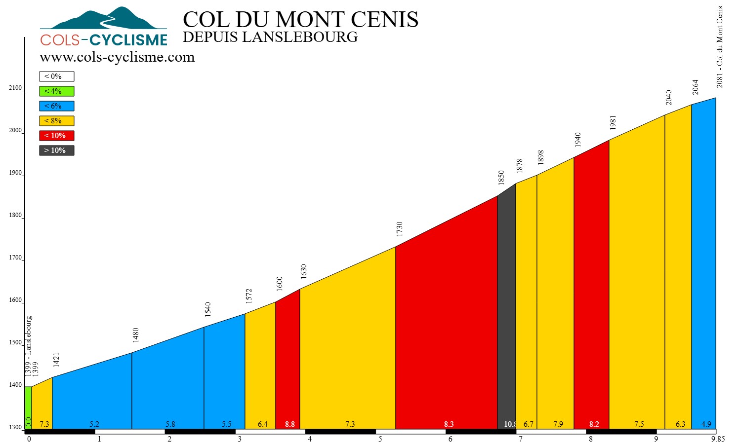
At Lanslebourg, this time I followed the D1006 over the river and towards the col. The road begins climbing immediately, sweeping up the valley side in five long switchbacks, initially through open meadows with views further along the valley towards the road I was on yesterday. A three mile stretch through forest is the steepest part of the climb, averaging nearly 8%, before the landscape opens once more to pasture, the gradient easing, as it approaches the col.
I reached Col du Mont Cenis ninety minutes after setting off, having stopped for a total of forty-six seconds (according to ride data!), once for a photo and once to get a piece of grit out from my forks. I rode straight past the col sign as the road was still climbing. Once I'd reached the highest point I turned and went back to the sign to get a photo. For some reason the sign comes about 100 metres before the actual col.

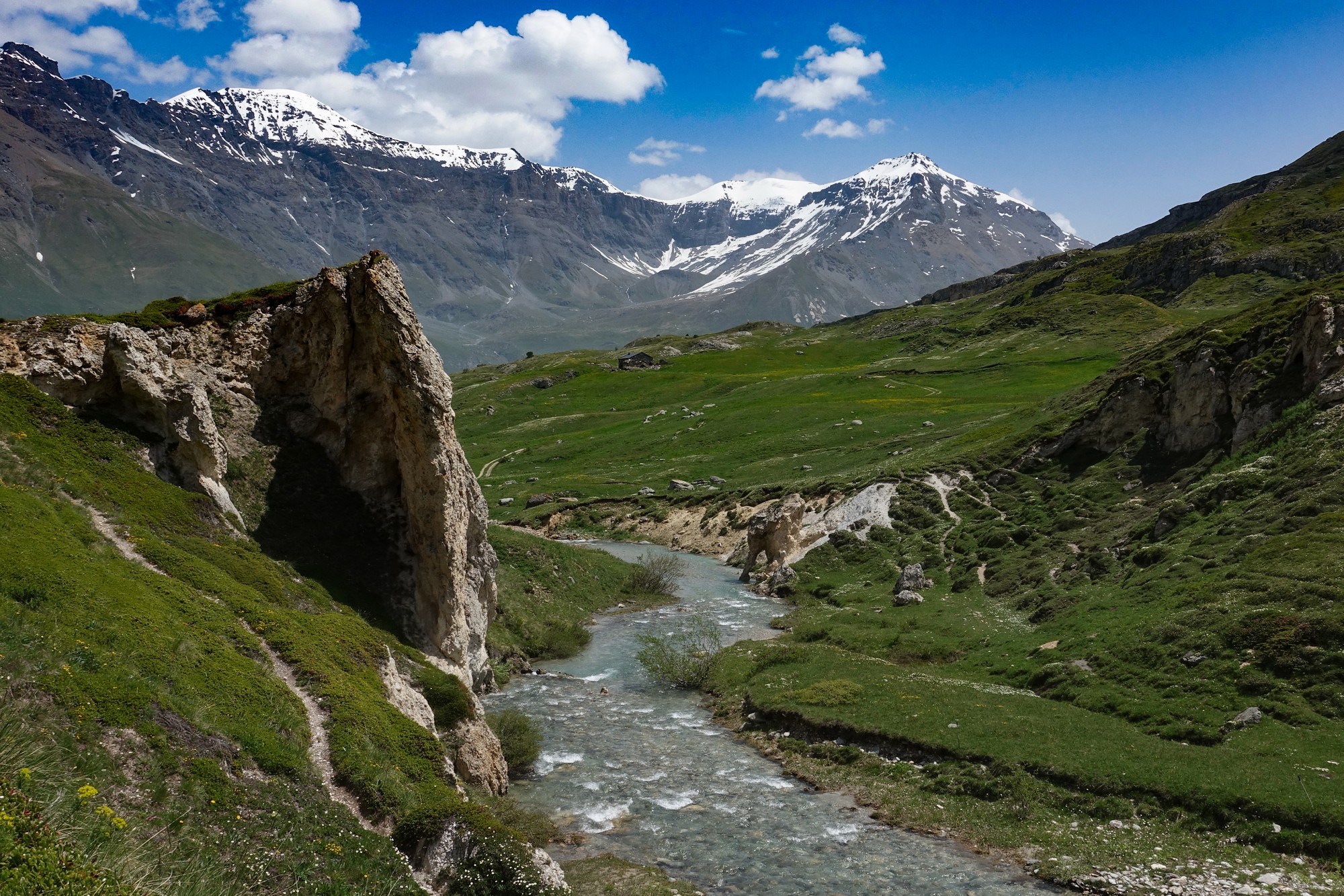
A few hundred metres further on from the col comes the turn off for Col du Petit Mon Cenis. And that's where five miles of cycling heaven begins (ten if you include the ride back!).


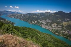
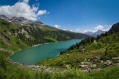
The narrow road threads its way through meadows aglow with dandelions as it skirts the western edge of Lac du Mont Cenis before heading along the beautiful valley of the Ruisseau de Savalain.


At the col du Petit Mont Cenis I had half my sandwich and a piece of fruit cake while I was taking in the splendour of the landscape. Then I got talking to a danish cyclist, Jasper. We stood there for quite a while chatting about all manner of things. I mentioned that it was a pity that the lake was not full because it doesn't look as good — he said he prefers it that way because there's 'more to see' — haha — different strokes for different folks!
Half an hour later I set off back to the main road. I stopped plenty of times for photos of flowers and scenery.

I could see cloud bubbling up over the Italian side. As I skirted the lake, a low grey veil lay across the dam and the water.

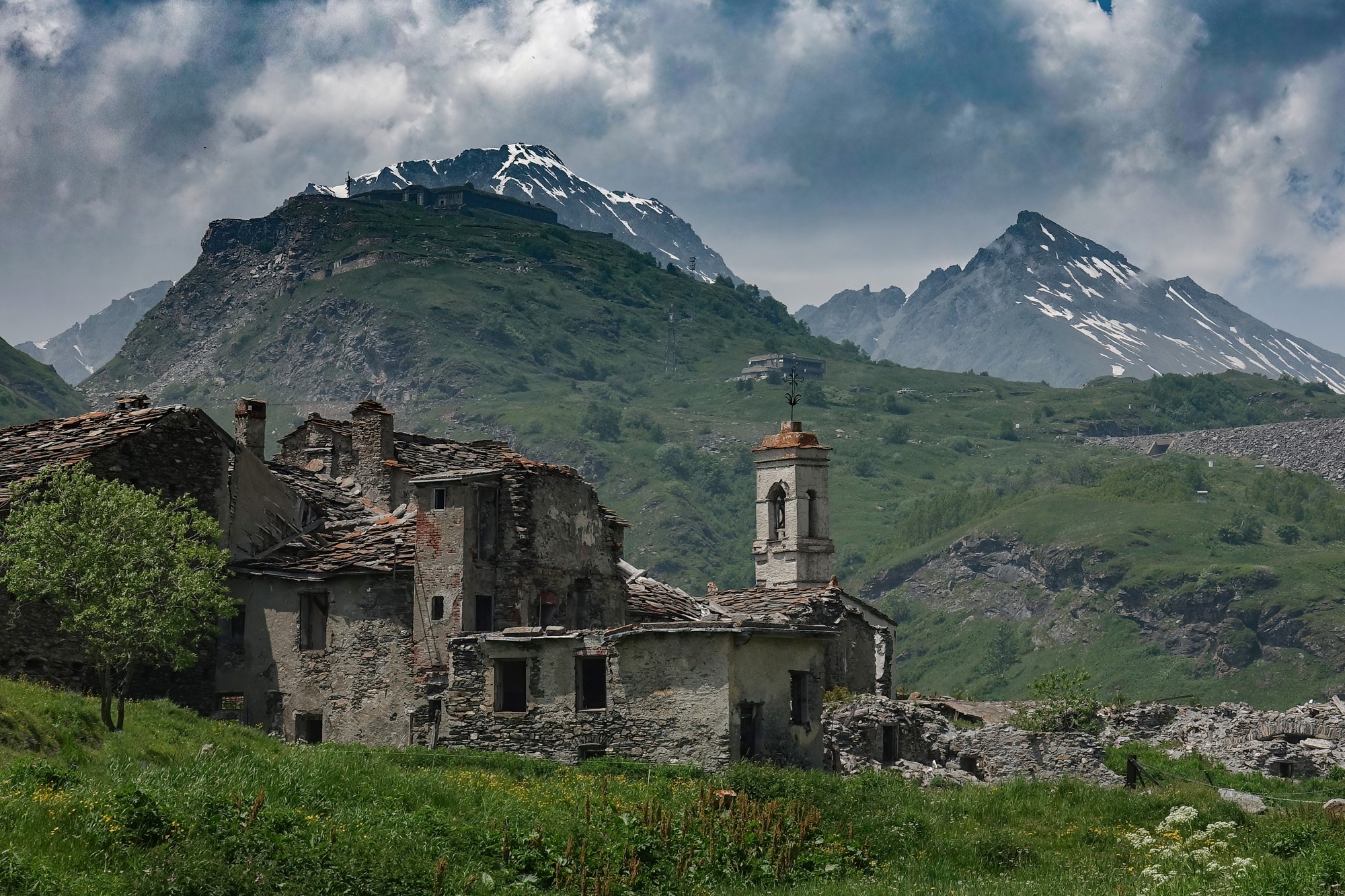
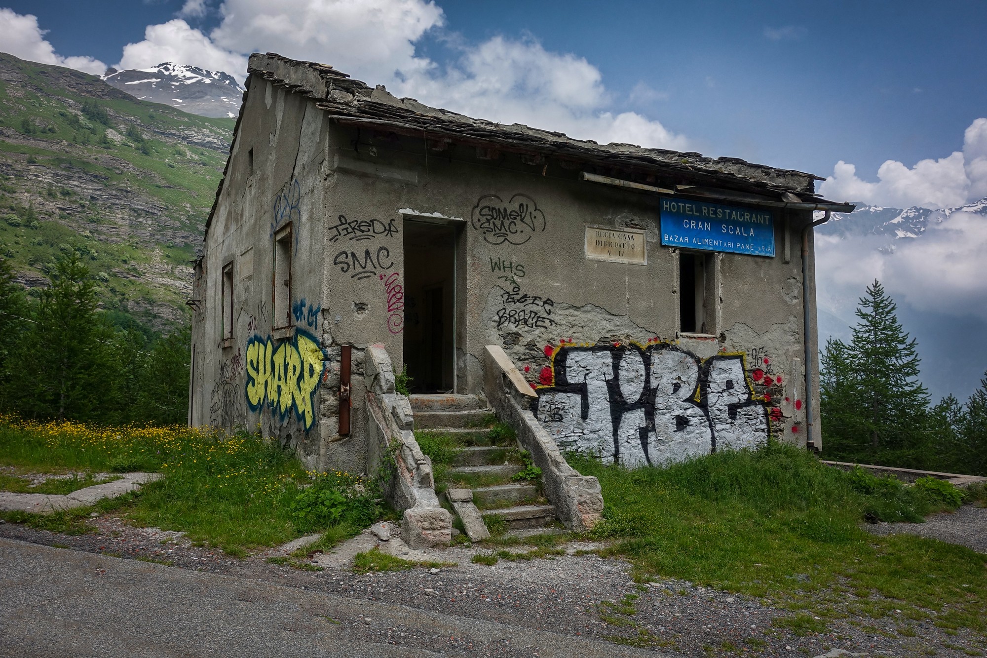
After four miles riding alongside the reservoir the road climbed briefly and then descended past the foot of the dam. An old village, Saint-Croix, once a thriving frontier stopover on the old road (now submerged) now lies abandoned, a veritable ghost town.
I carried on riding towards the Italian border.
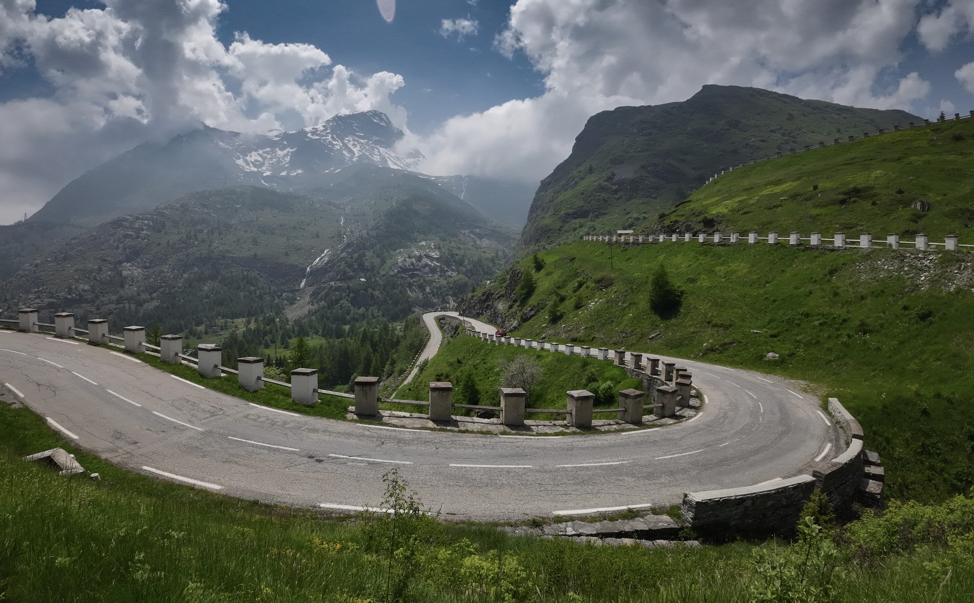
A stunning hairpinned road descends to the valley of La Cenise river. At the foot of these, I rode for a mile along the dead straight road and past the border line. I decided to venture further to see if there were any dramatic views down into Italy.
Unfortunately clouds got in the way of any views. I just stopped to do a quick report and have some fruit cake before making my way back across the border, the only indication of which was a stone in the roadside wall:

I rode back along that flat straight road and up the series of hairpins. They weren’t too bad and I just ground my way up there. But once at the top of those I realised there was still far more climbing to do. I had descended this very road barely half an hour earlier, so it’s hard to explain how I'd underestimated what it would take to get back. Seeing vans crawling high above on the next set of switchbacks was a surprise.
When I reached the level of the dam I spotted more vehicles even higher up. For a brief, hopeful moment I thought, at least I don’t have to go that high — I’m already level with the dam. But the road climbs well above it. I was doing okay; it was just more than I’d bargained for. In fact, in total it's a three-mile climb at 6.5% before a slight dip and then one final ramp at the same gradient.

Low cloud hung over the lake, ruining any real prospect of photographs — which, in a way, was useful, as it spared me further excuses to stop. I paused briefly for a shot of the dam and noticed a couple of marmots playing on a rock nearby. Even zoomed in as far as possible, the camera struggled to do them justice. Two Italian motorcyclists were standing there; having heard one of them mention marmotta, I pointed them out. They, too, were fascinated by them.


On the return to Col du Mont Cenis I saw dark skies gathering in the distance, suggestive of rain. I felt a few drops — or imagined I did — but by the time I reached the col it was definitely raining. Until then I had planned to descend without my jacket, the air being so warm, but I put it on. In the event, the shower came to nothing and stopped almost at once.
The descent down to Lanslebourg felt longer than expected — surprising, given I had climbed it only hours earlier — why does that happen? Looking down into the valley emphasised just how much height had been gained. My bidons were getting near empty, and I had eaten only half a ham sandwich and perhaps three-quarters of a slice of fruit cake. No gels, no energy drink — and all was well, although my stomach began to feel distinctly hollow towards the end; finishing the sandwich might have been wise.
It had been another wonderful ride from the Maurienne valley. The climb from Lanslebourg to Col du Mont Cenis was largely unspectacular — though everything is relative of course! The road to Col du Petit Mont Cenis was beautiful, with mountains, meadows, flowers and the river. So I've ticked-off another two cols above 2,000 m and claimed another Franco-Italian border crossing. Gotta collect them all !
Check out the video for a better idea of the ride:

Border Changes Prior to 1947 both Col du Mont Cenis and Col du Petit Mont Cenis were situated on the international border between France and Italy. After the 1947 Treaty of Paris the frontier was moved eastwards (to where the marker stone is). The entire Mont Cenis plateau, pass, and lake became French territory. The central cross on this marker pays homage to the Savoyard heritage that historically unified this Alpine area.

Old road The old road (prior to the dam construction in the 1960s) is now under the lake. That explains why I had so much climbing to do on the return from Italy. The new road had to be built higher around the lake, and at one point is even higher than the col. I discovered the course of the original road on an old IGN map.
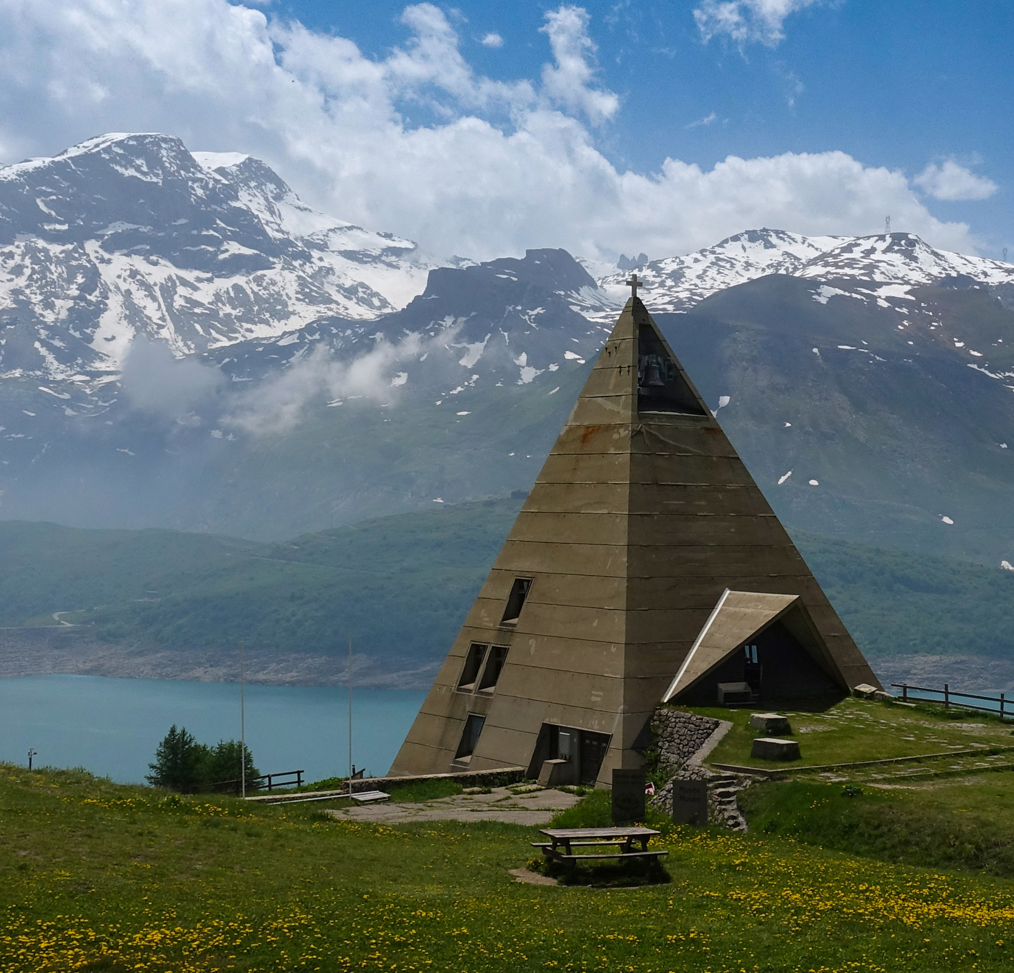
Lac du Mont Cenis The dam was built between 1962-1968. While not as devastating as the filling of Lac de Roselend, the subsequent reservoir submerged several buildings including a hospice and its priory. EDF built the Chapelle Notre-Dame-de-l’Assomption (“la Pyramide”) in recognition of the loss of the priory. I only discovered after the ride that there is also a museum inside la pyramide. Maybe it has a history display like that in the Chapelle de Roselend. I'll have to check it out if I ever do the southern ascent of Col du Mont Cenis from Italy!

Critérium du Dauphiné Just two days after I was there, the eighth and final stage of the 2025 Critérium du Dauphiné finished on the col du Mont Cenis. Had I known this in advance I could have scheduled my ride for that day and watched it from the finish line. However I did manage to see the race go right past my van in Termignon, just before that final climb. Stage report here.

Baja Bugs In the forest section of the climb today I saw a bunch of modified Beetles coming down from the col. Clearly designed for off-road use, I discovered later they're called Baja Bugs. They were taking part in Baja Alpina 2025. Judging from photos on the event website they'd been over Cormet d'Arèches, Galibier, Col de la Bonette and other favourites of mine.
Gallery
Click to enlarge / see slideshow


Thank you Vince ! I’ve been there twice, nice ride.
Thanks for your comment Thierry. I hope you enjoyed it as much as I did !