Distance: 35.5 miles. Elevation: 6351 ft.
Col du Parpaillon
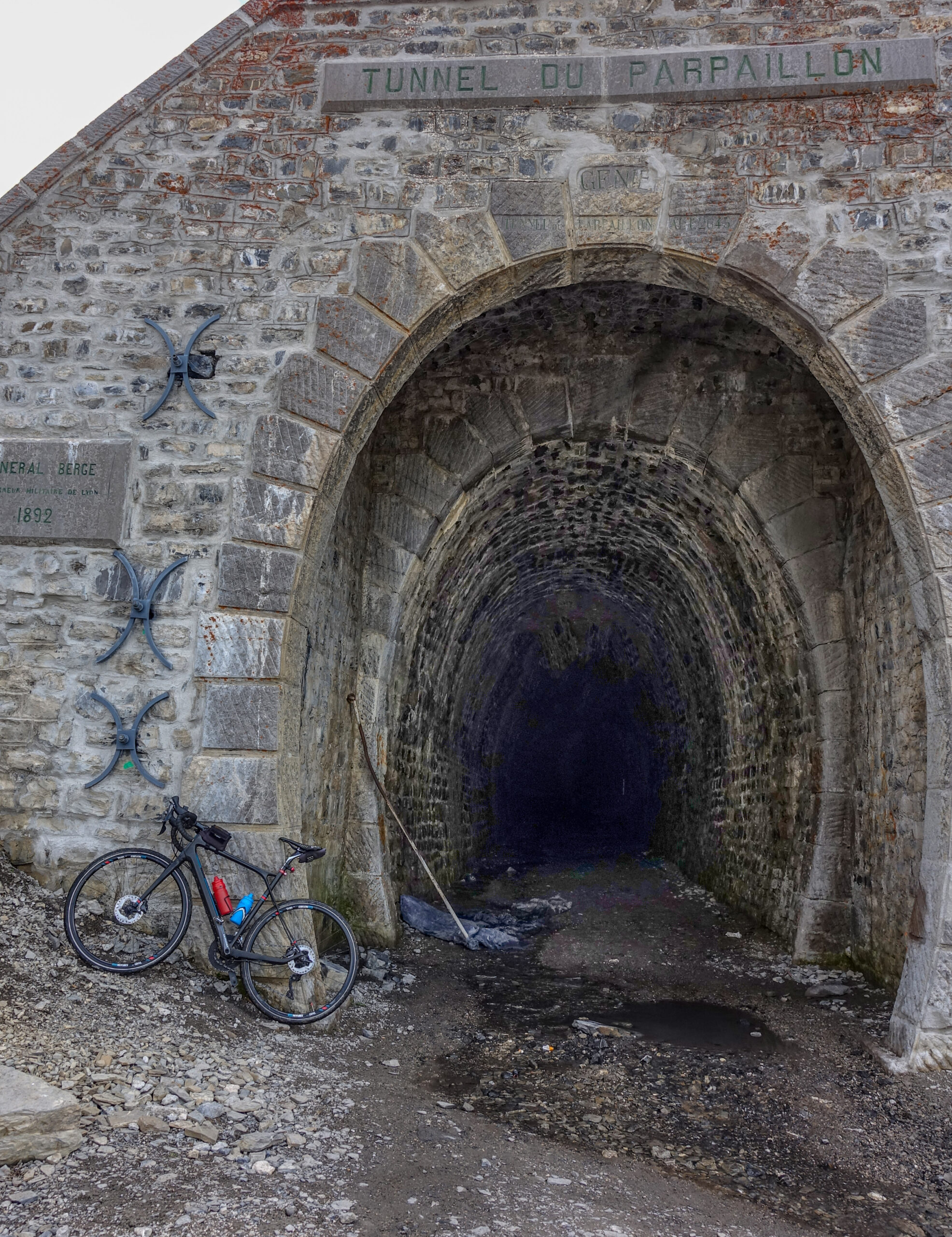
The mythical Tunnel du Parpaillon! Ever since I first learned of its existence it has been on my list — and even, at times, taken off it!
Originally I had contemplated climbing it from the other, probably harder, side near Jausiers. Initially I had been inspired by old reports and a charming and quite bizarre old film (see below). But more recent reports and videos online, including one of a motorcyclist struggling to get his machine over the terrible surface — much of it chewed up by the 4x4 brigade — have dissuaded me from attempting it.
Later I started looking at the other ascent, from Embrun, but again I found accounts suggesting it was really only suitable for a mountain bike. Then in July 2024 came news (via the Club des Cent Cols) that the tunnel was closed to all vehicles and pedestrians due to a collapse inside the tunnel, compounded by some of the track having been swept away by an avalanche. So I gave up on the idea of ever doing it. I remember driving through Embrun last year, looking up at the mountains to my left, knowing it must be somewhere up there, but with no notion of ever attempting it.
Something must have continued to niggle away, though, because I eventually found myself researching the northern (Embrun) ascent again — and reading that the department had carried out some work to improve the road (track really). But when I first arrived here at Embrun, I googled road closures and found out that the Tunnel du Parpaillon road is not open and won't be until mid July. That was a disappointment and is the reason I did yesterday's ride around Lac de Serre Ponçon instead.
But today I decided to attempt it and just see how far I could get.
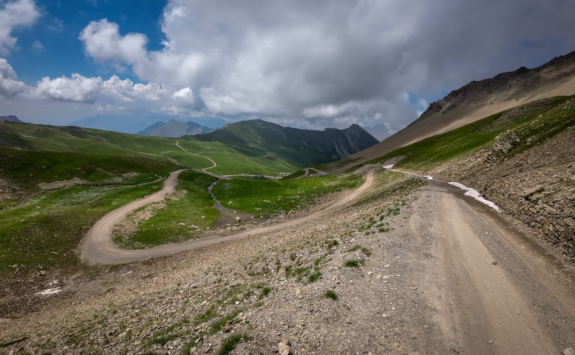
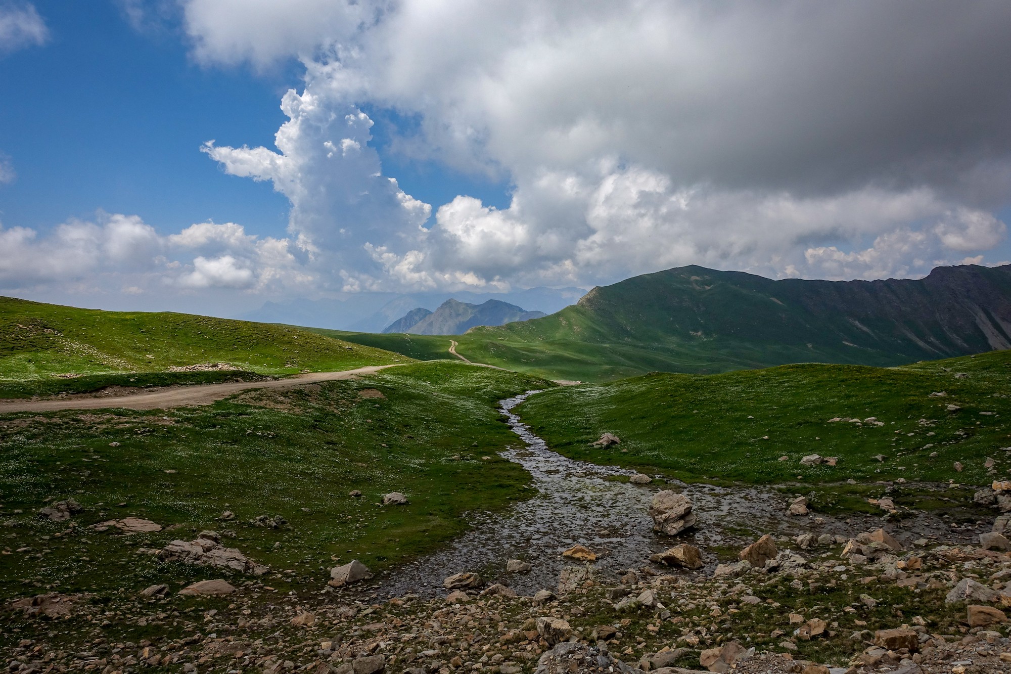
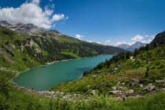
In contrast to yesterday’s ride around Lac de Serre-Ponçon, today's route was less obviously photogenic. But in most other ways it was far more up my street: largely devoid of traffic — and indeed people — with a real sense of wild mountain isolation. There was also an additional element of uncertainty, not knowing whether lingering snow would ultimately allow me to reach the tunnel at all. Add to that the challenge of a 15.5 mile climb at an overall average of 8%, the last 7 miles of which are gravel at an average of 9%. What's not to like? And let's not forget that this ride comes the day after yesterday's 8,000ft of climbing....
So I set off at 10:20. It was another warm day, the temperature already in the mid 20s°C — rising to around 30°C for most of the climb.
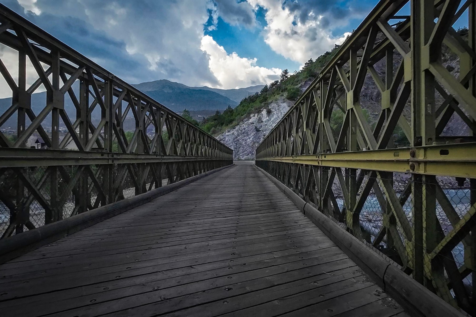
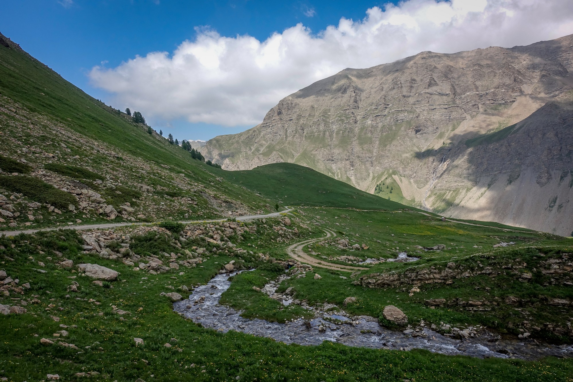
Escaping Embrun via the back streets, I dropped down to and across the River Durance on a noisy wooden-plank bridge, before tackling two miles at 9%, with occasional views back towards Embrun and Lac de Serre-Ponçon.
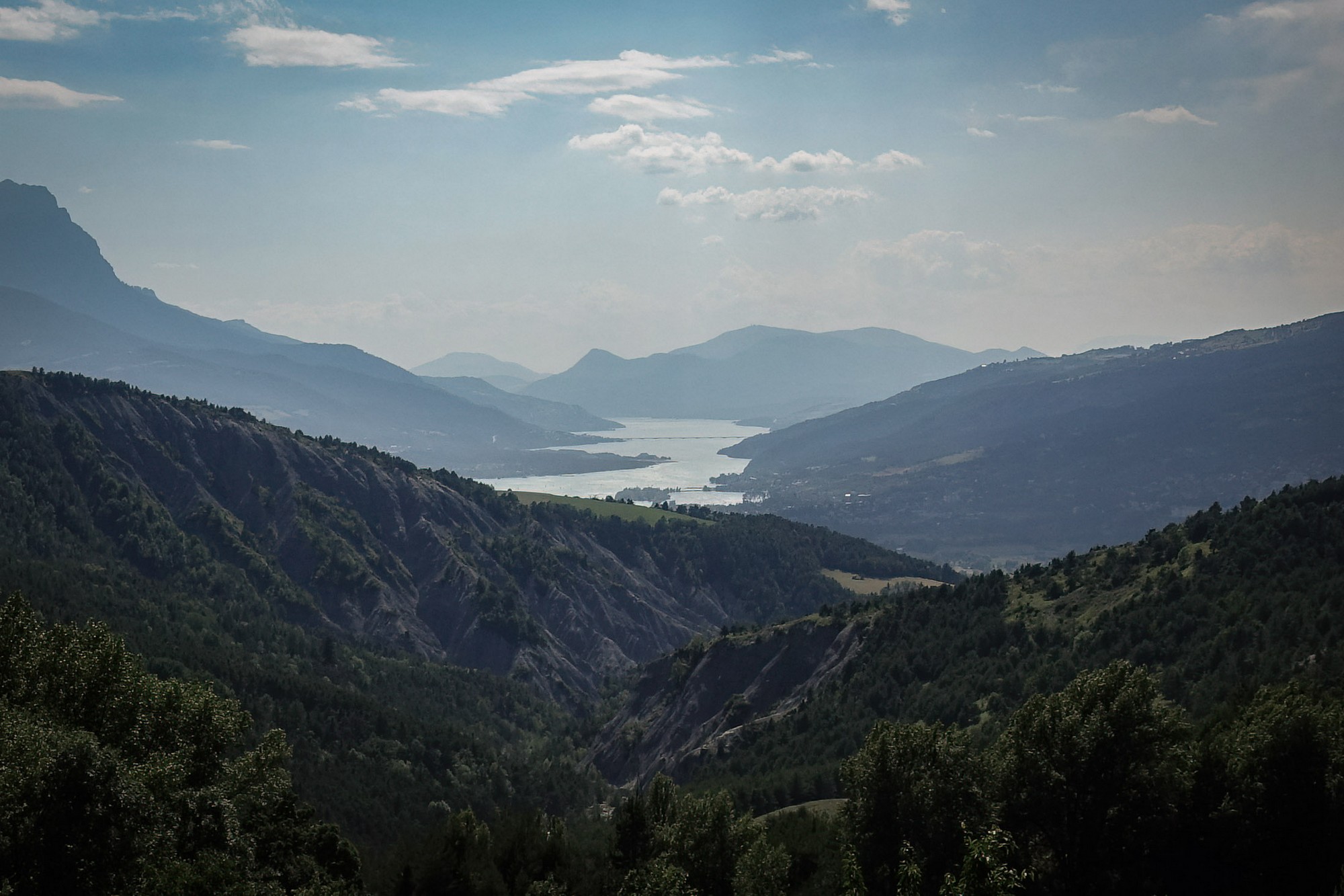
The climb then settled into a steady grind — five miles at an average of over 7% — in hot, still conditions, with barely a cloud in the sky and almost no traffic.
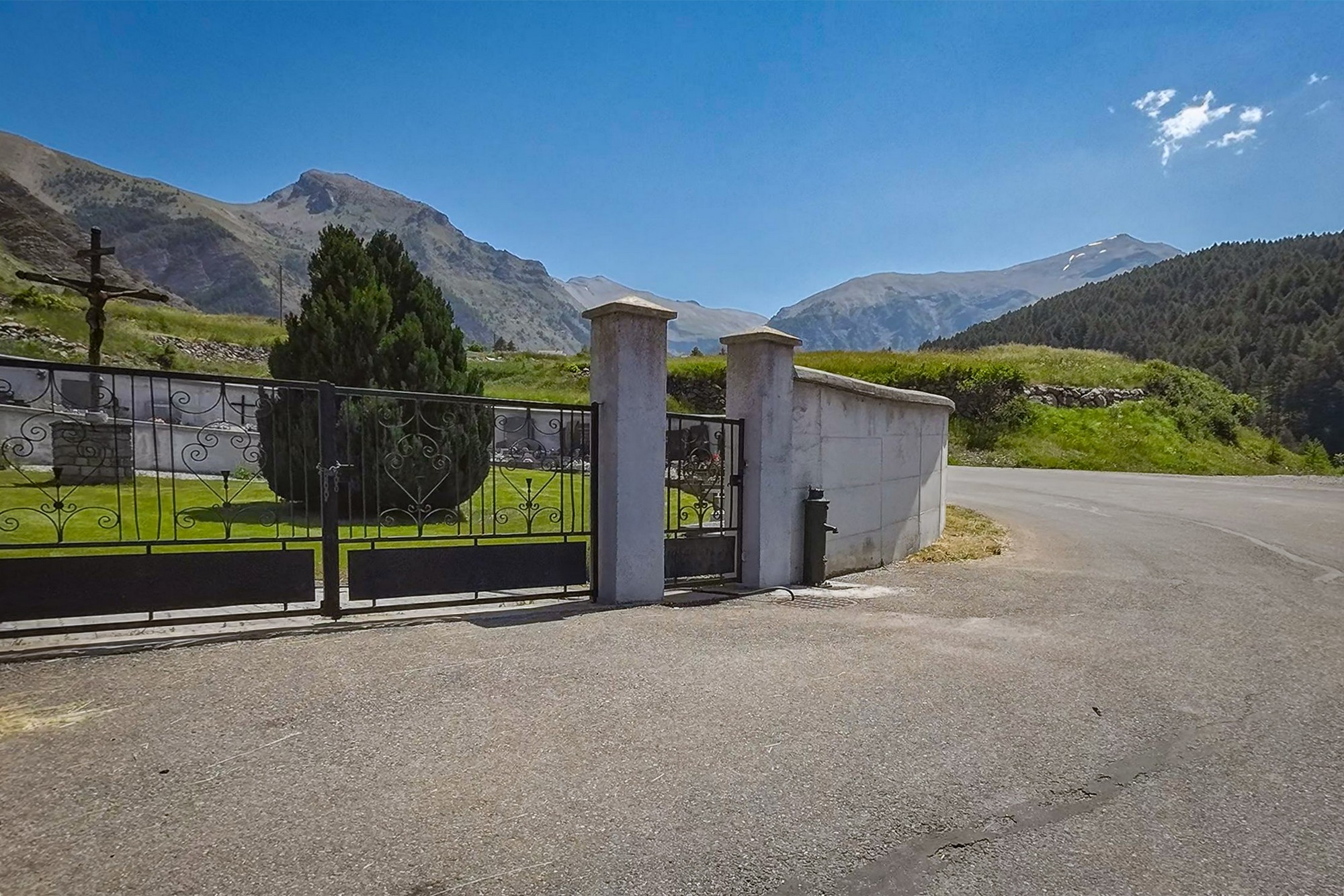
Two hours in, having climbed roughly 3,000 ft in just under ten miles, I reached the tiny village of La Chalp. I’d hoped to refill from the tap by the cemetery — one I’d read about online — but it wasn’t working.
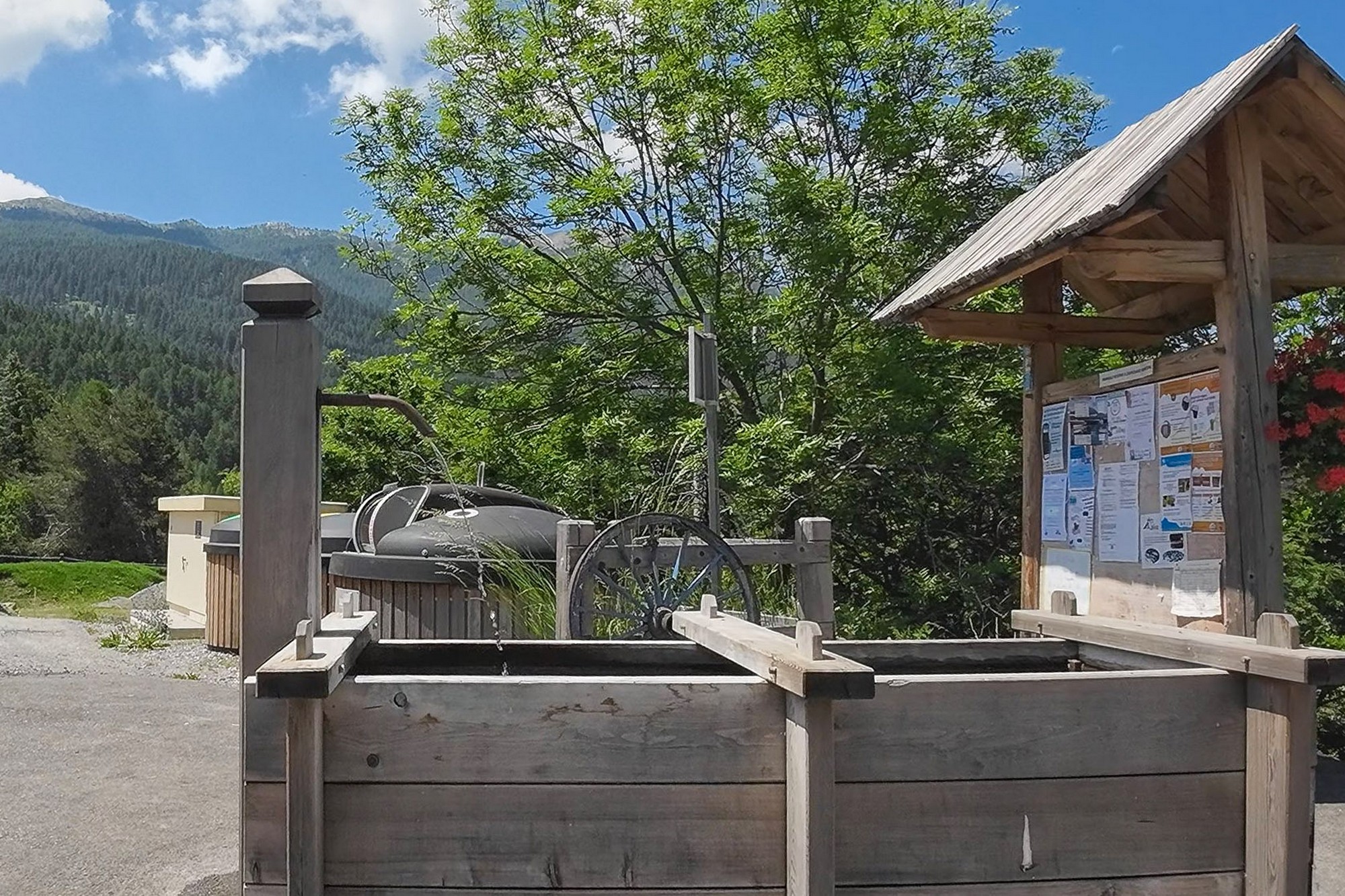
Fortunately, a little further on there was a water trough in the village, where I emptied and refilled both bidons.
On leaving La Chalp, the last sign of civilisation is an isolated roadside restaurant, La Petite Fringale. Beyond it, the road stays level for a short while before crossing the Torrent de Crévoux — the river whose course it has been following — at the Pont du Plan.
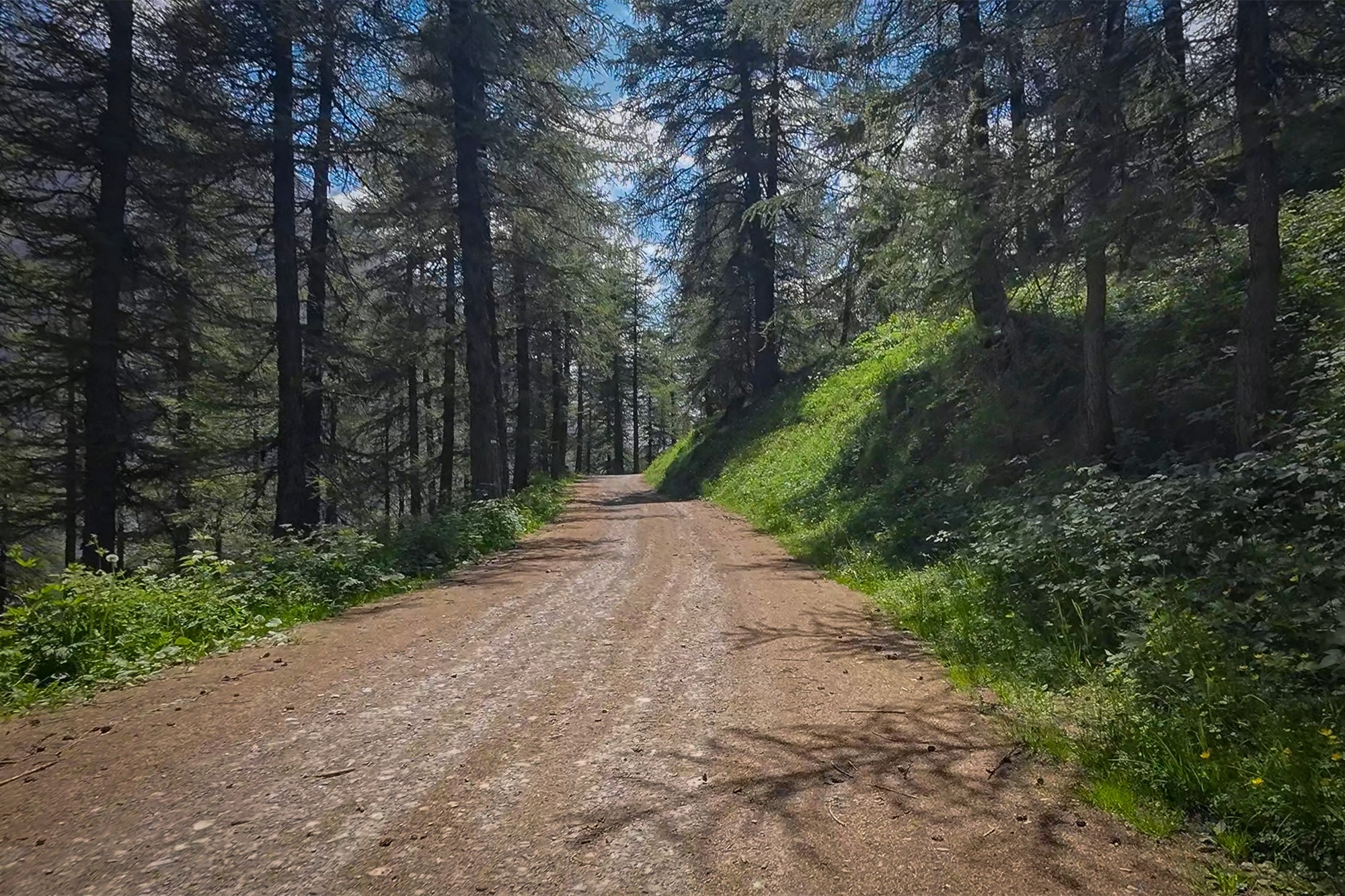
From there, the climb steepens into the forest, doubling back on itself before turning again to track the river, now high above it on the valley side.
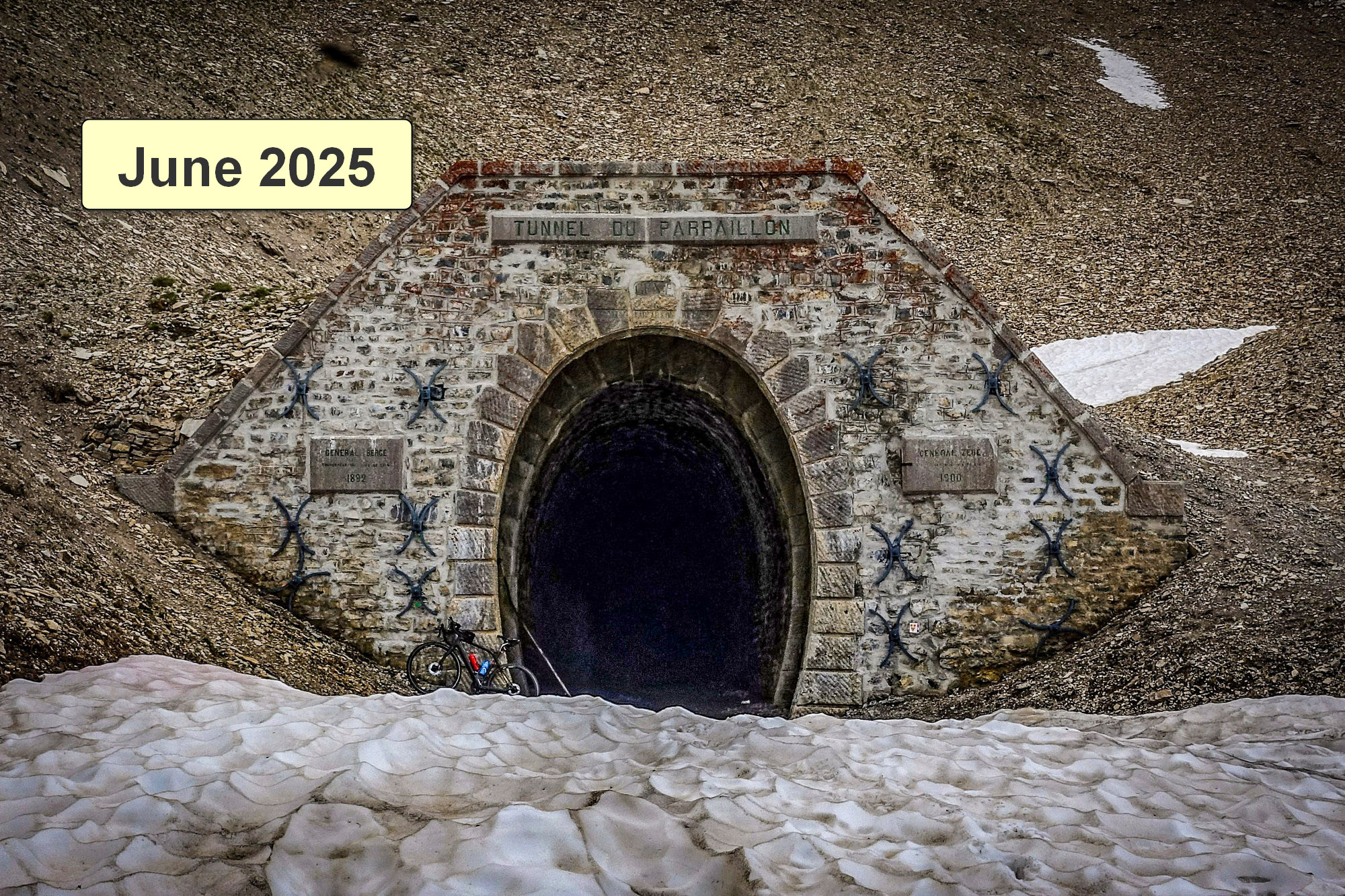
For the first mile or so the surface remains tarmac. Just as the gravel begins, I met a group of motorcyclists who assured me the track was open all the way to the tunnel — and in good condition. That was a welcome boost, allaying the doubts I'd had about being able to get there. At last I knew I was within reach of achieving something that had been on my list for years.
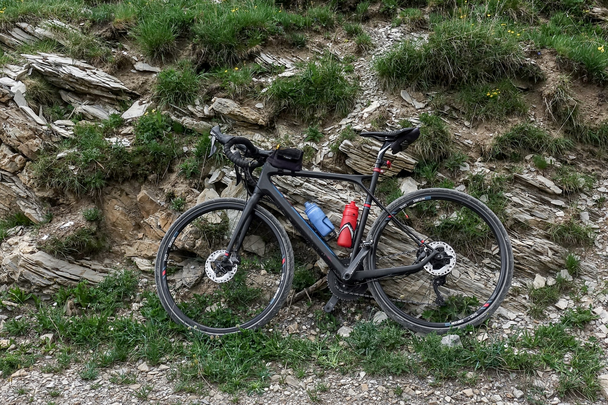
The track proved straightforward on a gravel bike, and smoother still along the edges, where the trees had laid down a soft carpet of orange pine needles.
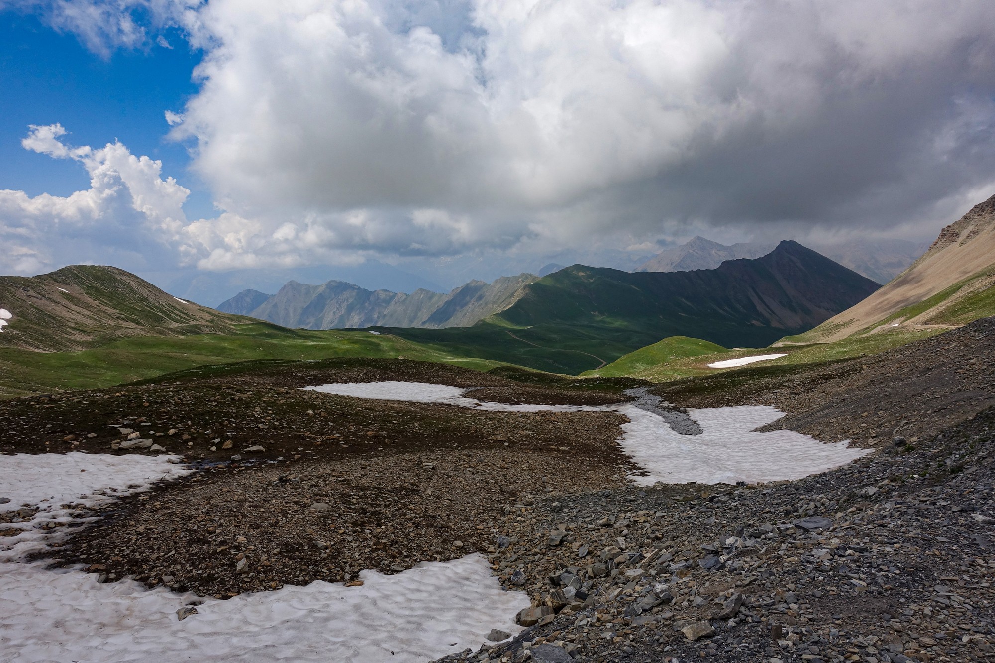
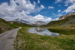
After a couple more miles at around 9%, the road finally broke out of the forest and into the sunshine of the open mountain, at well over 2,000 metres.
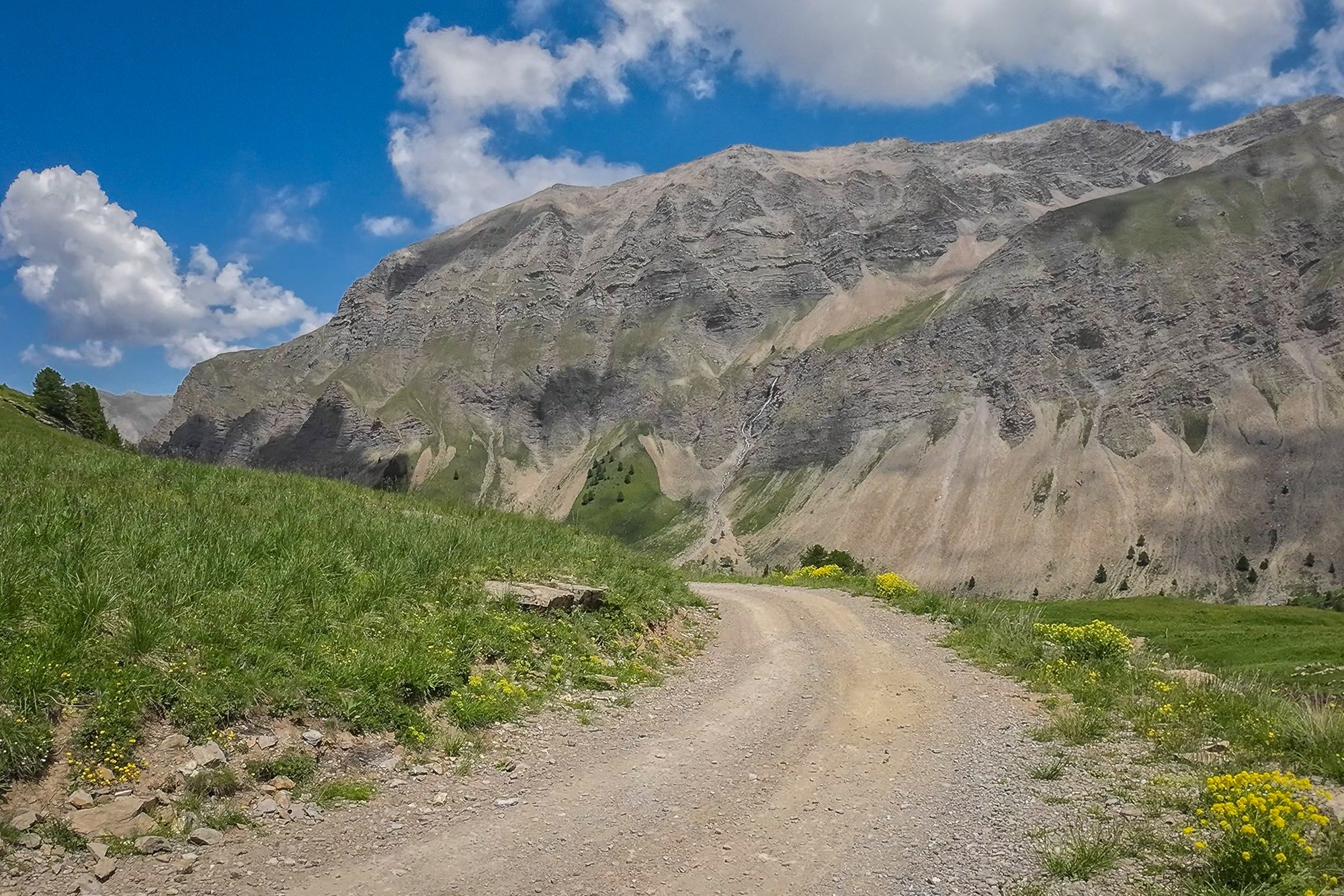
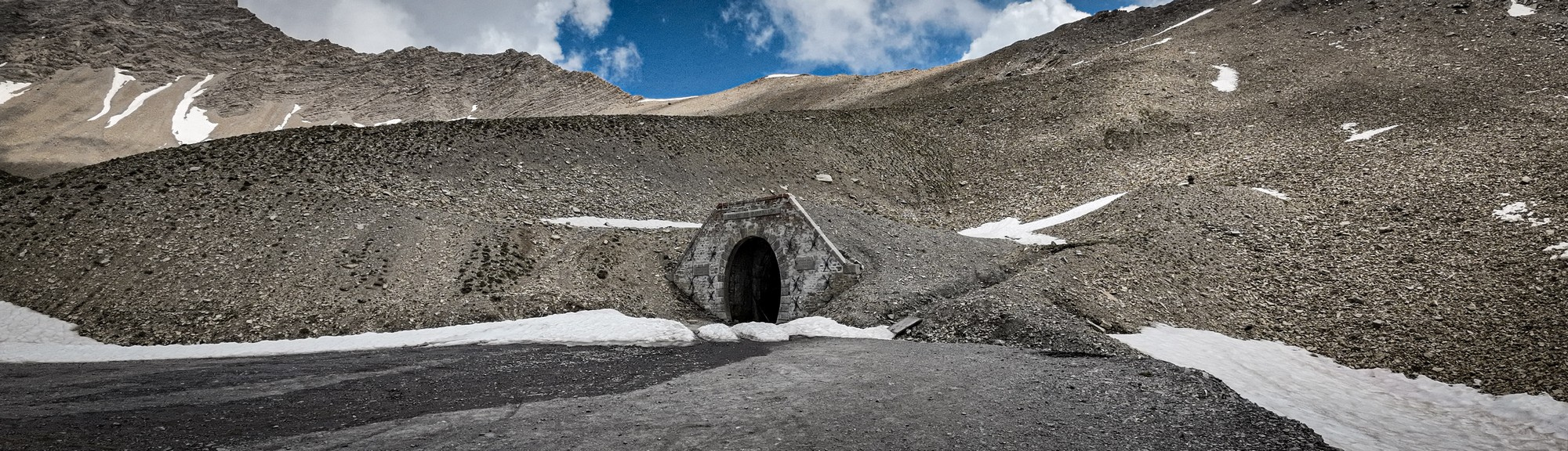
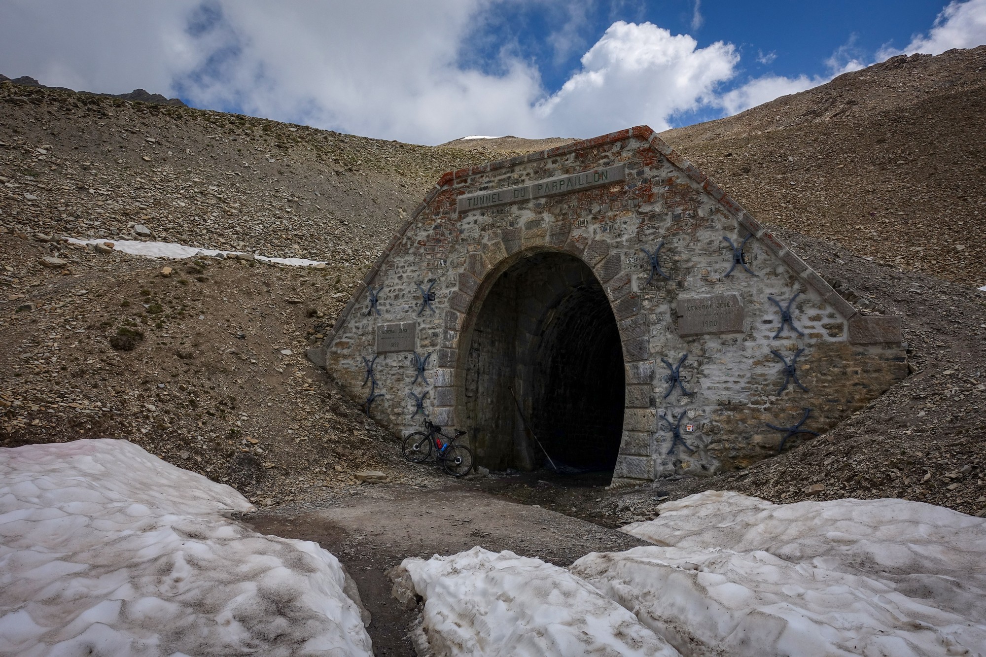
From there, it was another three and a half miles at roughly 9% to the top — an hour of riding, plus a few brief stops. I’m not sure I felt the altitude directly, but it was a grind by the end, reaching the Tunnel du Parpaillon at 2,783 m — the highest ‘official’ col I’d climbed.
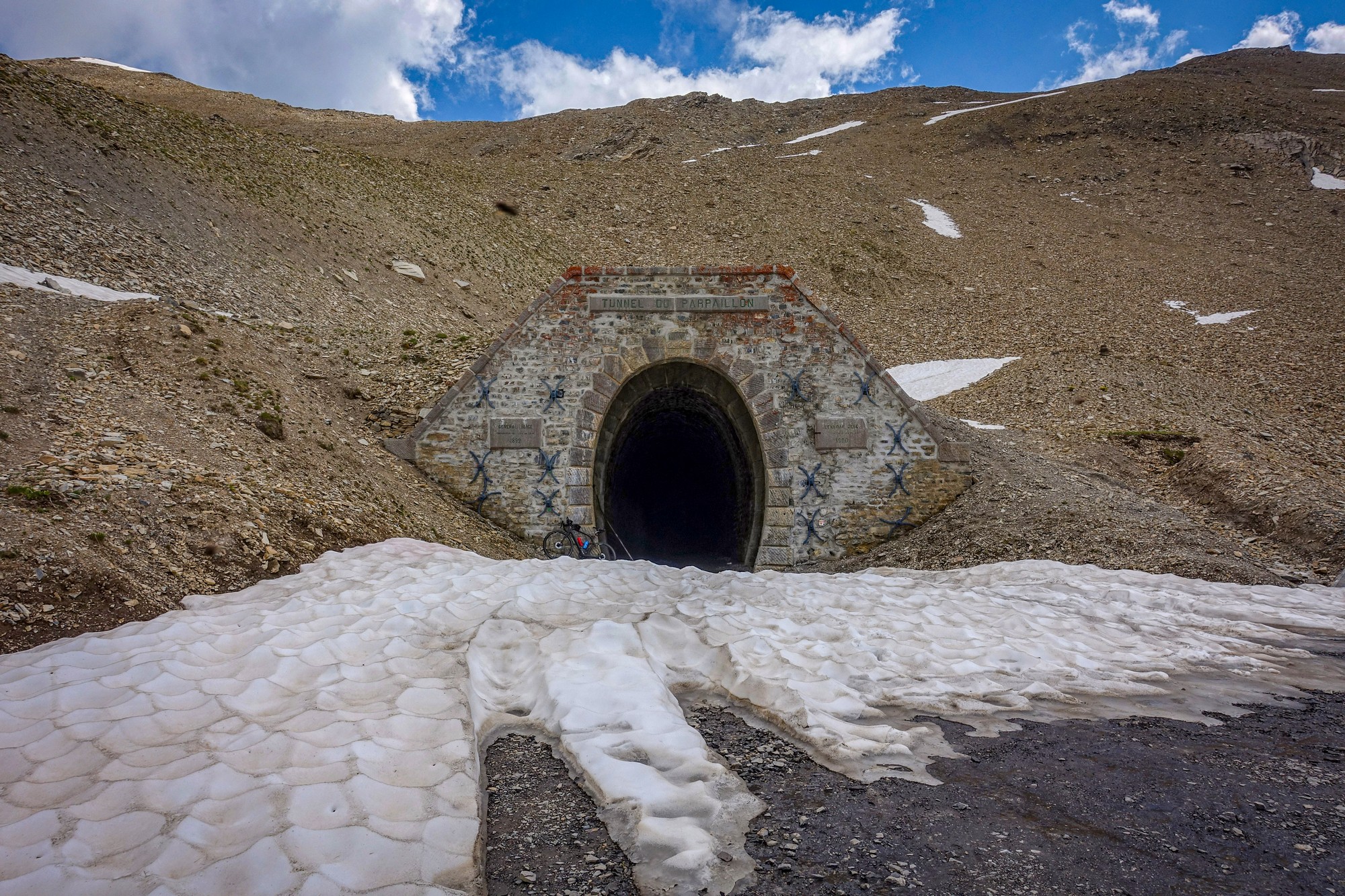
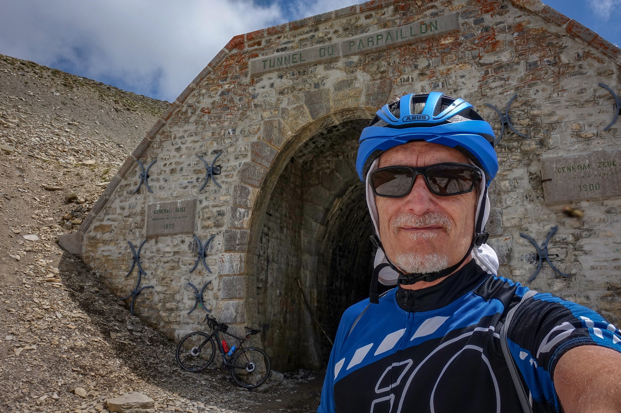
The amazing thing is that I was the only one up there. I had seen a couple of mountain bikers descending about a mile from the top, but that was it. So I could stand there and gaze around in peace (ignoring the flies - see video).
I stood there for a while, reflecting on my achievement and making some notes. Despite the altitude, the temperature was still in the high teens °C, so I remained comfortable in my lightweight kit. About twenty minutes later I began the descent.
The first mile or so was slow-going, the track covered with mud where snowmelt ran across it. Lower down I could let the bike run a little more freely, although with the gradient still around 9%, my hands rarely left the brakes. By the end my wrists, hands and neck were feeling the strain. I saw just one other road cyclist grinding their way upwards; otherwise the mountain felt deserted. Once back through the forest and onto tarmac, progress became much quicker, and the temperature steadily climbed, eventually touching 30°C near the valley floor.
In La Chalp, I stopped once again at the trough to refill my water, and also took the opportunity to wash all the mud off my bike by spraying water from a bidon.
Further down I took a different route to the wooden-plank bridge — Le pont neuf — across the Durance, before following the river downstream.
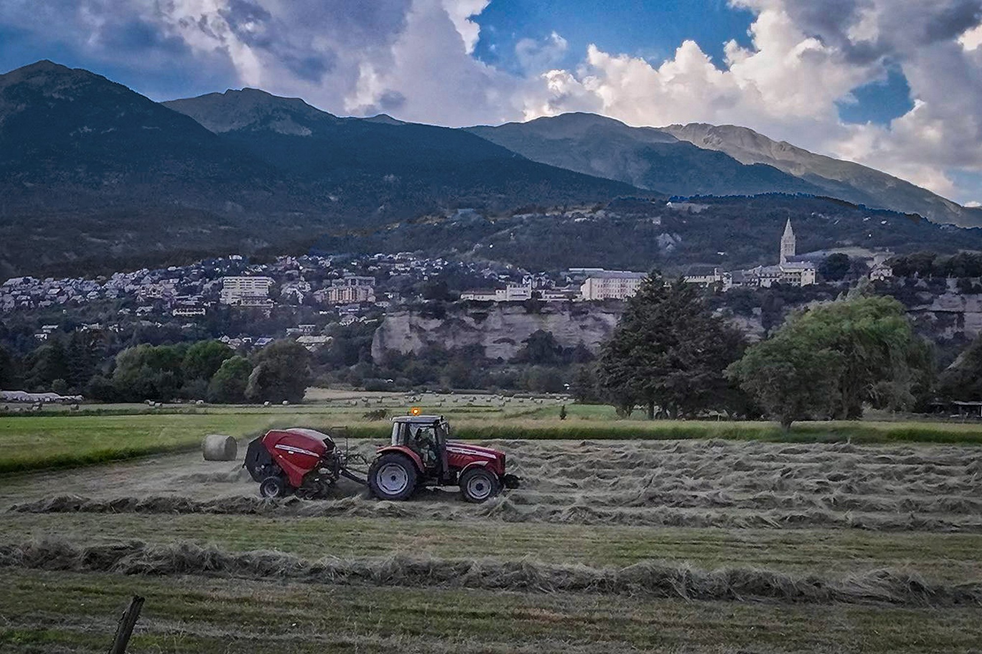
I stopped once to watch a farmer making those round bales of hay with his tractor — something I had always vaguely wondered how was done.
I paused one last time simply to absorb the late-afternoon atmosphere: the open fields and skylarks chattering incessantly overhead.
The final few hundred yards were unexpectedly steep, forcing me off the bike and onto a narrow footpath. Then I heard a familiar blackbird song. I wondered whether all the blackbirds around Embrun shared the same call, as I pushed my bike up the incredibly steep footpath — only to emerge at the top of the path within a few metres of my van! It had been the very same bird I’d been hearing throughout the previous couple of days here! I found that quite amusing — and a fitting end to another amazing ride that had ticked-off one of the big unknowns on my list.
The Col That Got Away
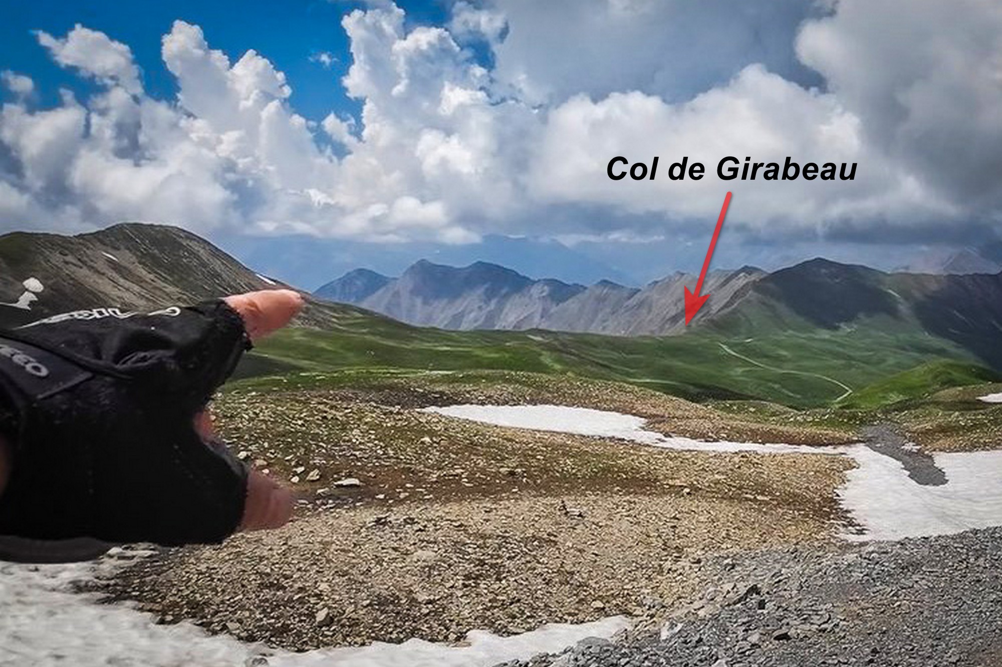 The one thing I got wrong on this ride was forgetting to claim the Col de Girabeau. Months later, rereading an old exchange with another centcolist, I found his warning — “Don’t forget to claim Col de Girabeau while you’re up there” — and my reply: “I won’t.” But I did forget! Damn — an easy 2000m+ col missed."
>> STOP PRESS (May 2026) >>
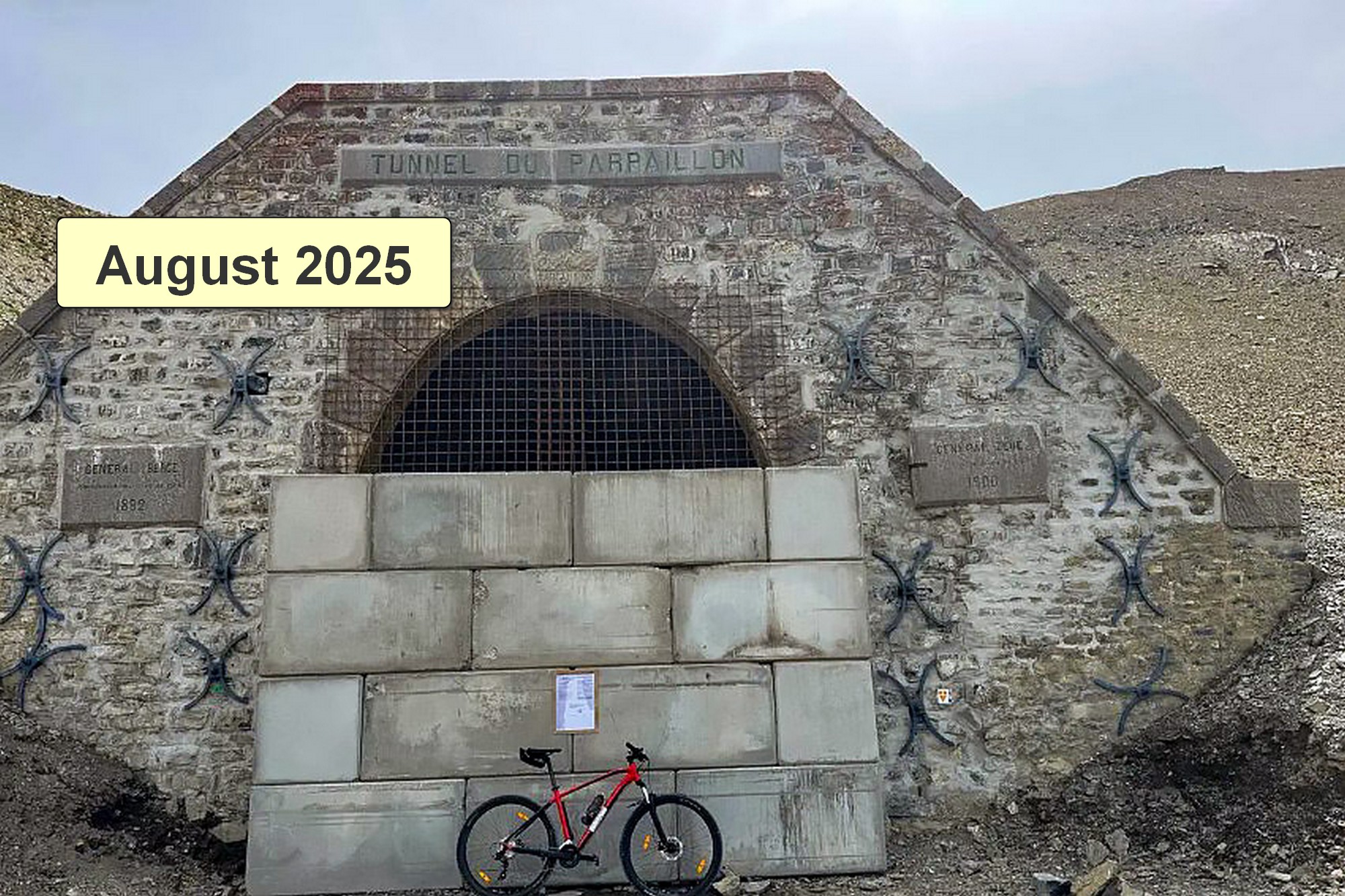
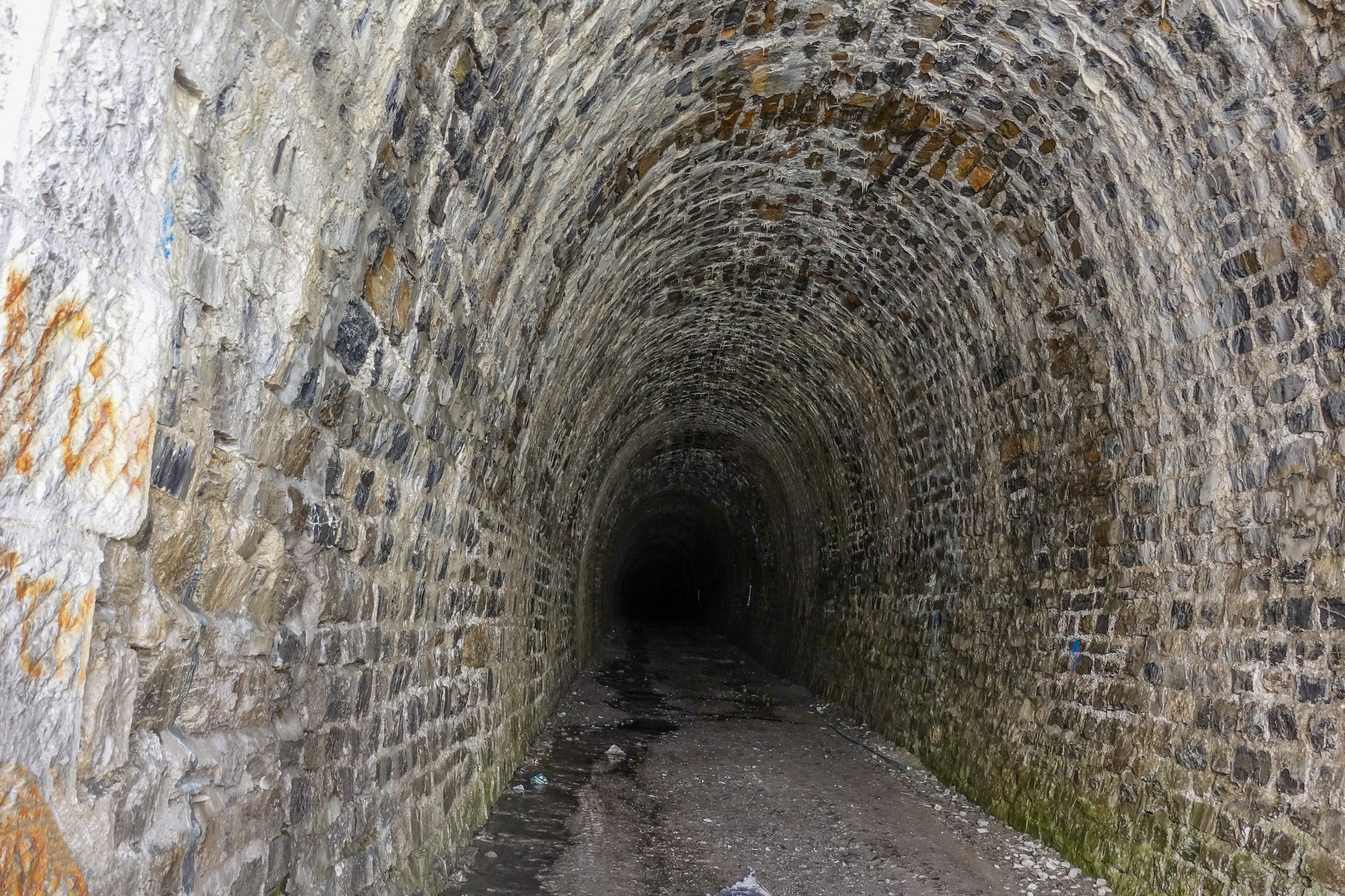
Further research, almost a year after this ride, has led me to discover that the tunnel is now, sadly, physically closed — not with the old steel doors, but with ugly concrete blocks. It looks as though this time it may be for good.
One of my personal tenets is that nothing lasts forever, but it is still sad to see the Tunnel du Parpaillon possibly being added to the list of extraordinary roads closed in recent times, such as the Grands Goulets. Rockfalls and landslides are almost always the culprits.
Once again, I feel immensely lucky to have done this ride while the tunnel was still open, just weeks before it closed, maybe forever. Although I didn’t venture inside, I’m glad I saw it in its natural state.
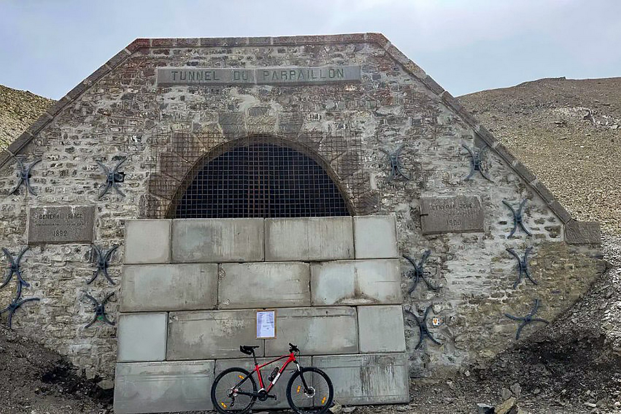 On a more positive note, they haven't completely bricked-up the entrance — we can only hope those blocks are temporary. They're certainly ugly, and look makeshift. Time will tell ...
So the only way now is 'over', not 'through'. It's a very challenging hike-a-bike mission to go over the actual col above the tunnel:
Testimonial from Thomas Guillaud (summer 2025):
"We got over the ridge, but it took us two hours. There’s a vague, very narrow path on the way up, but on the other side there’s no obvious route at all. Both slopes are extremely steep. One false step — especially with a 20 kg bike on your back — and you’re gone. We came out of it completely drained, both physically and mentally."
Further reading
I have read dozens of evocative accounts of the Tunnel du Parpaillon, many of which make my own humble efforts look like the work of a mere hack.
- The Parpaillon saga Lots of articles on Col du Parpaillon published in the Club des Cent Cols magazine between 1974 and 2020: a saga compiled by Gerald Cowham.
- L'homme heureux au sommet du col (Parpaillon) This is a tiny video excerpt from the crazy film "Parpaillon" — released in the US as "Up and Down" — by Luc Moullet (1992), an absurdist comedy about a cycling race to the tunnel, owing as much to Alfred Jarry and Jacques Tati as to cycle sport..
As can be seen, back then, a road bike was sufficient to take on the southern ascent. The complete film was once on YouTube but has unfortunately been removed. It's well worth checking out if you can find it. - Damage to the Parpaillon tunnel: towards permanent closure? Information and photos about the original closure in 2024
- Tunnel du Parpaillon appears to be closed for good More info about the tunnel and its latest closure, and the alternative route over the top.
Gallery
Click to enlarge / see slideshow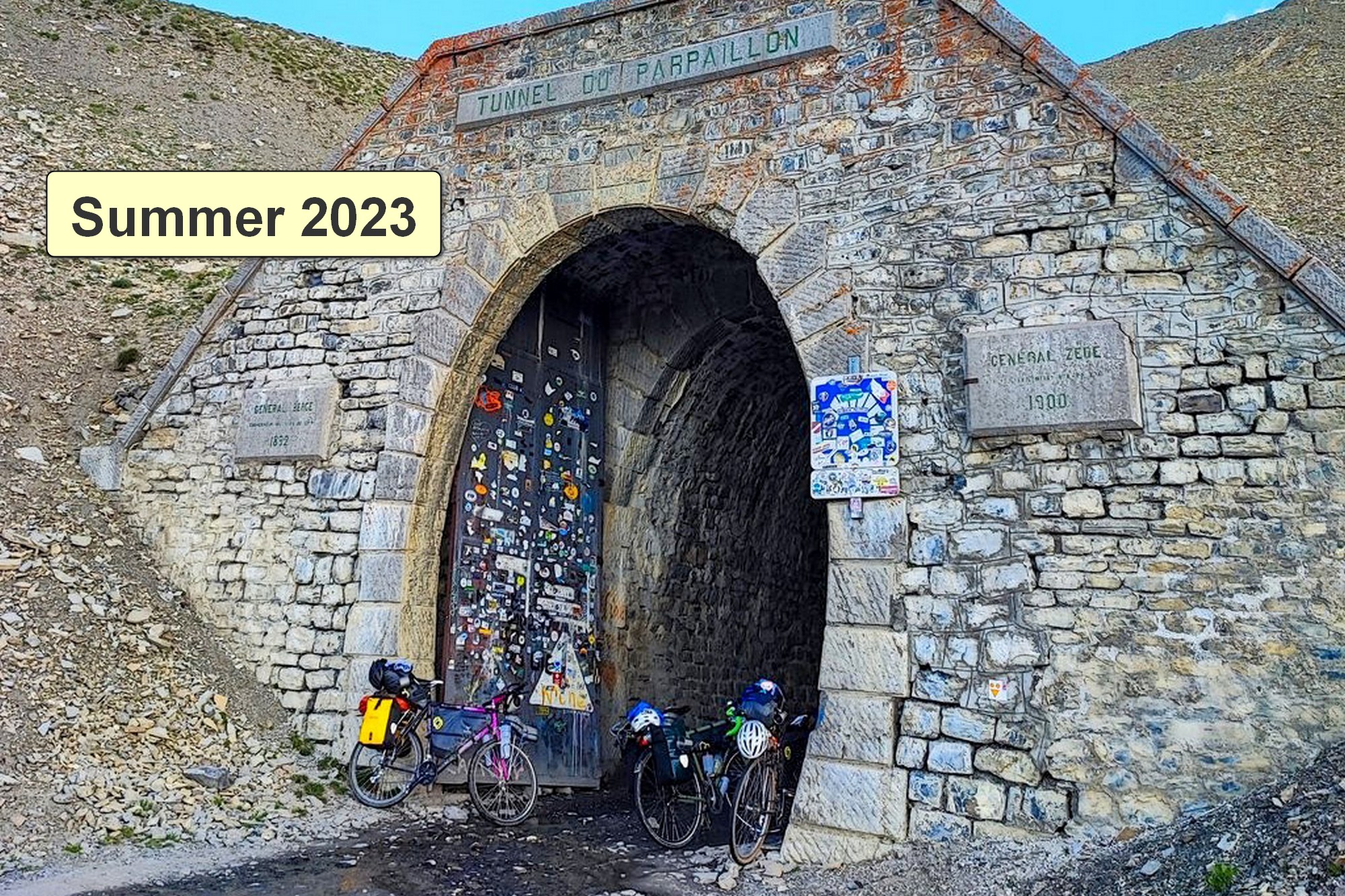


Thanks for providing today’s entertainment Vince, another superb ride report. I’ve ridden a few of the famous paved Cols, but these tough and gnarly gravel ones are surely in a category above, well done! While opportunities to photograph construction equipment en route are more rare, I was glad that you found an agricultural alternative (tractor+bailer). Looking forward to following your new adventures this summer.
Cheers
Martin
Haha! Thanks Martin! Hopefully I’ll see some more road-laying vehicles, etc in a few weeks time!
Cheers
Vince
Merci Vince pour ce nouveau reportage toujours aussi intéressant… Je suis monté au tunnel il y a près de 20 ans, en VTT, côté sud… la piste était très mauvaise mais restait à peu près praticable en VTT. Mais j’étais plus jeune, j’avais une grande partie sur le vélo à la montée. Un grand souvenir !
Merci pour ton commentaire, Thierry.
C’était peut-être l’âge d’or ? Tant d’anciens itinéraires deviennent de plus en plus difficiles à faire aujourd’hui. Tu as probablement réussi à tous les faire à l’époque !
Amicalement,
Vince