Off The Road Again

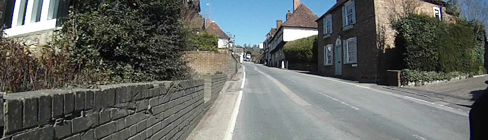
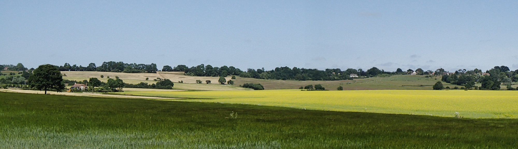
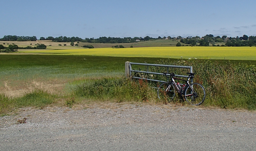
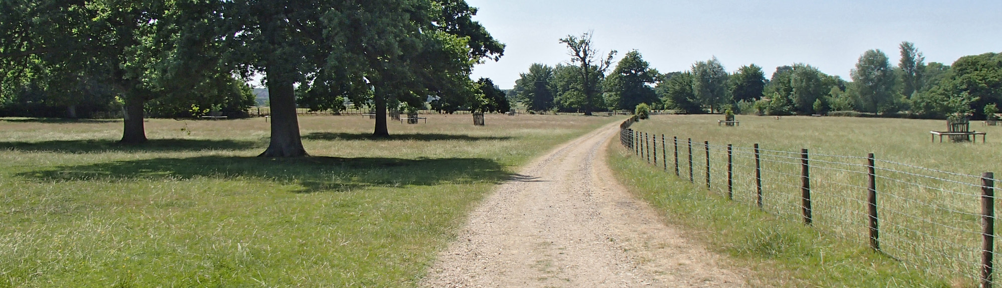
I planned another ride around the lovely lanes in the Smarden / Pluckley area. But, as has happened before, I hadn’t checked that all of the route was actually on roads! The weather was beautiful – sunny and warm. Shortly into the journey my Garmin told me to turn right here:godinton 
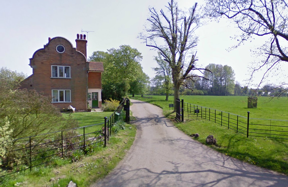
The sign next to the gate says “PRIVATE DRIVE”. I had a quick look at the Garmin to see if there was a way around, but there wasn’t a short alternative. I couldn’t believe that the mapping software would lead me up someone’s ‘garden path’! I was more inclined to believe that it was a public right of way and the sign was just there as a deterrent. So I rode up it anyway. The path led me past a huge country house (which I later discovered was Godinton House) and then through what seemed like a country park. I was soon travelling on a rough path and over cattle grids. OLYMPUS DIGITAL CAMERA

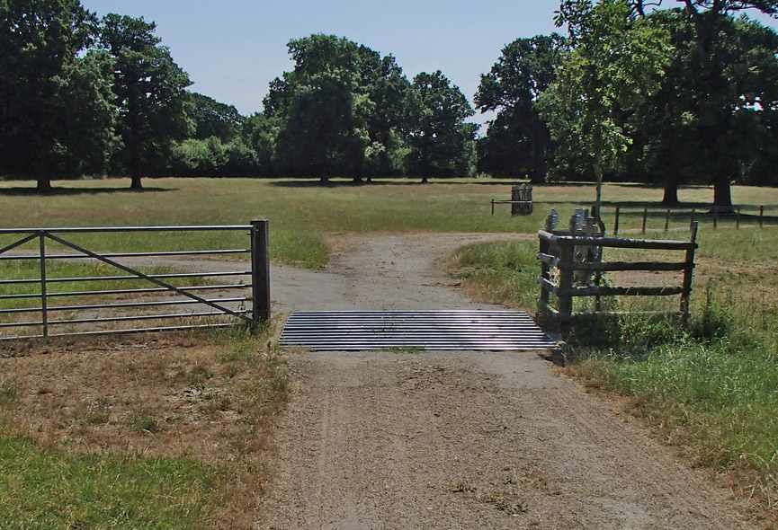
I still didn’t really know if I was allowed to be there, but it  was a lovely ride so I carried on.

snake

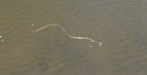
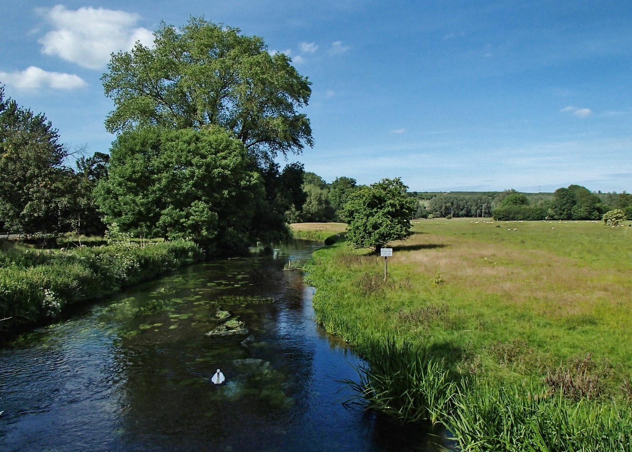
Soon I came to a nice spot by a river (The River Spinney), so I sat there for a while in the sun and spotted some interesting wildlife, including a grass snake swimming up to the bank and a frog leaping for its life. I also saw lots of beautiful flying insects that I subsequently discovered were darters, a type of dragonfly.spenny

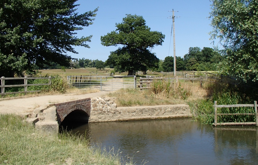
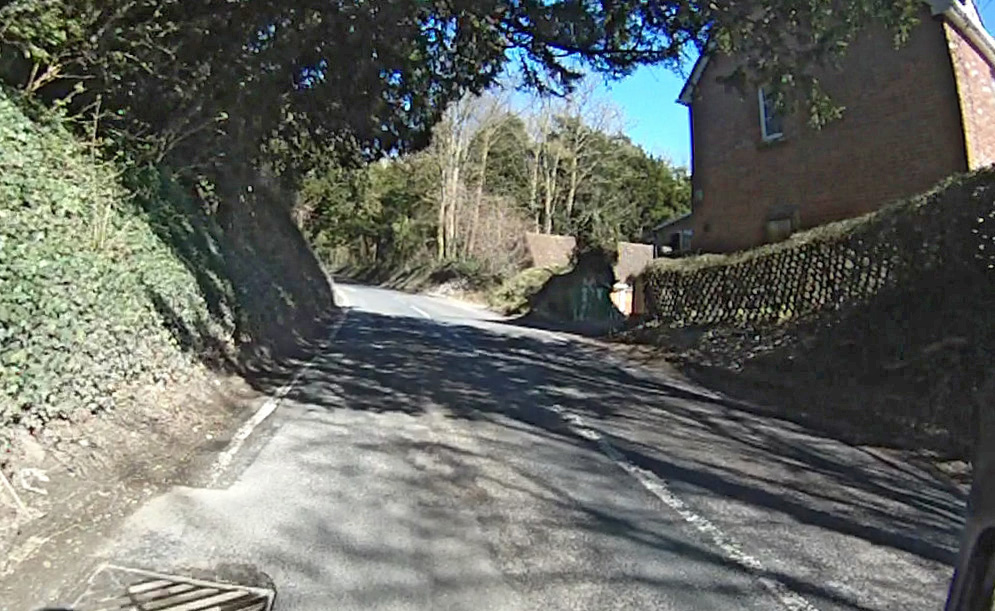
I met several dog-walkers who confirmed that it was a public right of way.OLYMPUS DIGITAL CAMERA
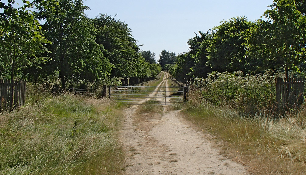
About half a mile later I was back on public roads for the remaining 15 miles of my journey. It had been another interesting unplanned off-road excursion.

Hollingbourne Hill

 Date climbed  6th April 2013
 Elevation gain  371 feet
 Length  0.8 mile
 Duration  8 minutes

Hollingbourne Hill is a long (by Kent standards), ever-steepening slog. It starts just as you pass Hollingbourne Manor on your left. It’s already quite steep as you ride through the village and past The Dirty Habit pub on your right. As you exit the village it gets steeper.

hbh2

The high banks on either side of the road offer no views to inform you how high you are and there is never any sign of where the top of the hill is. It just keeps climbing remorselessly towards the next bend up ahead. And it keeps getting steeper! After about six and a half minutes you finally see the gradient easing up ahead; the road takes on a convex profile, indicating that it’s becoming less steep. You’re nearly there. The worst bit is over. You can change up a couple of cogs now and ease off the gas as you approach the summit.

Hollingbourne Hill


Addendum

Two and a half years later, I entered the Hollingbourne Hill Climb event

Second Club Run

I went on another club run with the San Fairy Ann CC. This time I drove to Marden with the bike in the car. And I’m glad I did. The only stats you need to describe this ride are:

29°C+
56 miles
16.8 mph avg.

Very hot and sweaty!

P7140379I still enjoyed it though. The pace was fast considering the temperature, but it was a flat route. Stopped at a cafe in Wye for coffee. There were eight riders today so I got a chance to meet more of the group.

New Chain

I decided to check the wear on my bike chain to see if it needed replacing. This is something I have never done before! My latest bike has done well over 2000 miles so I thought I had better check it. So I bought a  When I googled how to use it I discovered that you don’t need any tool other than a steel rule to measure the chain with! And this method is even more accurate, although slightly more fiddly, than using the special tool, apparently.

The reason for replacing the chain is that it gradually wears and ‘stretches’. That doesn’t mean that any of the steel actually distorts, merely that the chain gets slightly longer due to internal wear on the rollers. This causes the chain links to no longer engage accurately with the teeth on the sprockets. This will cause the sprockets to wear, and since chains are cheaper than cassettes it pays to replace the chain regularly to avoid having to replace the cassette.

I used the chain wear indicator to measure the wear on the chain. You just hook one end of the tool into the chain and try to insert the other end. The other end has a single long prong on each side. One of them indicates 0.75% stretch and the other 1.0% stretch. On a new chain you won’t be able to insert either of the prongs. Here you can see on mine that I can insert the 0.75% prong:OLYMPUS DIGITAL CAMERA

That means that there is at least 0.75% stretch. Then I tried to insert the other prong:OLYMPUS DIGITAL CAMERA

It wouldn’t insert fully. So I don’t have as much as 1.0% stretch. This indicated that there was some chain wear and that I should replace the chain. Some people advise that if you have 1.0% stretch or more then you should replace the cassette as well as the chain.

To replace my chain I used the following items:OLYMPUS DIGITAL CAMERA

The first job was to remove the master link on my existing chain using the link pliers:
OLYMPUS DIGITAL CAMERAI just squeezed the link and pulled it apart:
OLYMPUS DIGITAL CAMERA

The new chain had more links than my old one so I had to remove two links from the new chain using the chain link extractor. The tool removes the pin by pushing it all the way through the link as you turn the handle:OLYMPUS DIGITAL CAMERA

OLYMPUS DIGITAL CAMERA

I lined up my new chain next to the old one to see how much the old one had stretched:OLYMPUS DIGITAL CAMERA
The old chain was 4 or 5 mm longer than the new one!

The new chain came with a SRAM Powerlock chain connector. These are designed to be used once only. I wanted a connector that would allow me to remove the chain for cleaning every once in a while and re-connect it multiple times. I chose to fit a Wippermann Connex 10-speed chain link:OLYMPUS DIGITAL CAMERA

OLYMPUS DIGITAL CAMERAThe Wippermann link can be fitted and removed by hand, without any special tools.

Once I had fitted the new chain I went out for a test-ride. The new chain felt much smoother and quieter than the old one. Job done!

Edit 17/03/14: Section from the manual for correct orientation.

wippermann

Chain Wear Indicator

A New Challenge

I planned a route to explore the nice quiet lanes around Pluckley. I also included 2 climbs at the end – the first one climbing the Greensand Ridge at Sutton Valence, then dropping all the way down again before climbing the very steep, but uncharted by me, East Hall Hill. The day started cloudy, 18°C. There was a westerly breeze that was in my face for the first part of the journey. By the end of the ride the sun had come out, 21°C.


I took it fairly easy, averaging 15.3 before I got to the hills. Around the 30-mile mark I started to flag slightly and didn’t relish the prospect of the two hills that I knew were coming up. I stopped and had a while I took in this lovely view:

P7110328r

Whether it was the 2 JBs I had just before climbing the first hill, or whether it was the Mule Bar I’d had about 7 miles before that, or whether it was my , or whether it was the that I was using for the first time, I don’t know, but I climbed both hills with no problem. In fact I went up both in second gear. Don’t get me wrong, East Hall Hill was no picnic. I was out of the saddle the whole way, but I settled into a rhythm, taking in huge gulps of air with every pedal stroke and my legs just on the verge of, but not quite screaming “STOP!”. At the top of the hill I recovered quickly. The even better news was that when I got home I felt totally fine, like I had just been for a brief stroll or something! It’s really great when that happens!

Mule Bar
new sunglasses
Chapeau Chamois Cream

Shades of China

These are really excellent quality for the price – £13.67 delivered! They come with loads of accessories including 4 interchangeable lenses, including polarised. I love Chinese stuff!

P7110342b2

East Hall Hill

 Date climbed  11th July 2013
 Elevation gain  254 feet
 Length  0.6 mile
 Duration  5 minutes

This is one of the hills that rises from the Vale of Kent up to the Greensand Ridge. This one could well be the steepest of them all.P8020456

It’s one of those hills where you can never really see what lies ahead as there is always a bend blocking the view, and every time the road turns, it gets steeper. After progressively getting steeper it ends up with a very steep section that goes on for longer than you want it to. I’d say it’s as steep as the worse bit of Barn Hill, but it goes on for much longer.

ehh

My First Club Run (for 40 years)

Today I went for a ride with four other cyclists from the San Fairy Ann CC, a well-established cycling club based in Maidstone. It’s the first time I have done a ‘club run’ since I was a boy.  I cycled down to Marden and met the other guys there for 9 AM. The weather was very hot – 28°C, with a light breeze. This was the route:

Chatting as we rode I soon re-learned the etiquette of group riding. We travelled through some glorious countryside and wooded areas as we headed for a garden centre in Crowborough, where we stopped for a coffee. By the time we got there I was dripping, due to a combination of the lumpy ride and the heat. I enjoyed a toasted tea cake while others had a more substantial snack. The other guys were all experienced cyclists and had racked up various major achievements between them including JOGLE, London-Cannes, etc.

For this ride I did actually manage to pace my drinking correctly and I had drunk both bidons by the time I got home. Apart from the tea cake all I had to eat were two fig rolls and about 5 JBs. I found this ride to be tougher than I had expected. I peeled off before the end of the trip and took a less-than-optimal route back from Horsmonden, costing me a couple of extra miles. It would have been a lot easier if I had driven to Marden, thus avoiding Barn Hill on the return.

It was a nice ride through beautiful rolling countryside on a sunny day, in good company – what more could you want?

…except to then be able to watch one of the most exciting tennis matches I’ve seen, as Andy Murray beat Novak Djokovic in the Men’s Final at Wimbledon!

Voyage to Botany Bay

That’s Botany Bay, Kent, by the way, not Australia! It was a beautiful sunny day and not too hot – ideal cycling weather. I was considering riding to Whitstable and then ride the Oyster Bay Trail coast path all the way to Botany Bay (those names sound so exotic don’t you think?), but I realised that I would have to ride 20 miles along the coast path shared with other users and the going would be really slow compared to roads. So I decided against it. Here’s the route I eventually took: Apart from a lumpy section between Charing and Canterbury the route wasn’t very hilly. East of Canterbury and onto the Isle of Thanet, in particular, was very flat. [In case you’re wondering why it’s called the Isle of Thanet it’s because in the past it was separated from the mainland by the nearly 2,000 feet (600 m) wide River Wantsum.]

View South from Chartham Downs Road
View North from Housefield Road
River Stour near Chartham

The first part of the ride, the hilly bit, was full of beautiful rolling hills and far-off views. The last 20 miles or so were largely flat and featureless, which didn’t inspire me to stop and take photos. I found this ride quite a slog, which it shouldn’t have been given the distance and flatness. Maybe I didn’t eat enough. I had one banana and two slices of fruit loaf – doesn’t sound a lot really! Because of the warm weather I was determined to keep hydrated – I aimed to drink 2 bidons by the time I got there; by half way I had drunk about half my supplies so I was on target, but I still had too much left at the end of the ride – it’s so difficult to judge. I arrived at Botany Bay at 7pm, just in time for the evening sun to be casting a golden glow across the sands. It’s quite a secluded beach, being sheltered by chalk cliffs. I stayed on the beach for a couple of hours having a barbecue with friends and watched the sun go down.