White Hill

This route was planned with the sole purpose of riding up White Hill. Someone on a club run had mentioned it and I had made a note to do it one day. And that day was today. As usual, of late, the weather was warm and sunny. I planned a 54-mile route that took in quite a lot of unknown territory.


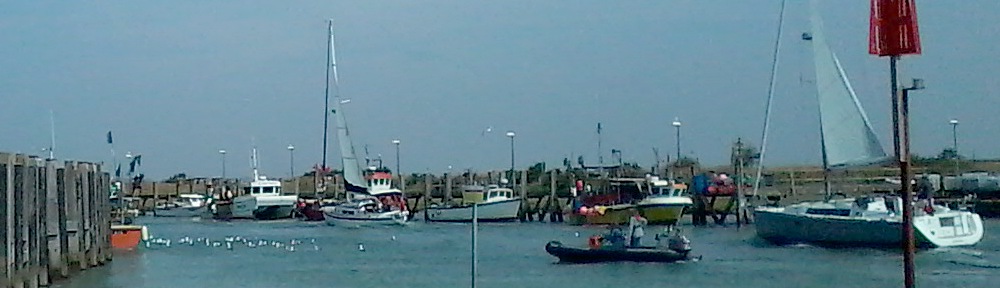
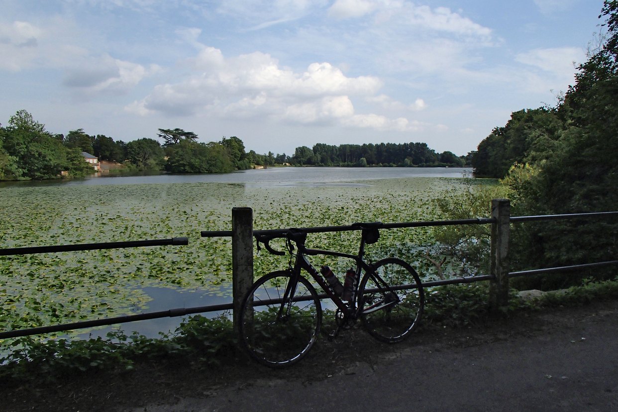
The first 18 miles or so were covered at 16mph. There were some nice lanes around Charing, just keeping to the South of the Downs. After 23 miles I came to a lovely lake, Eastwell Lake.

OLYMPUS DIGITAL CAMERA
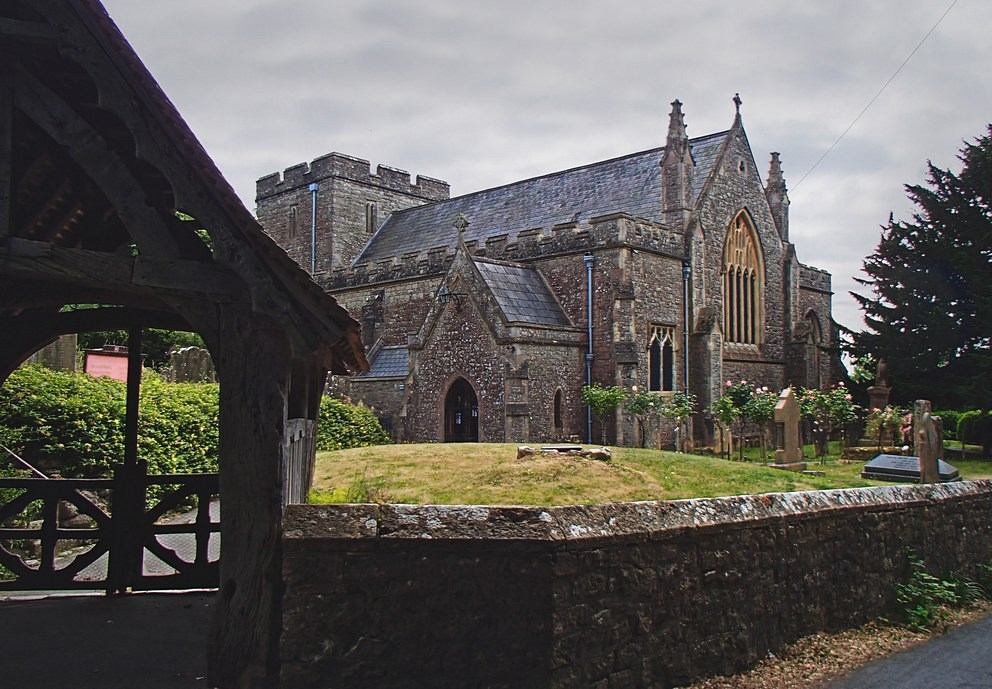
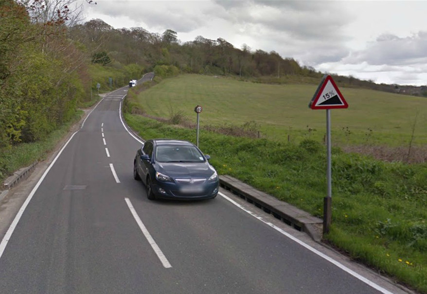
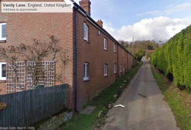
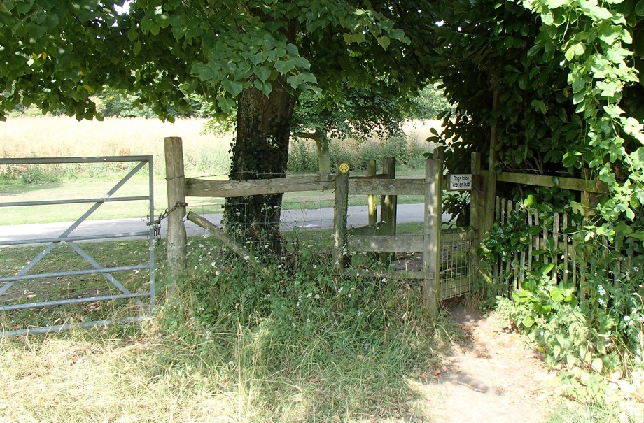
Less than a mile past the lake my progress came to an abrupt halt when I was confronted with this:

gateDamn! Again I had failed to check if all of the route was on public roads. But again I figured that the route-planning software wouldn’t direct me across private land, so I once more assumed that there was some sort of right-of-way.

Footpath

tower

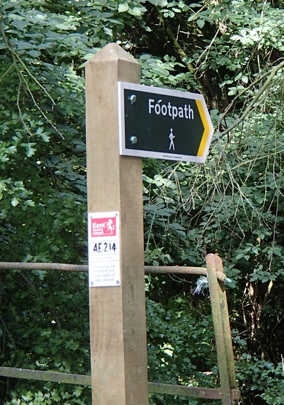
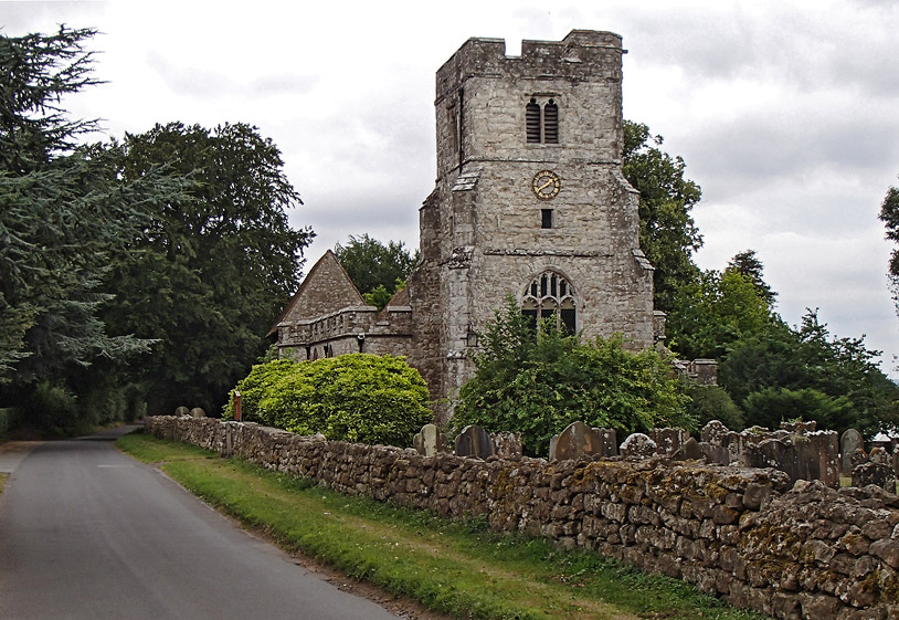
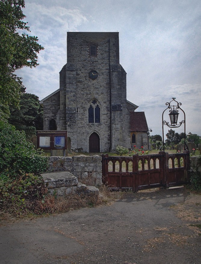
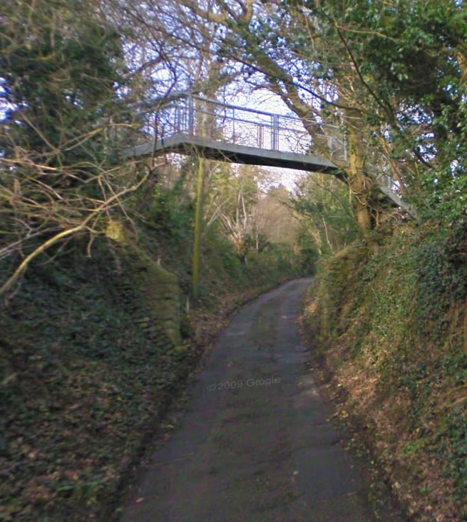
I looked for a way around this road blockage and noticed, a little further back from the gate, a footpath sign. This led me past some sort of old tower or something.

Through one of those anti-bike type gates and across a rough field I came to another bike-unfriendly gate. This one was too small to manoeuvre through, so I just lifted my bike over the gate next to it.

style

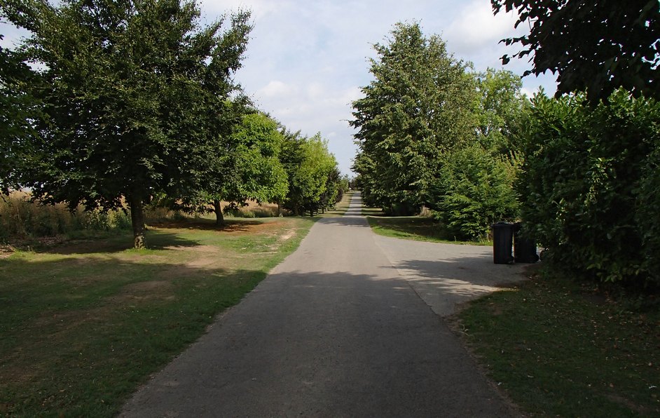
and found myself on a smooth tarmac road

OLYMPUS DIGITAL CAMERA

OLYMPUS DIGITAL CAMERA

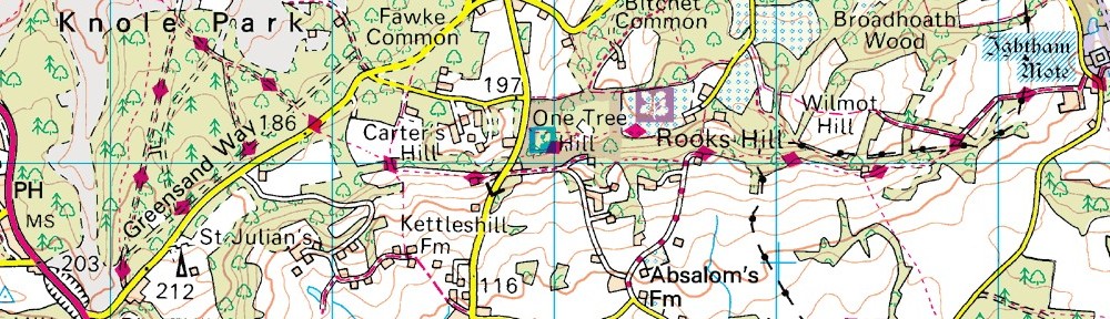
After about a mile of this I came to learn where I actually was, by virtue of this sign

sign

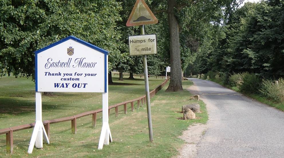
Another interesting ‘off-road’ excursion comes to an end.

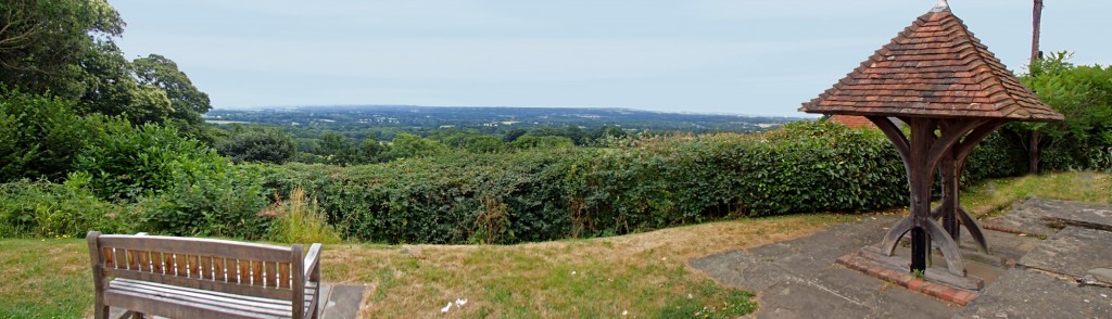
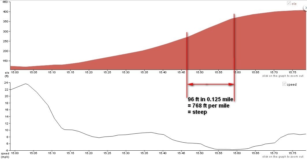
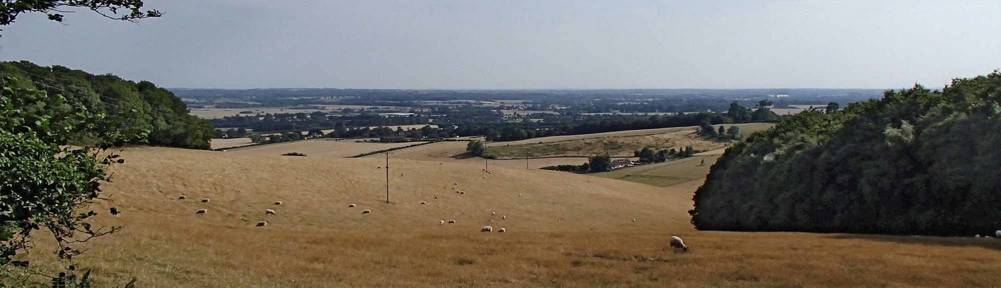
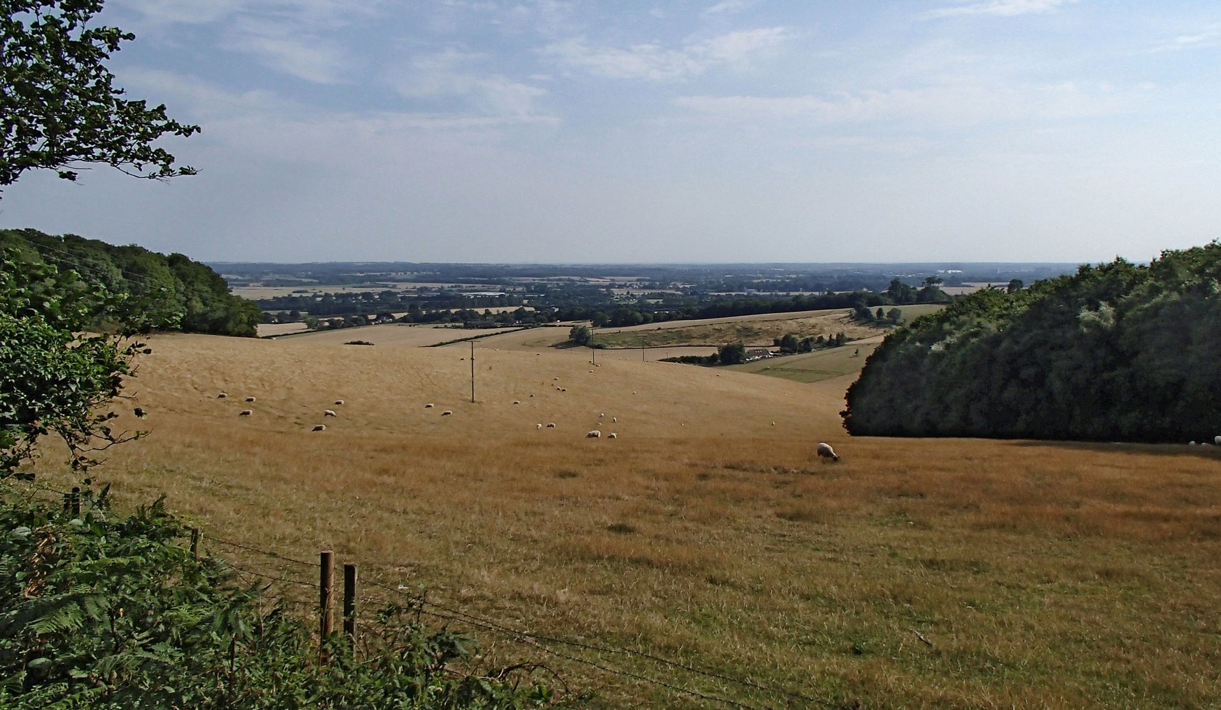
About a mile and a half later I arrived at the goal of this journey, namely White Hill. As it turned out, it wasn’t too bad a hill. It’s quite long at 1.6 miles, over which it rises about 450 feet, but I managed nearly all of it in 3rd gear, so it was hardly challenging. But the view from the top was worth it.

OLYMPUS DIGITAL CAMERA

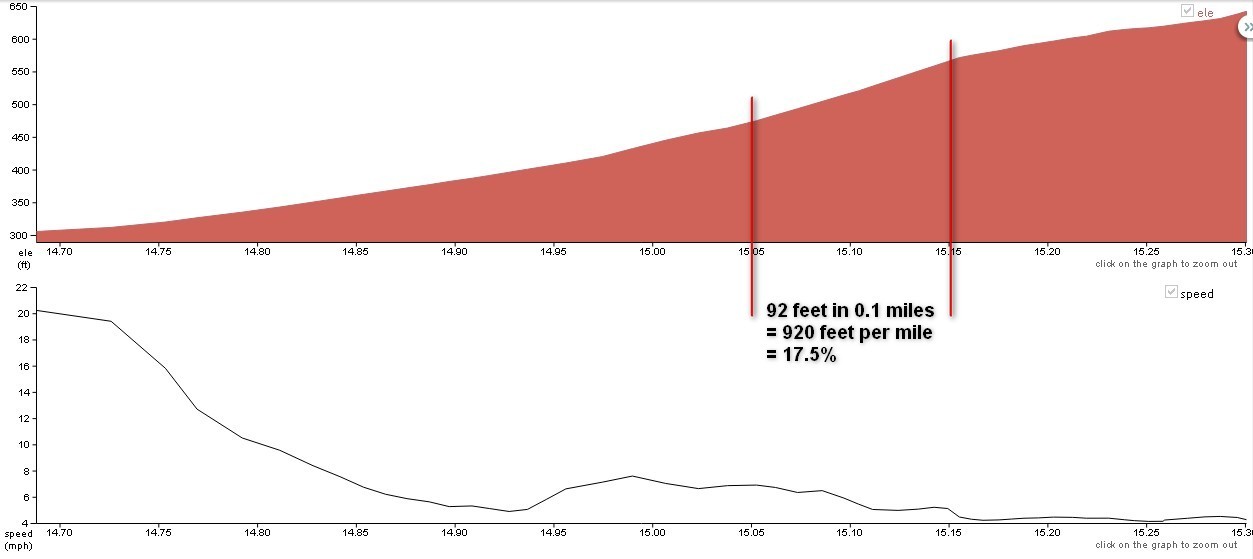
The next seven miles consisted of some beautiful roads across the top of the Downs before dropping down again through Lenham Heath and Grafty Green, after which I climbed Ulcombe Hill to the Greensand Ridge for the next four miles before dropping down again into the Vale of Kent. I included a bit of a twist in the tail of this journey in the shape of Westerhill Road, whose 17% gradient I just had enough energy left to climb.

Burwash (SFA)

Went for a ride with the Fairies again, this time to Burwash. There were about 9 or 10 of us riding, and again the weather was superb – mainly sunny and not too hot. The main topic of conversation seemed to be last week’s ride to Medway Bridge, which I had missed. In particular, talk centred around tales of angst regarding Lockyers Hill, near Luddesdown. It is one of the few ‘double-chevron’ hills around here, boasting a gradient, according to the sign, of 25%. Damn! I wish I hadn’t missed that one. I’ll have to plan a route there myself.

We had a coffee (plus poached egg on toast) break in a nice café in Burwash called the Lime Tree Tea Rooms. Luckily we could park all our bikes down the side alley.tearooms

It was a fairly hilly route except for the bits near Marden. 52 miles at 14.4 mph.

Greensand Hills (slight return)

Well, as promised, this route is a modification of the Greensand Hills Route I did last week, except this time the previous descents become the new ascents and vice versa.

I wasn’t really in the mood for this ride. Maybe it was the couple of beers I’d had the previous evening; I just felt a bit lack-lustre, performance-wise. It was a fairly hot day (25°C) with sunny spells.

The first climb of the day was Yalding Hill, and it felt a bit of a slog, which was worrying, this early in the ride. Then, it was down Barn and up Hunton Hill. This was the first time I had climbed Hunton Hill and it was steeper than I had expected. Nearly two miles later came Vanity Lane. Having climbed this for the first time a couple of weeks before, at least I knew what to expect; it didn’t make it any easier though! As I panted my way up the steep incline, a woman jogging (or at least to the extent that one can ‘jog’ down such a steep slope) past me in the opposite direction quipped “and I thought I was mad running down it!”. A grunt of acknowledgement was all I could muster in response, as I gasped for more air. I was glad to get Vanity Lane out of the way – the remaining hills are all less severe. Only eight more to go!

Five hills later I was wishing it could be over. When I came to the top of Windmill Hill I mistakenly thought I had completed the last one, so when I found myself descending again I thought “Drat, there must be another one to go” (or thoughts to that effect!). And there was – Headcorn Road has an ascent of 220 feet in half a mile. With that out of the way I just had 11 fairly flat miles to ride home.

Even though it was a slog I was still glad I had done it once it was over.

St. Peters, Church Hill, Boughton Monchelsea
St Peter’s and St Paul’s, Church Lane, East Sutton

Hastings

Just a quick post. Rode to Hastings today. The Met Office radar showed showers all across Kent and Sussex but I took a chance and managed to get there dry! Every other time I have cycled there I have got wet. It was very windy though, and that added a bit to the time, although I did clock up a few PBs on Strava including one for Stonestile Lane. The data from my Garmin reported a top speed of over 50 mph! I do remember going very fast at one point but I’m not sure I would have been going that fast on that particular piece of road – I’ll have to compare with other trips.

Once again my Garmin had recorded bad elevation data and according to it I was frequently cycling at 150 feet below sea level! When I got home I researched this issue and found that you are supposed to switch the unit on and give it 5 minutes or so to calibrate before setting off. I tried that this evening and sure enough it did get more accurate after leaving it a while. I must remember to do this before every ride. I also found out that the altimeter is affected by temperature – which explains why, when I stop at a café and put it in my pocket, it seems to think I have ascended 150 feet while I have been drinking my coffee!

This is the first ride with my new pedals, which I fitted last night. They were great – I soon got used to the slightly different way of clipping in.

pedal

Greensand Hills

Reading something on the web about a year ago, someone suggested a route of this nature – ie. going up and down each consecutive hill along the Greensand Ridge starting at Yalding Hill and moving East. At the the time I thought it would be a killer,  as I considered Yalding, Barn and Hunton Hills, Westerhill Road, Vanity Lane, etc, but really these are the worst ones – with one or two exceptions the hills get easier as you go East. I thought I’d give it a go. I designed the following route (43 miles, 3,340 feet ascent) : It was a hot day (26°C) with light winds. The first climb was Barn Hill. I’m very familiar with this short, sharp shock. The next ascent was Westerhill Road and that was really tough, certainly the steepest on this route – it’s up there with the toughest of all the Ridge hills and required out-of-the-saddle heavy breathing action to get up it! With that one done, the rest were easier.

St. Michael’s Chart Sutton

During this ride I discovered some really nice country lanes around here that I had never ridden before, such as Loddington Lane.  I think this route will become a favourite. I have designed another one that goes up the hills that this one goes down and vice versa. I tried something new on this ride, namely having an IsoGel every 7 or 8 miles. It seemed to work OK and I noticed no unpleasant side-effects, other than feeling more hungry than usual once I got home.

Carter’s Hill (aka One Tree Hill)

 Date climbed  28th April 2013
 Elevation gain  336 feet
 Length  0.6 mile
 Duration  6 minutes

I remember the first time I saw One Tree Hill. It was on a ride back from Ide Hill and as I passed near Underriver my route turned right but as I looked to the left I saw a large house on the top of a hill and I couldn’t believe how high it looked. You had to almost crane your neck up to see it. I made a note to check it out when I got home.

Well I did check it out and found that it was Carter’s Hill, although everyone seems to know it as One Tree Hill. It has enough of a reputation that I was able to find several cycling-based references to it on the web. I became intrigued. I had to try it.

There is a false start to this climb. In fact it even descends briefly before the good bit kicks in. And kick in it does, ramping up steadily getting ever steeper as it twists and turns its way up to Fawke Common. The section just before the end hits 17.5% gradient for about 600 ft, before it eases back to 10% to the finish.

It’s a good one. There is a sportive called the Circuit of Kent that features this hill at the end of a 80+ mile ride. That’s just cruel!

carters hill2

Rye Harbour (SFA)

Rye Harbour

I went for my third club run with the San Fairy Ann (SFA) cycling club. The day started off cloudy and cool, but by the time we got to Rye Harbour it was 25°C with a cloudless sky. Thankfully the temperature and the average speed were lower than on last week’s ride. There were five of us riding down to Rye and we met another rider there, so there were six of us on the way back. I got to meet a couple more members of the group. In fact I’m the only rider who has been consistently for the past three runs – not bad for a non-member!


We averaged 16 mph on the way down there. The route consisted mainly of quiet country lanes and a couple of steep (15%) descents, one of which had a dangerously tight bend halfway down. I wasn’t looking forward to climbing these hills on the return journey – luckily we came back using a different route! Rye Harbour wasn’t as characterful as I had imagined – in fact it was really just a place for people to launch their boats. We sat outside a café in the sunshine, sharing the available tables with some other bikers; when I say ‘bikers’ I mean the sort with leather jackets, beards, tattoos and Harleys, in somewhat stark contrast to us in our colourful lycra and silly cycling shoes. Luckily there wasn’t a stand-off!

The route back was less lumpy and started off dead flat as it followed the Military Canal for about 6 miles to Appledore. Quite a bit of the ride back was on busier roads, which are not as enjoyable as the lanes, but you do tend to get further, quicker. We averaged 15.4 mph back to Marden and had covered 58 miles in total. All in all this was a much easier ride than last week’s, and I had survived on just the piece of flapjack that I’d had at the café!

Vanity Lane

 Date climbed  18th July 2013
 Elevation gain  284 feet
 Length  0.7 mile
 Duration  6 minutes

I was chatting to someone about the steep hills on the Greensand Ridge and I said that I thought East Hall Hill might be the steepest. “But surely Vanity Lane is steeper” they said. Needless to say, my next ride included Vanity Lane. I had never climbed this hill but had been down it a couple of times about ten years before. I was always amused by a sign about halfway down warning drivers to be careful of “Free Range Children”.

By the time I came to climb it yesterday I had already ridden 55 miles in 28°C heat, so probably not at my best. The first few hundred metres seemed easy. I looked down at my gears and saw that I was in fourth. “This is going to be easy” I thought to myself. Vanity Lane is one of those hills, like so many around here, that gently twists as it rises, so you can never see that far ahead.

VL
Just past this building the road ramps up sharply and disappears into the trees

Around one bend it ramps up, and in the distance you can see that it’s getting steeper. In all it has three distinctly separate and progressively steeper segments. The third, and steepest, section starts just before you ride under a strange footbridge spanning the steep-sided (or ‘sunken’ as I have heard it called) lane.

vl bridge

By the time I got to that part I had run out of gears, but I still managed to maintain a steady pace because now I could see the gradient easing up ahead.

Accurately calculating gradients is difficult, it seems. While most internet sites agree when it comes to distances, they vary wildly when it comes to gradients. Strava reports that the steepest gradient in Vanity Lane is over 20%, whereas Cob Lane only reaches 18%. Instinctively I feel that Cob Lane is much steeper than Vanity Lane. My own calculations for Vanity lane show the steep section as being about 15%. Suffice to say that it’s bloody steep. But it’s not as steep as East Hall Hill which is not only steeper, but sustains a steeper gradient for longer.Vanity Lane