Distance: 73.5 miles. Elevation: 10214 ft.
Col des Tempêtes
Notes
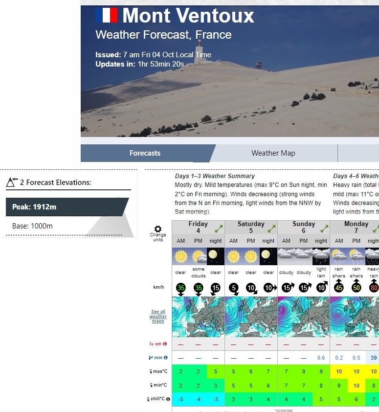
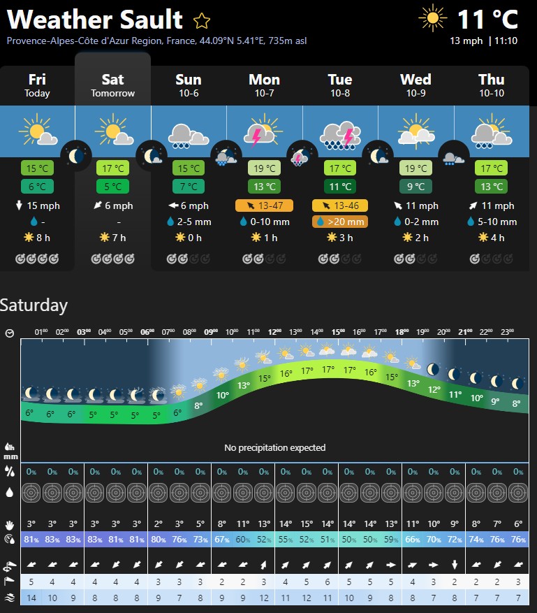
The weather has been looking good for Saturday (tomorrow) for the past several days, and I’m pleased to see that it still looks good. I just looked on the mountain forecast website, and that shows that I might be lucky again (like I was in 2016) finding a slot in the surrounding day's weather, certainly wind-wise.
I’ve been analysing the feasibility of doing both ascents, by comparing with other rides.
The ascent from Sault looks like this:
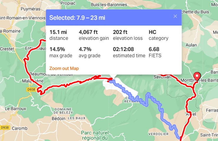
So, 15 miles at 4.7% avg.
Well last year on my Col de l’Iseran ride I reached Val d'Isère only stopping once for photos, but not feeling the need to stop. And that looked like this:
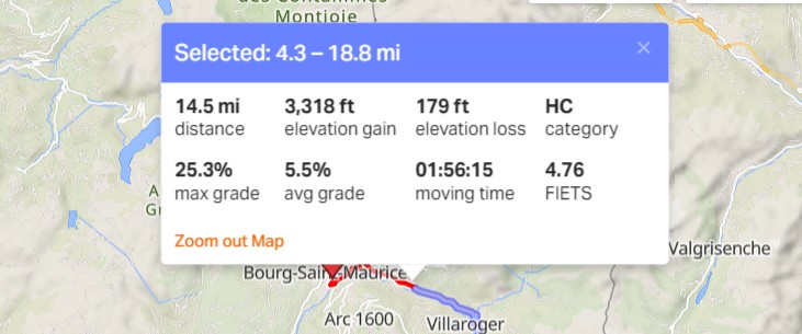
... which is nearly the same distance but steeper, and I did it in less than two hours.
The Malaucene ascent looks like this:
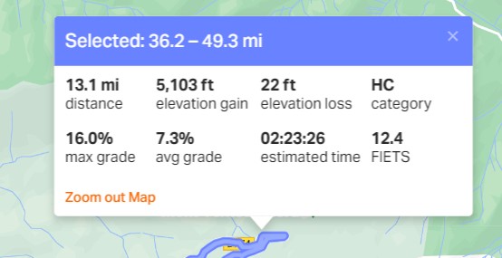
13.1 miles at 7.3%. That’s quite tough. But I don’t necessarily have to do that without stopping.
So the remainder of the Col de l’Iseran ride, from Val d'Isère to the summit doesn’t quite match up and looks like this:
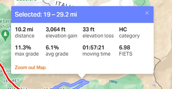
Only 10 miles at 6.1%.
So both climbs of MV will be tougher than the Col de l’Iseran. But obviously with more oxygen available at the top!
The overall ride for the double Mont Ventoux looks like this:
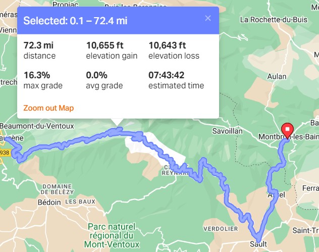
72.3 miles with 10,600 ft.
But my ride of Les Trois Cols was more
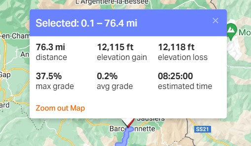
So Les Trois Cols was four miles longer with 1,500 ft more climbing. But that took me over 8.5 hrs moving time and over 2 hrs stopped, making 10:45 overall.
Looking back at my 2016 ride up Mont Ventoux from Bédoin, it looked liked this:
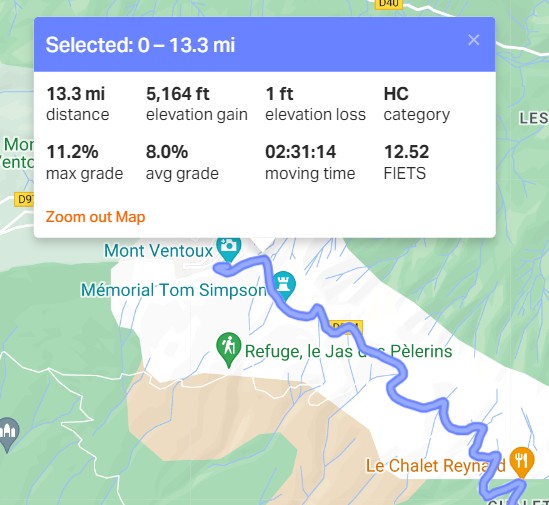
In fact that was quicker than I had remembered. I always thought it had taken me three hours.
So the Malaucène ascent is 13.1 miles at 7.3%, whereas Bédoin was 13.3 at 8%, definitely tougher.
So currently I’m estimating:
Montbrun-les-Bains to Sault - 40 mins (28 mins to Aurel, which I already did + 12 minutes descent to Sault as estimated by RWGPS)
Sault to Mont Ventoux - 2 hours 20 minutes (RWGPS estimates 2:12)
MV to Malaucène descent - 40 minutes (RWGPS estimates 50 but I did Bédoin descent in 26 mins)
Malaucène to Mont Ventoux - 2 hours 45 minutes (RWGPS estimates 2:23, and I did Bedoin in 2:31, but that was back in the day)
MV to Sault descent 45 minutes (RWGPS estimates 55, which seems excessive for 15 miles of downhill)
Sault to Montbrun-les-Bains - 30 minutes (but who cares!)
All of those figures do not include stops. So the total estimated riding is 7:40 (RWGPS estimates 7:43, so very close)
Call it 8 hours and at least an hour of stops so 9 hours.
So it would seem a good time to start from Sault would be 9am, theoretically to be back by 17:30 or so. So try to leave here at 8:15 AM
Temp looks like it will be 5°C or 6°C at the top
Start of the climb from Sault could be 7°C or 8°C but feeling cooler.
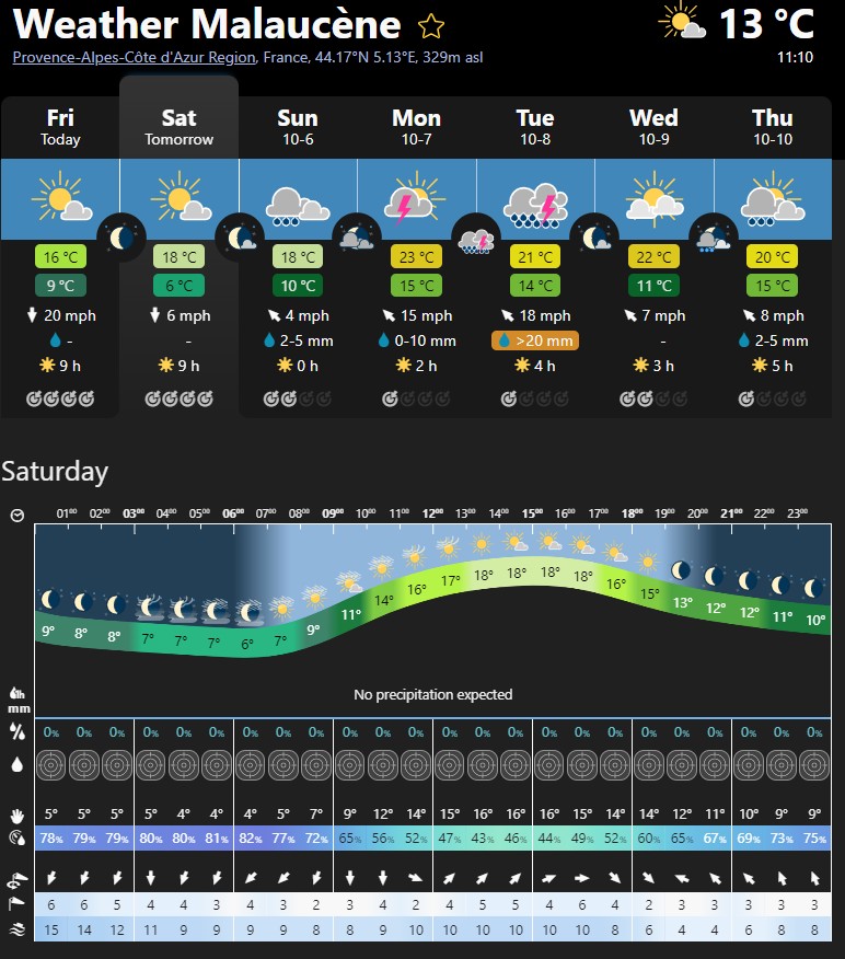
Highest temp will probably be the start of the ascent from Malaucène when it could be 17°C or 18°C
Strangely, and annoyingly, I can't find any reports I might have done during the ride, so all I have is my memory and the video footage to rely on.
Looks like I left more than 30 minutes later than intended, at 08:48. I wore 3/4 shorts, thick socks, base layer, club winter jersey, snood, helmet, long-fingered gloves and rain jacket.
The temperature at the start of the ride was 0°C, dipping to -2°C on the way to Sault. So it was a bit fresh! The sun was hidden behind the surrounding hills at first, and I was glad when it finally shone on me, offering some welcome warmth. I reached Sault in 40 minutes. I took off my rain jacket, stuffed it in my backpack and started the climb.
My intention was to do the whole climb without stopping, same as I had done from Bédoin in 2016, and as far as I'm concerned, I did. BUT, during the climb from Sault, while still in the forests before Chalet Reynard, I realised I was in desperate need of a comfort break. Well, not desperate, but I didn't want the discomfort that could come later when there would be absolutely nowhere to stop for one on the moonscape between Chalet Reynard and the top. I was weighing up the situation and it was really distracting me, so I decided to have said comfort break, and stopped for 95 seconds!
As can be seen from the profile, the climb from Sault starts with six miles at a steady 5.5%, initially through open fields, and then into the trees. The following 4.4 miles, to Chalet Reynard average a mere 2.6% with the last mile or so of that virtually flat. I had only seen a handful of other cyclists to that point.
At Chalet Reynard there were loads of cyclists milling around. The 12 miles to that point had taken me 1.5 hours. As before, I just pedalled straight past and onto the steep remainder of the climb to the top.
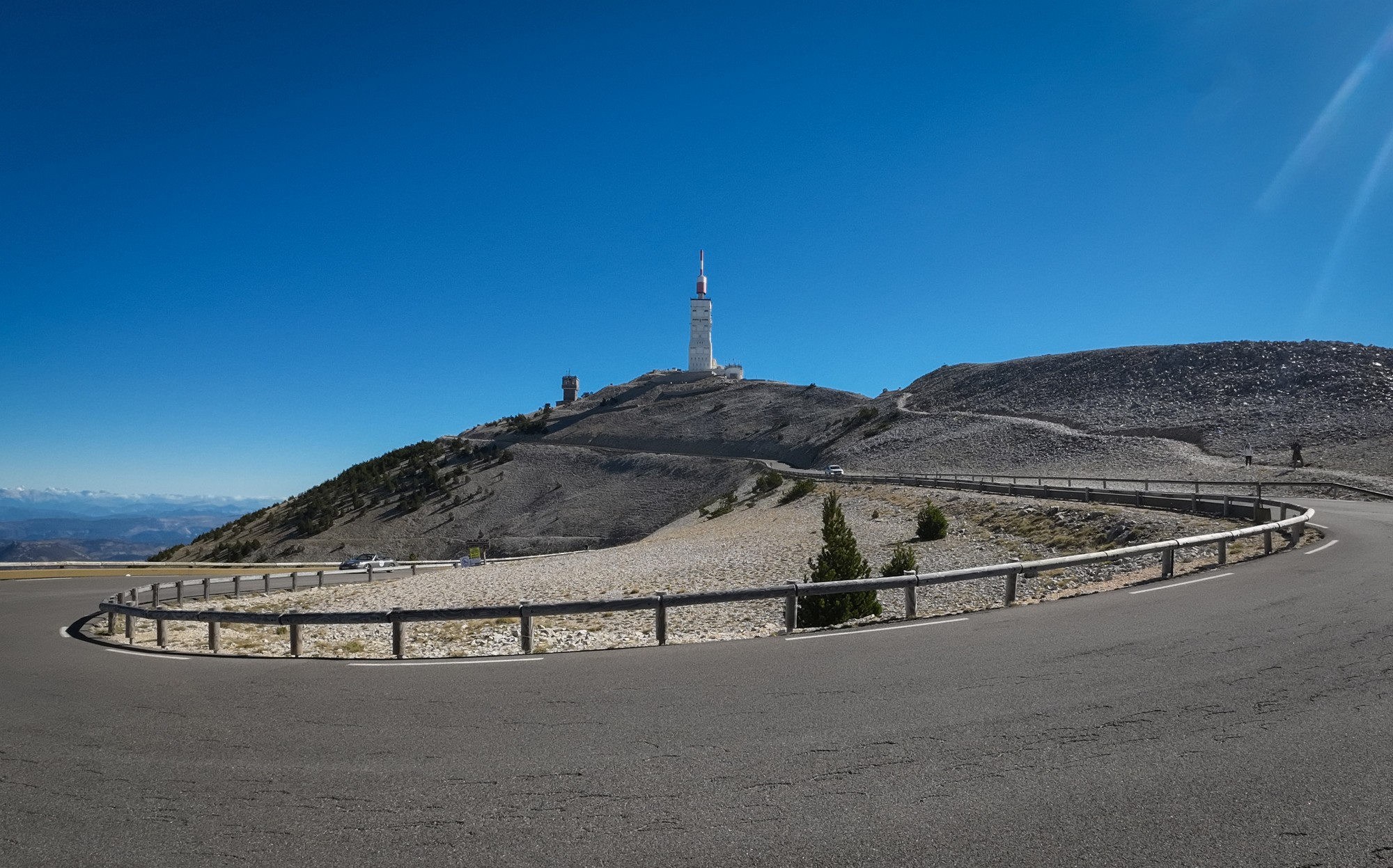
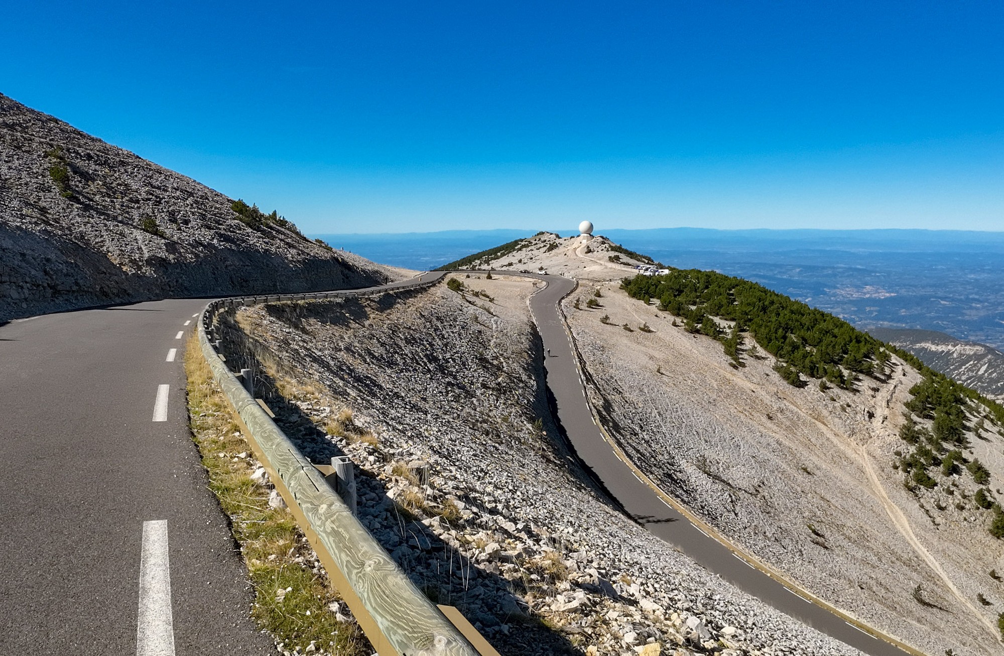
There were many more riders on the moonscape section to the top, obviously having started from Bédoin. That last section is 3.7 miles at 8%. It felt steeper than I had remembered, but was still manageable. The weather was perfect; wall-to-wall blue sky and barely any wind. 43 minutes of steady pedalling got me to the summit.
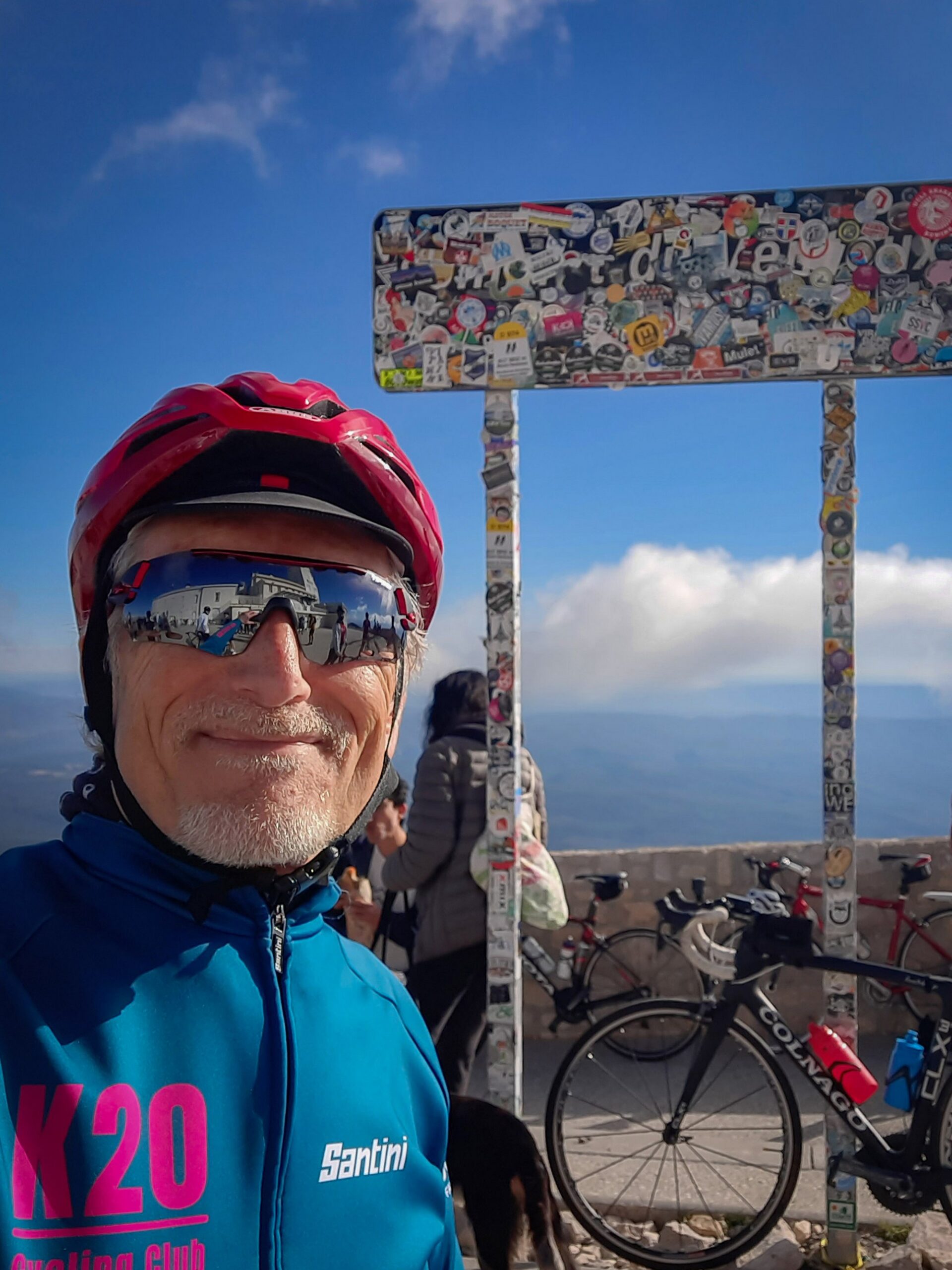
There were hundreds of riders up there, music playing (We are The Champions - Queen - oh dear) and people whooping and clapping. My idea of hell. Oh no, I thought, it has become like Alpe d'Huez since I was last here.
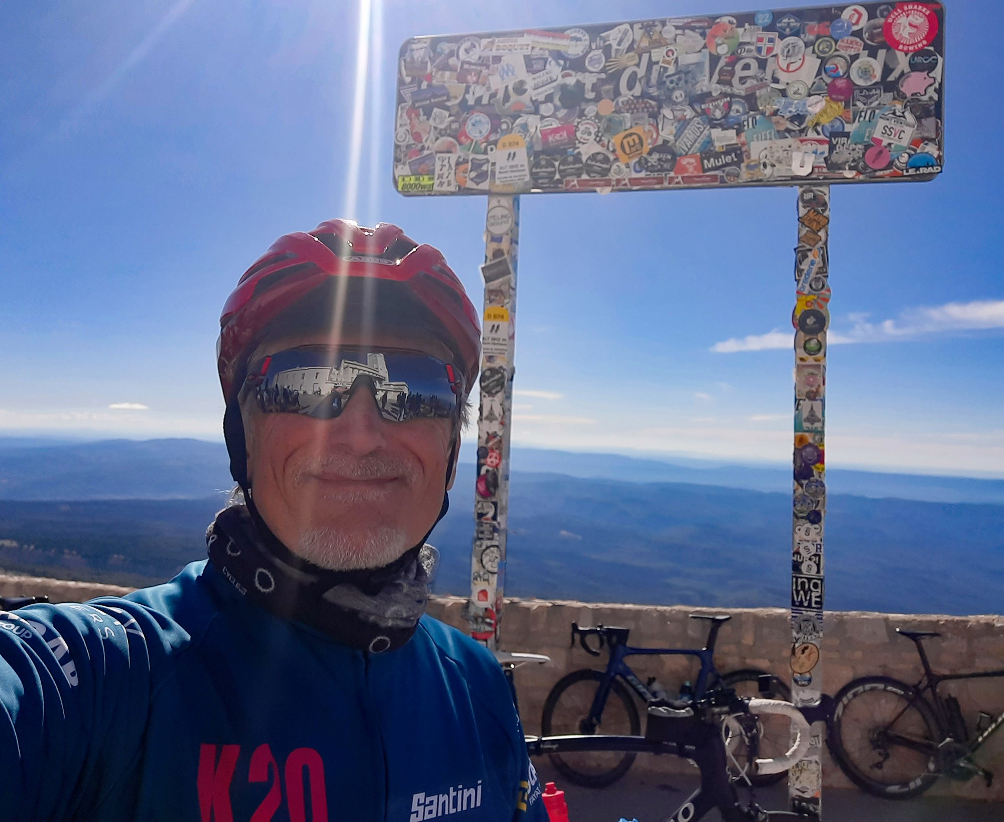
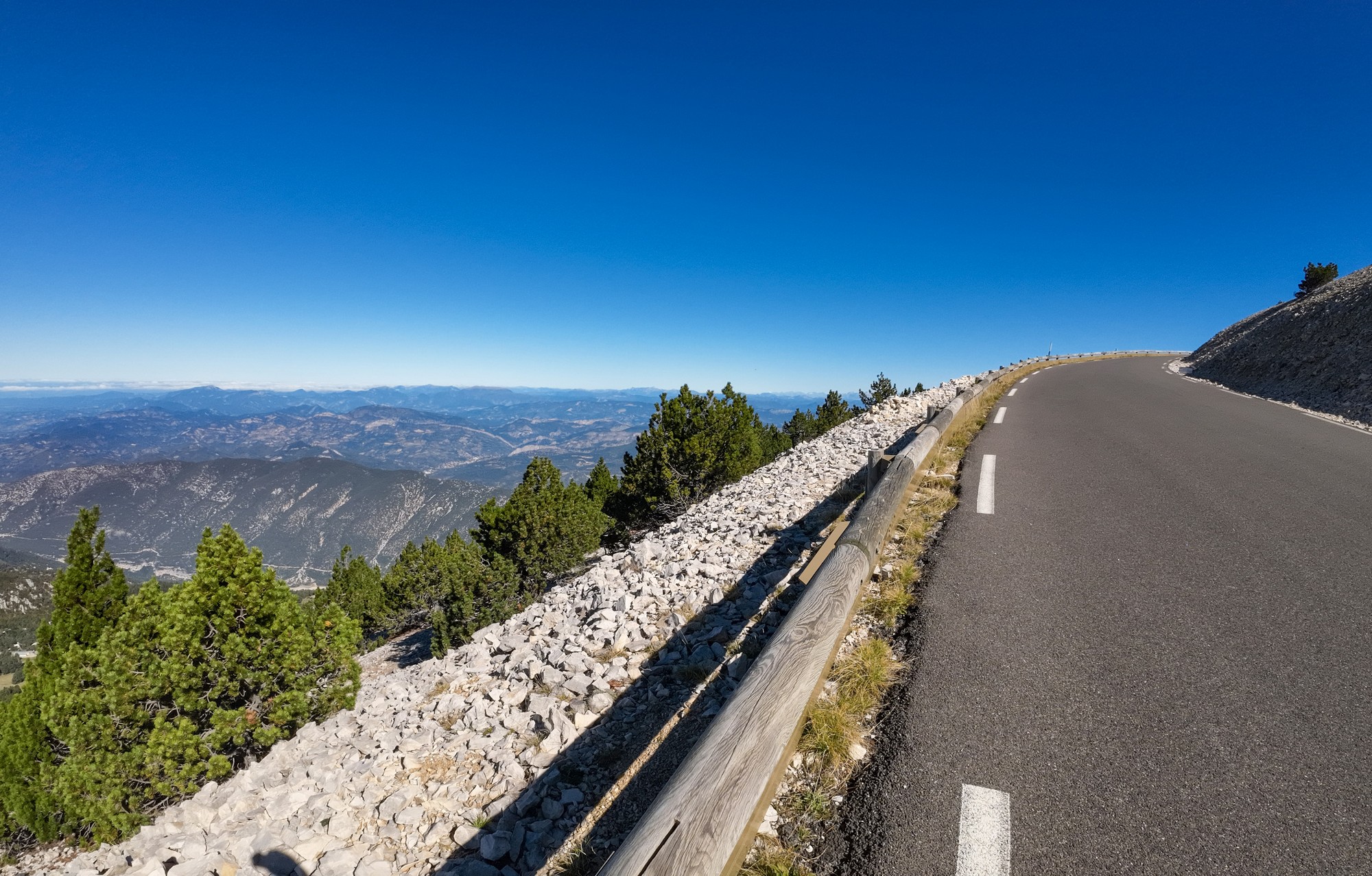
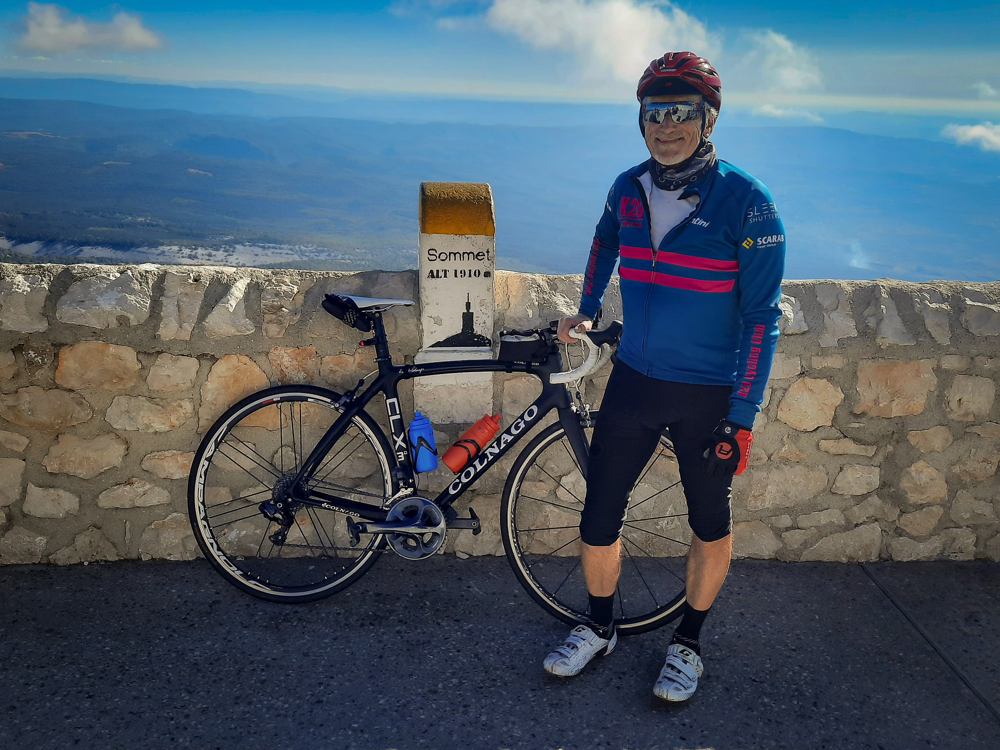
I quickly got a photo and moved away from the throng to eat half my sandwich. I put my rain jacket back on. Twenty minutes later I was on my way down the other side towards Malaucène. It was the first time I'd seen this side of the mountain from there. The view was more rugged and mountainous than that on the other side - I preferred it.
I'd seen something about the road being closed but it didn't look like it was today - I checked with a couple of English guys. They confirmed it was open.
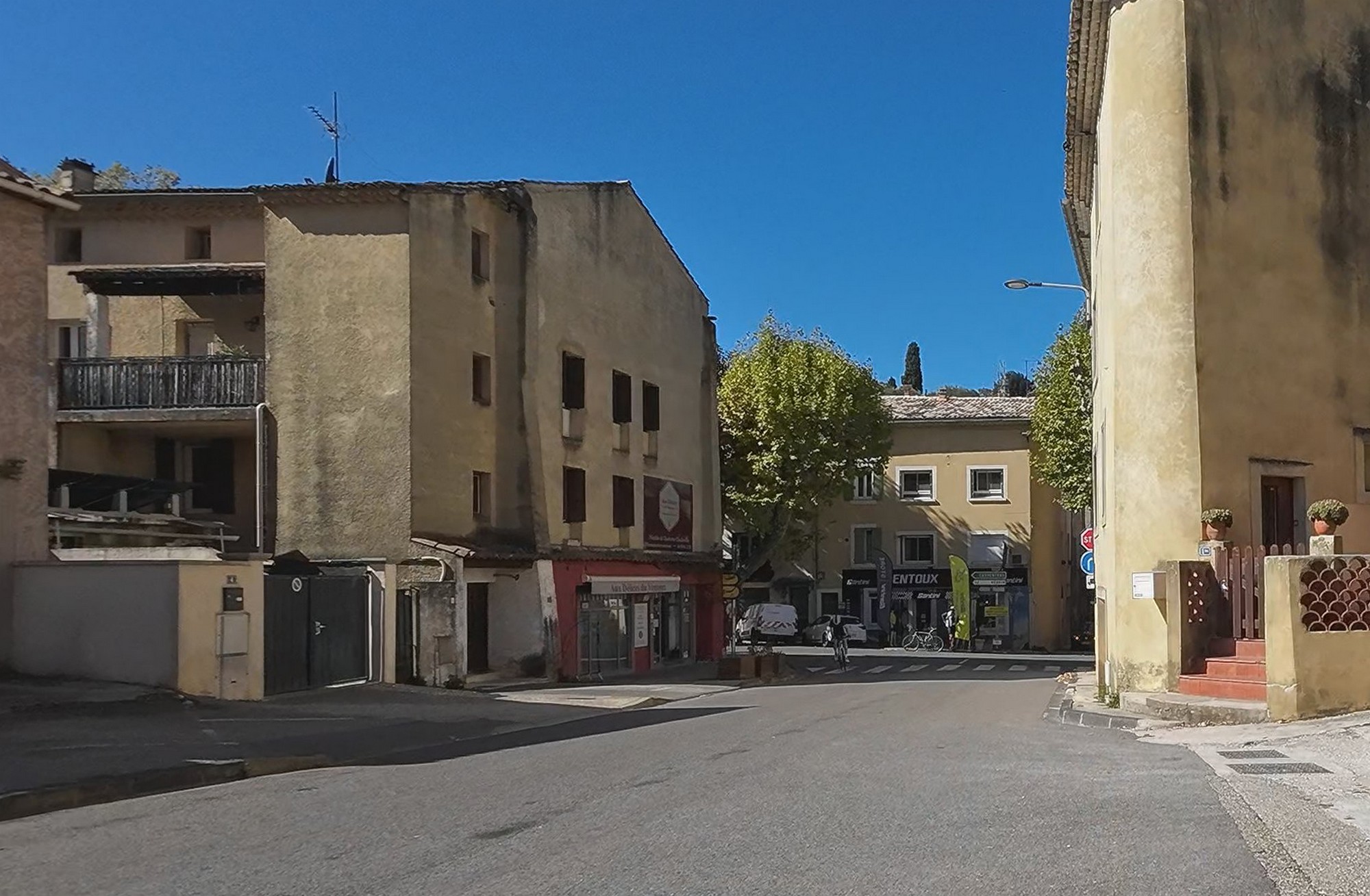
About 35 minutes later I arrived down in Malaucène. I took my rain jacket off again, ready for the climb. There was no question in my mind that I was going to climb back up there, and not take the easy way back. Standing there, a guy came up and started talking to me. I didn't recognise him at first but he was one of the pair of English cyclists I had talked to earlier. He was worried that his friend hadn't arrived and asked if I'd seen him while riding down. No, I hadn't. I said I'd look out for him on the way up. And so I started the second ascent of Mont Ventoux.
The first mile away from Malaucène is at a fairly leisurely 5%. It even flattens out somewhat. But that's followed by 2 miles at 8.3% average. Then it backs off again for about 3 miles at 6.3%. Then things turn nasty with 2 miles at over 10%.
Once more this is followed by a mile at 4.5%.
The finish comes in the form of 3.5 miles at well over 8%. Again, that's average; there are steeper bits in there.
Looks like I did the first six miles before stopping, then stopped 2 or 3 more times before the top. I vaguely remember having a banana and probably an energy gel or two. I seem to recall having a gel somewhere near the top and then regretting it because I didn't have far to go.
I reached the top at around 4pm. Still the throngs were milling. I got another photo (or three...)
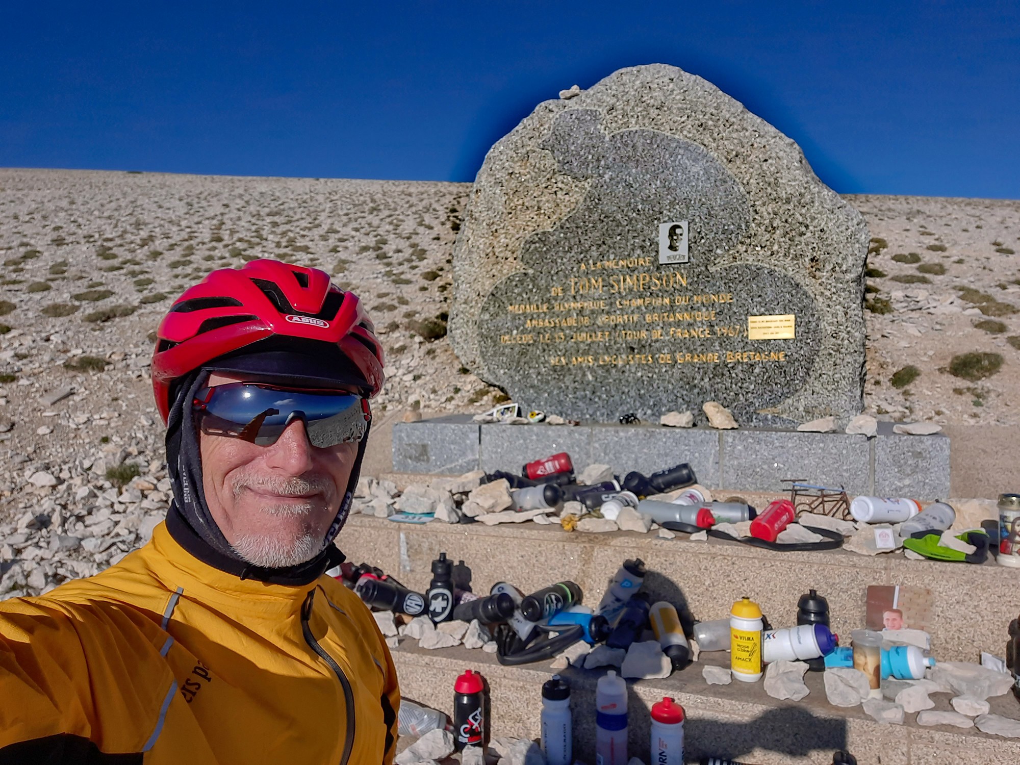
After about half an hour of looking at the scenery and reflecting on my ride, I started back down. This time (unlike eight years ago) I remembered to stop at the Tom Simpson memorial.
All that was left was a twenty mile ride back to Montbrun-les-Bains, most of which was gloriously down hill. I got back at about 17:45, after exactly 9 hours, same as my estimate!
I had been so very lucky with the weather, although it wasn't as though I hadn't put any thought into it. It was about as close to perfect as you could get. OK, it could have been a few degrees warmer, allowing me to wear lighter gear, but you can't have everything.
So now I've done all three sides of Mont Ventoux, so I'll never have to go up there again! Unless it's a special theme or something, such as three ascents in a day, or to see the sunrise or whatever. Hopefully not on a weekend..