Distance: 23 miles. Elevation: 3944 ft.
Today’s climb to the spectacular Colle del Nivolet was, like my previous ride, inspired by reading Simon Warren’s book The Colle del Nivolet hadn’t been on my radar until I read that he’d elevated it to his favourite road, displacing Col de la Bonette from the number one slot. I, too, regard the Bonette from Saint-Étienne-de-Tinée as one of the most spectaular roads I’ve climbed, so I was inevitably keen to see what could usurp its standing.
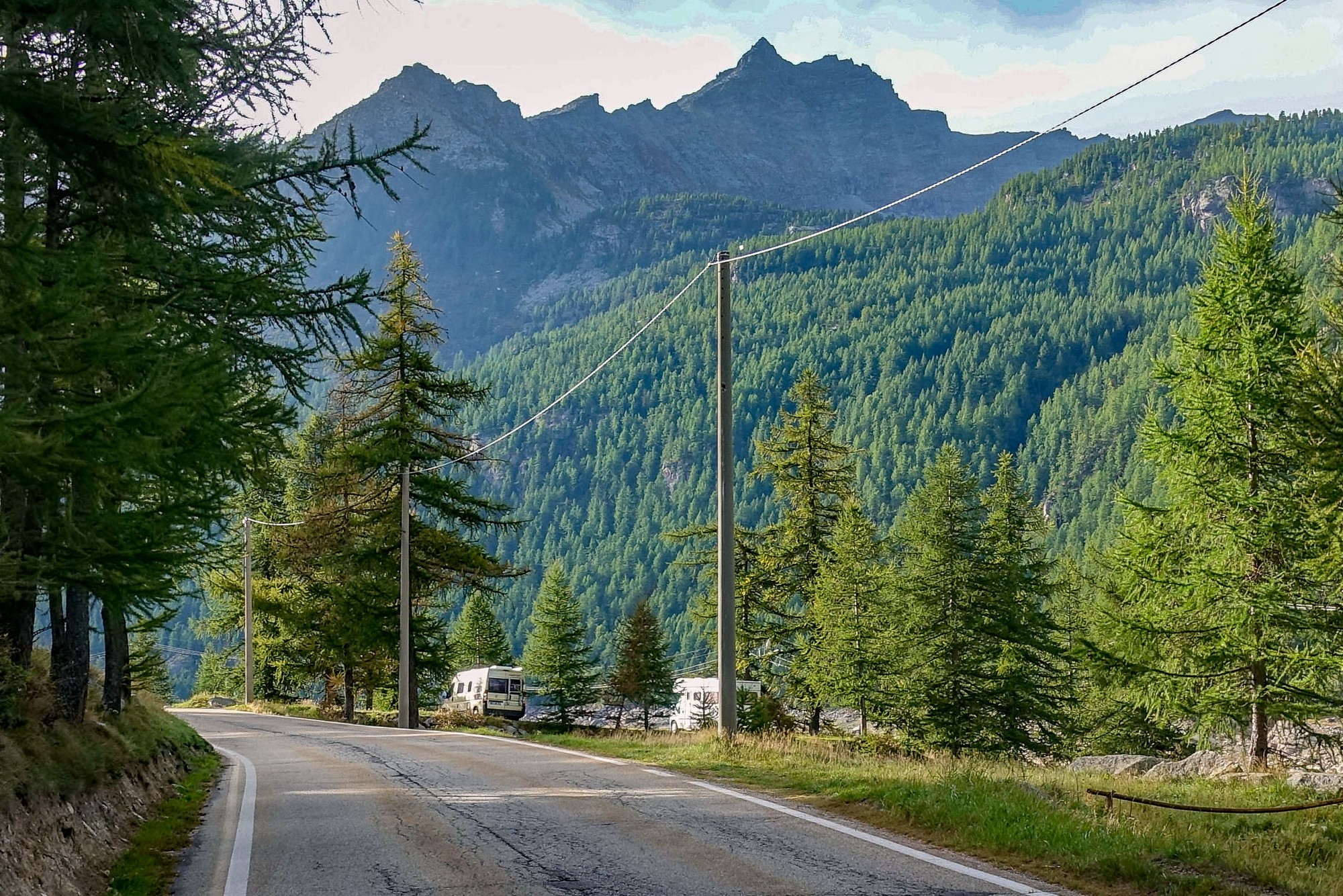
With the threat of thunder later in the day, I left at the early (for me) time of 9:15 am. The air was cool so I wore arm warmers and base layer. I took my rain jacket in an old bidon with the top cut off and stored in my second bottle cage, like I normally do.
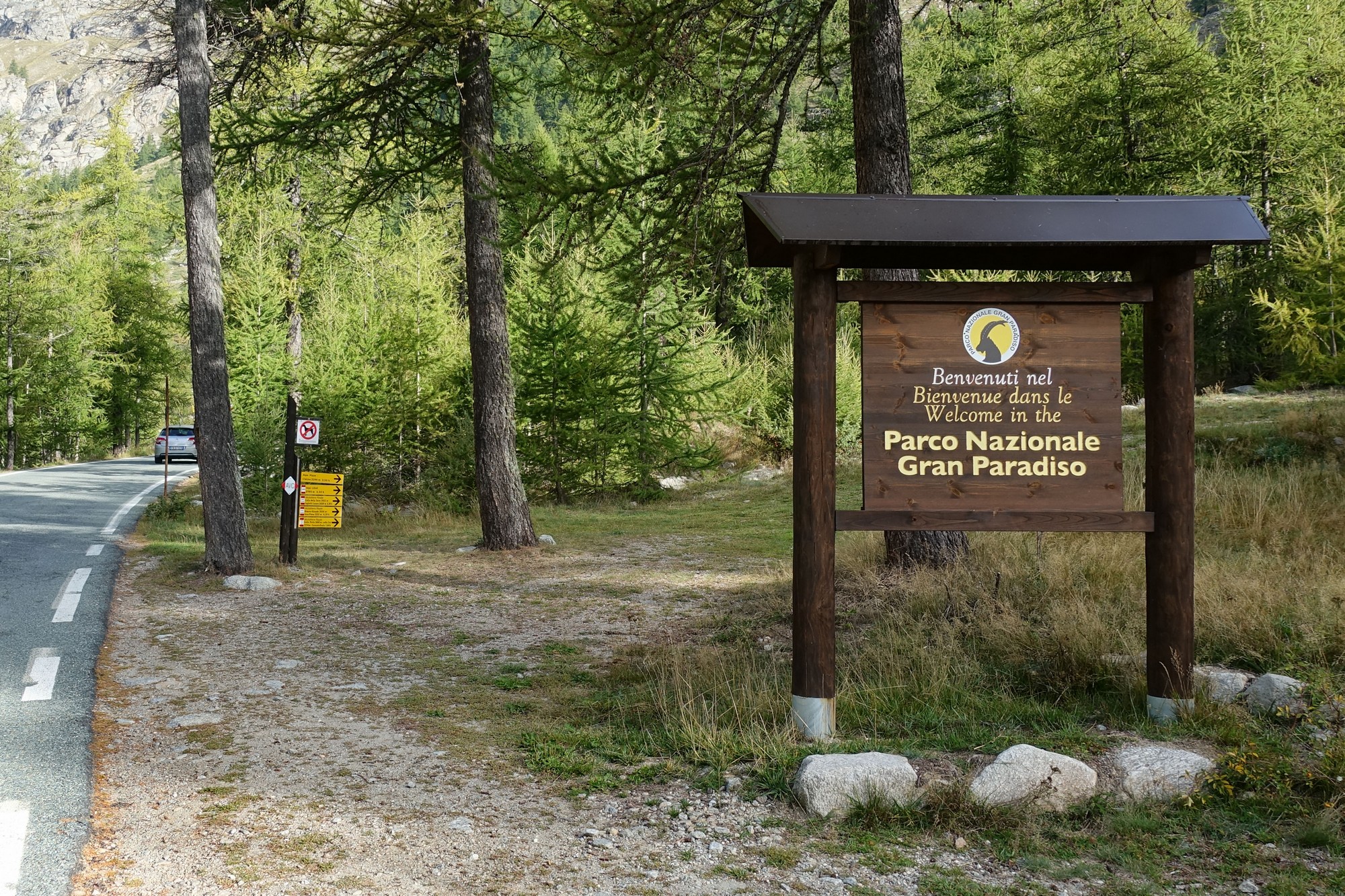
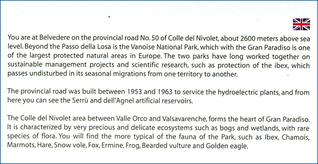
The Nivolet is in the protected area of the Parco Nazionale Gran Paradiso.
Very early in the ride I was wondering why I was feeling so sluggish. I was not finding it easy. I started thinking whether it was to do with recent rides/sleep/diet. I couldn’t understand it. After a while I switched my Wahoo Bolt to the gradient page and it all became clear. I saw I was climbing at 9 and 10% most of the time. Rarely was it the 7% that I’d been expecting. So that’s why it was so tough. Before leaving I had seen that the average gradient overall was 7.5%, but of course when you factor in the flatter sections and even some downhill, then it’s inevitable that there will be sections significantly steeper than the average. I should really have known that!
Unusually for me, I then left the Wahoo displaying the gradient page for most of the climb.
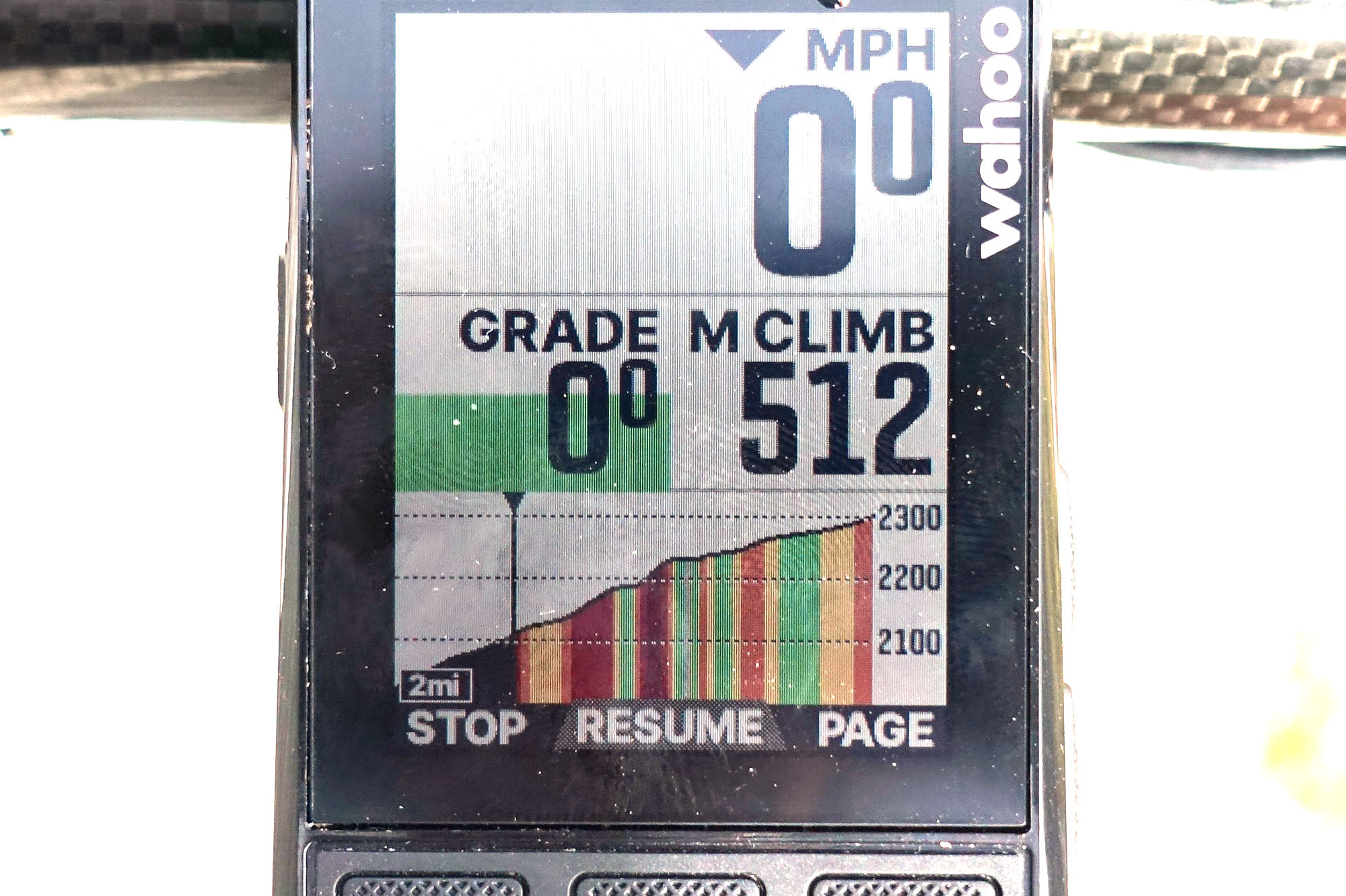
That way I was able to see the steep sections displayed on the screen in red as I approached them.
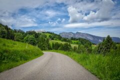
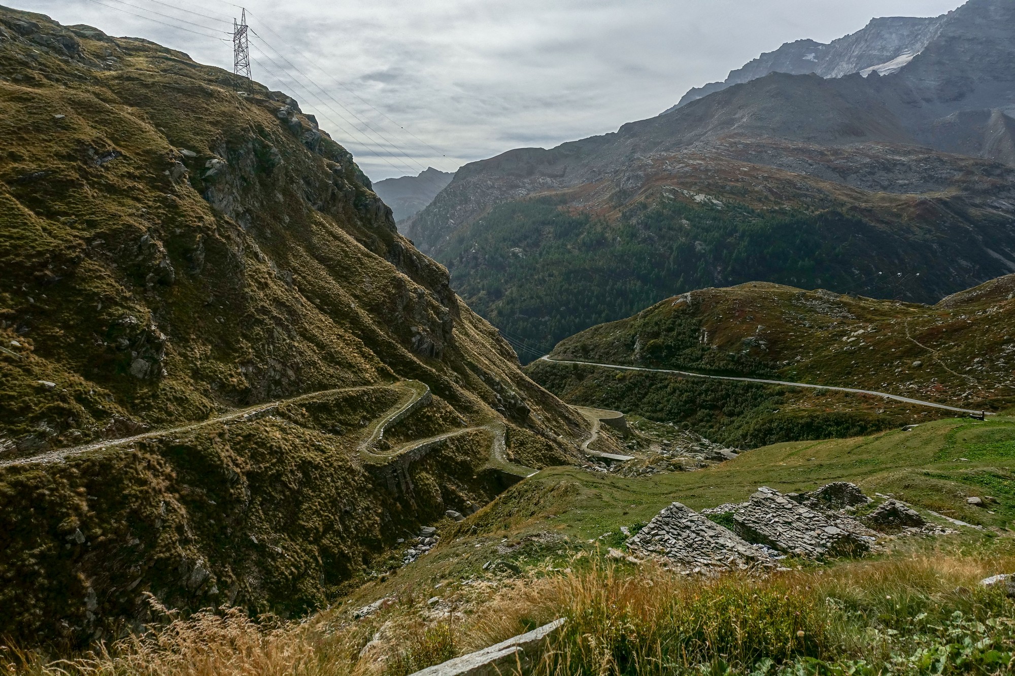
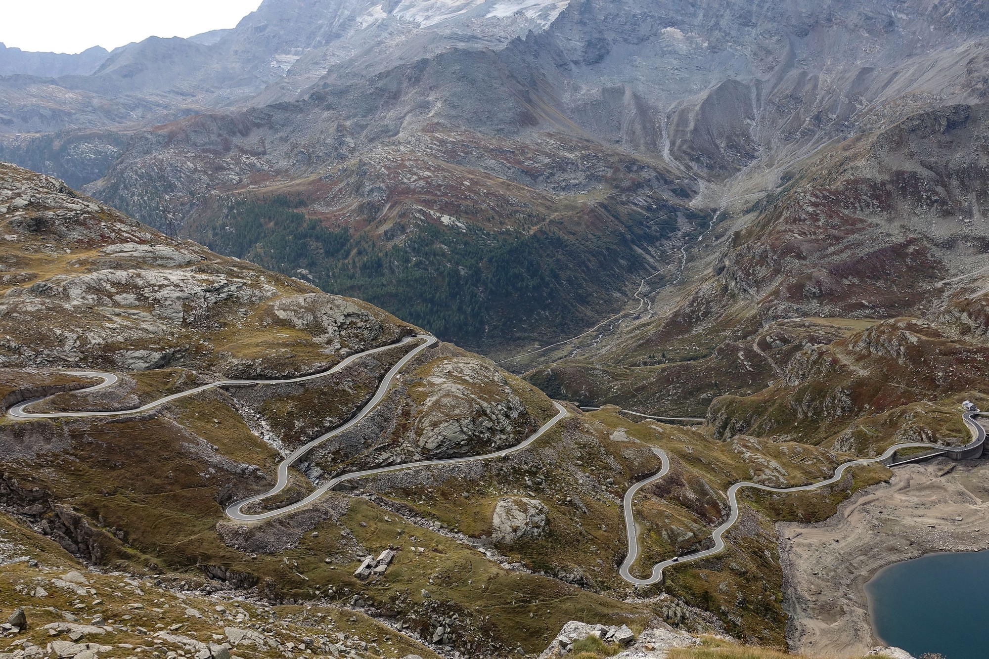
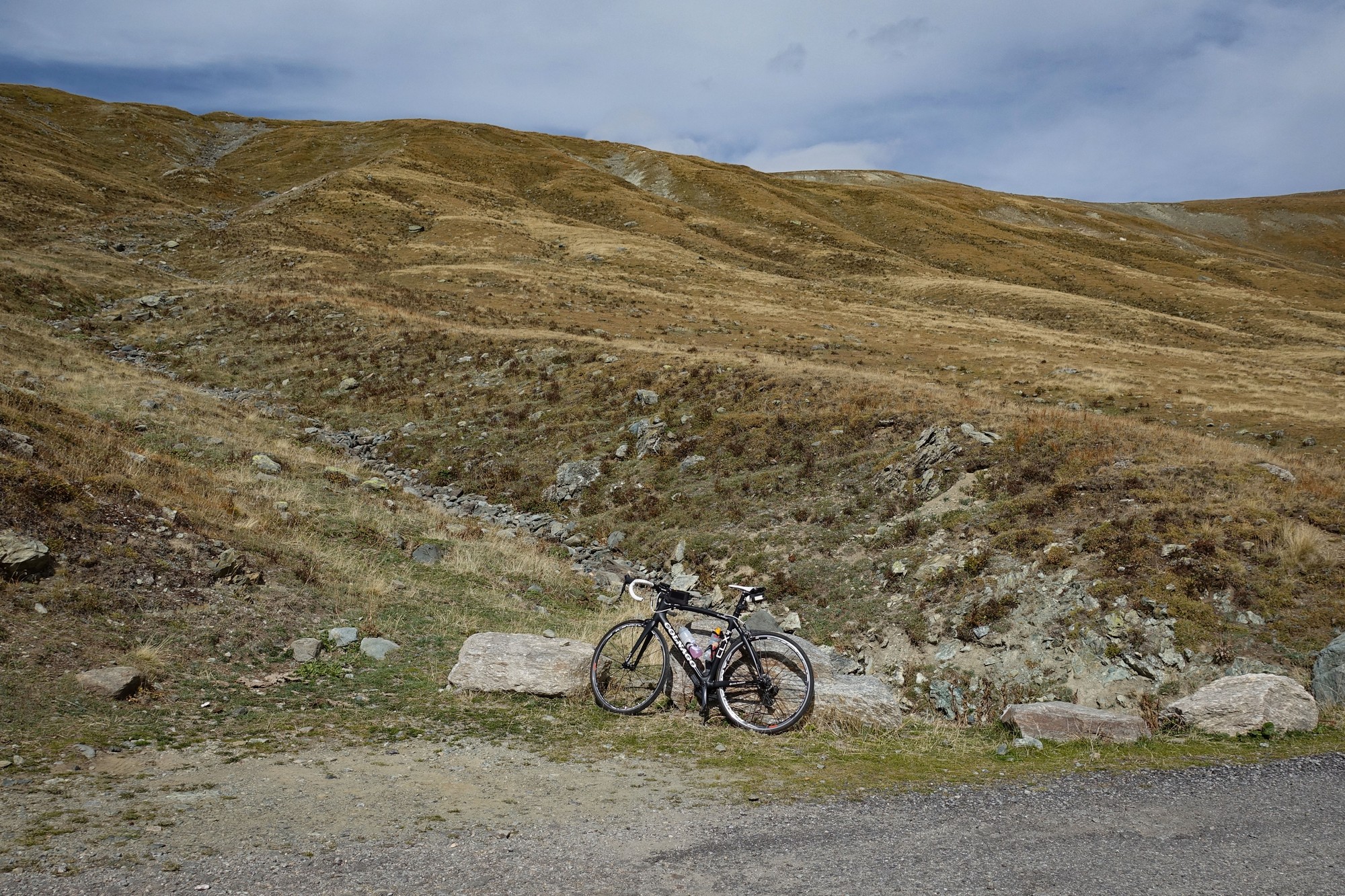
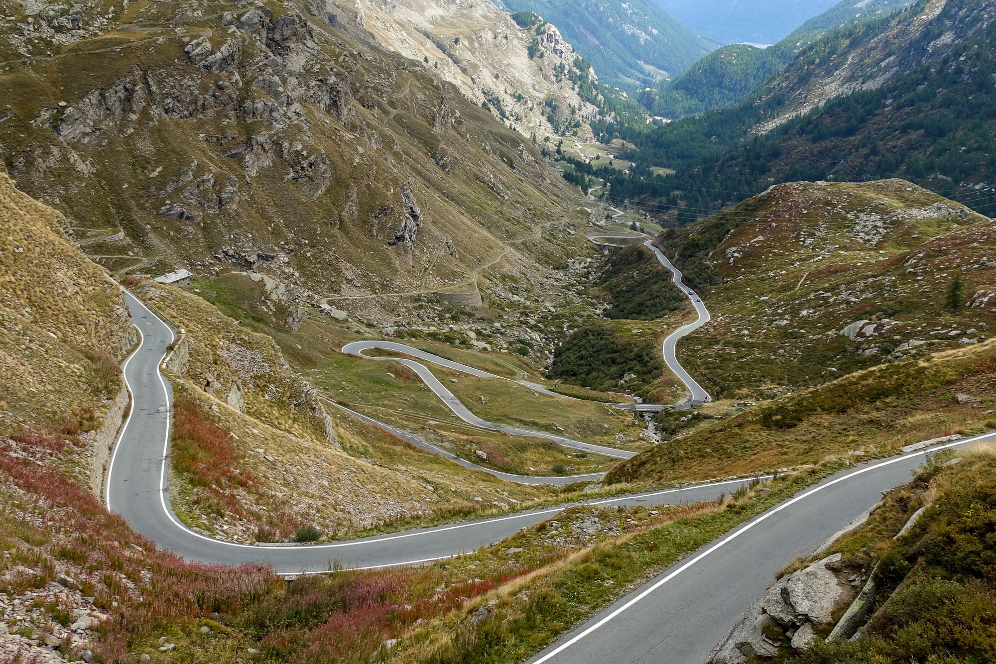
The landscape became more barren as the road climbed above the tree line.
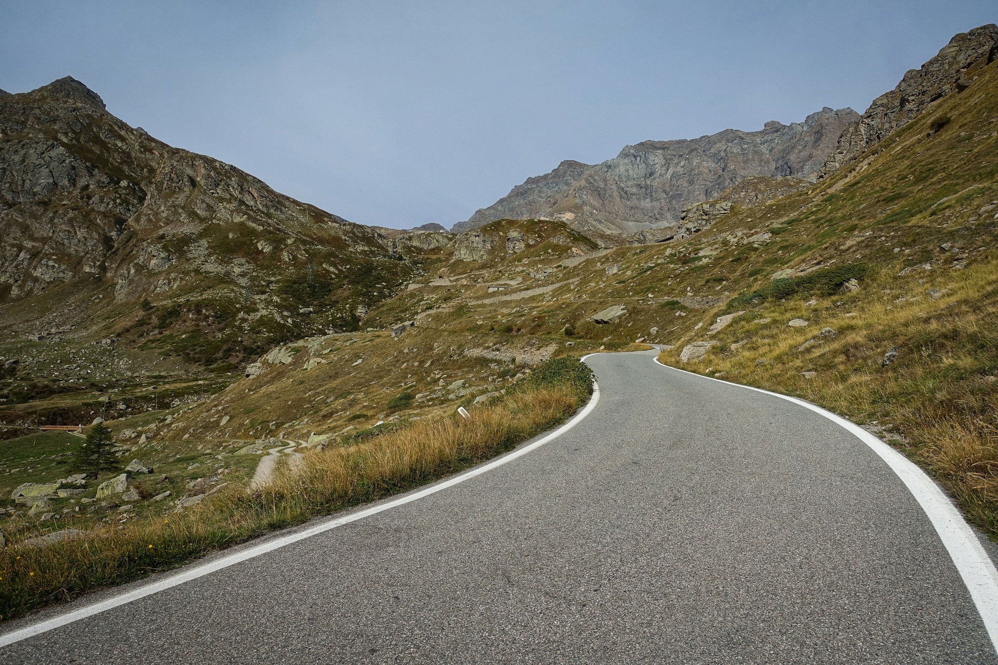
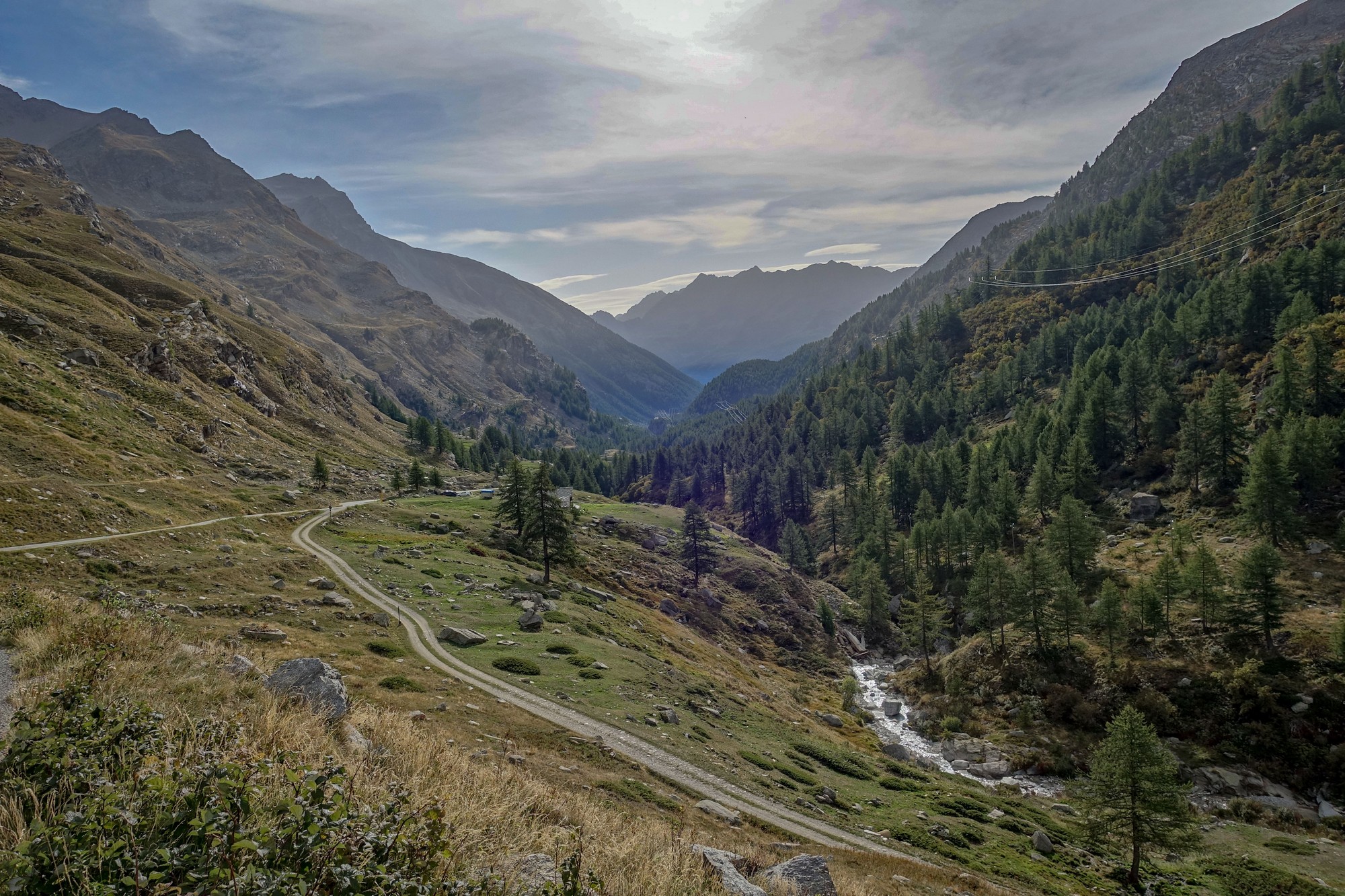
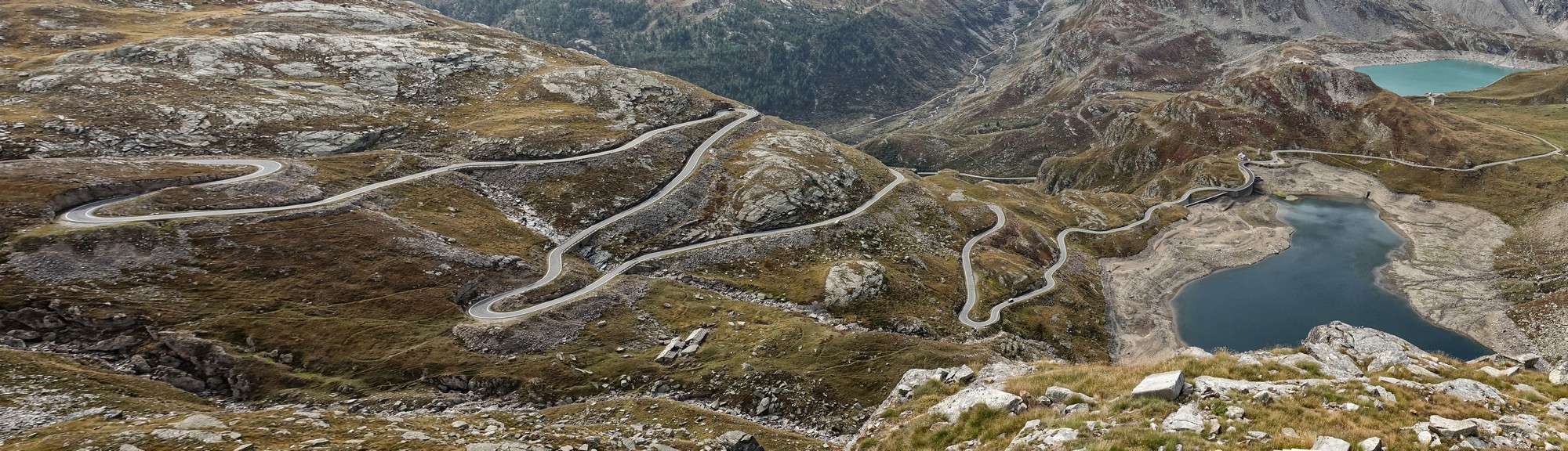
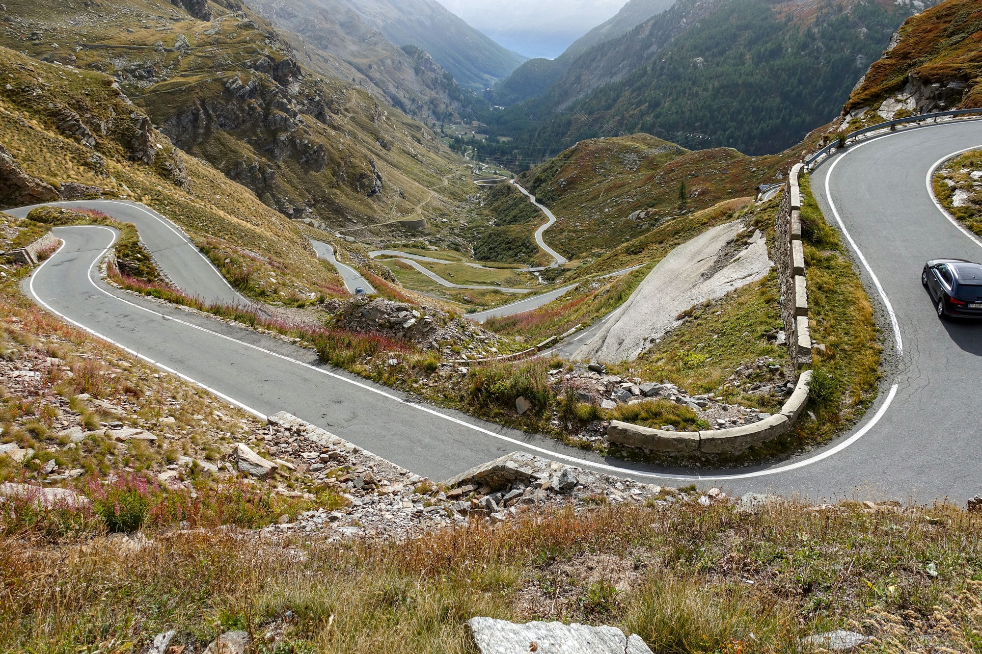
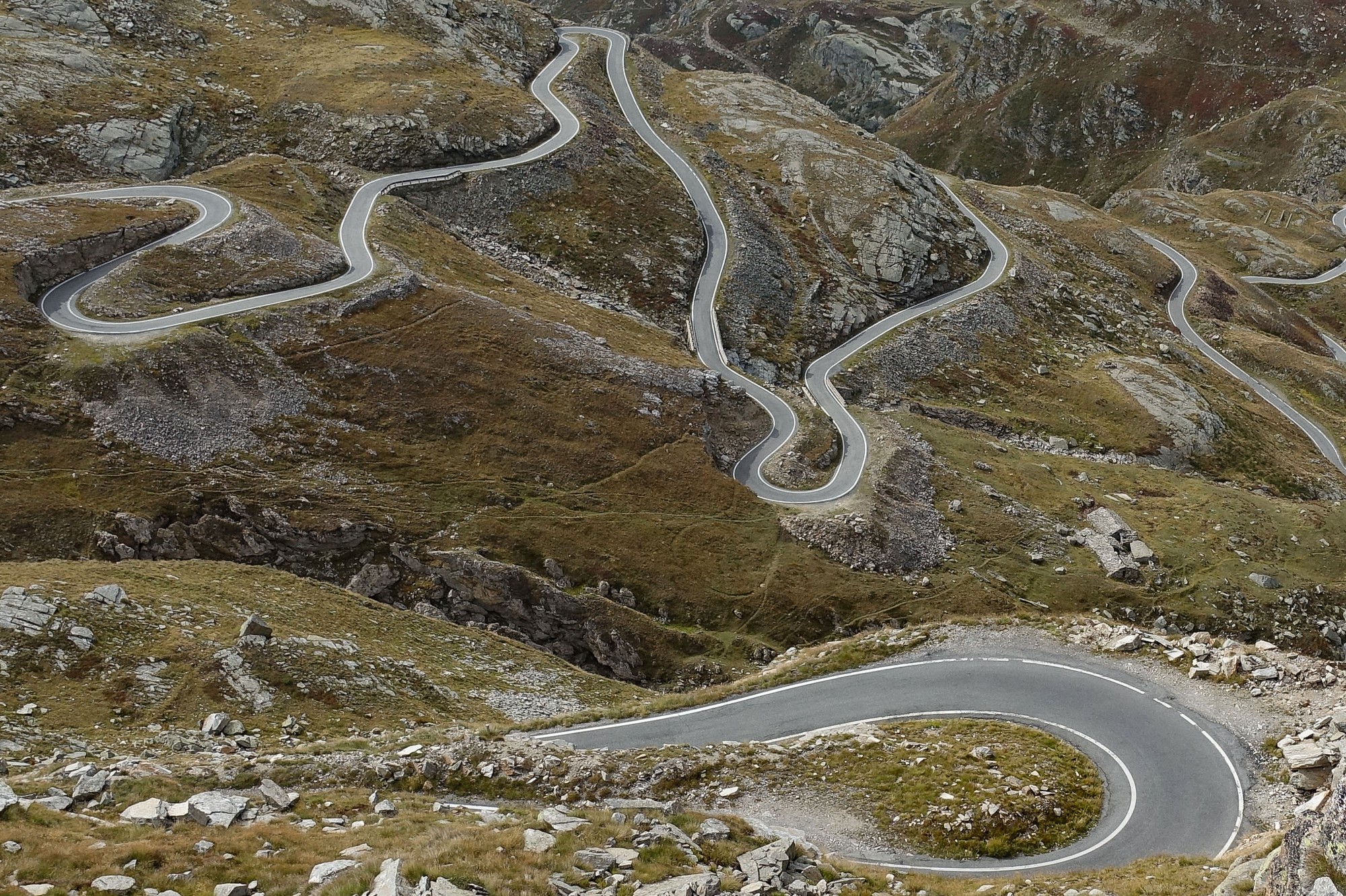
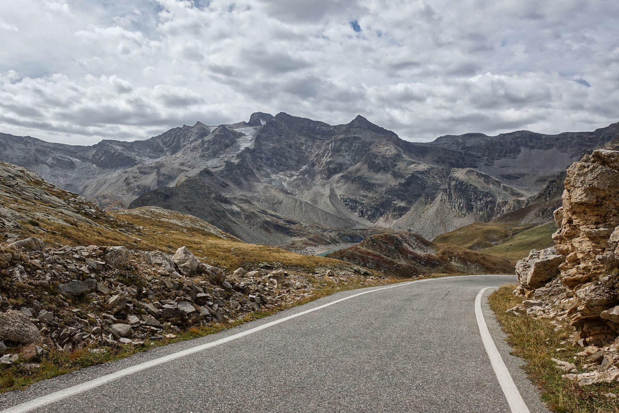
When I came to review my photos for this post, I realised that they nearly all consist of views looking back down, as opposed to ahead. Looking back I saw the road unwind below me, like a long string of spaghetti. Looking ahead was just a wall of rock with rarely any clue as to where the road went.
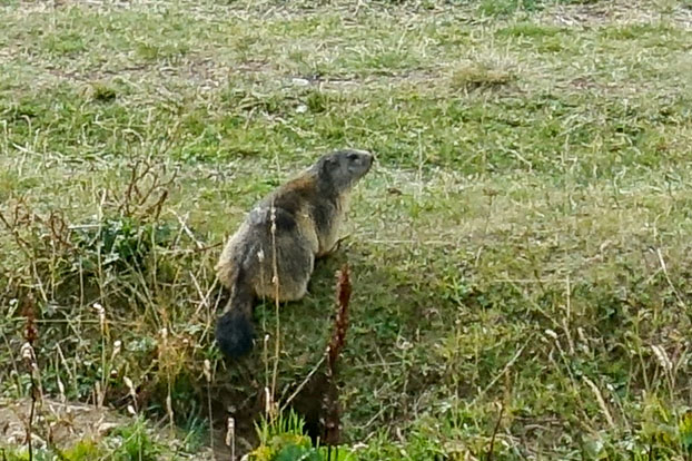
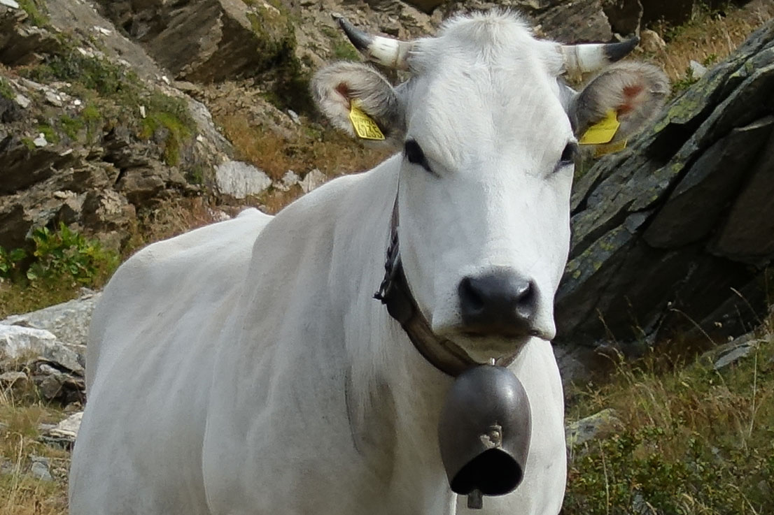
The shrill calls of marmots was never far away. I saw a couple by the roadside but they scuttled away and I was only able to get a long range shot of one,

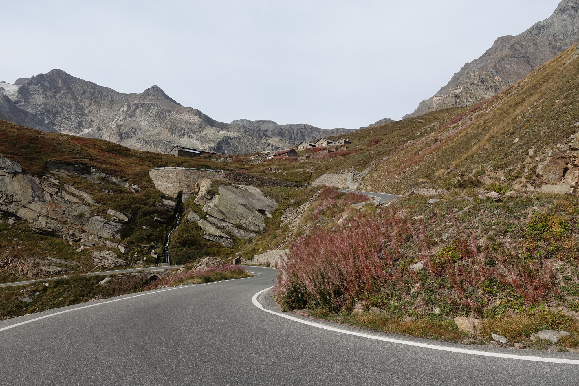
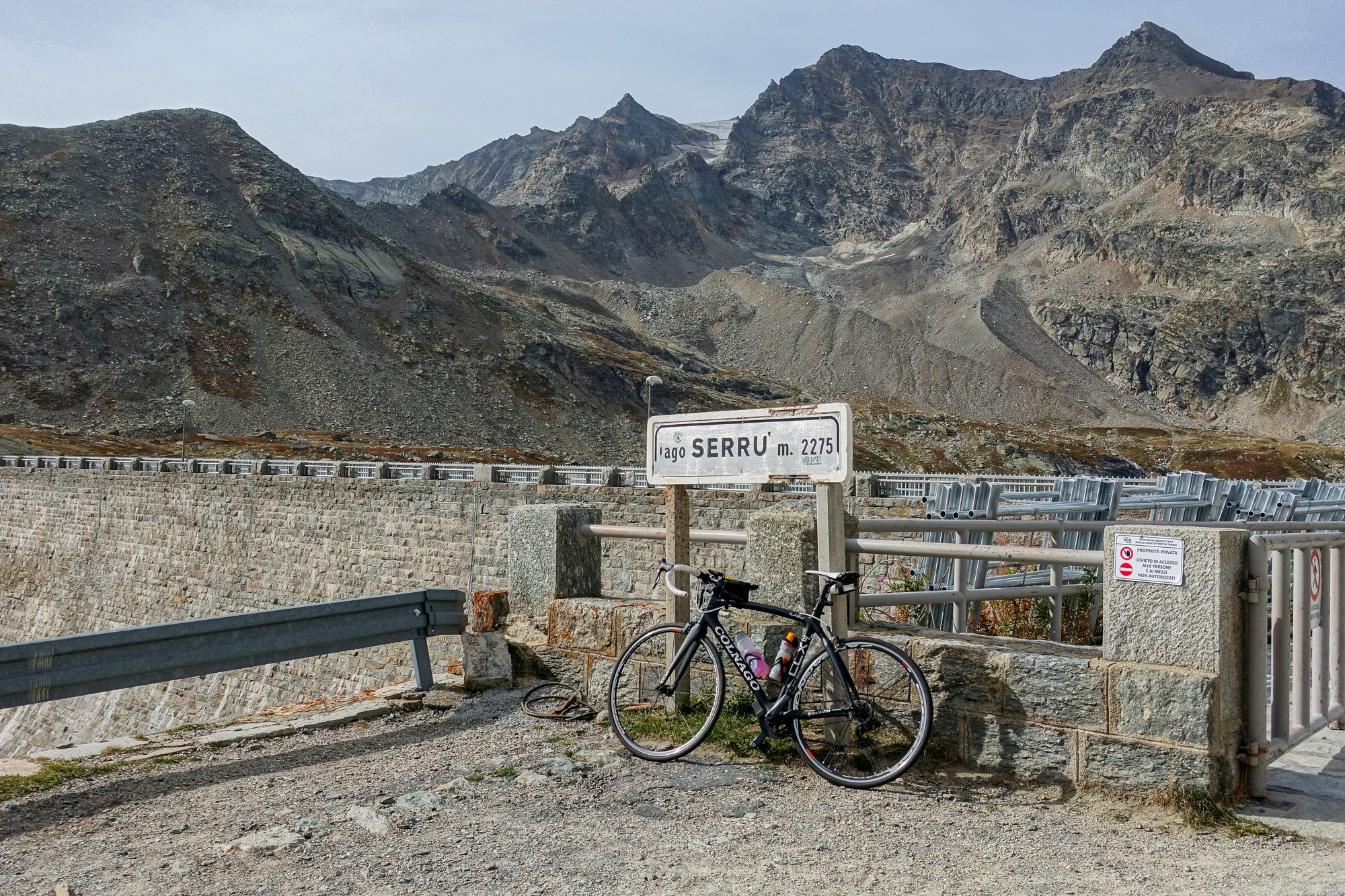
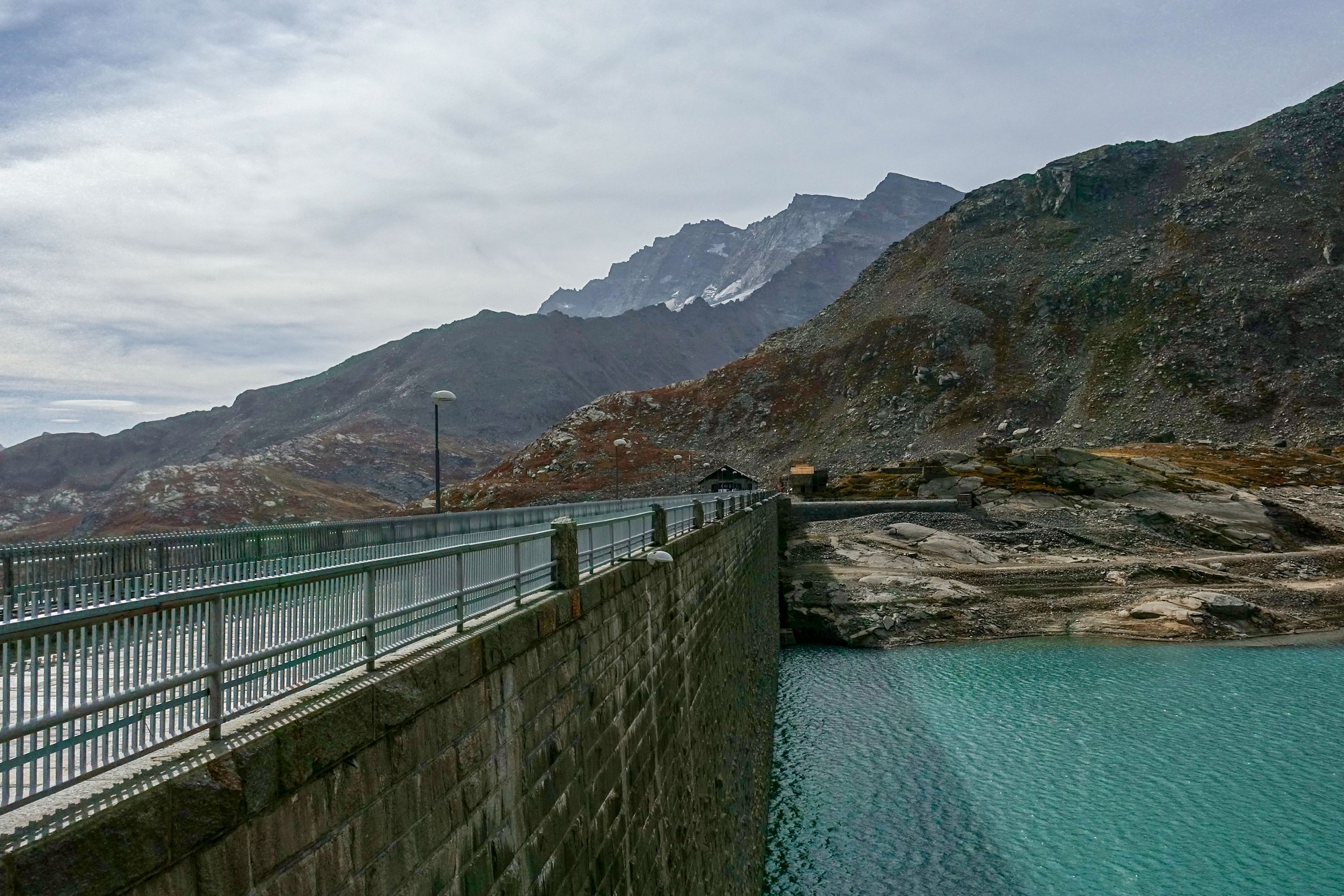
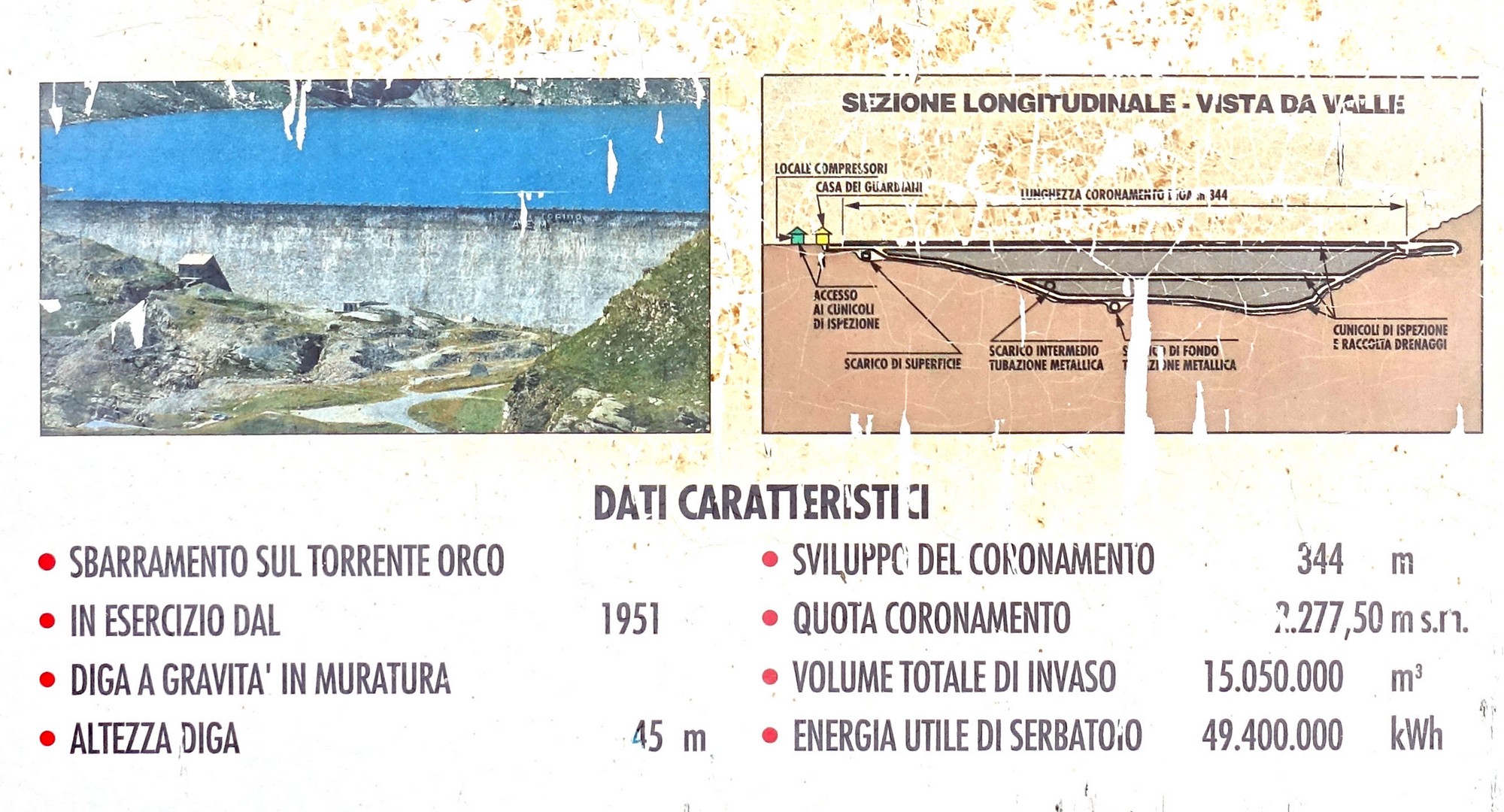
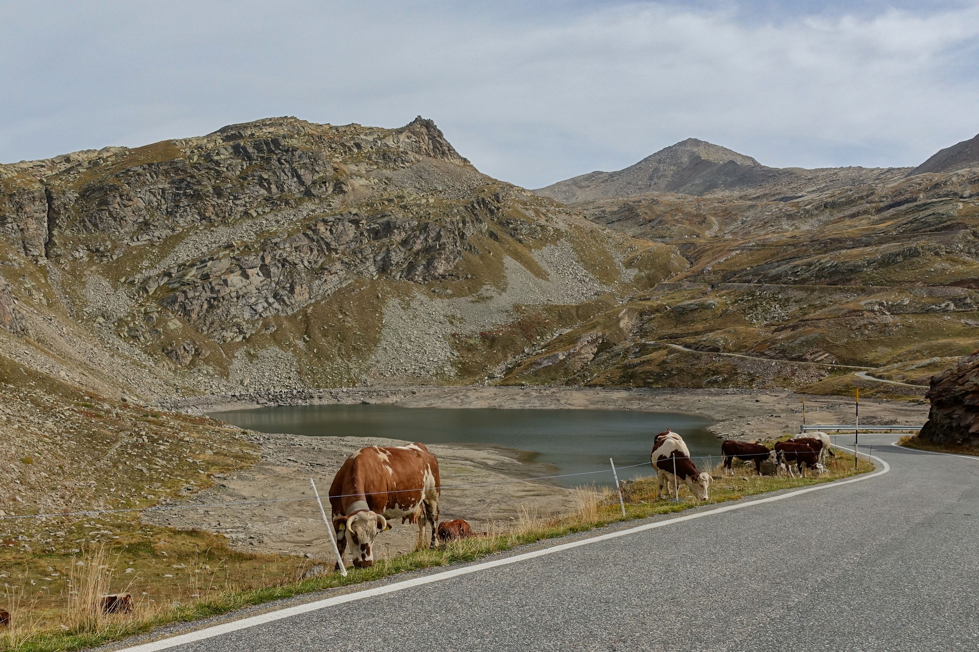
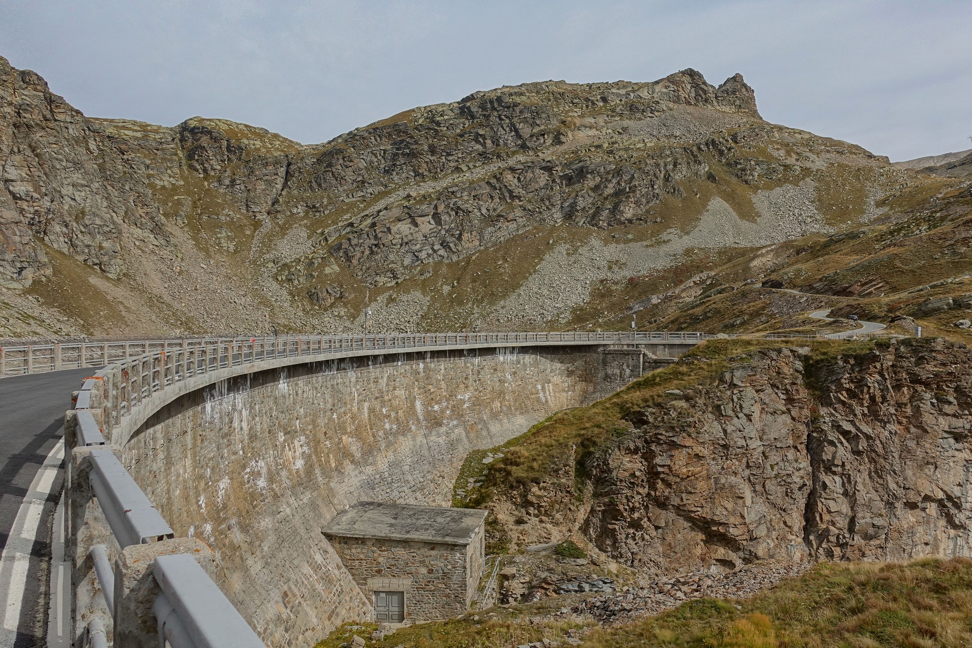
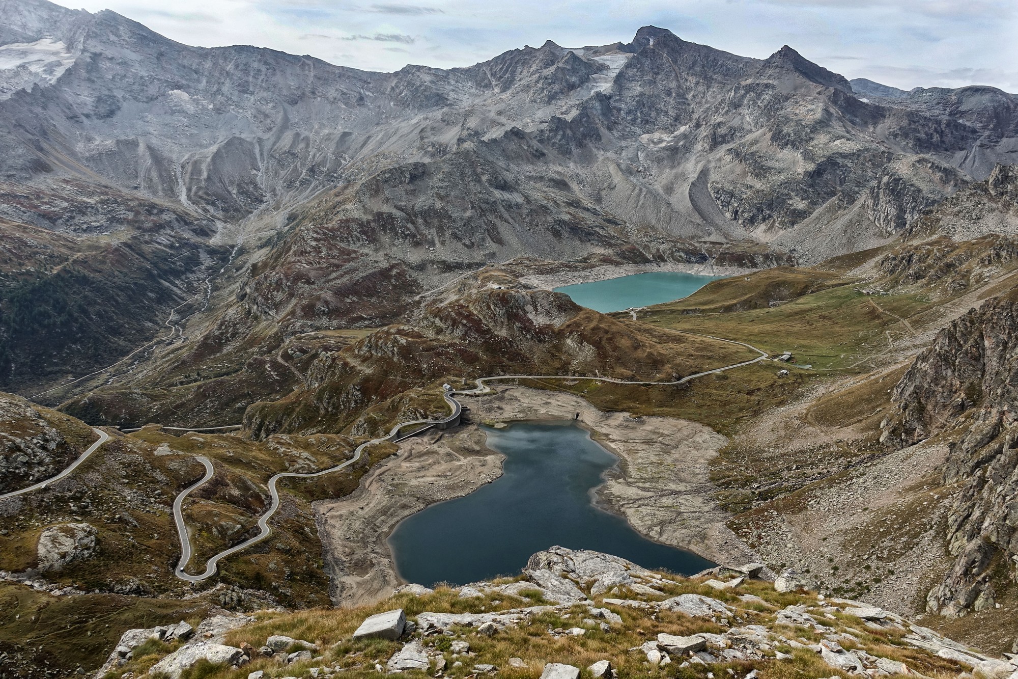
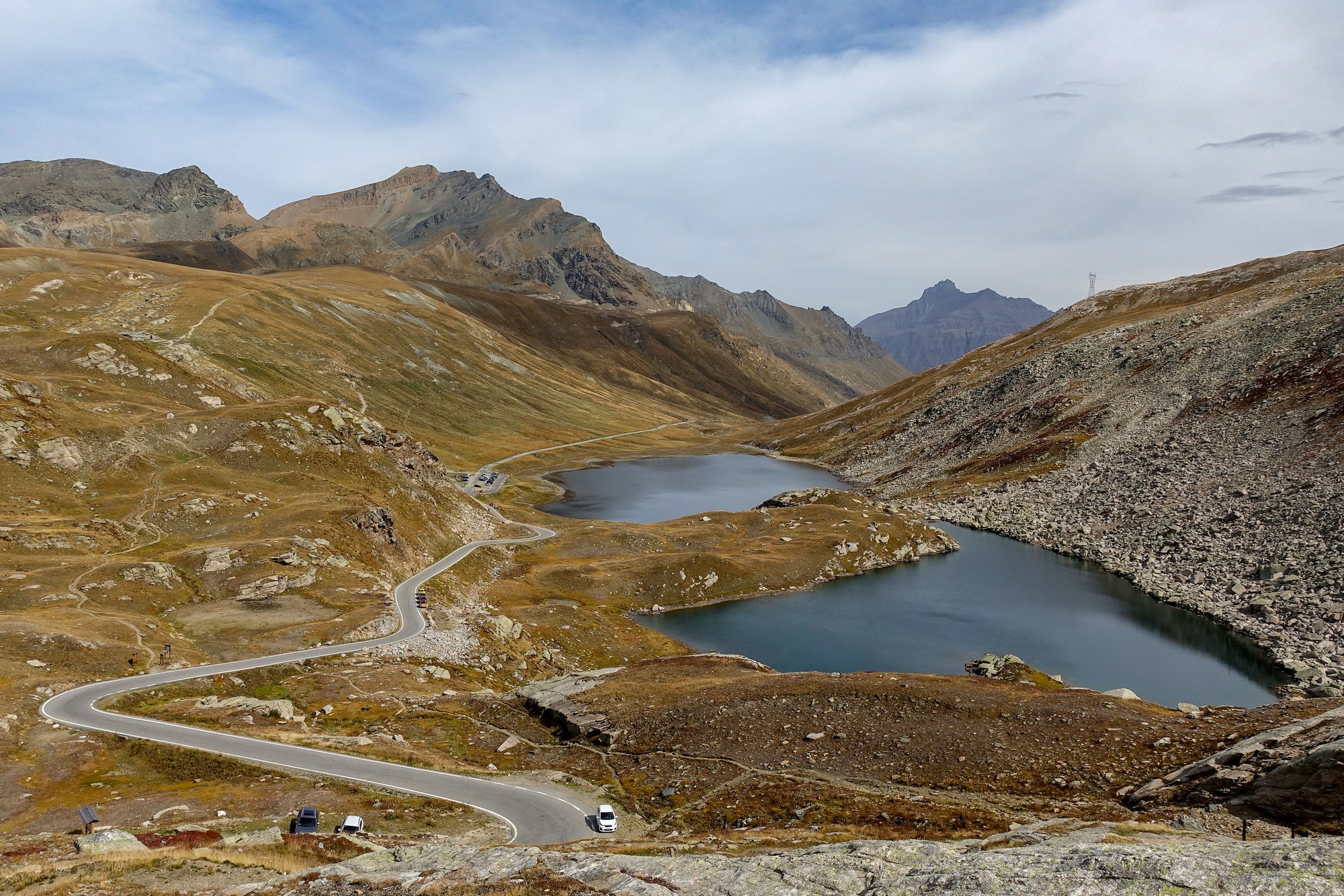
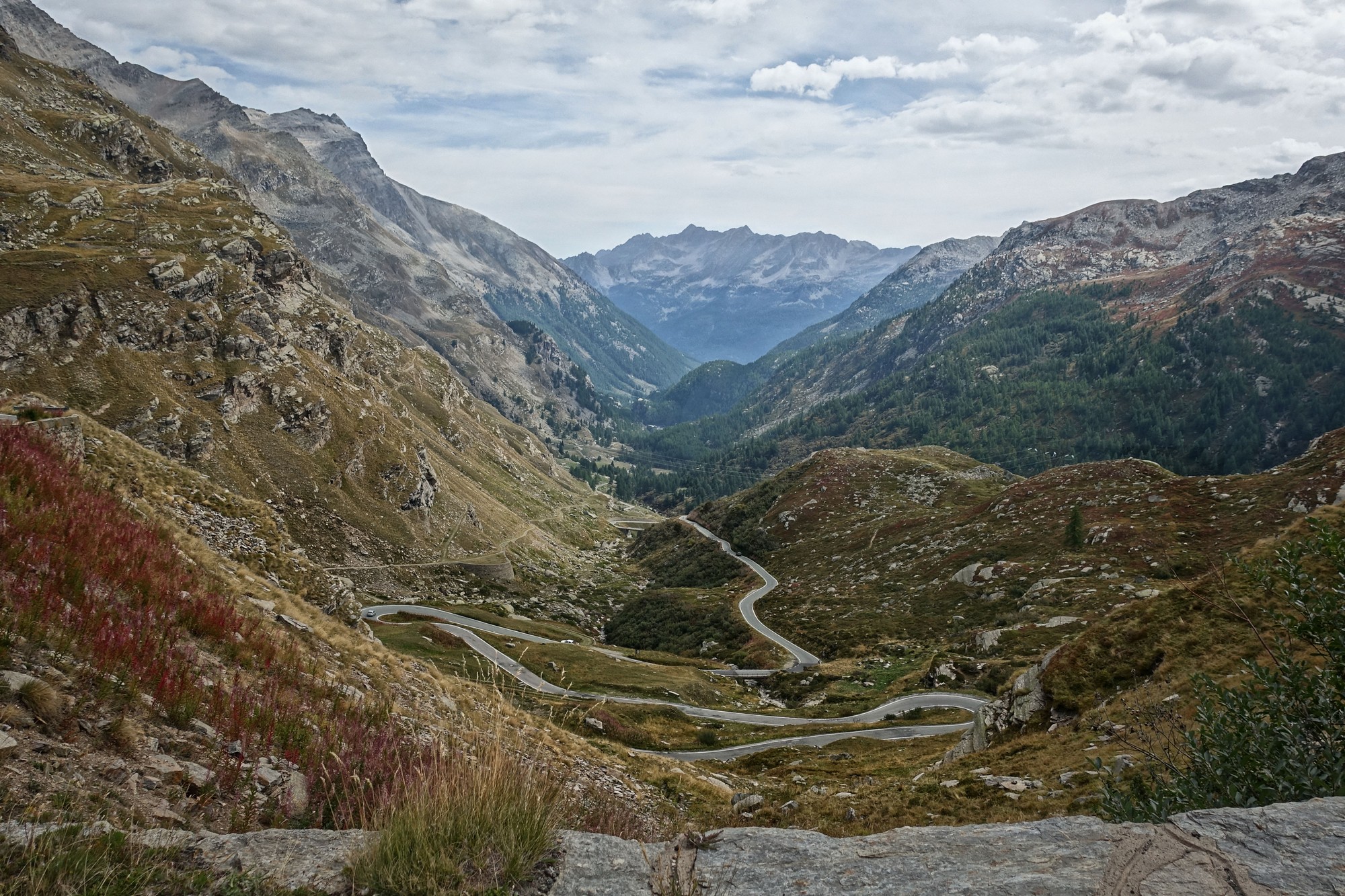
After 6½ miles of climbing I had reached the dam across the river Orco, at 2275m
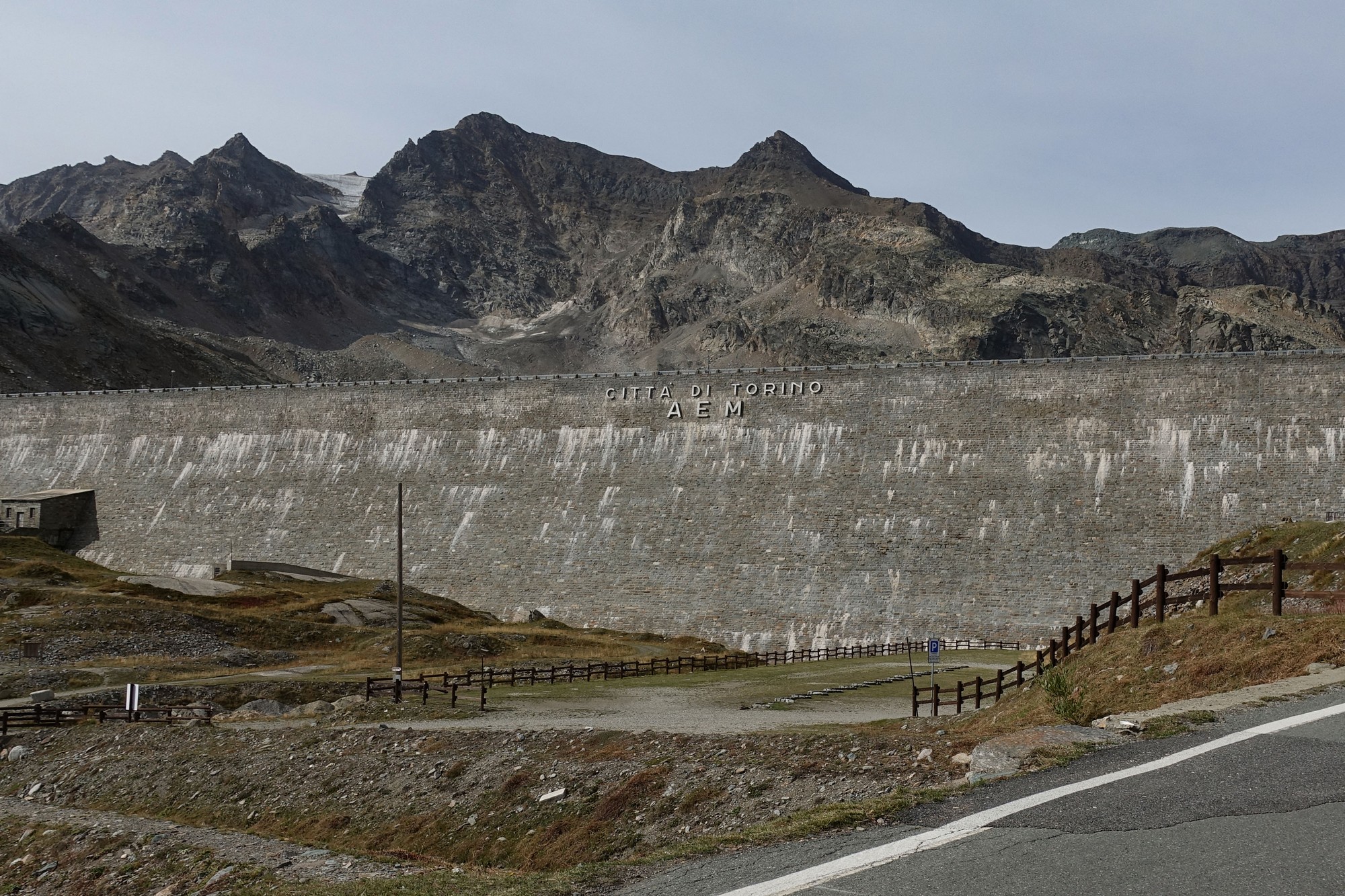
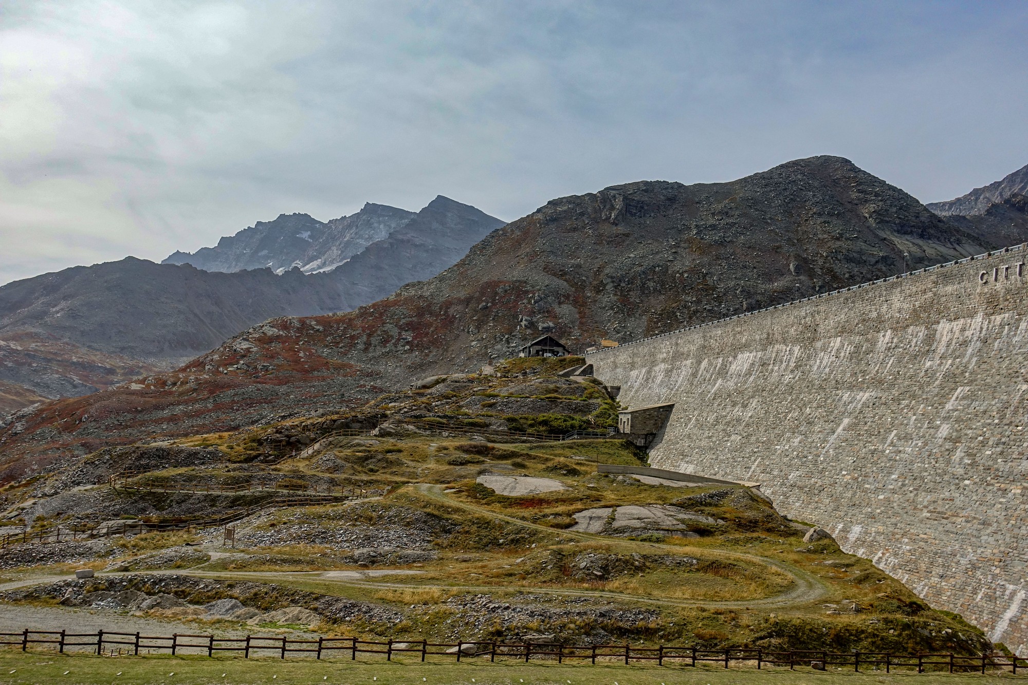
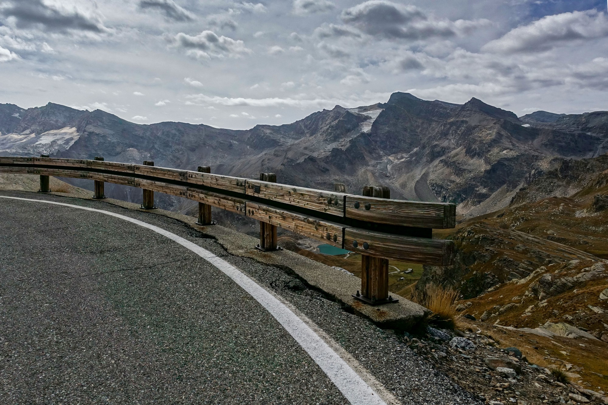
The road continued to climb after the lake but then dropped down to another lake and another dam, the Diga del lago dell’Agnel
It was on this section that a guy on an electric bike ‘rode’ up alongside and started talking in Italian. He didn’t know any English but nevertheless managed to tell me that the Nivolet was about 3km away. In fact it was nearer to 3 miles away, at an average of nearly 8%.
I don’t want to sound greedy, given the visual delights I was surrounded by, but these lakes would have looked more attractive if they were filled up. I don’t know if it’s a time-of-year thing, or whether the low levels are caused by the dry summer.
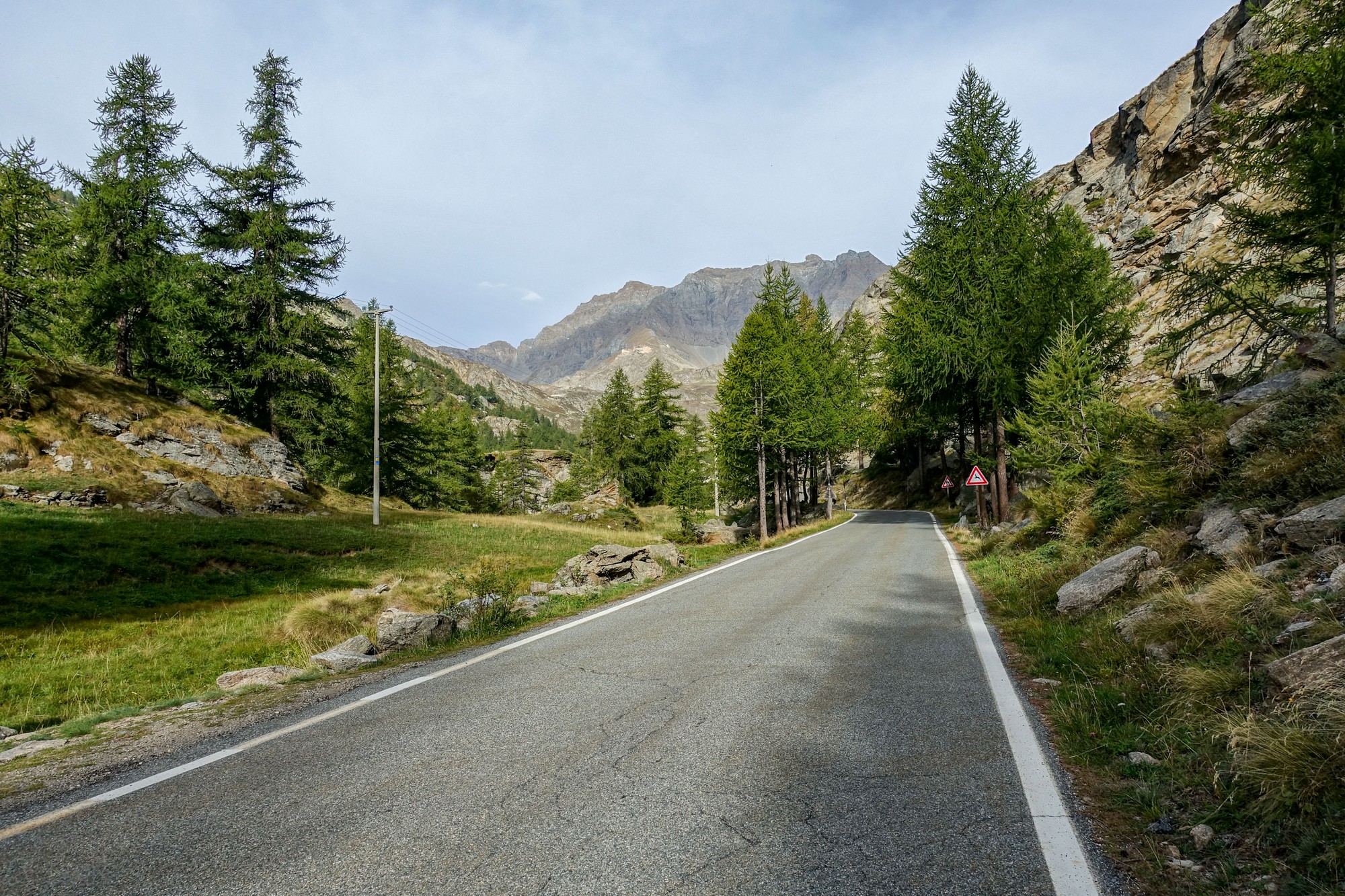
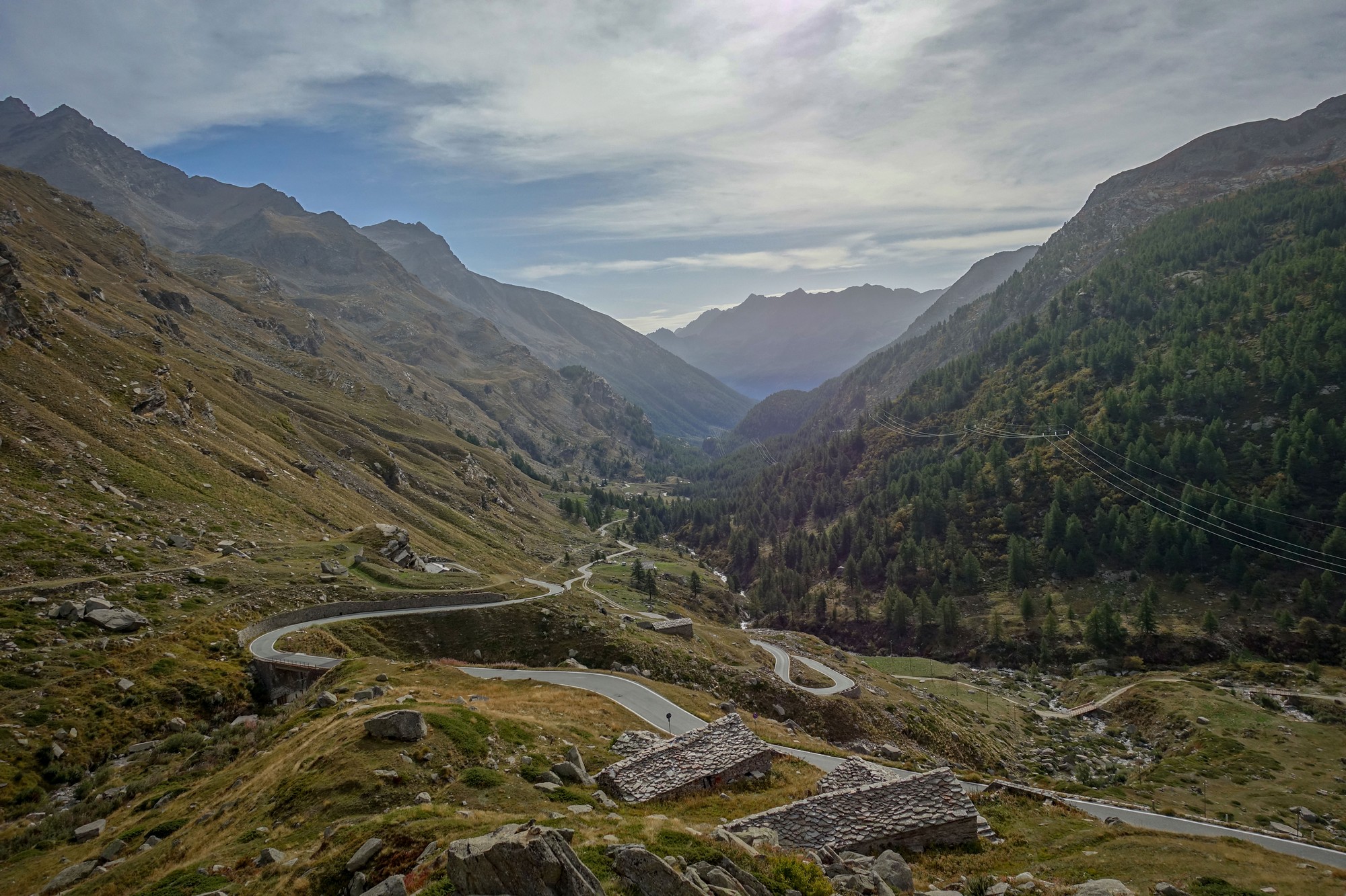
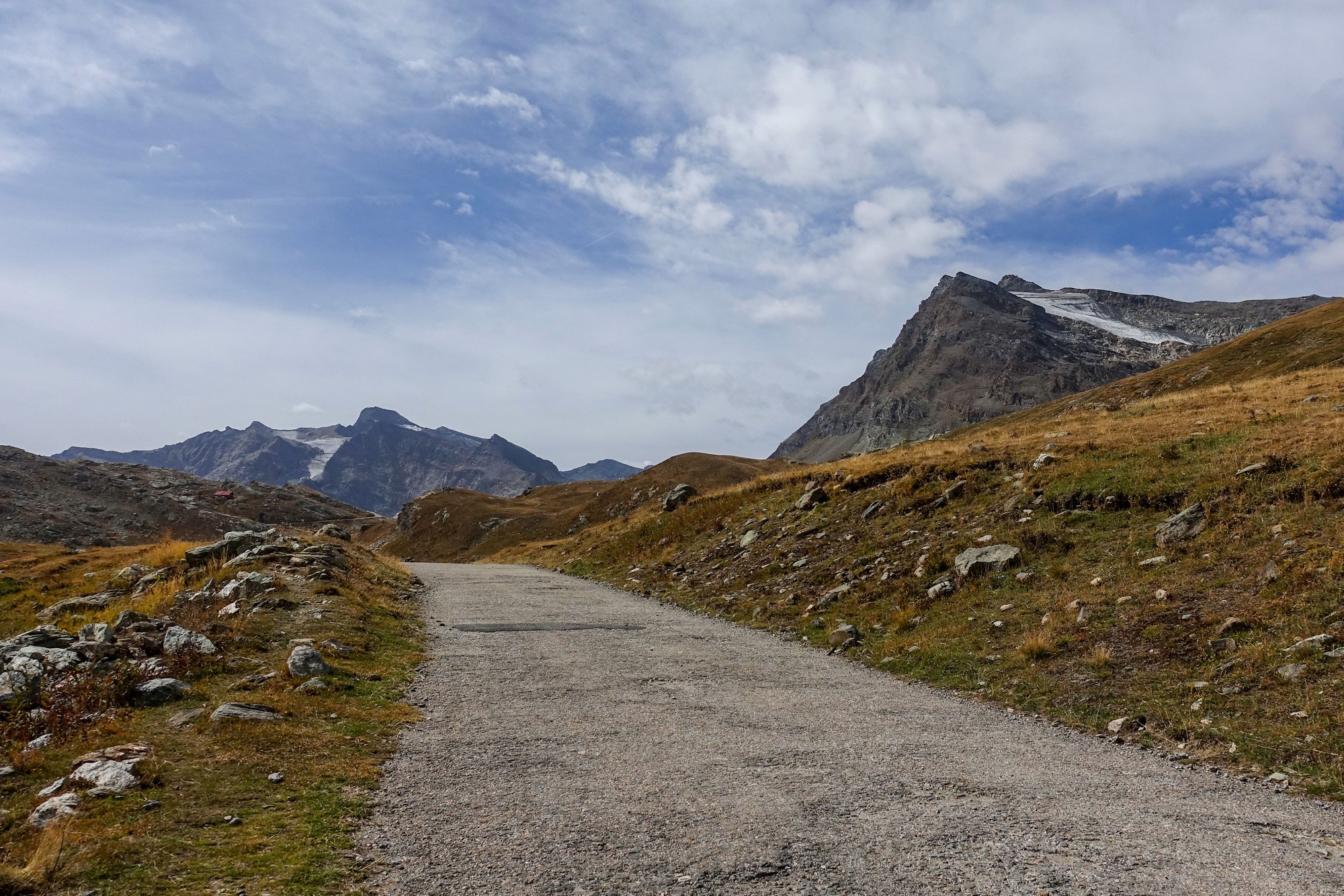
The road continued to climb, spectacularly, above the lakes. Luckily the light wind was behind me for most of the climb. There was hardly any traffic. After all, the road is not a through road so it’s just visitors, mainly walkers.

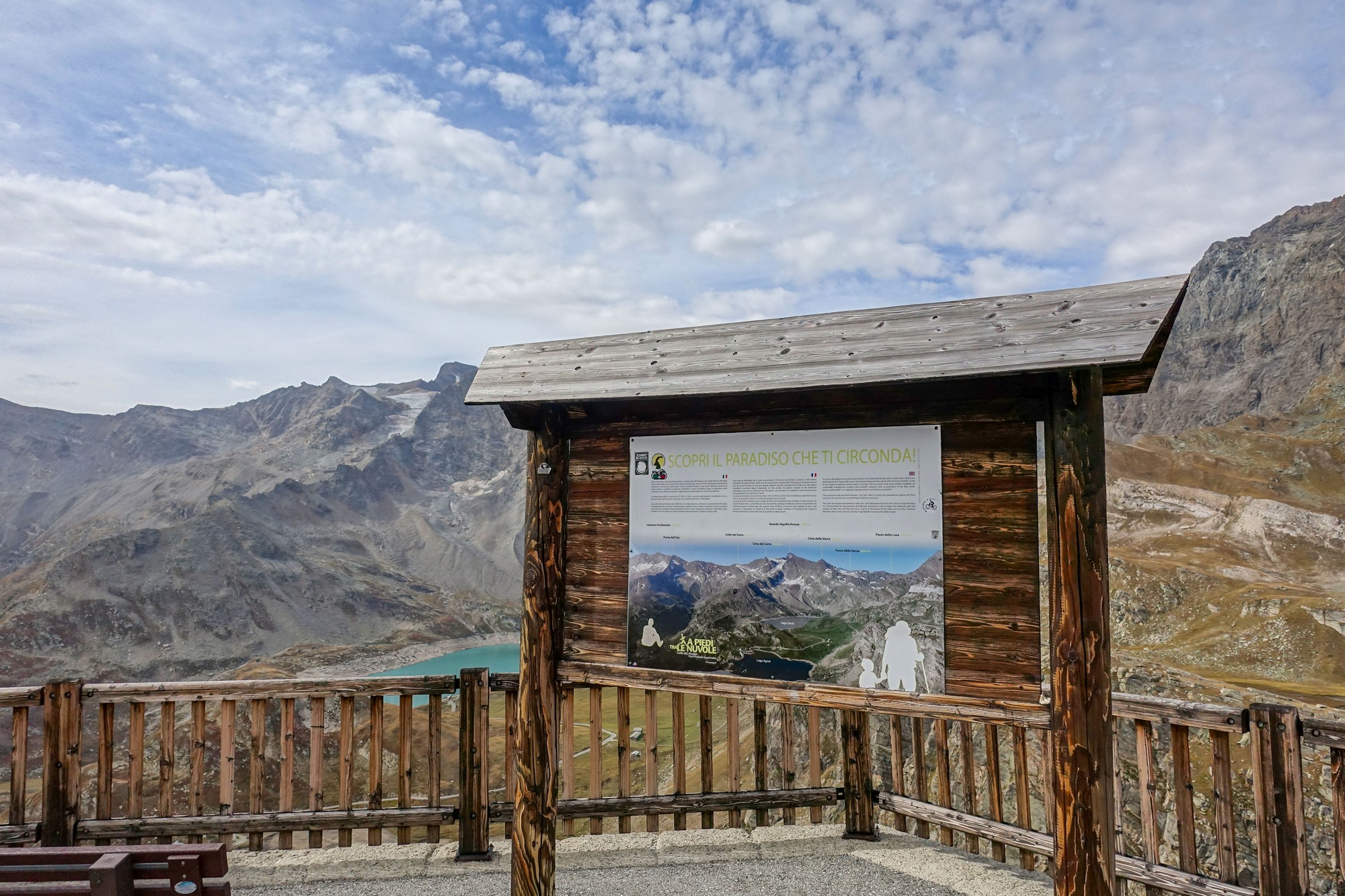
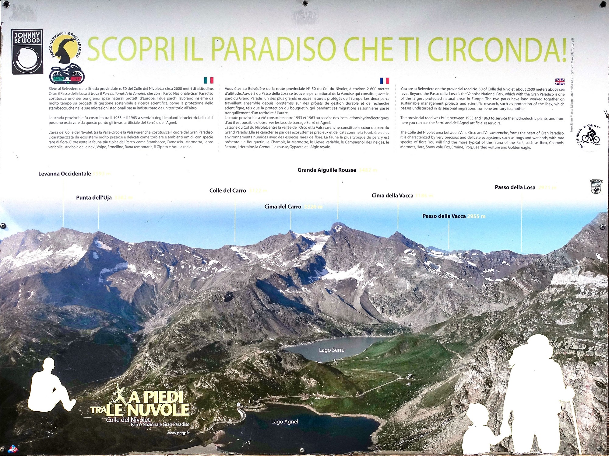
I reached a lookout point with information about the surrounding landscape
It was here that someone asked me (in English, after Italian had been ruled out) whether you could go that way by bike, pointing towards the col. I said I hope so. I thought it was a strange thing to ask, but later realised she probably wondered whether you could carry on past the col towards Aosta.
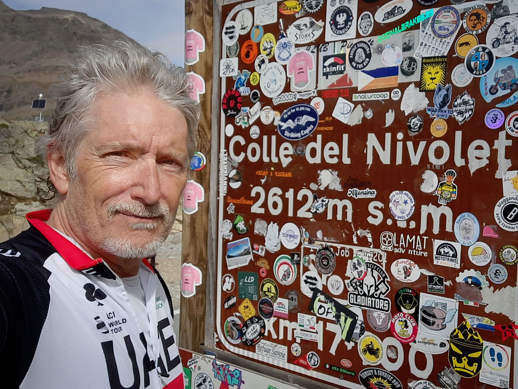
Another quarter of a mile up the road, I reached the Colle del Nivolet.
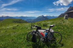
I’d had two energy gels and a banana on the way up. Thank goodness for the hazy sun and cool air. That climb would have been unmanageable on a hot day.
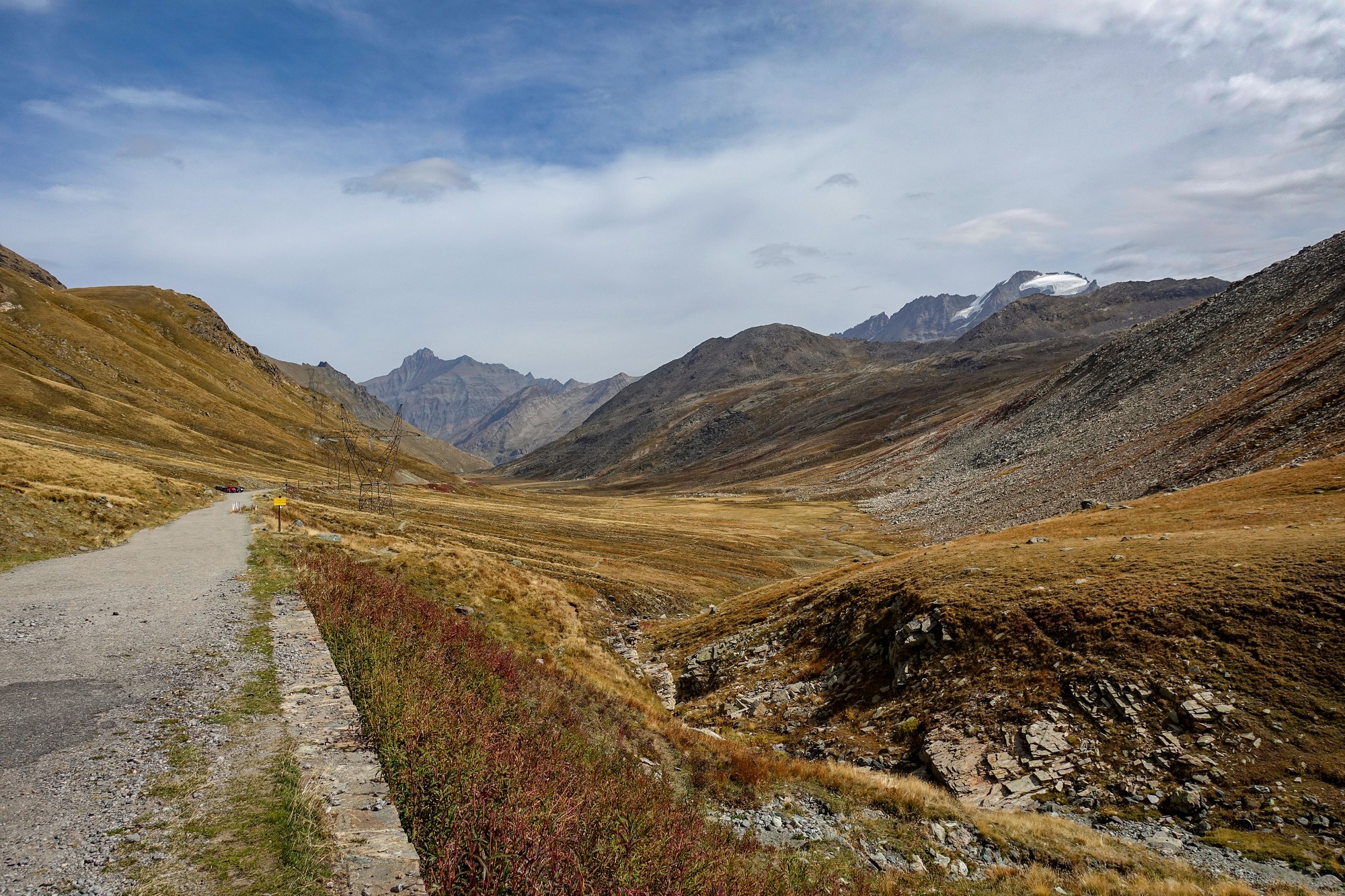
From the colle I could see down the other side to the Nivolet lakes (laghi del Nivolet), where the metalled road comes to an end, at a car park.
At least those lakes had plenty of water! I briefly considered not going any further, but it didn’t look too steep so I rode another mile down, past the lakes and along a gravel track until I saw a nice place to have my lunch.
I sat on a rock and took stock of my surroundings while eating my CST sandwich. It was really peaceful down there. A few groups of walkers were the only others around.
One guy stopped and asked me from which direction I’d come. I said from the col. He said the gravel road continues to Aosta, which I didn’t know. I don’t know if he meant the area or the town. Anyway you’d have to be walking or mountain-biking to do it I think. In fact I checked later to see that it’s 3.8 miles as the crow flies to reach the village of Pont, where there is a proper road that leads north to the Aosta Valley.
Another group of walkers stopped and one spoke in English. They asked about my ride and how many times I’d done it. I said it’s my first, but never again – I joked. As they wandered off I heard one of them explaining to the others what I’d said.
Soon it was time to climb back up to the colle.
Back at the colle, I put my rain jacket on, to keep warm on the descent. I saw a couple taking photos by the col sign so I offered to take one of them both. We got chatting. They were Austrian, so it was English and German we used. He had a road bike and his partner had an electric bike. I joked that he should tie a rope on so she could pull him up the hills. Coincidentally they had recently done the Cormet de Roselend, same as me.
So the descent started. I was warm enough in my rain jacket. Inevitably I took quite a few photos on the way down, knowing that some of them would probably be duplicates of those taken before, but the shape of the road slinking its way down the valley is just too gorgeous to ignore. Once again the SwissStop brake blocks were excellent.

On the way up I had seen no cyclists, but on the descent I passed quite a few, making their way up there later in the day. That’s very unusual. Normally it’s the other way round with me being the later-in-the-day climber.
So I broadly concur with Simon Warren’s judgement. I think the Colle del Nivolet has the wild barren beauty of the Bonette but is so much steeper. The layout of the Nivolet road is the most awe-inspiring I’ve seen so far. As to which is better, I’ll say it’s a draw. When I did the Cime de la Bonette, it was October so there were even fewer people / vehicles / motorbikes / marmots around.
I hadn’t realised how close I was today to the col d’Iseran, on the other side of the mountains. In fact it’s about 4½ miles as the crow flies from Pont St Charles to the Lago Serru dam.
Fuel
Gallery
Click to enlarge / see slideshow