
Distance: 75.9 miles. Elevation: 9004 ft.
Col du Télégraphe | Le Col | Collet du Plan Nicolas | Col du Galibier
This is the ‘classic’ climb to Col du Galibier via Col du Télégraphe from the Maurienne valley. [See here for Col du Galibier from Briançon].

The climb proper starts from Saint-Michel-de-Maurienne, but I was staying at La Chambre, further down the valley, so I chose to do it from there. That meant an additional 16-mile ride along a busy main road—slightly uphill—before I could even get to start the actual climb. The day was going to be sunny and hot so I just wore lightweight kit, plastered myself in sunblock and wore my neck-protector thing. I had my rain jacket and arm warmers in my backpack, along with three energy gels, a HDM sandwich, a slice of fruit cake and a banana.
I left at just before 9:00. The first part of the journey was on the relatively quiet D74, that I had taken on my return from Col du Mollard four days ago.

But that road only goes as far as Saint-Jean-de-Maurienne, beyond which I was forced to use the much busier D1006.
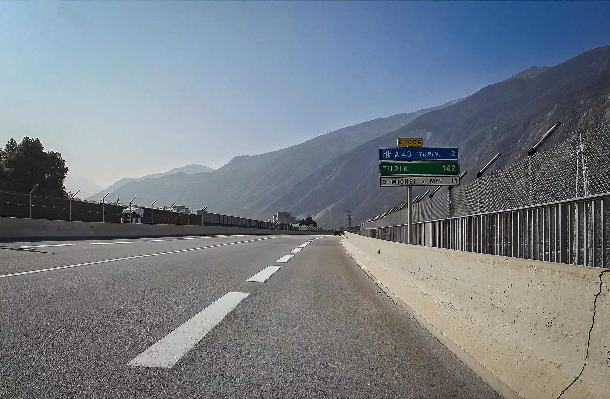
There was a cycle lane for most of it, but it’s still quite stressful having noisy lorries and traffic speeding past.

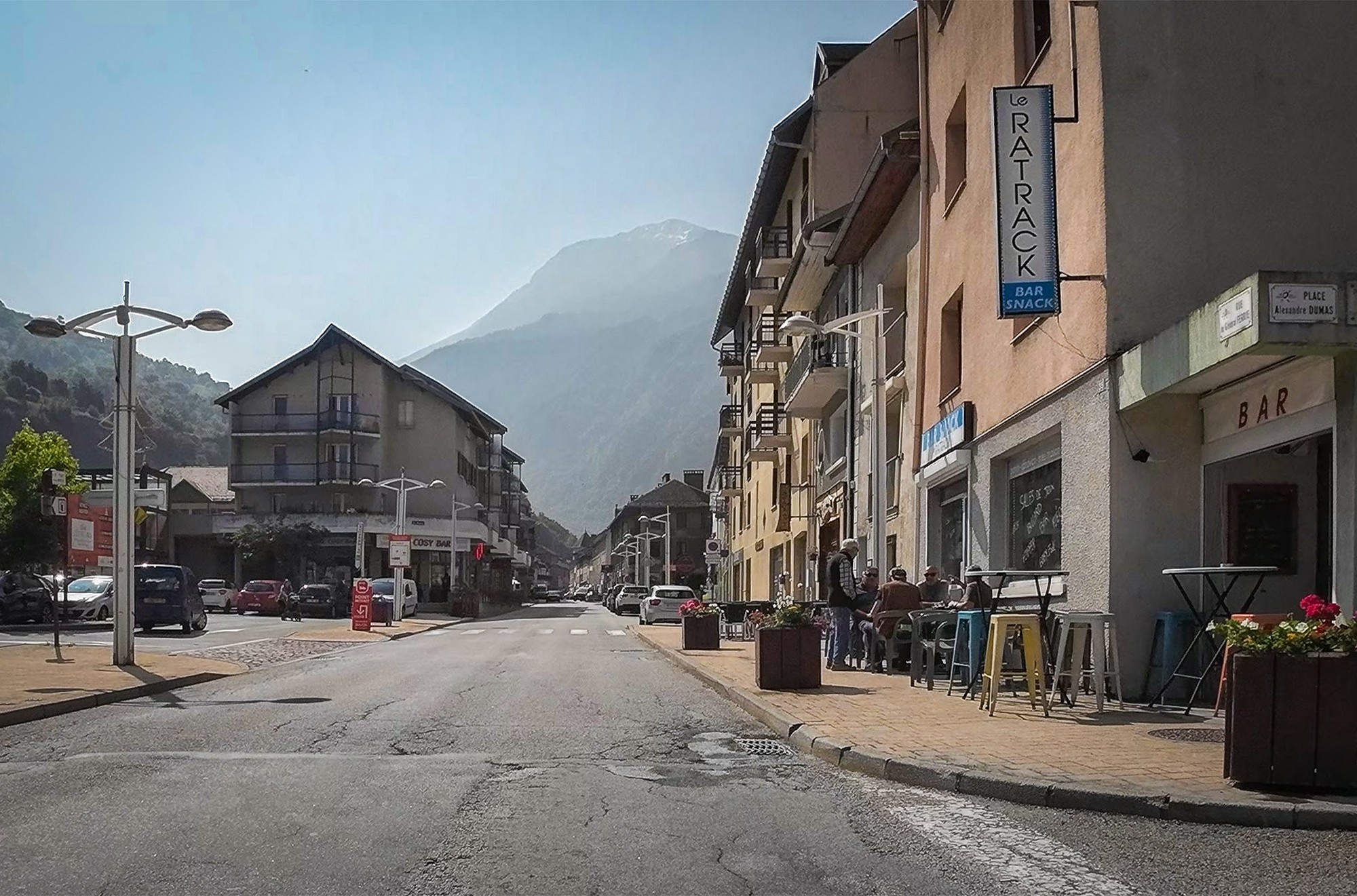
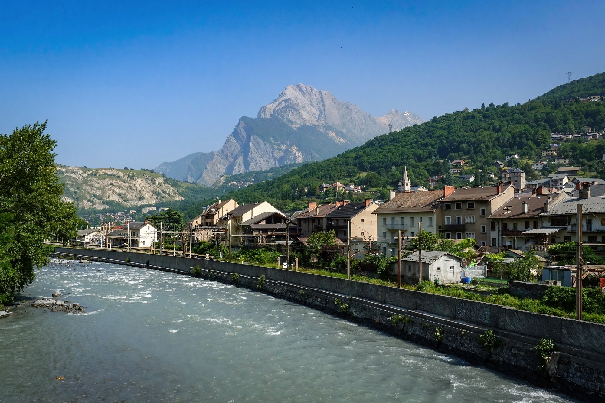
There was a slight tailwind and the drag from the passing lorries helped further. The mountains ahead were somewhat obscured by a misty haze. I reached Saint-Michel-de-Maurienne in just over an hour. That’s where the climb to Col du Télégraphe starts. I stopped to make some notes and have a bite of banana.
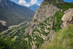
The climb to Col du Télégraphe is 7.3 miles at just over 7%, much of it through woods. I did it without stopping, taking an hour and twenty minutes, despite there being some wonderful aerial views back over the Maurienne valley. For about twenty minutes of the climb I was chatting with an English guy riding alongside.
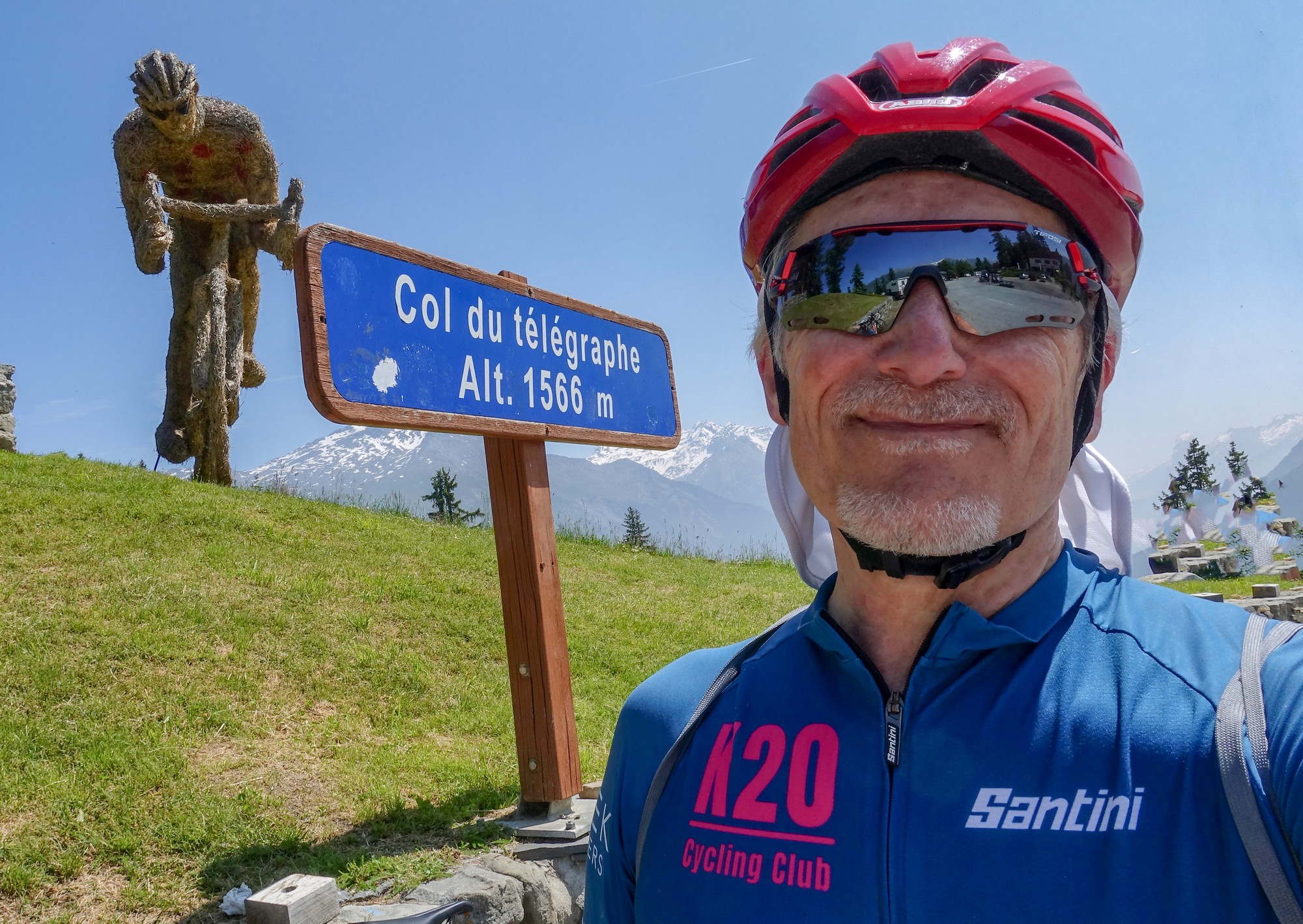
At the col another cyclist offered to take my photo, and I accepted. I didn’t hang about there and went straight into the descent to Valloire, taking ten minutes of riding, stopping briefly to see if there was any sort of view over the deep valley to my right (Vallée de la Valloirette), but there was nothing photogenic to see. That descent was more significant than I’d been expecting and would be a challenge to climb later in the day on the return.
I rode into Valloire just in time to hear the church bells chiming midday. Good timing as usual! I stopped, sat down and had half a sandwich and a piece of fruit cake. I also topped up my bidons even though I hadn’t drunk much. Seven minutes later I was back on the road.

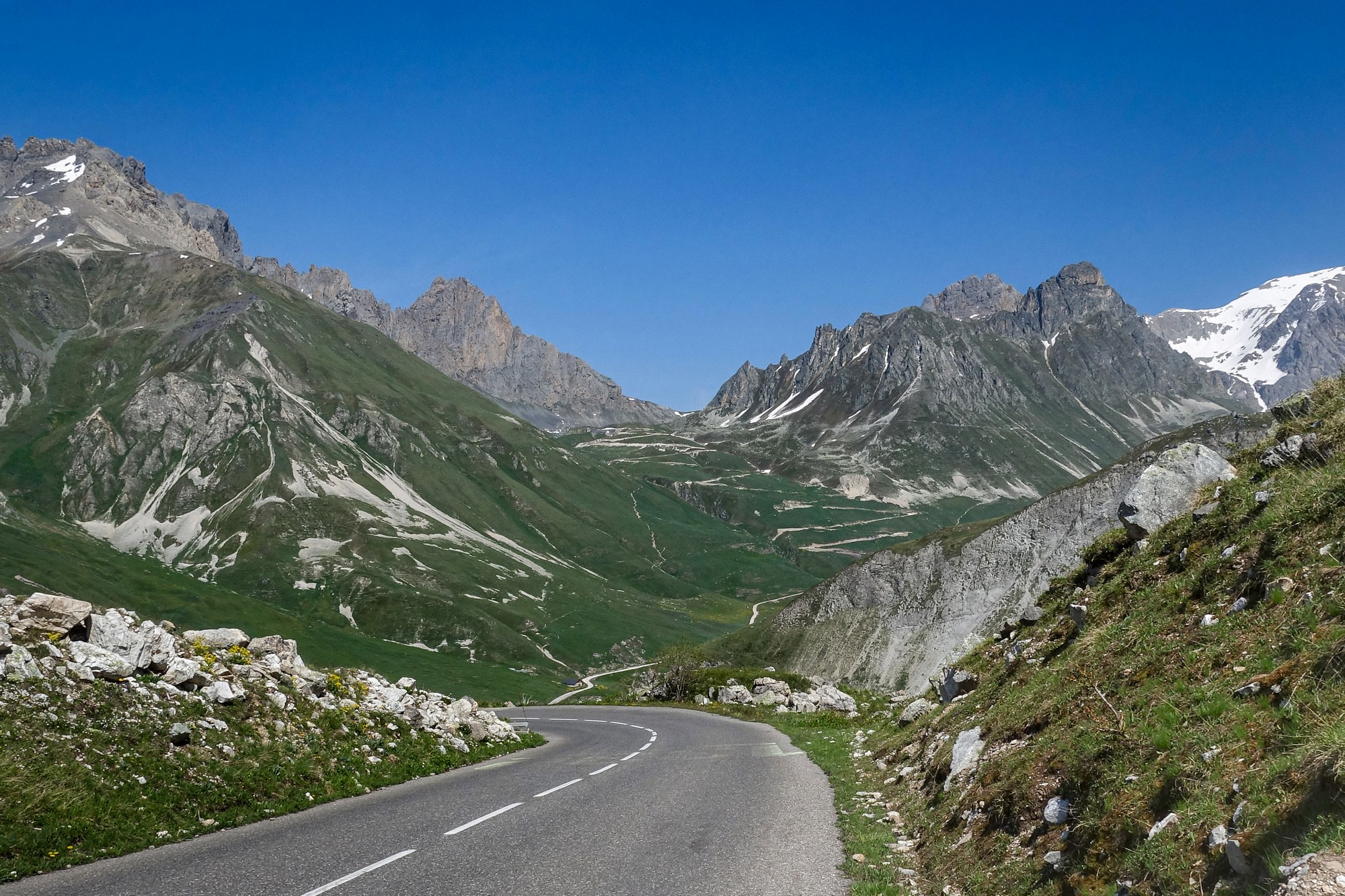
There’s a steep climb out of Valloire and after a couple of miles I found myself beyond the remaining chalets, etc. Then it’s a beautiful mountain road, heading south, still following the course of the Valloirette river on the right. There was virtually no shade, but the temperature was bearable and there was a slight tailwind. Aside from the occasional cyclist there was hardly any traffic.


Six miles and just over an hour after leaving Valloire, I reached the last outpost of civilisation in the valley—the Auberge de Plan-Lachat. A couple of cars and a handful of cyclists had stopped there for lunch, but I rode straight past. Soon after came the Pont de la Valloirette, where the road finally stops shadowing the river, crosses over it, and doubles back on itself to begin the last slog towards the summit. The spot is strongly reminiscent of Pont Saint-Charles on the Col de l’Iseran climb from Val d’Isère.
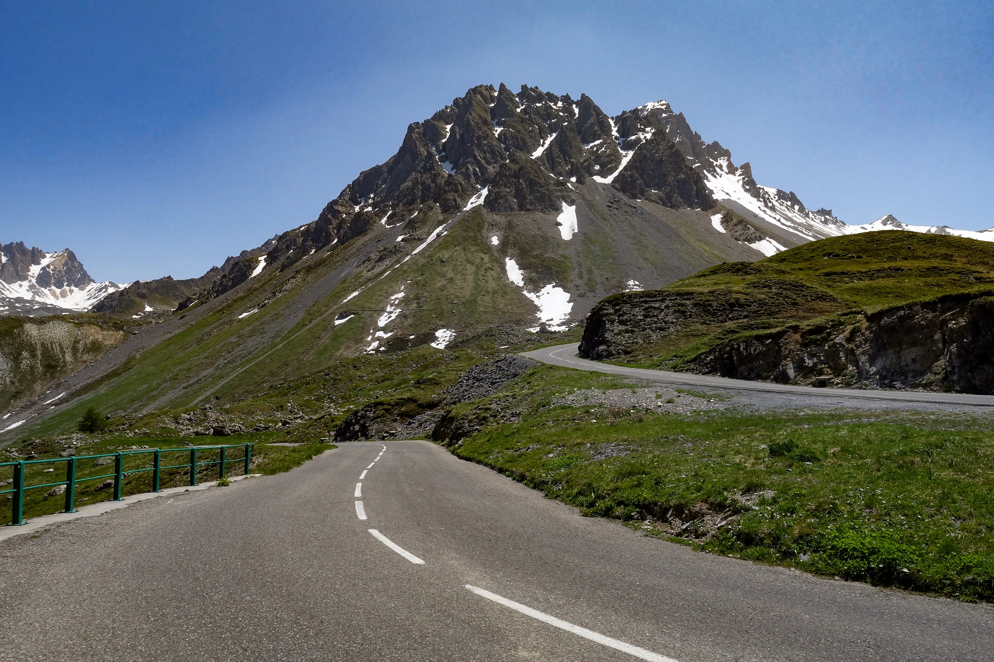
From here it’s five miles (8 km) to the Galibier at an average of 8.2%, with the hardest work very much saved for last.

I stopped to make some notes and then started the haul to the top. The climb to the col took ninety minutes. I stopped four or five times for photos and a breather.


As on the other side of the Galibier, the final section from the tunnel up to the col above is the steepest of the entire climb. It’s around 1 km at an average of over 9%, with steeper stretches thrown in for good measure. I managed it without stopping, driven now by the knowledge that the end was in sight.

Inevitably there were a few cars, bikers and cyclists up there, but thankfully no commercial interests to ruin it. I got a col photo and then sat on a wall to take stock of the achievement. While putting my arm warmers and rain jacket on, I got chatting to a couple of german cyclists who were also preparing for the descent. They were in the middle of doing the La Marmotte, so had already climbed the Glandon from Le Bourg d’Oisans before the Galibier and were about to descend to Col du Lautaret on their way to Alpe d’Huez. Kudos for doing that tough event. They kindly donated a couple of jelly babies to me!
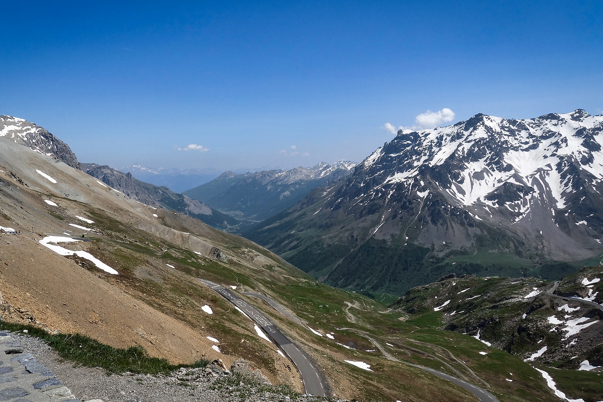
I was up there for about 15 minutes before making my way back. Just a couple of hectometres down, I stopped to take photos from above the tunnel.

Standing there I had an interesting chat with a touring cyclist. She had climbed, like me, from the Maurienne valley. But unlike me she had descended the Maurienne valley from Val Cenis, after having ridden over Col du Mont Cenis from Italy. That’s a long pass. She said she found it tougher than the Galibier. She was on her way ultimately to Grenoble to stay with a friend. Cycle touring must be such an adventure, full of more unknowns than I usually face.

I had my rain jacket on with arm warmers underneath. Again I’d put my rain jacket over the outside of my backpack to stop that swinging around on my back, as often happens on descents.
I stopped to take a few more photos on that first part of the descent.

From Pont de la Valloirette, I rode all the way down to Valloire without stopping, covering those six miles in fifteen minutes. By then the temperature had risen significantly and I took off my rain jacket and rolled my arm warmers down. I topped up both water bottles at the same fountain I had used before and I sat on the same bench to eat the rest of my sandwich, except for a bite’s worth. I had an energy gel in preparation for the climb to Col du Télégraphe.
That climb wasn’t too bad in the end—certainly not as tough as I had expected it to be. So I reached Col du Télégraphe once again and just rode straight over the top. The temperature was very high so I didn’t stop to put anything on for the descent.
And that descent went on for much longer than I was expecting. It was a reminder that the Col du Télégraphe climb is significant in its own right. Down into Saint-Michel-de-Maurienne I found myself having a bit of a race with two other cyclists. Back in the valley the heat was stifling.
The return journey along the main road was, for the most part, slightly downhill. But the bad news was that there was a frustrating headwind—and noticeably more traffic. Again, you do get a cycle lane but it’s still quite stressful, with huge lorries rushing past at close quarters.

When I got back to La Chambre I still had that bloody great climb to do to get back to the campsite!
But I had made it. A very tough ride made more of a challenge by the 16 miles of slight uphill needed just to reach the start of the climb.
I think I had judged the weather well. On the climb to Col du Galibier I had gained altitude at a rate that largely offset the rise in temperature as the day warmed up. The temperature of the climb was always comfortable, but there was inevitably some effect of being under the sun almost the entire way.
So it had been another superb day’s cycling. I had ticked off the epic Col du Télégraphe/Col du Galibier double bill under perfect weather and with hardly any traffic on the actual climb, and met some nice folks along the way. It doesn’t get much better than that!
Gallery
Click to enlarge / see slideshow


That looks like it was a great day on the bike Vince , obviously made even greater by your encounter with some fine examples of construction machinery!!!
Cheers
Haha! Yes an amazing day thanks.
I always think they look aesthetically pleasing, particularly so when set against a mountain backdrop. Whereas Porsches, etc are two-a-penny up there!
Cheers
Très beau reportage et très belle sortie à vélo ! Congratulations Vince !
Thanks for your comment Thierry