
Distance: 25.9 miles. Elevation: 4220 ft.
Col du Ventour | Col du Chaussy
There can be few people who are not amazed by their first aerial view of Les Lacets de Montvernier, whether it be a photograph or the spectacular helicopter footage of the Tour de France peloton and its entourage winding their way up the seventeen tightly packed switchbacks (lacets). That was certainly the case for me when I first saw an aerial image of this remarkable road.
It turns out I had designed routes here back in 2019 and again in 2023, both starting from Saint-Jean-de-Maurienne, but I never actually made it to the Maurienne valley, so they were left festering in my collection. Now, in 2025, finding myself based at La Chambre, those lacets suddenly came back into focus when I realised Montvernier was just up the road. For the third time, then, I designed a route that included that wonderfully twisty climb, along with a couple of other cols thrown in for good measure: Col du Chaussy and Col du Ventour.
It wasn’t to be an epic ride like the Glandon climb-fest of two days ago. The idea was to just pop five miles up the road to the foot of the Lacets de Montvernier, climb those, make a quick off-piste detour to Col du Ventour, then return over Col du Chaussy. Job done!
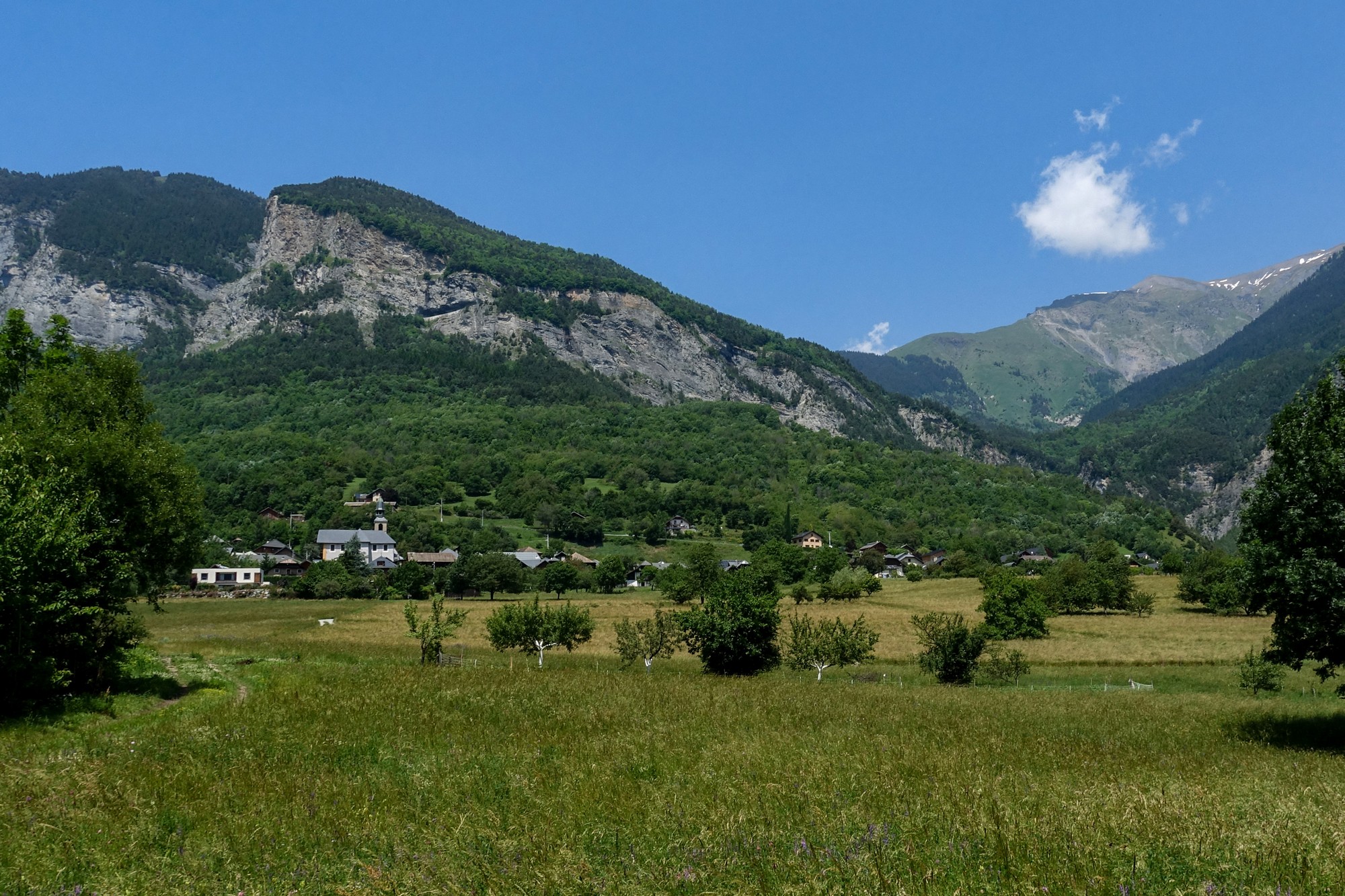
To allow the day to warm up and to increase the odds of sunshine, I didn’t leave until after lunch. By then it was a largely cloud-free sunny day with a misty haze over the mountains along the valley. Temperature was around low 20s°C with the persisting northerly breeze keeping things fresh.
Riding SE along the Maurienne valley, I essentially retraced the reverse of my return route from two days ago. This time I found an even quieter stretch of road, bypassing Sainte-Marie-de-Cuines.

Twenty five minutes later I had reached Pontamafrey where the road crosses the river and faces Les Lacets head on (although you wouldn’t know it)

I went up the Lacets de Montvernier in one go, without stopping, relying on my action cam to capture any views over the valley. The 1½ mile climb at 8.2% took me 17 minutes. There were some great views along the valley but you can’t see any of the rest of the road except the bit you’re on, which I pretty much expected.
At the top I kept riding. It opens out to pastures up there.

I soon saw the track across the field to my right which I thought was the way to the ‘view’. It led to a small wooded area with a fairly well-trodden path through it. I left my bike and proceeded on foot. Sure enough it led to that view:

What a sight! It reminds me of other places where I’ve scrambled through woods to emerge on a precipice, overlooking something spectacular. It’s probably the best vantage point above the Lacets de Montvernier available without the use of a drone or helicopter.
I stayed there for about five minutes, taking it all in, but began to feel a slight sense of vertigo, not helped by the wind. So I made my way back through the field. Midway I saw a snake crossing the track ahead. I approached it — still on my bike — hoping to get a closer photo. It remained motionless, but as I reached towards it to get a better look it turned and lurched its head towards me — a defensive threat that had the desired effect. I backed away and watched it slither off into the grass.
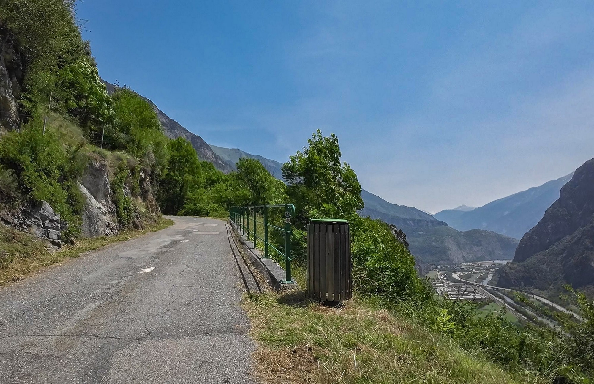
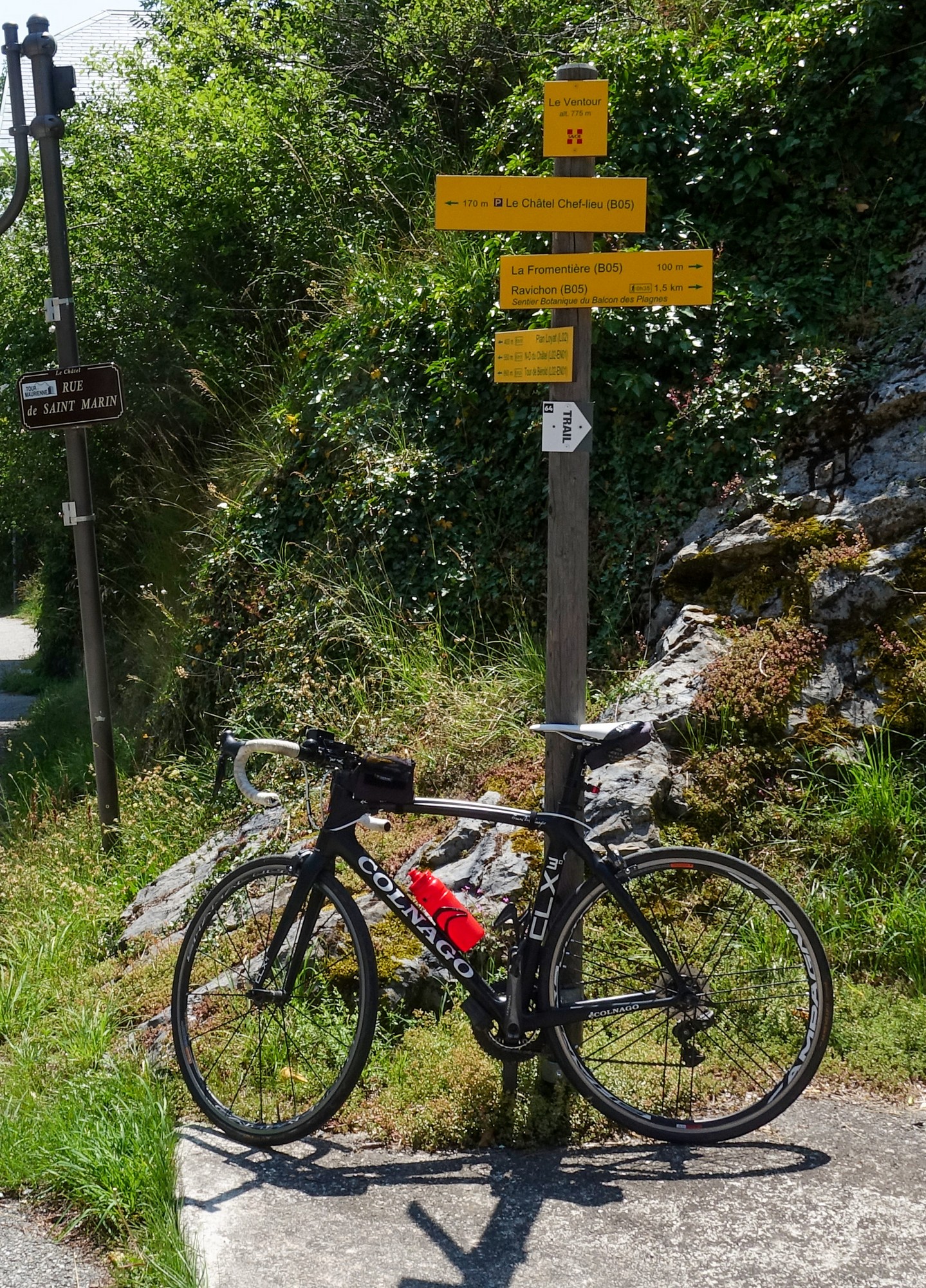
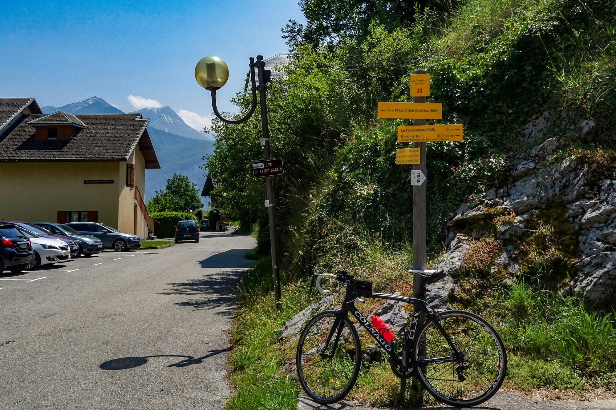
Once back on tarmac I rode the couple of fairly flat miles to Le Châtel, to claim Col du Ventour

Then it was back to Montvernier where I paused to chat to a bunch of English cyclists who’d stopped to regroup after having just climbed the Route des Lacets. I asked them if they’d seen the view. One of them said yes but I wasn’t sure they knew what I meant so I showed them the photo on my camera, at which they became very excited, so I explained to them about the route across the field. We stood there talking for 15 minutes or so – a really nice bunch. Some of them were from my (original) neck of the woods in SE London. I bade them farewell with a final “watch out for snakes” as I rode away from them. (Later, I saw on Strava that they had posted photos from that vantage point so they’d evidentally gone back and found the secret lookout.)
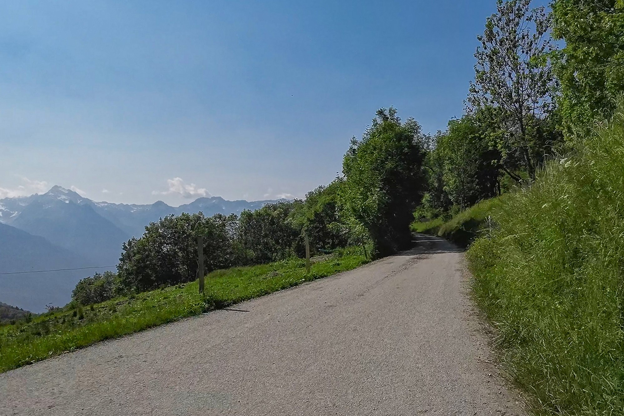
I headed for Col du Chaussy, a 6½ mile ascent at 7.5%. About halfway into that climb I reached a balcony road section with amazing views over the Maurienne valley.


I had taken my selfie-stick with me for the first time, hoping to get a shot of me standing by the edge, dramatising the virtiginosity of the situation. It didn’t really achieve the desired effect. Maybe I’ll try a drone shot next time.


After that last shot looking up the valley, the road turned up the wooded hillside towards Montpascal. Then a mile after that I reached Col du Chaussy.

After getting my col photo, I made a few notes, put my rain jacket on and set off on the nine mile 6% descent back to base.
It was an amazing descent through a mixture of woods and pasture, passing through the villages of Bonvillard and Montaimont and then joining the D213 for the last couple of miles of the road down from the Col de la Madeleine. The air was quite cool and I’m glad I had my rain jacket—even arm warmers wouldn’t have gone amiss. Today I returned to La Chambre from above so I didn’t have that final climb back to my campsite to contend with.
I felt really good after the ride. It was one of those days that had so much to it: the lacets, the secret lookout point, the nice group of English riders I met, the snake, the lizard (see video), the balcony road section, etc, etc. What more could you ask for?
The most stunning climbs are the ones that keep blowing your mind whilst you're actually riding them: Galibier, Nivolet, Bonette, Cayolle, Iseran, Fauniestre, etc, etc.
The Lacets de Montvernier don't even feature on that very long list.
Gallery
Click to enlarge / see slideshow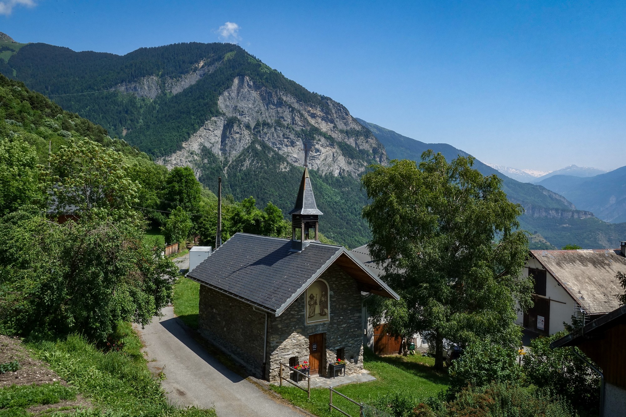


Very interesting… as usual ! Thank you
Thanks Thierry
YIKES- Snakes in the grass!!! I don’t like the sound of that!
Maybe it’s best after all that I didn’t know about the detour to take in the “view”.
Indeed Vince the lacets should be on any cyclists to do list not just for the views but also for the amazing feat of road engineering that they are . I’m glad you were finally able to enjoy them and I look forward to reading about your other adventures.
Cheers
Thanks for your comment Martin. More coming soon. Did you notice the steel cable bolted to the rock to the right of the cross near the lookout point in the video? That might be connected to the via ferrata you mentioned before ?
Cheers
Ahh yes I see it there now. I think you would be correct in connecting it with the via ferrata, and having the cable end at the cross makes it convenient to give thanks for having survived the climb!
Haha! Indeed. It makes me wonder if that’s why the path across the field is quite well worn (by vehicles) these days—by via ferrata participants, etc..
Yes it would seem to stop at the cross as this map indicates.
https://www.viaferrata-fr.net/via-ferrata-31-La-passerelle-Pontamafrey-Savoie.html
Cheers Martin – useful info.
Thinking of going that way next time are you !?