
Distance: 56.2 miles. Elevation: 9156 ft.
Col du Glandon | Col de la Croix de Fer | Col du Mollard | La Cochette | Le Collet
I planned this ‘classic’ loop from La Chambre in the Maurienne valley to Col du Glandon, then on to Col de la Croix de Fer and returning via Col du Mollard. I already ‘bagged’ the first two of these cols three years ago, but back then the Glandon was just an easy by-product of the Croix de Fer climb from Allemond. This time I would be climbing it ‘properly’. In the design of today’s route I also included an optional tough ‘off-piste’ climb to Relais du Chalmieu and back.

In terms of difficulty, Col du Glandon from La Chambre is similar in length and elevation to Mont Ventoux from Malaucène. So it’s not exactly easy. From Saint-Étienne-de-Cuines there are 5 miles at 7.3%, then about a mile and a half of respite from Saint-Colomban-des-Villards, after which you have nearly 6 miles at 8.8% avg, the last couple of miles of that being at 10.5% avg.
Col du Glandon has featured numerous times in the Tour de France, but most of those times climbing from Allemond, the ‘easy’ way. As far as I can tell, the last time it was climbed from La Chambre as part of the tour was back in 2001, Stage 10.
Lately I’ve been doing reports straight into my action cam. It’s much more convenient than doing them on my phone like I used to. I don’t need a phone signal, and I can do some of them while I’m actually riding along, before I forget things.
I left at 9:37. It was sunny with a northerly wind, so the air wasn’t super-warm.
By ten o’clock I’d covered roughly three and a half miles, riding alongside the river, its rushing water always in earshot. When I first set off the air felt quite cool, but that didn’t last long. Despite the early hour, the sun was already really hot, and I found myself hoping for stretches of shade, which came and went just often enough to be useful. The climb had started gently out of La Chambre and was in full swing from Saint-Étienne-de-Cuines. I was already down in second gear, which is lower than my old first gear. Three road cyclists came past me—there wasn’t much traffic.
The road alternated between steep ramps and easier sections. I was moving between gears one, two and three. There were no bornes kilométriques to count down at first. I didn’t feel as strong as I had on the Col de la Madeleine the other day, perhaps a sign I hadn’t fully recovered. There were occasional patches of shade to enjoy, and when the wind appeared it was cool, blowing from the north. I’d partially unzipped my jersey for some ventilation, though that carried the risk of insects getting inside.
By seven and a half miles I’d settled into a rhythm and still hadn’t stopped. That’s one aspect of recording thoughts mid-ride. It felt hard-going and the Wahoo was showing red, confirming that it really was steep. The road had climbed way above the river now, its rush getting fainter, another good indication of how sharply the road was climbing. I passed an errant sheep on the road.


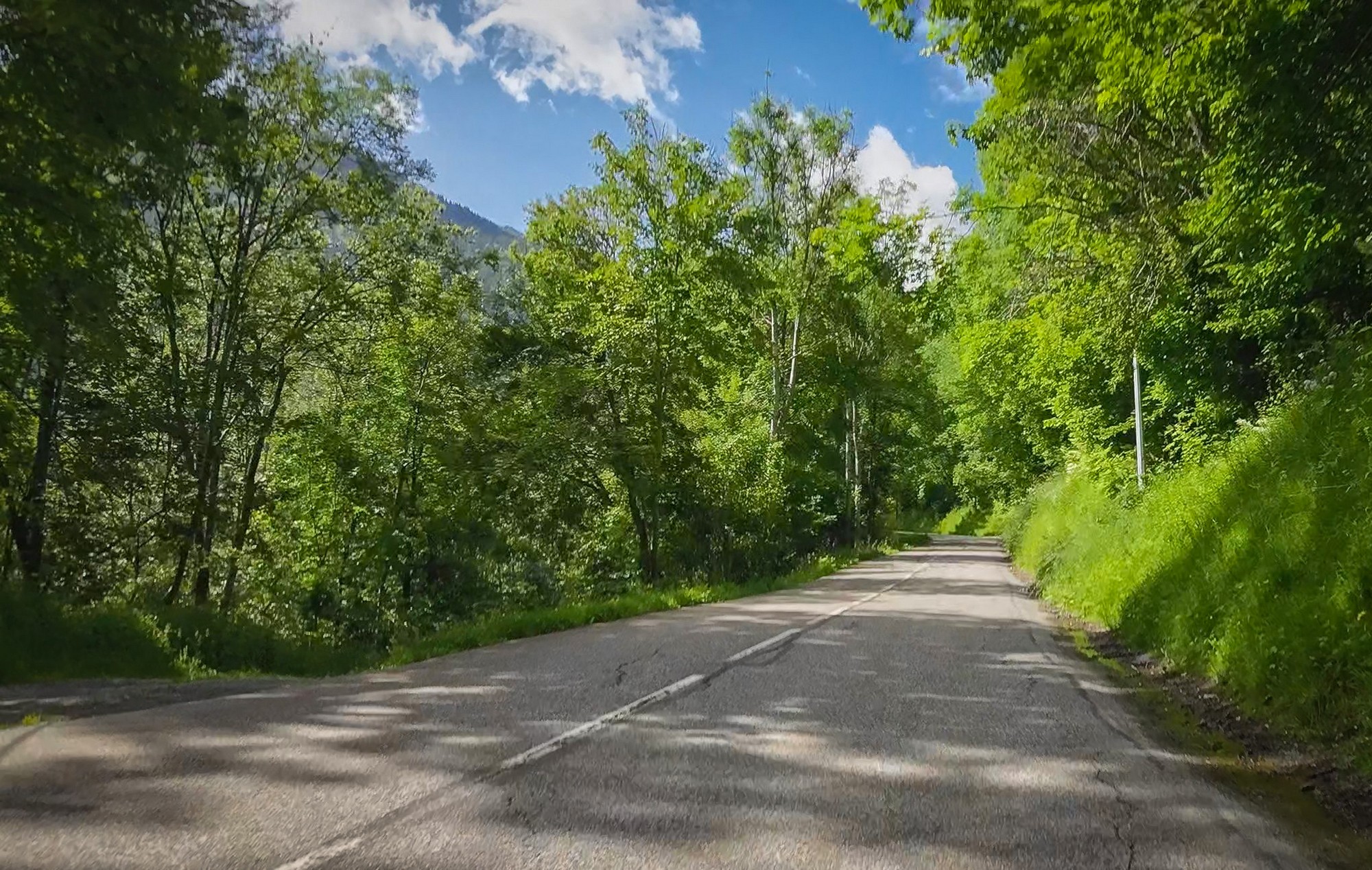
Apart from stopping briefly to take a photo of that church, I kept going. Whether I’d manage the whole climb in one go was still uncertain, but I knew the end bit would be hard, so any proper breathers could be saved for that. The road to Col du Glandon is far more attractive than that to Col de la Madeleine (from La Chambre). With nice villages and beautiful scenery.


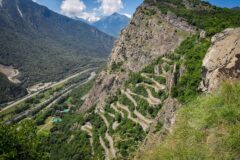
Buildings became scarcer as I neared the top. At the head of the valley, where the mountains on the left and right converge to form a seemingly impenetrable wall, the road finally leaves the river—merely a trickle this close to its source—and climbs the side of the valley. A series of steep switchbacks seeks out the lowest path over the top—the very definition of a col.
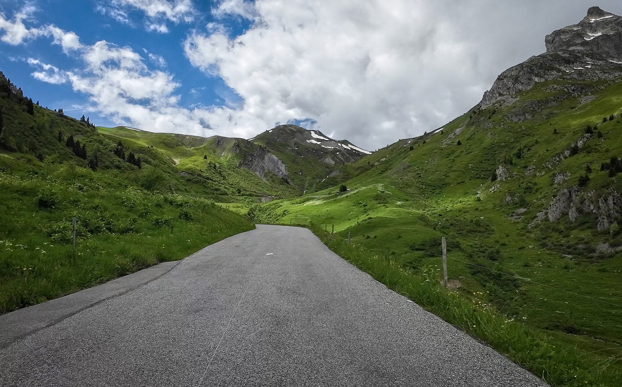
That last section was just as everybody describes it: 10%+ for a tough finale. I stopped once on the switchbacks to take a photo looking back down the Glandon valley. You can’t miss these opportunities.

In the end I completed the two-and-a-half-hour climb with just three minutes of stoppage; once for a group of cows who refused to pose for a photo, and once for that shot looking back down the valley. I was relying on my action cam to capture the scenery.
The Col du Glandon from La Chambre has got to be up there in my top ten favourite climbs; it’s really beautiful. Just flowing streams and mountain stuff. Nice villages. It was a bit of a shame when I reached the top to find a raucous crowd of motorbikers and cyclists. Still, the landscape more than made up for it, and I heard a marmot shrilling across the rocks.

I sat on a rock wall behind the col sign for ten minutes or so and had half a sandwich before setting off for the Col de la Croix de Fer.
I got my earlier wish for the sun to disappear—only to find myself wishing it would come back again. I approached the Col de la Croix de Fer with a tailwind, though a chilly one. The air had turned cold, no doubt helped by the rule of thumb of one degree lost per hundred metres of altitude.
So once again I found myself near the head of the beautiful valley leading up to the Croix de Fer, and once again the sun stubbornly refused to shine, same as the last time I was here. You can’t have everything.


I soon reached the col de la Croix de Fer and got a col photo. A group of about eight animated English cyclists turned up, having climbed from Allemond, pleased with their achievement; I took their group photo for them.

I put my rain jacket on; and the descent from the Croix de Fer was cold enough to warrant it. I was actually glad to know there was another steep climb coming up, if only to warm me up a bit.
The road dropped for more than eight miles from the col. Steeply at first, then easing up once through Saint-Sorlin-d’Arves, a deserted out-of-season ski resort.

My route turned right, crossing the river Arvan whose course I’d been following. Immediately it ramped up to 9%. I assumed I had started the optional climb I had included just for fun! Half a mile later came the actual turn off for that off-piste climb. I’d been on the col du Mollard road. Now that I knew for certain I was at the start of the climb to Relais du Chalmieu, I took off my jacket and had an energy gel.
The climb to the aerial itself took an hour: 3.6 miles at an average of 9.6%. The road was narrow, twisty, steep and not always in tip-top shape. I slogged my way slowly up the hillside, knowing I could just turn round and descend if I ran out of steam. I mean there wasn’t even a col up there! That climb was just for the sheer hell of it!

A few cars were parked at the top where people had gone for walks. A gravel path went further and I’m sure it would have led to even more amazing views of les Aiguilles d’Arves. But I wasn’t on my gravel bike and in any case I just didn’t fancy making any more effort to go higher.


From the aerial, the views were extraordinary in every direction, but I was absolutely dreading the descent. It was so steep that I knew I’d be on the brakes constantly, weaving a course over the sometimes patchy road surface, craning my neck the whole time—something that always causes me trouble. I’d already taken a second painkiller at the Croix de Fer, the first having been before the ride, so I thought I might as well have another. I descended slowly and, just as expected, my neck hurt.

At the bottom — back at the turn-off — I went straight into the climb to Col du Mollard. I was getting low on water so kept a lookout for any taps. The climb was fairly easy at first but got tougher. The first mile at just over 6%, then a flat bit through the village of Les Rieux, finishing with nearly a mile at over 8% into and out of Le Mollard. The col was just outside the village.

I still didn’t have any water, but thought it’s not as crucial when descending. I put my rain jacket on and carried on riding. One mile later—at Albiez-Montrond—I saw a water trough, so I refilled my bidon after taking a couple of large glugs.

Some parts of the descent had gravel all over the road making it very risky. I was careful not to brake or steer sharply.
The road drops down through some spectacular scenery, at first with views of a massive crevice in the side of a mountain. I later discovered that is Combe Genin.
From Albiez-Montrond, the road winds down the edge of the steep valley, or gorge, of the river Arvan, but unfortunately it is mainly covered from view by trees, with only fleeting glimpses to remind you how rugged the terrain really is. The lacets are numbered—à la Alpe d’Huez—counting down from one at the top (Virage N° 1), so I had no idea how many were still to come.
Eventually the road straightens and levels out somewhat as it reaches river level. I was now able to let go of the brakes completely for the next three miles into the outskirts of Saint-Jean-de-Maurienne, where I encountered Friday evening rush hour traffic.
Once through town, my route crossed over all other lines of passage squeezed along the Maurienne valley: first the River Arc itself, earliest occupant of this glacially-carved corridor; then the D1006 main road; then the railway, and finally the A43 autoroute, leaving me on the quietest of the lot, the D77 ‘route départementale’.

A couple of miles further down, I crossed back over all that lot again to pass through Sainte-Marie-de-Cuines, and then a third time to return to La Chambre, where I still had nearly a mile of 7% climb back to my campsite—just what you don’t need at the end of every ride!
There are times cycling when you think you’re on your last legs and feel really drained, but usually a short break restores your energy momentarily. I often wonder what point you’d have to reach before you literally couldn’t turn the pedals. On even my toughest rides I haven’t quite reached that point—and that’s probably just as well, because I don’t particularly want to find out.
I added music to my video this time – see what you think:
Fuel
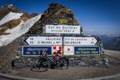
Gallery
Click to enlarge / see slideshow


Thanks again for another great recap of your ride Vince , the Glandon also makes my top ten list, and it was nice to relive it through your video and music. The view of the Aguilles from the relais must have made the climb and bumpy descent well worth it. I have a fond memory of passing a disabled tour bus at one of the last hairpins on the Glandon with it’s front end jammed into the pavement and the driving wheels lifted off the ground! It was a school trip and the students were making their way down the road to meet another bus that was coming to their rescue.
All the best to you in 2026!
Thanks for your comment Martin.
That bus incident sounds jaw-dropping—I certainly wouldn’t fancy being a bus driver in the Alps!
And I hope you also have a great 2026!
Cheers