Distance: 62.4 miles. Elevation: 6511 ft.
Col de Berthiand | Col de Matafelon | Col de la Rousse | Col de France | Col de la Croix des Angoulures | Trou du Sac | Col de la Pérouse | Col de la Chaise | Col de la Roche
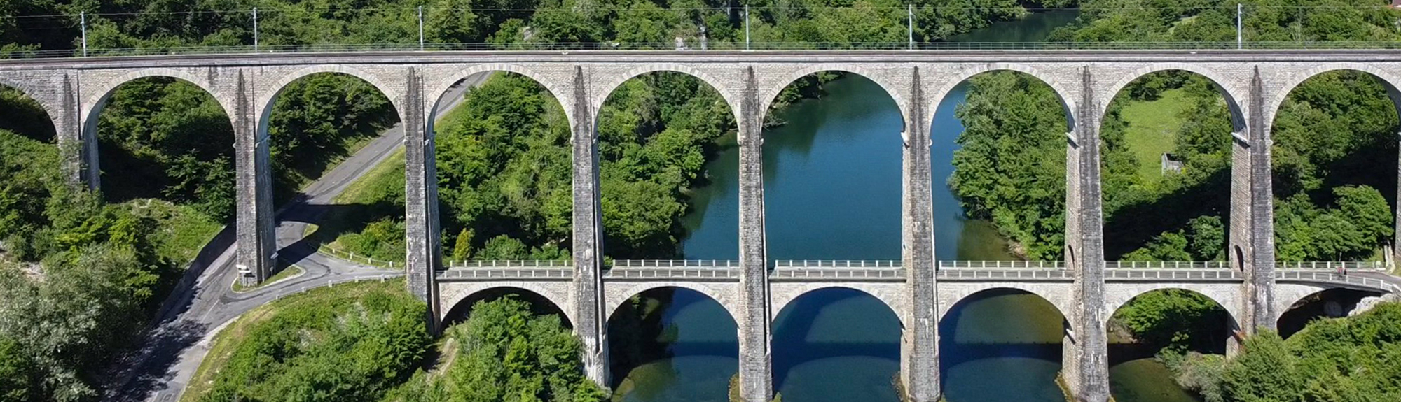
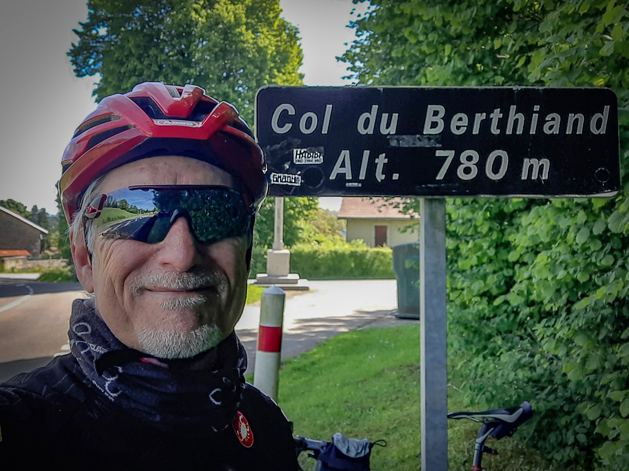
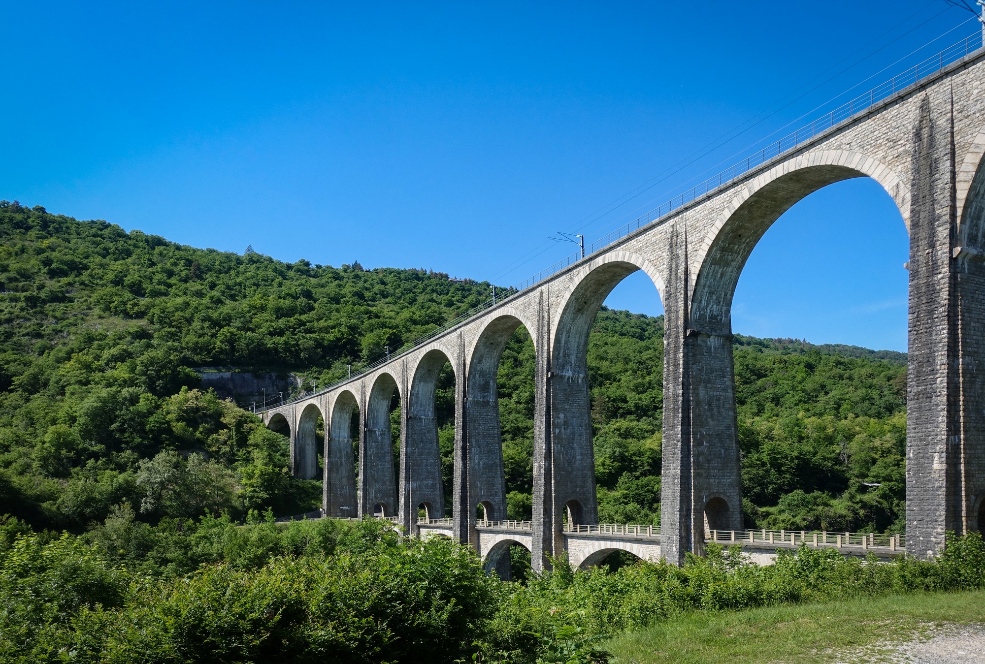
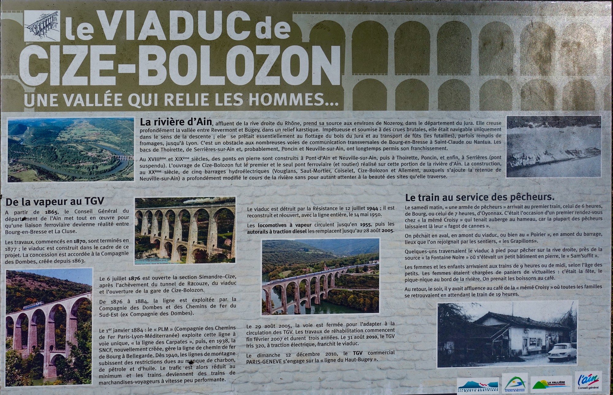
After recently learning of the existence of Le Viaduc de Cize Bolozon, I was determined to incorporate it on a ride, so I designed a route deliberately seeking out cols in the area, the first and main one being Col de Berthiand. I managed to include eight others.
I wore shorts, short-sleeved jersey with arm warmers and a snood, with my rain jacket, drone, food and everything else in my back-pack. I used my gravel bike because it was already set up from yesterday, although I didn’t expect any tricky surfaces today. I left at 10:30.
11:54 First report I’ve stopped here at the top of what I think is the third climb of the day (correct). When I started out the air was quite cool and I was glad to have my arm warmers on. I was also glad when I found myself climbing in the sunshine to warm me up a bit. Initially my legs felt tired from yesterday but after however long it has taken me to get here they’re feeling a bit better, now they’re warmed up.
The first climb of the day was to Col du Berthiand and that was the longest one of the day, about three miles at 6.5% avg but with a half a mile at over 10%.
Some of it I was in second gear so it was quite steep. But most of it was in the sunshine – just the right temperature really even though my back feels a bit hot because of the backpack, as usual.
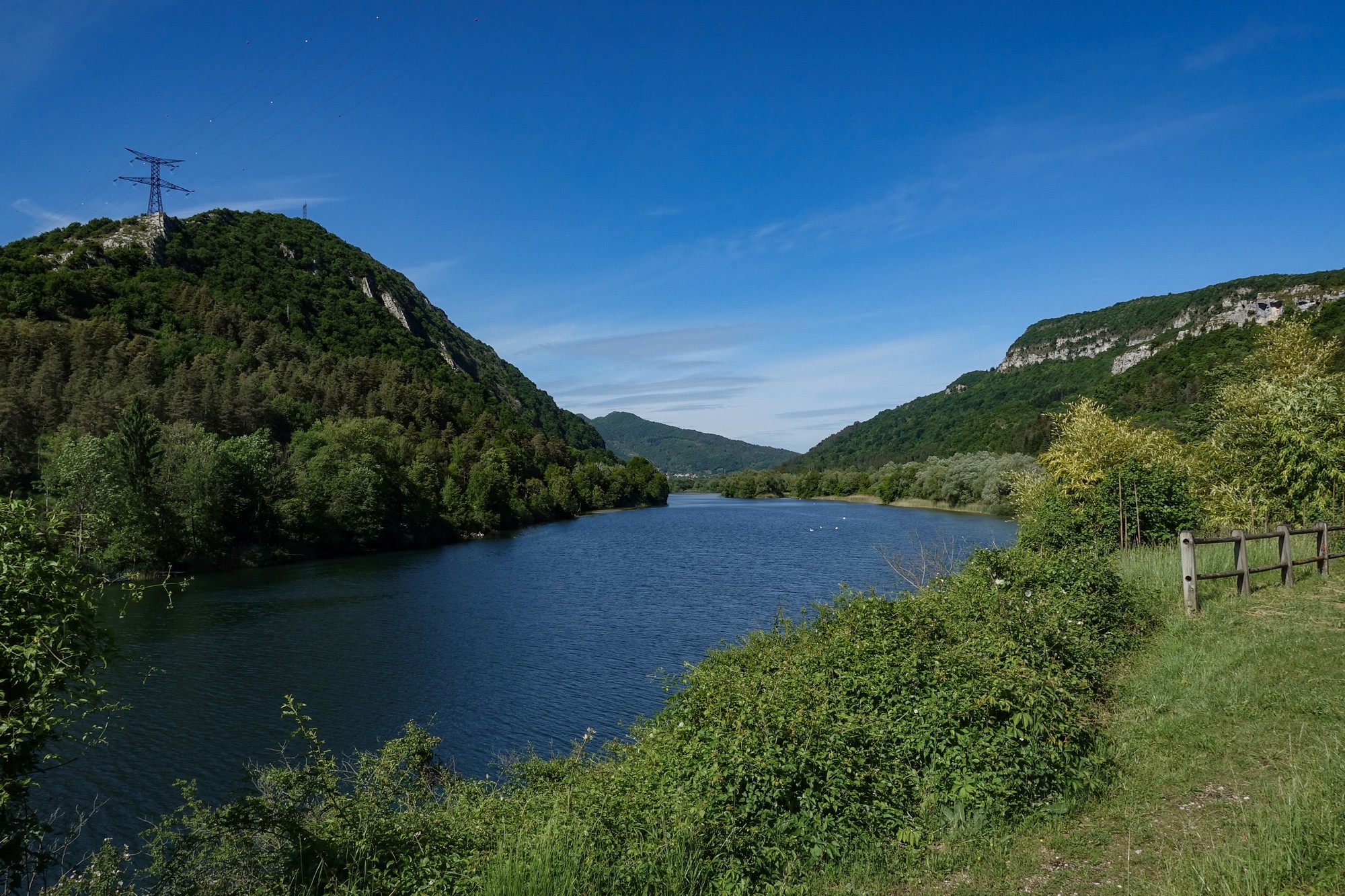
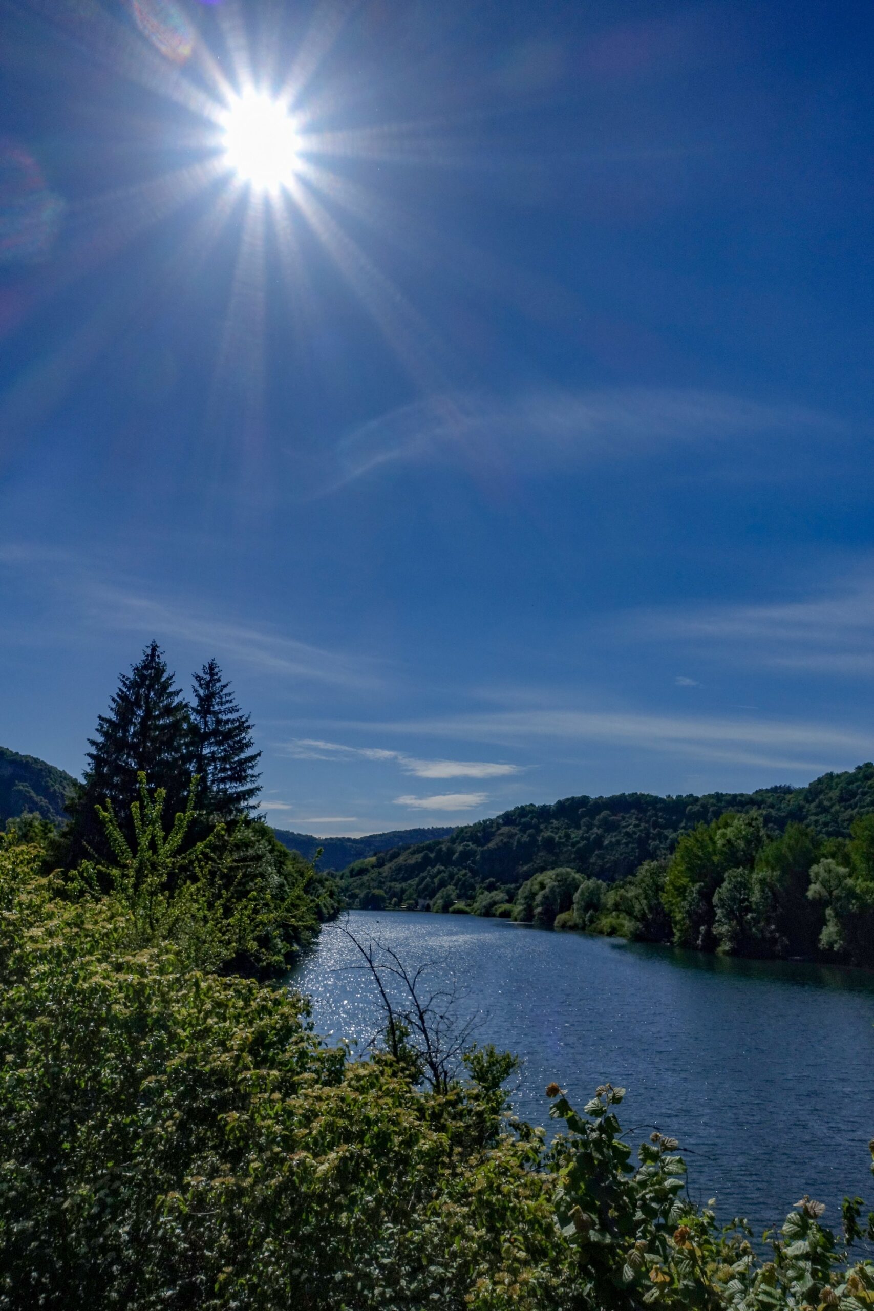
There’s a fair bit of traffic on that road – maybe a car every minute or so. Quite a few motorbikes out today, being a Saturday and with the sunshine. The descent from Col du Berthiand was absolutely amazing. There were lots of signs saying 15%, and I was doing 40 miles an hour for quite a long stretch. That would probably be quite a tough climb on that side. That descends down to a bridge, Pont de Serrières-sur-Ain, across the river Ain.
Then straight into another climb which descends down to a village I think (correct: Hautecourt-Romanèche). Then there is another village somewhere (nope!) and now I’m at the top of this third climb – Col de la Roche – having done 13.2 miles. I’ve had my rain jacket on ever since the Col du Berthiand. So I’ve done a couple of climbs with it still on. The sun is out although getting hazy now. But the air is cool – I guess 12 to 14 degrees. Must crack on…
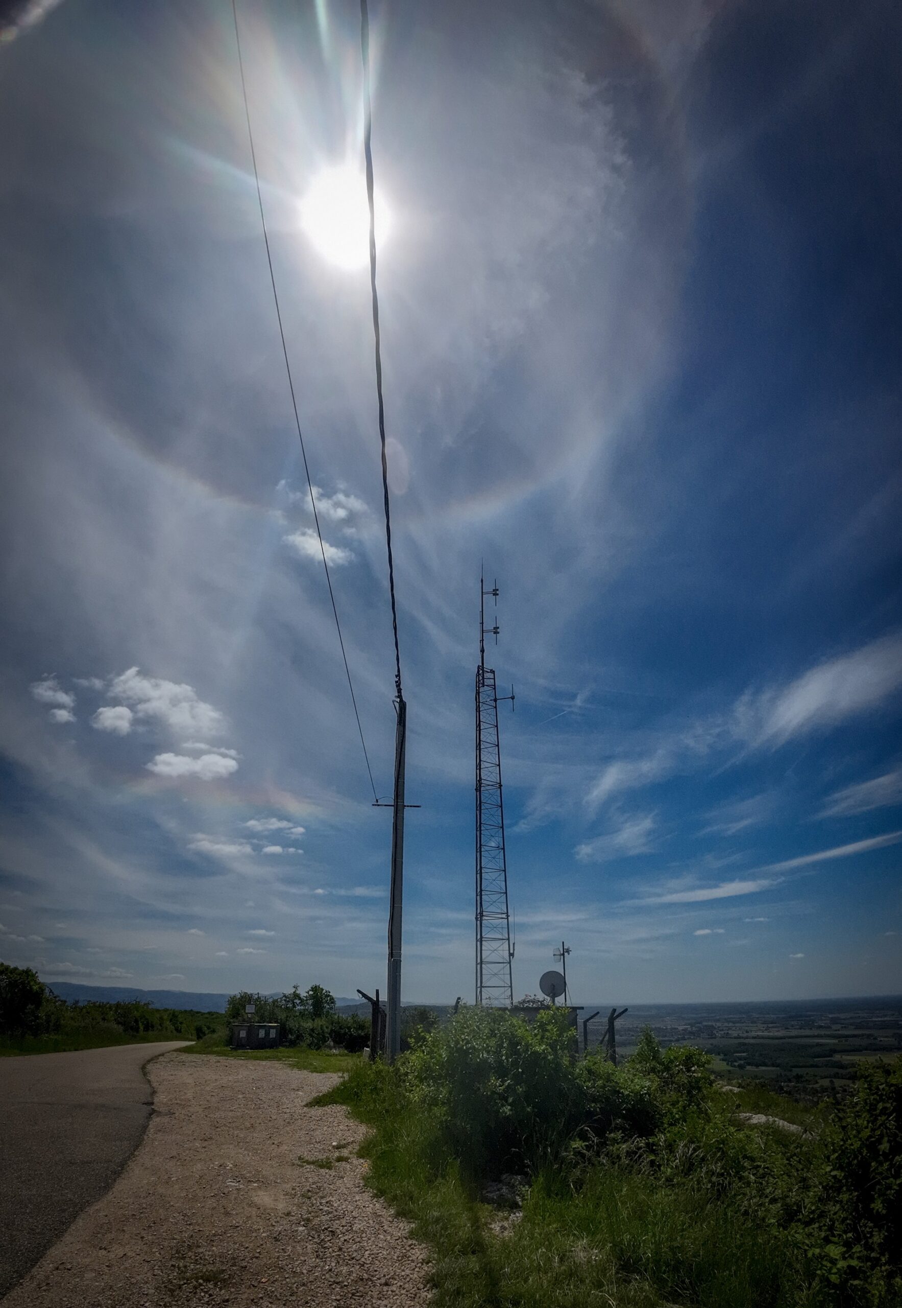
13:22 Mont July Well theoretically I’ve got a strong signal here because I’m standing right next to Relais de Mont July la Montagne.
Since the last report it has basically just been a series of ups and downs going through some villages.
The road descended to Ceyzériat, where the climb up to here started, first via Mont July. It was a tough slog of a climb up to here – two miles at 8.5% avg, with steeper sections. I gradually caught and passed a guy on his mountain bike spinning away like crazy in a very low gear.
I had a half a choc-chip brioche just at the start of the climb and took my jacket off for the first time since I’d put it on, and I’m glad I did because it was a steep climb and very warm in the sun still.
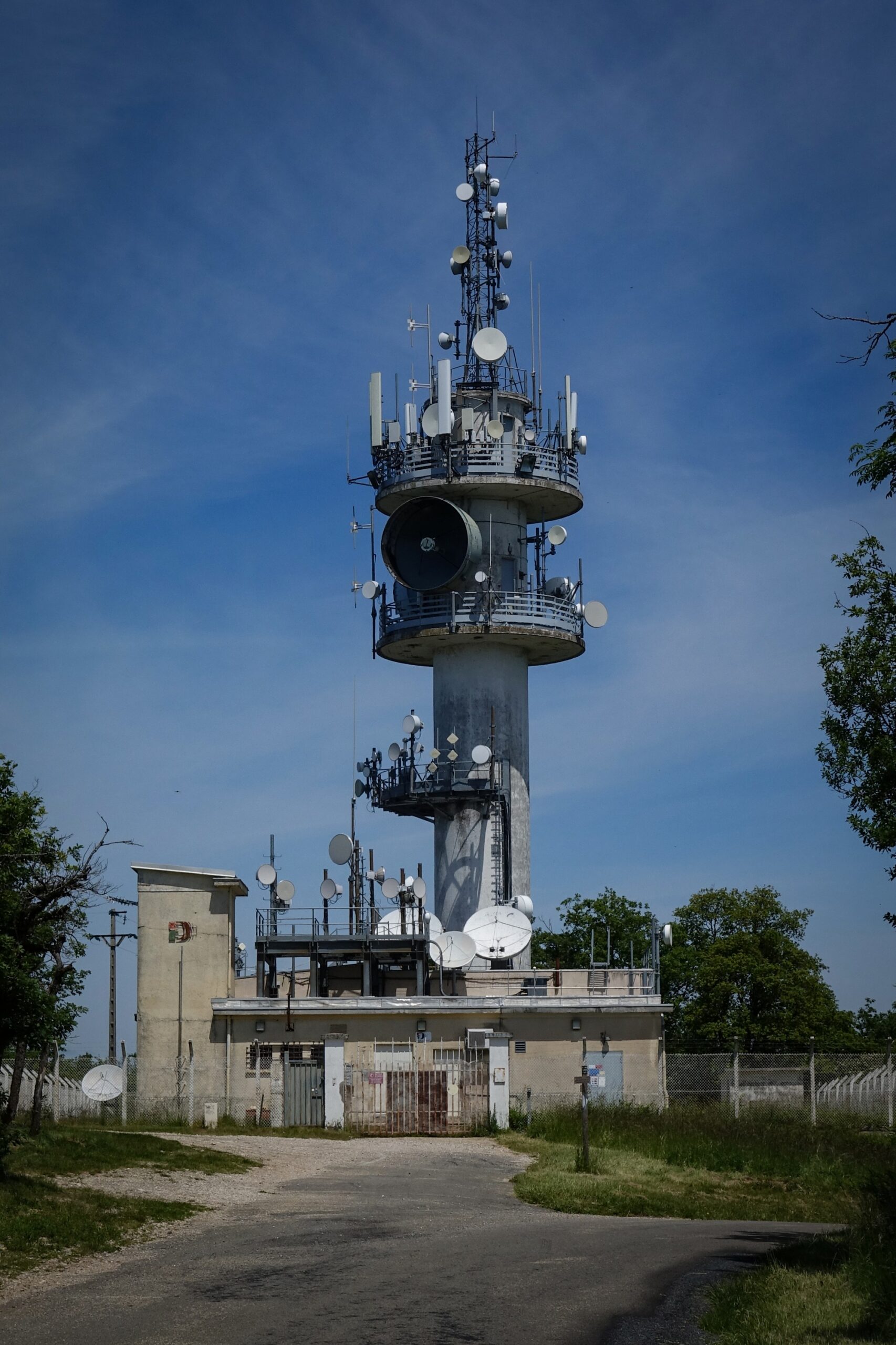
I reached some aerials and thought “this isn’t the huge structure I glimpsed through the trees earlier on the climb”.
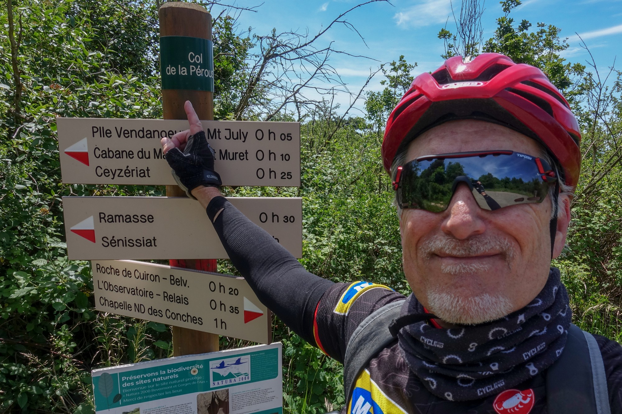
From those aerials I had to descend ‘off route’ for half a mile or so to bag Col de la Pérouse.
I rode back up to the aerials and then higher to eventually spot the huge Relais de Mont July la Montagne which I had caught sight of earlier.
The sun has warmed the day up somewhat even though the air is still cold, coming from the north I think. I’ve stopped here at 13:20 with 23 miles done. I’ve seen a few road cyclists so far.
I’m just going to have half my sandwich here and put my coat on again for the descent because, as I say, the air is cold and I think it might be in the woods.
I briefly thought of flying my drone but wondered if it might be prohibited near the transmission tower. And there were a few gusts of wind also. So I didn’t.
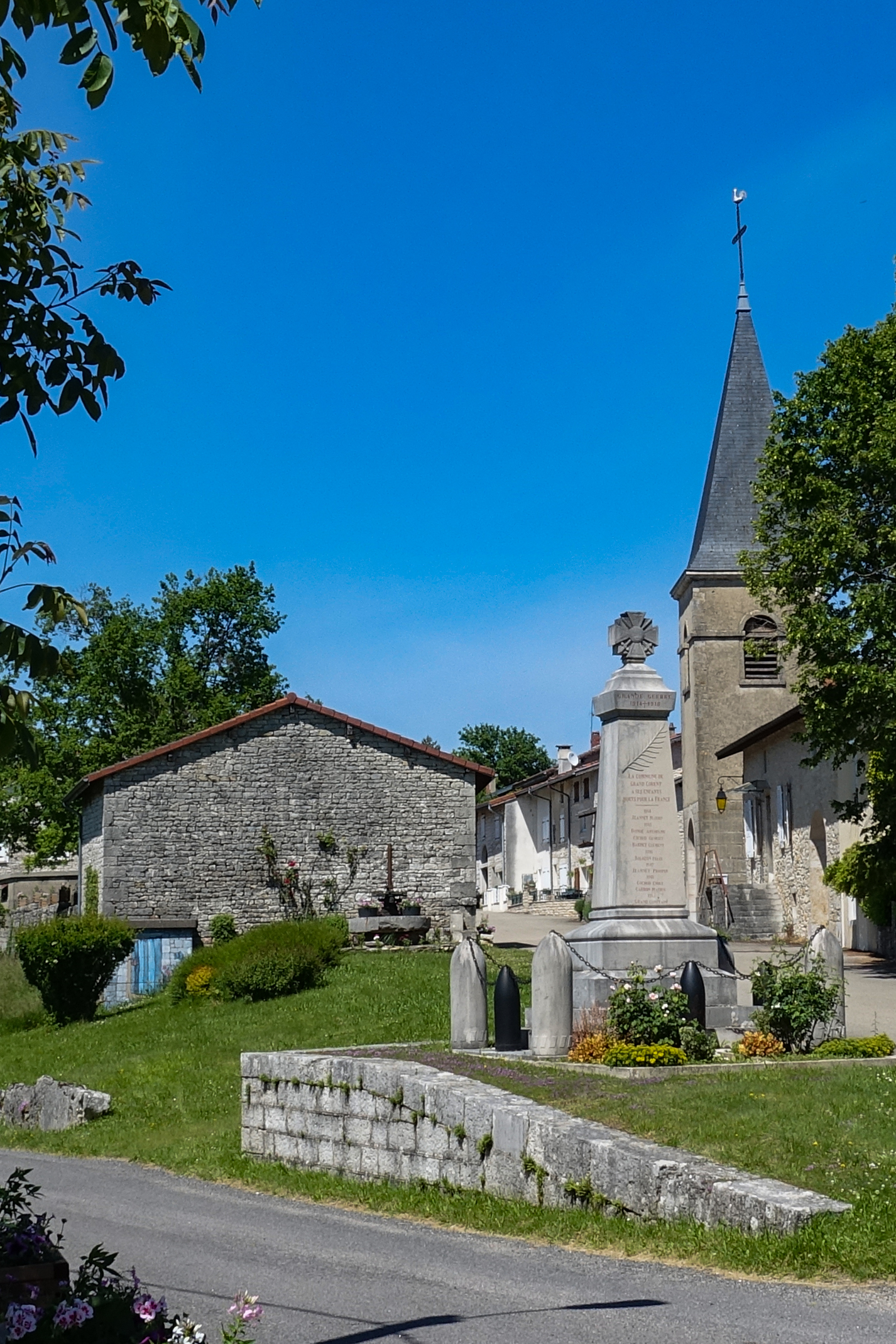
15:19 at Grand-Corent I’ve stopped at a village that looks like it’s the last one before the viaduct. After leaving the big aerial the road descended right down and off the edge of the Jura, essentially down onto La Bresse (a broad, low-lying plain between the Jura Mountains to the east and the Saône River to the west.)
There were some lovely sweeping roads, quite flat. I arrived at a small town (Val-Revermont) where I saw I was going to be climbing for a few miles back up into the massif, so I stopped to have an energy gel and take my rain jacket off, which I had put on for the descent from the aerial.
After that climb I was back on sweeping roads, again coming through various villages.
The sun has managed to stay out, so now I’m pretty well warmed-up even though there is that northerly chill in the air. I’m getting a bit low on energy but I’m saving the rest of my sandwich for the viaduct.
To get here I’ve just come up a 2.3 mile climb, and I would have taken my last energy gel but when I looked on the list of remaining climbs on the Wahoo there was another four-mile one further on so I decided to save it for that. The climb I’ve just done I did find quite tough. I think it was like six or seven percent for a couple of miles, then it eased up towards the top and now I’m in the village. I kept having to get out the saddle to relieve some discomfort. I’m hoping that will be the last big climb of the day.
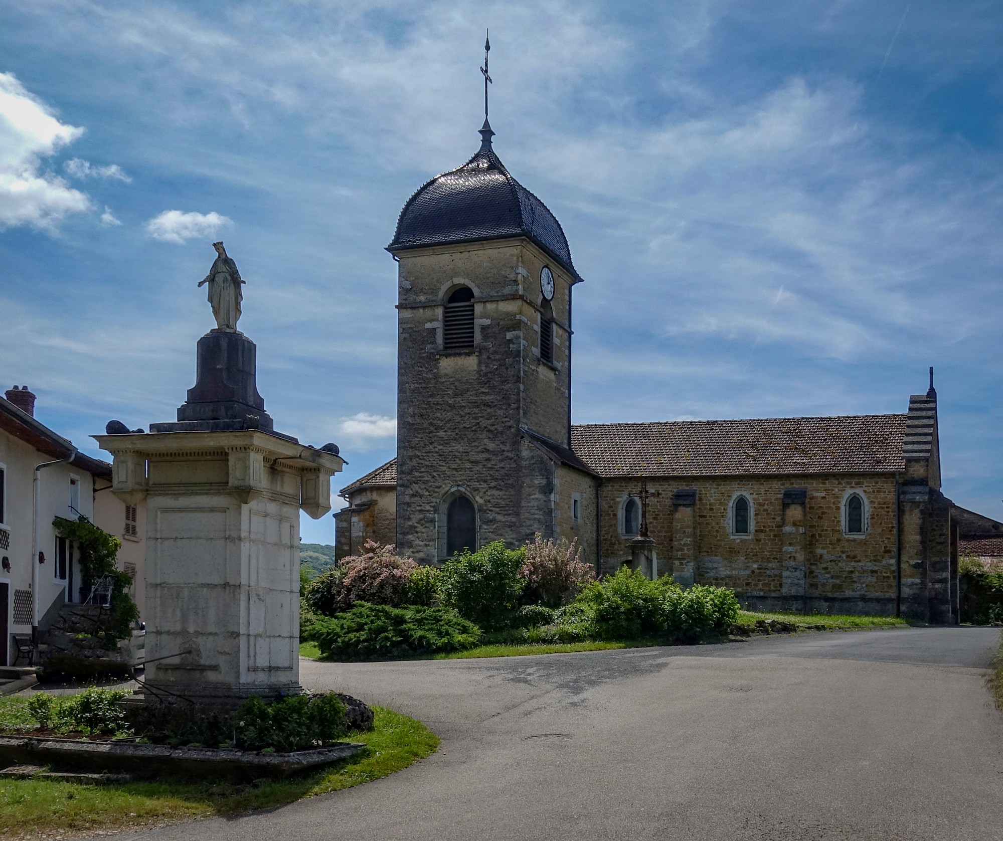
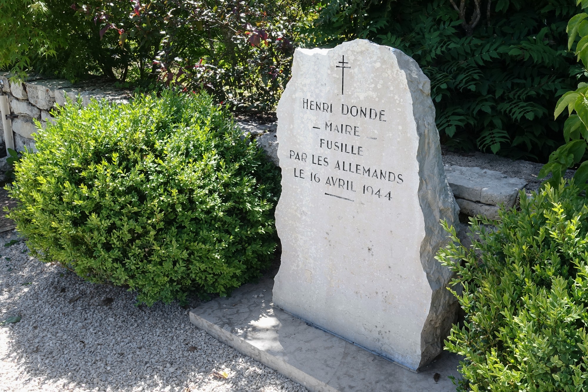
I’m standing next to a stone commemorating the mayor of the village who was shot by the nazis in 1944. There is a chilling description of the event on a placard nearby. Reminders of the horrors and barbarity of war appear all over France.
I think I’m starting to feel the effects of the sun because I’ve been in it for like five or six hours or something so I think I’ll have a painkiller, just before I set off downhill to what I expect will lead to the viaduct.
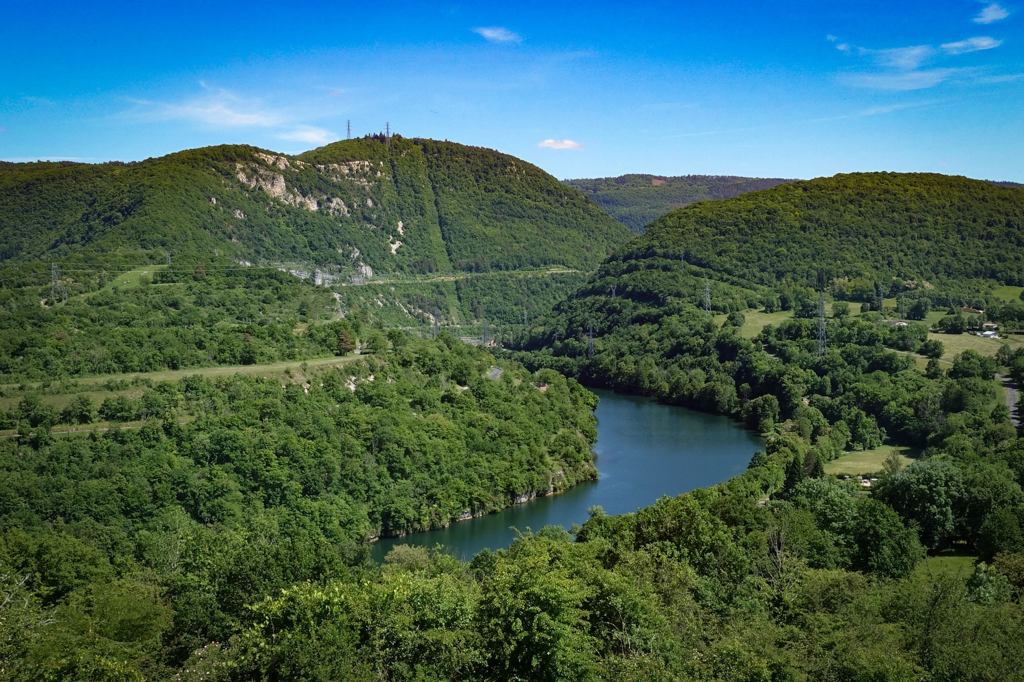
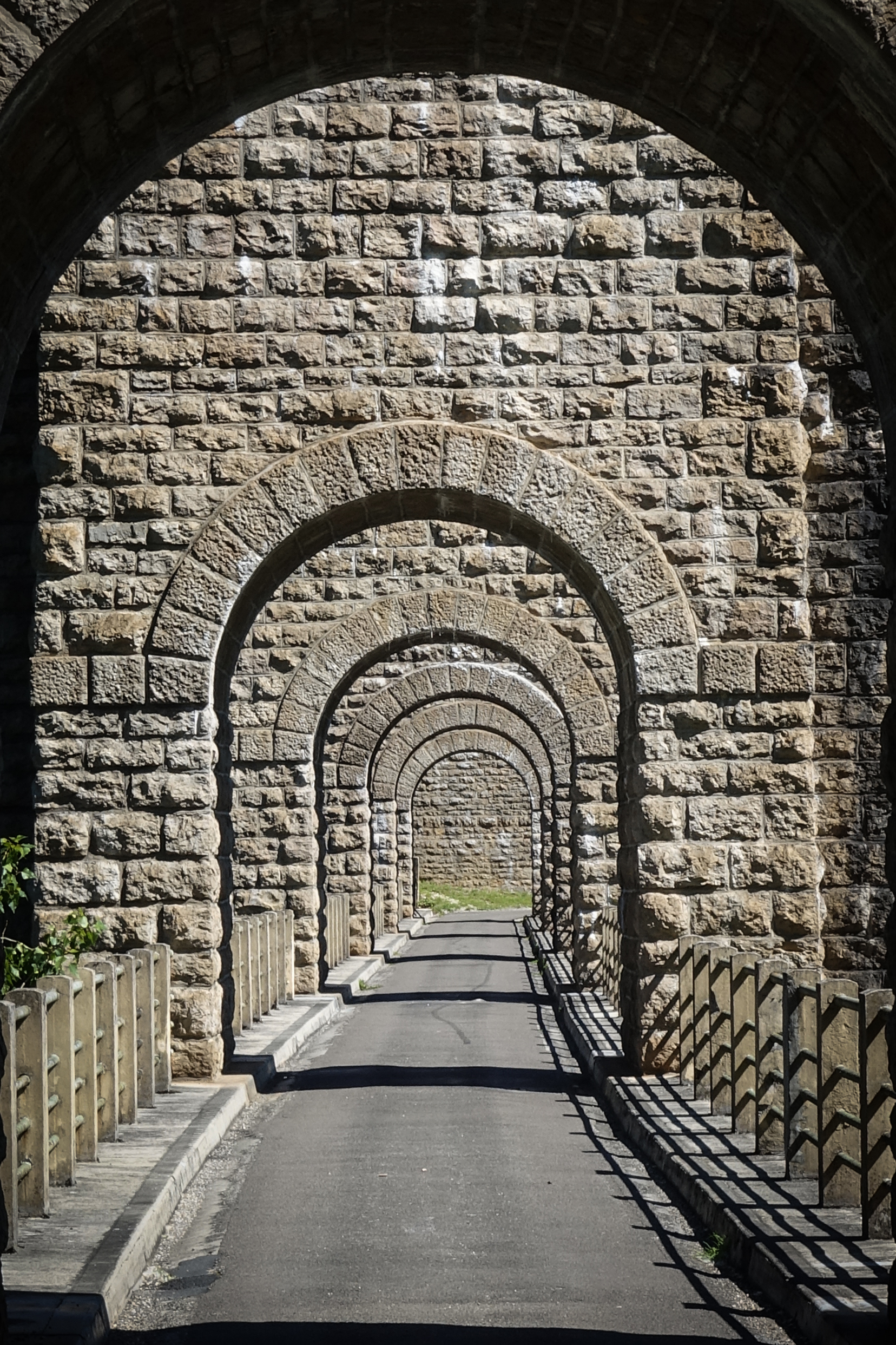
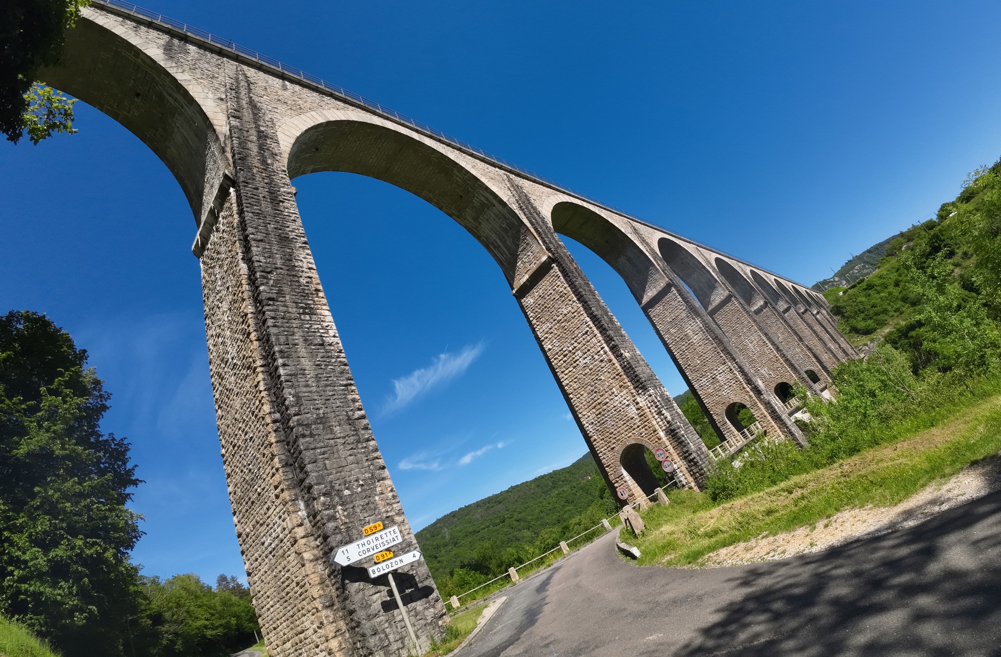
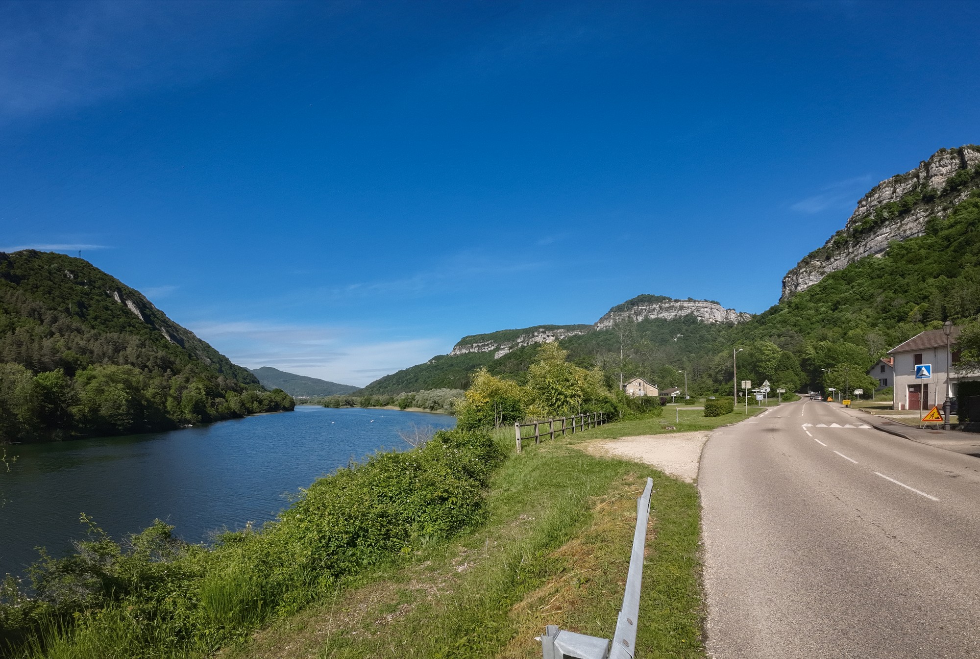
Final report The road from that village descended the side of the Gorges de l’Ain, with increasingly better views of the viaduct.
Then it entered the village of Cize and followed the curve of the river round to the viaduct. I found a suitable spot away from trees and got my drone set up and flew it over the river getting some good shots and video of that impressive structure.
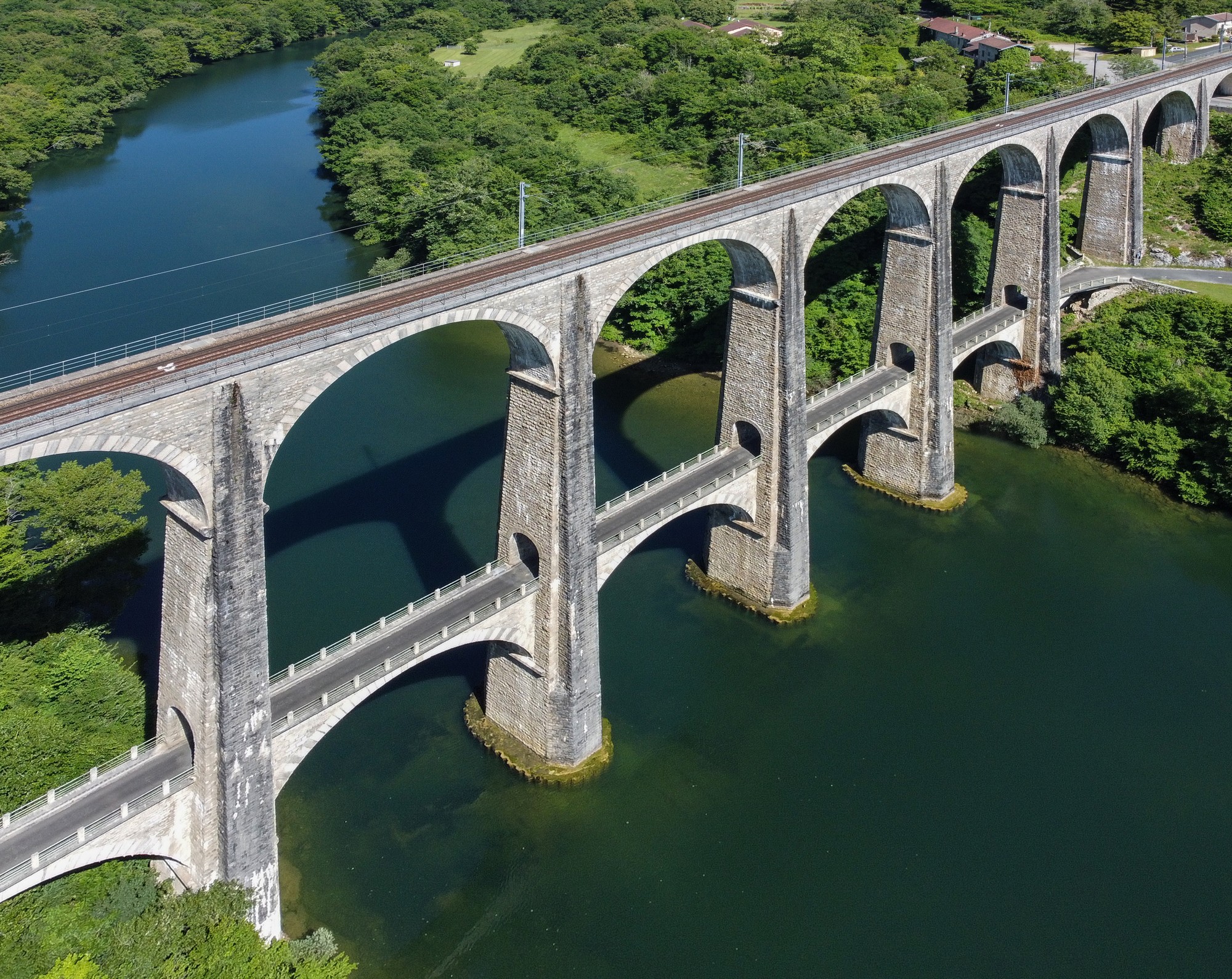
I was lucky that the sun had stayed out to show the viaduct in all its glory against the deep blue (reflected sky) of the Ain river, which it spans.
After the drone flight, I packed all my stuff away and rode over the viaduct. I got another photo from that side.
My route then followed the course of the Ain river, but with only glimpses of it through the trees. The day had really warmed up and I had been drinking more juice, so was getting quite low. I topped up in the village of Granges.
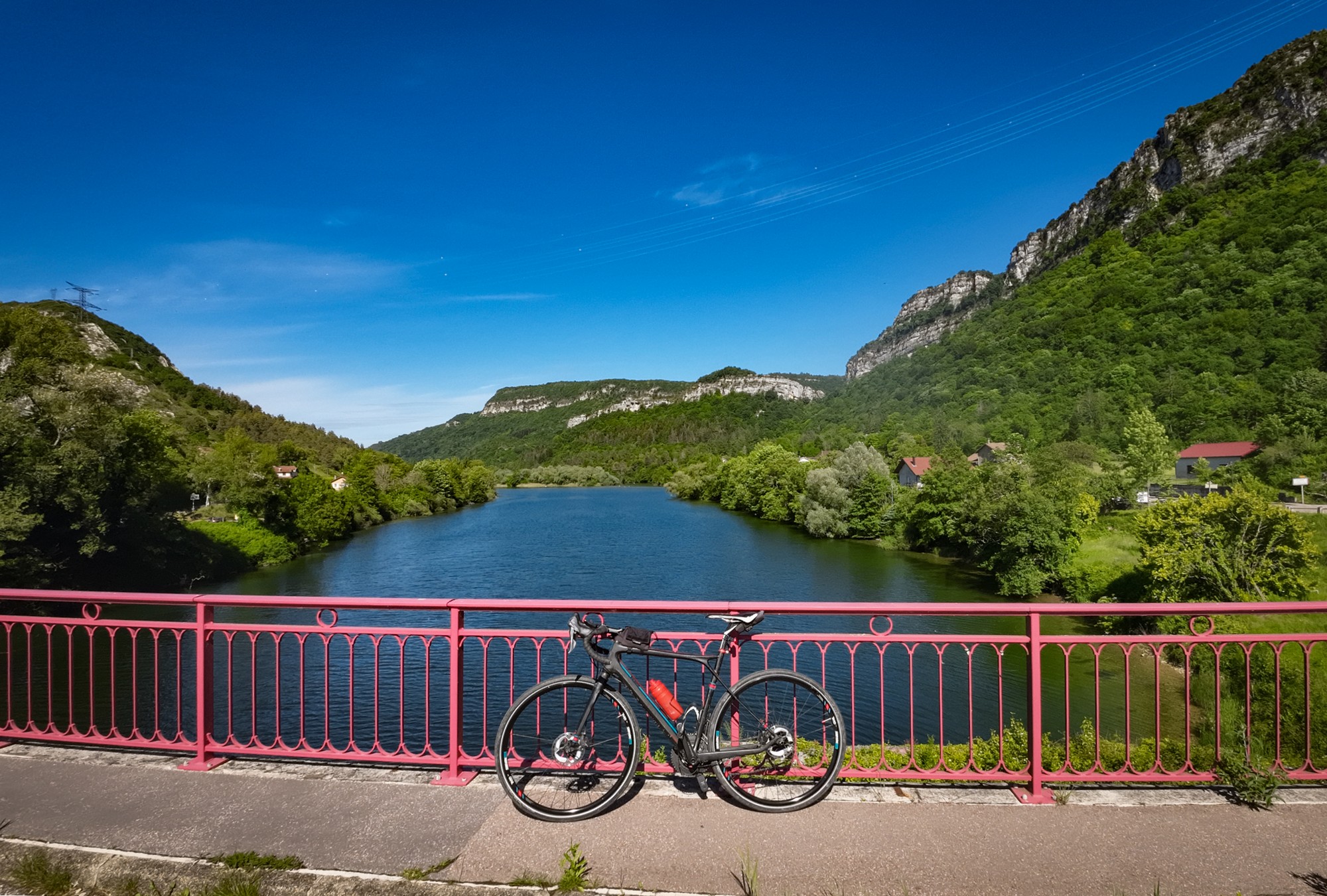
I was counting down the miles to that last 4-mile climb. About half a mile from it I had my last energy gel. Just after that I came to a bridge, Pont de Thoirette, that looked worthy of a photo.
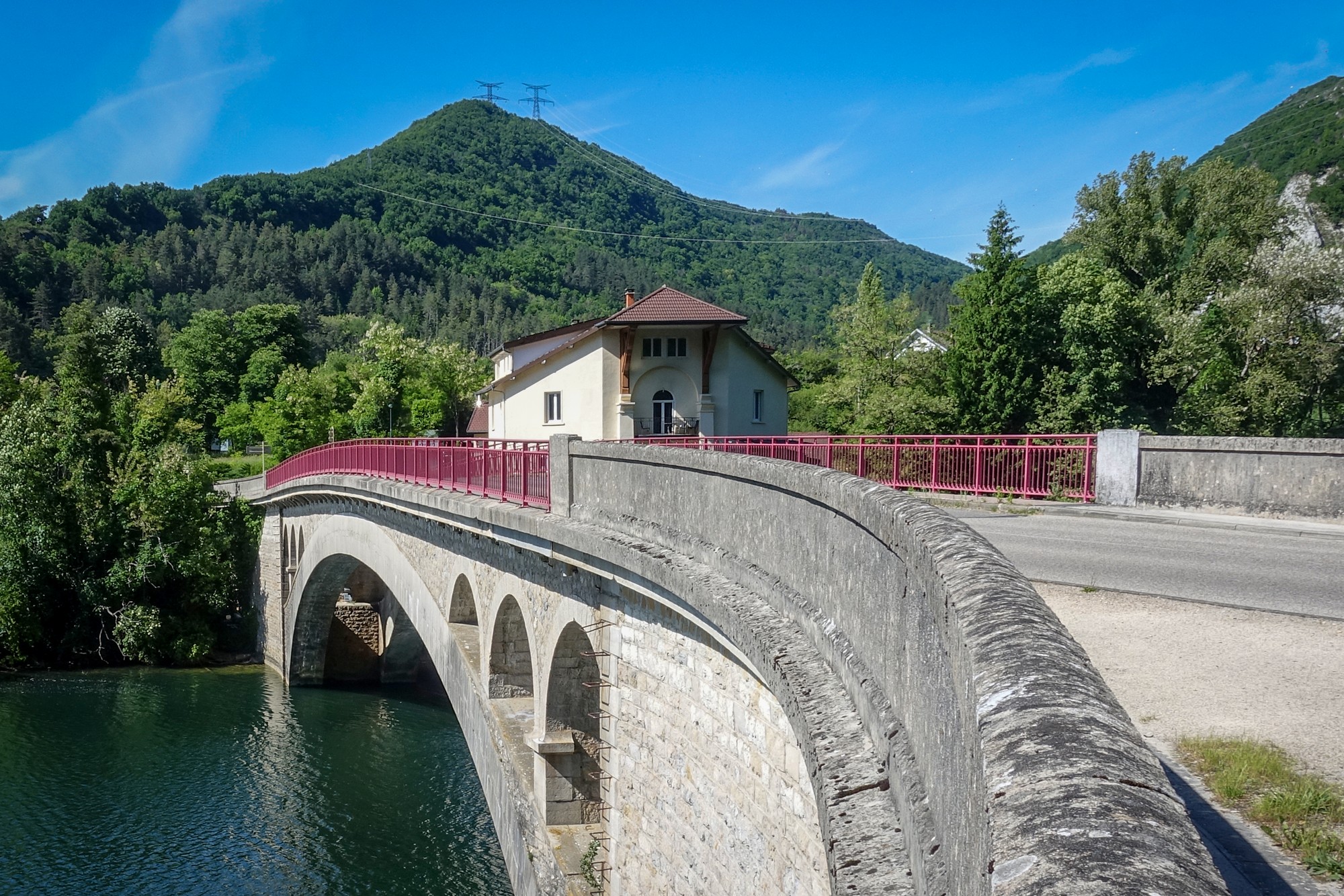
My route didn’t cross the bridge, but the climb into the hills started just after it. My Wahoo said it was a 4.3 mile climb at just over 4%. Not too bad. But when I looked at the profile image I saw that the middle section was virtually flat. The first two miles were nearer 6%. Oh well. I slogged up there without problem. Thirty five minutes later I was back at Izenore, where I cycled up the road and back to round my ‘mileage’ up to 100km!
Another brilliant ride full of the wonderful scenery of the Gorges de l’Ain, the icing on the cake, and the main raison d’être of this ride, being the magnificent Viaduc de Cize Bolozon, which I hadn’t even heard of until a couple of months ago! Despite the air being cold at first, the weather had been excellent. Everything looks better in the sun!
Further reading
Viaduc de Cize-Bolozon Wikipedia (French one has more info than English one including excellent drone video, better than mine! Right-click to translate))
Fuel
Gallery
Click to enlarge / see slideshow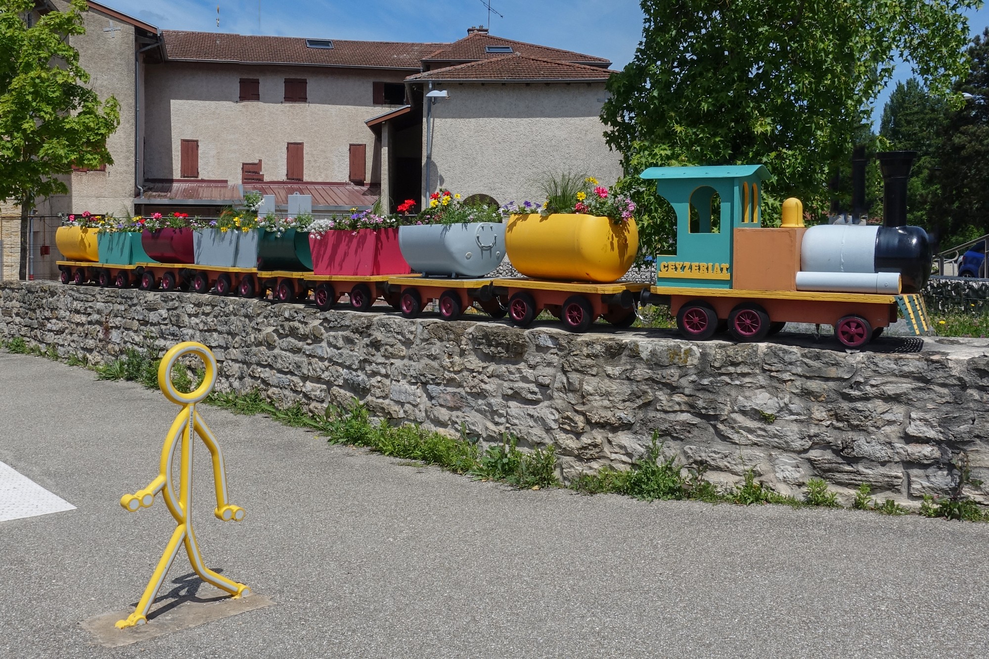


Joli reportage merci pour le partage
Merci Jean-Marc. J’apprécie ton commentaire.
Wow, outstanding documentation Vince!
The drone and action shots are awesome. I don’t know how you find these hidden gems, but keep up the good work. Vive Vince’s Velo Vacations!!!
Thanks again Martin for your wonderful comment! I was trying to think up an alliterative reply but gave up!
Cheers
Quite nice bike tour ! Thanks for the report.
Merci Thierry pour votre commentaire !
Cheers
Vince
Bravo pour ce reportage remarquable qui me pousse à aller voir ou cela se situe.
Les photos sont superbes et les vidéos aussi. Merci et bravo pour ton blog !!
Merci Jacques pour votre commentaire !
Cheers
Vince