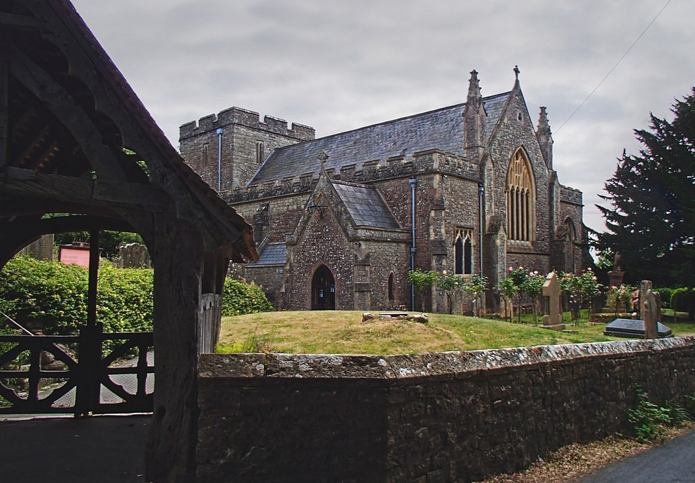
Off-roading, sheep-herding and fly-catching. . .
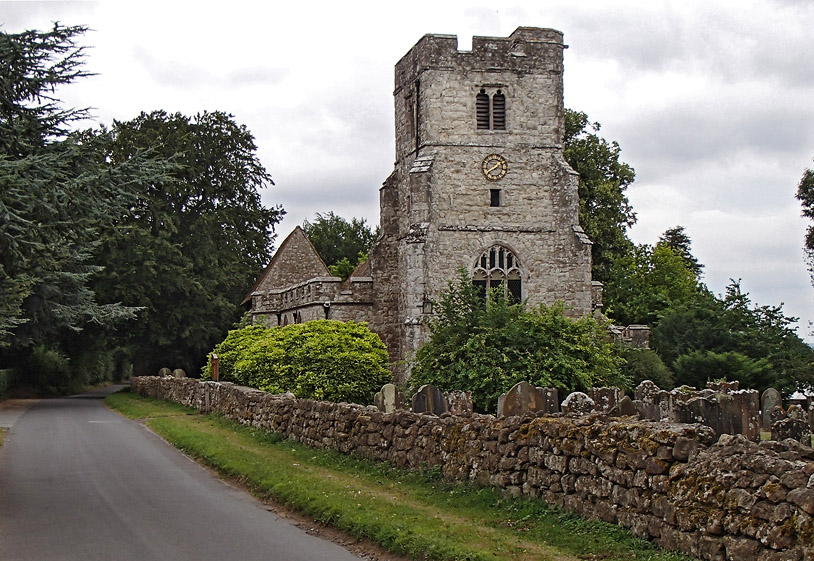
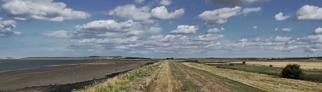
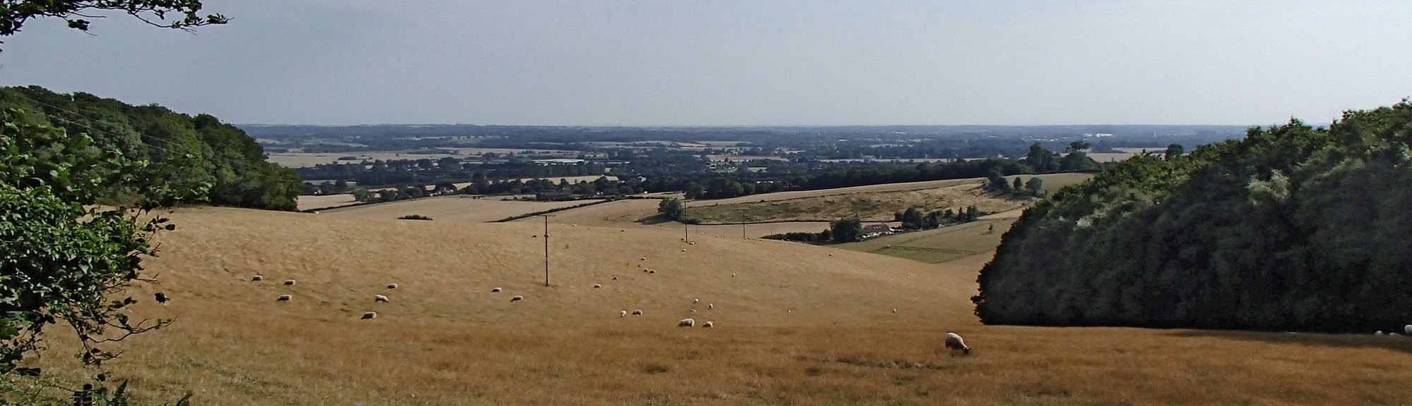
Teynham Level and Luddenham Marshes
Adventures on my bike
Off-roading, sheep-herding and fly-catching. . .
Went out this evening on this ride:
It was a beautiful sunny evening. I really went for it, hoping to beat my last average of 17.2 mph. My legs were still aching from yesterday’s 53 mile/4000 ft ride and I’d only had 4.5 hours sleep last night. Right, that’s the excuses out of the way! I really gave it everything I had (left).
By the time I had covered the 11.6 miles to the foot of Yalding Hill I had averaged 19.1 mph and was over a minute up on my previous best. But I had nothing left for Yalding Hill. I went up it as fast as I could. I kept getting out of the saddle but the pain in my legs was too much so I’d sit down again. Then I got up again, and down again. “Work, you bastards” I said under my breath (but actually out loud) to my legs, but they had had enough. I pushed as hard as I could to the top. It was such an effort that I thought I might have beaten my previous time up the hill, but later analysis showed otherwise. At the top of the hill I saw 17.6 avg on the Garmin so I knew I was still up on my previous best for the journey as a whole. I pushed as hard as I could for the last mile, most of which was still slightly uphill, and managed to end up with 17.4 mph. I had beaten my previous time by 51 seconds, even with the slower climb of YH.
Now my legs are aching even more.
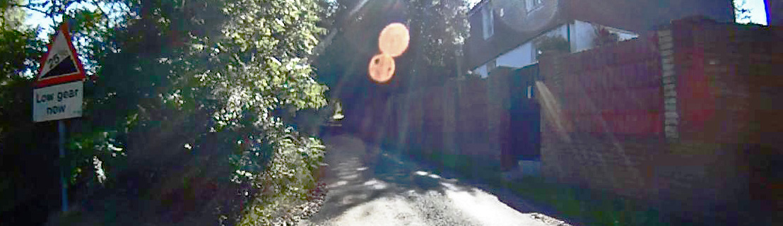
In search of Lockyers Hill
| Date climbed | 26th August 2013 |
| Elevation gain | 193 feet |
| Length | 0.3 mile |
| Duration | 3.4 minutes |
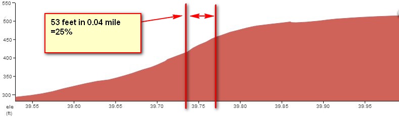
I first heard about this hill whilst on a club run. It was described as one of the few ‘double-chevron’ hills in the area. 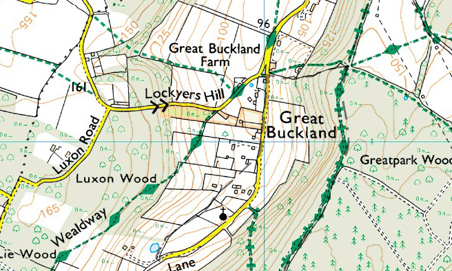 The double chevron symbol on an ordnance survey map indicates a gradient steeper than 20%. In this case it’s 25%!
It’s one of those hills that has trees and woods on each side. As you struggle to climb it there are no visual clues as to the severity of the gradient. The absence of any man-made verticals, like gate posts or brick walls, combined with the lack of long-range view makes it almost impossible to get any sense of how steep the incline might be. Your legs will let you know though! Standing on the pedals in your lowest gear, putting loads of effort in and going virtually nowhere fast are all the signs you need to tell you that it’s ‘kin steep. Like all good hills, this one gets steeper and steeper. And, as if you don’t already have enough to concentrate on as you grind your way up, the surface isn’t very good either, so you have to spend effort dodging the potholes and staying off the gravel.
And now for the good news: it only lasts three and a half minutes or less!
I climbed this hill during this ride. Although Lockyers is steeper at 25%, it didn’t feel as tough as Cob Lane, a mere 20%, which still holds top spot for the toughest hill I have yet encountered.
My ability to focus leading up to this sportive was compromised somewhat when the clutch failed on my car the previous evening, just as I was arriving in Bristol to stay with friends overnight before the event. I ended up stranded on an industrial estate late on Saturday night and waited over two hours for the recovery service to haul my car to my friend’s place. Luckily I was able to borrow their car to get to the event the next day. I ended up getting about 4.5 hours sleep.
Next morning I got to the event at 7:40. The weather was fairly mild, mainly overcast, and I could see that it was raining in the distance over the hills. Also it was windy! I took my helmet to the registration area to get the timing chip stuck to it and get my competitor number which had to be attached to the bike. I put my gear on, stuffed my pockets full of food and gels and headed to the start line. To avoid traffic congestion they only allow the riders to start in batches of about 20 at a time. We were given a quick lecture about route signs, safety and suchlike; then we were let loose.
In order to achieve gold standard I needed to average 15.5 mph over the 91-mile ride, but to be on the safe side I had a figure of 16 mph in mind. The elevation image showed that there were three main climbs; I made a mental note that they were at 20, 30 and 62 miles into the journey. There was also a 25-mile flat section through the ‘Somerset Levels’. This is where I hoped I could make up time lost in the hills.
I averaged 15.7 mph over the first 20 miles. The first climb, Burrington Combe, is a gorge through the limestone of the North side of the Mendips. It climbs 700 ft in 2.5 miles and was not difficult, just a bit of a slog. But it still ate into my average and by the time I had reached the top it had dropped to 14.2 mph. It had started raining midway up the hill and continued for the next 8 miles – I got pretty soaked, although my feet remained dry. The rain really cools your legs down. My right knee began to ache quite a lot as it got cold – I’ve definitely got something wrong with that knee and I need to get it sorted. I was aware that the next hill was coming up at the 30-mile mark and as I approached it the rain had stopped and the sun was coming out so I was trying to dry my knee and get it warmed up again before the climb. By now I had recovered my average to 15 mph again. As usual I scoffed a couple of jelly babies just before the hill.
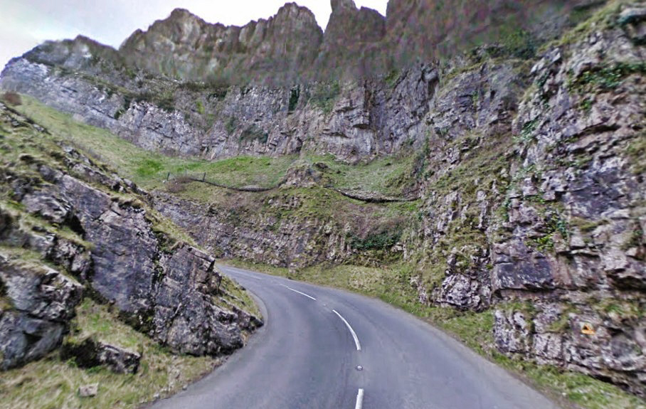
This one was Cheddar Gorge and apart from a really steep but very short bit on one of the bends (shown above) it was a piece of cake really. My knee had stopped aching by this point. The climb starts off fairly steep in the rocky bit,
but the gradient progressively eases over the next 4 miles of climbing. And my average dropped back down to 14.4! But I now had that flat bit coming up – an opportunity to make good. A glorious 800 ft descent over 2 miles plunged us down into the Somerset Levels. Although flat, the wind was directly in our face now as I rode with a group of 5 others keeping a really decent pace of about 18 mph, enabling me to once again recover my average to 15.7. But I knew it wasn’t enough to keep gold in my sights; I needed a much higher average than that to act as a buffer for all the slow climbing that was yet to come; so, reluctantly – but realistically, I changed my target to Silver, but it still took a concerted effort to keep on track for that. I stopped at the 53-mile feed station and topped up my juice, ate a piece of flapjack and grabbed a couple of fig rolls. I was stationary for 4 minutes. By the way, 53 miles was the furthest I had ever ridden without stopping.
I had forgotten my mental note of when the next hill was. I had it in mind that it was 70 or 80 something miles, so at 62 miles I wasn’t prepared, jelly-baby-wise, for Ebbor Lane and Deerleap, a climb of nearly 800 feet in just over a couple of miles, with a 17% section halfway up! The far-away views to the South were stunning.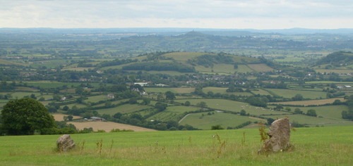 It was a long slog, but not too bad. Especially as it was the last of the big climbs of the day (or so I thought!). There were less than 30 miles to go now and, riding on my own, I concentrated on keeping the pace as high as I could manage.
I don’t think many riders were ready for Woollard Lane at 85 miles. I certainly wasn’t. After all, it’s just a small blip on the right of the elevation image. We started to climb and as I looked up ahead I saw the gradient of the road increasing as it turned the bend ahead. “That looks steep” I said to another rider, or to anyone who was listening; I was really just saying it to myself. But around that bend there was worse to come. The road ramped up to what felt like 20%, but in reality was probably ‘only’ 17%. (Addendum 26/8/13: I recently measured this on an OS 1:25000 map and the steep bit was well over 19%, so my original estimate was close).
There was no choice but to stand on the pedals. My legs were screaming. They felt like they were literally going to seize up with cramp. My pace slowed to a crawl as I ground the pedals round. Others were walking at this stage. And I very nearly joined them. I was seriously thinking of ending the pain by getting off, but then I saw the gradient easing up ahead just around another bend, so I forced myself onwards and eventually made it to the top. That was the toughest thing I’ve ever had to do on a bike. I think that Woollard Lane, on any other day, would just be an interesting climb, but after 85 miles in the saddle it took on a whole new meaning. That was evil of the event organisers to put that climb in the route so near the end! Mercifully the next 5 miles to the finish were nearly all downhill. I finished the ride at an average of 15.2 mph, enough for a Silver.
After the ride I didn’t feel too bad. Certainly the bits that ached the most were my knees. I had my protein recovery milkshake and did some stretches before attempting the drive back.
The thing I got terribly wrong on this ride was hydration. When I got to that feed station at 53 miles I only topped up one of my bottles because the other one was still full up. That meant that I had consumed just one bidon over 53 miles or 3.5 hours of riding. That is way too low. It should be one bidon per hour. I think the rainy weather at the start of the ride wasn’t making me feel thirsty enough to keep drinking. Even though I didn’t get much of a headache I did later get one of the other extremely painful symptoms of dehydration.
So I didn’t get Gold. I am still really pleased with what I achieved. To put it in perspective, almost a year ago to the day I did this 15-mile dead flat ride in an hour, at 15.2 mph and I was so pleased at the time. Now, a year later, I have achieved the same average over a much more tortuous 91-mile route! That’s progress!
Fuel:


A club run to Four Elms. Only five of us this time. The weather had threatened showers but we managed to stay dry. Not too hilly, we managed 16.4 mph over the whole journey, although the return leg had a good average of 17.3, and over the last 16 miles we averaged 18 mph, so basically we got much faster towards the end!
I forgot to switch my Garmin on until about a mile into the journey, so it was just over 56 miles in all. Nice one.
Went out on a 34-mile ride this evening and averaged 20.2 mph over the 8.5 miles to Staplehurst, beating my previous best of 19.1 mph! I’m very pleased with that!
I had only taken my rear light with me and by the time I got back it was almost dark. Cycling through the woods at the top of Barn Hill, I literally could not see the road – I was guided purely by the dark silhouette of the trees. It was so dark I could see the glow of my flashing red rear light on the road in front of me! I also got 2 personal bests on the way back – probably because I was racing to beat the failing light!
This route was planned with the sole purpose of riding up White Hill. Someone on a club run had mentioned it and I had made a note to do it one day. And that day was today. As usual, of late, the weather was warm and sunny. I planned a 54-mile route that took in quite a lot of unknown territory.
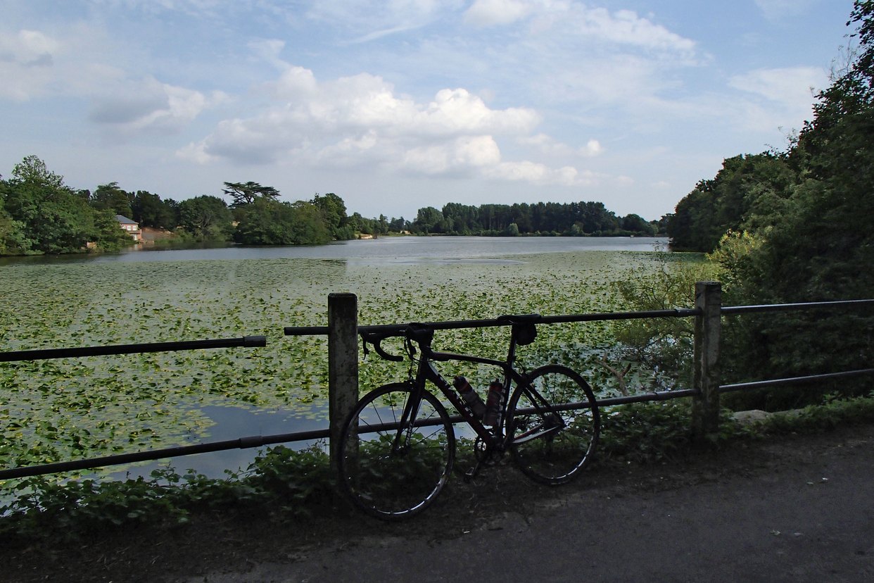
The first 18 miles or so were covered at 16mph. There were some nice lanes around Charing, just keeping to the South of the Downs. After 23 miles I came to a lovely lake, Eastwell Lake.
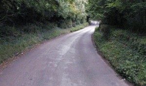
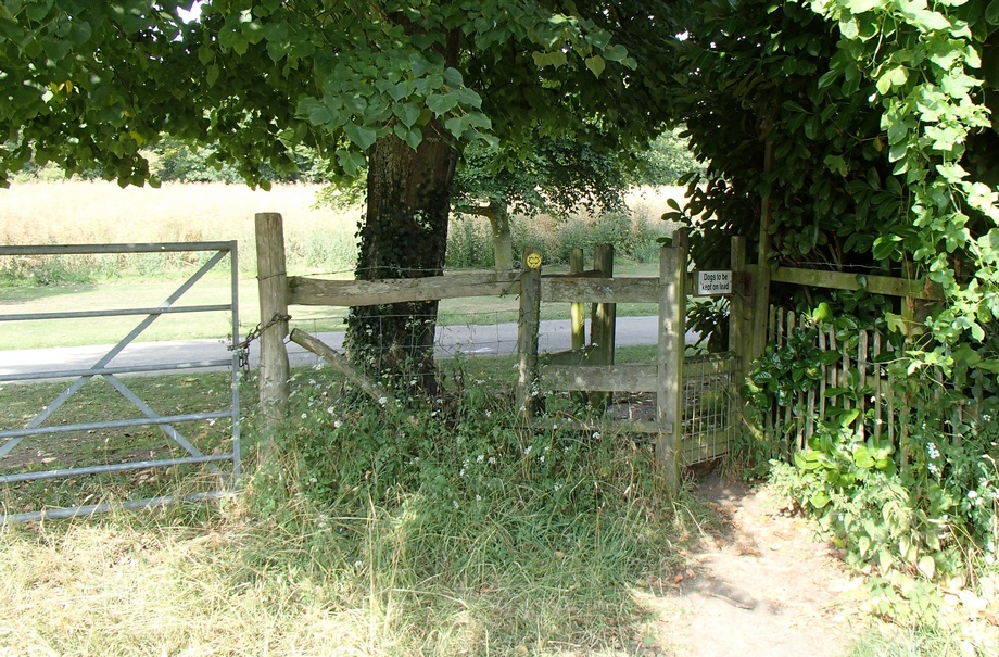
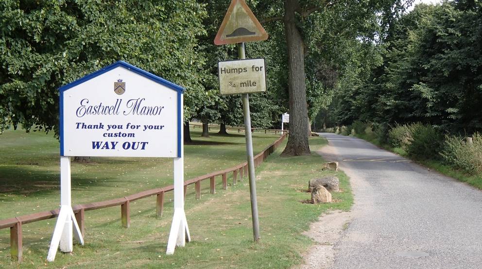
 Less than a mile past the lake my progress came to an abrupt halt when I was confronted with this:
 Damn! Again I had failed to check if all of the route was on public roads. But again I figured that the route-planning software wouldn’t direct me across private land, so I once more assumed that there was some sort of right-of-way.
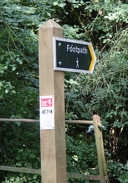

I looked for a way around this road blockage and noticed, a little further back from the gate, a footpath sign. This led me past some sort of old tower or something.
Through one of those anti-bike type gates and across a rough field I came to another bike-unfriendly gate. This one was too small to manoeuvre through, so I just lifted my bike over the gate next to it.
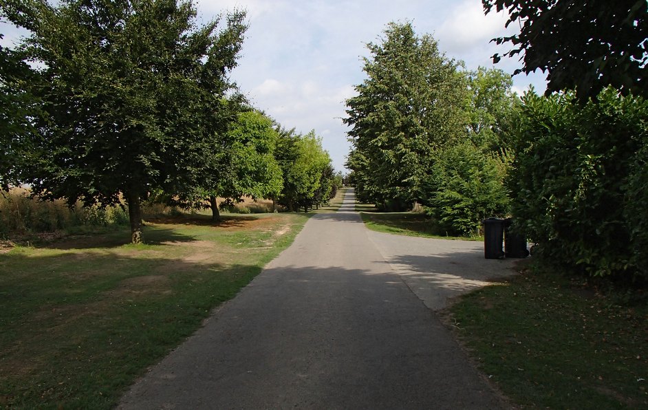
and found myself on a smooth tarmac road
After about a mile of this I came to learn where I actually was, by virtue of this sign
Another interesting ‘off-road’ excursion comes to an end.
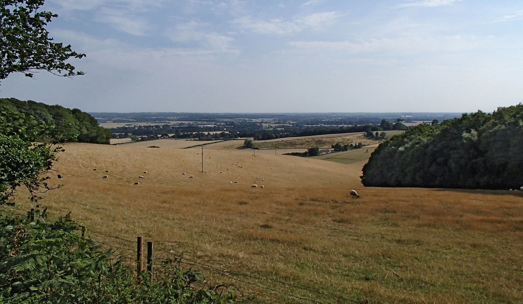
About a mile and a half later I arrived at the goal of this journey, namely White Hill. As it turned out, it wasn’t too bad a hill. It’s quite long at 1.6 miles, over which it rises about 450 feet, but I managed nearly all of it in 3rd gear, so it was hardly challenging. But the view from the top was worth it.
The next seven miles consisted of some beautiful roads across the top of the Downs before dropping down again through Lenham Heath and Grafty Green, after which I climbed Ulcombe Hill to the Greensand Ridge for the next four miles before dropping down again into the Vale of Kent. I included a bit of a twist in the tail of this journey in the shape of Westerhill Road, whose 17% gradient I just had enough energy left to climb.
Went for a ride with the Fairies again, this time to Burwash. There were about 9 or 10 of us riding, and again the weather was superb – mainly sunny and not too hot. The main topic of conversation seemed to be last week’s ride to Medway Bridge, which I had missed. In particular, talk centred around tales of angst regarding Lockyers Hill, near Luddesdown. It is one of the few ‘double-chevron’ hills around here, boasting a gradient, according to the sign, of 25%. Damn! I wish I hadn’t missed that one. I’ll have to plan a route there myself.
We had a coffee (plus poached egg on toast) break in a nice café in Burwash called the Lime Tree Tea Rooms. Luckily we could park all our bikes down the side alley.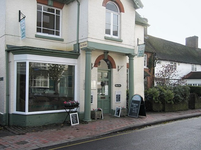
It was a fairly hilly route except for the bits near Marden. 52 miles at 14.4 mph.
Well, as promised, this route is a modification of the Greensand Hills Route I did last week, except this time the previous descents become the new ascents and vice versa.
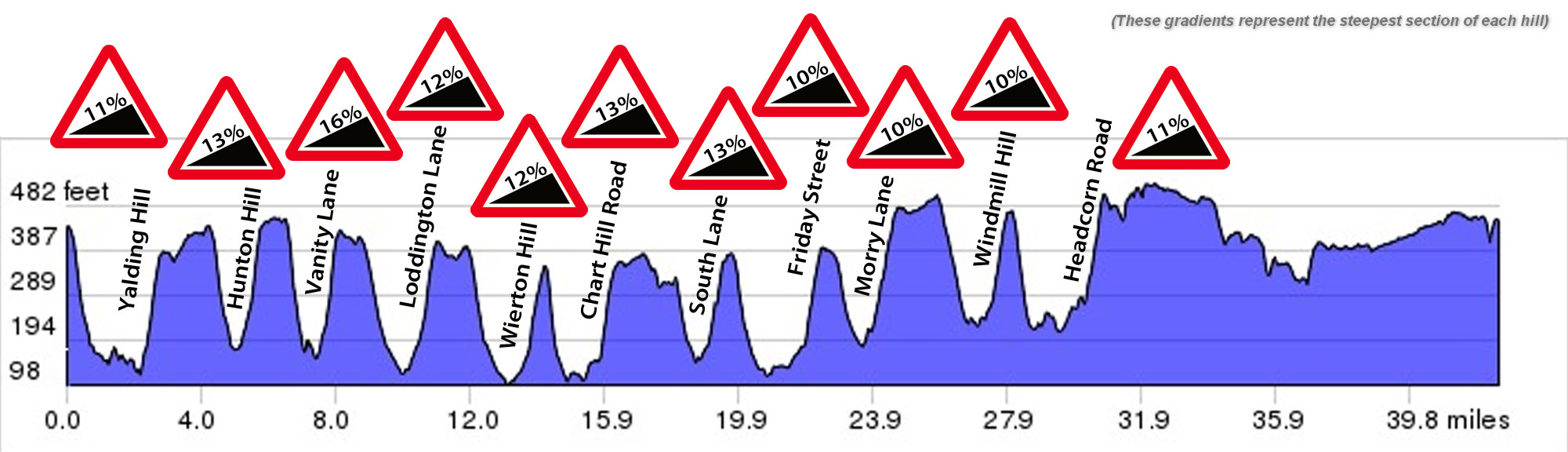
I wasn’t really in the mood for this ride. Maybe it was the couple of beers I’d had the previous evening; I just felt a bit lack-lustre, performance-wise. It was a fairly hot day (25°C) with sunny spells.
The first climb of the day was Yalding Hill, and it felt a bit of a slog, which was worrying, this early in the ride. Then, it was down Barn and up Hunton Hill. This was the first time I had climbed Hunton Hill and it was steeper than I had expected. Nearly two miles later came Vanity Lane. Having climbed this for the first time a couple of weeks before, at least I knew what to expect; it didn’t make it any easier though! As I panted my way up the steep incline, a woman jogging (or at least to the extent that one can ‘jog’ down such a steep slope) past me in the opposite direction quipped “and I thought I was mad running down it!”. A grunt of acknowledgement was all I could muster in response, as I gasped for more air. I was glad to get Vanity Lane out of the way – the remaining hills are all less severe. Only eight more to go!
Five hills later I was wishing it could be over. When I came to the top of Windmill Hill I mistakenly thought I had completed the last one, so when I found myself descending again I thought “Drat, there must be another one to go” (or thoughts to that effect!). And there was – Headcorn Road has an ascent of 220 feet in half a mile. With that out of the way I just had 11 fairly flat miles to ride home.
Even though it was a slog I was still glad I had done it once it was over.